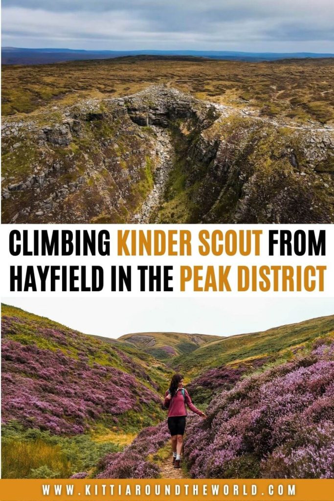
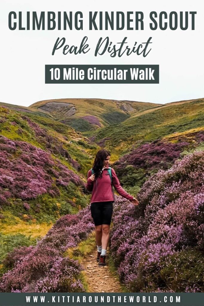
Kinder Scout Circular Walk – Climbing the Highest Point in the Peak District
This Kinder Scout walking trail follows the footsteps of the Kinder Mass Trespassers from the village of Hayfield to the highest point in the Peak District.
Along the route you’ll pass some iconic features such as Twenty Trees, Kinder Reservoir and Kinder Downfall, the tallest waterfall in the Peak District. You will be able to see the mysterious Mermaid’s Pool and walk through some stunning rock formations. In addition, on a clear day you’ll also be treated with the most amazing views over the Peak District, Greater Manchester and beyond.
If you’d like to see our Kinder Scout circular walk then make sure to watch our YouTube video by clicking here. You can also check out our Peak District Playlist for more hiking adventures.
Disclosure: This post may contain affiliate links, which means we may receive a small commission if you click a link and purchase something. Clicking these links won’t cost you anything, but it will help us to keep this site up and running! Learn more about our affiliate policy.
About Kinder Scout
Kinder Scout is located to the south-east of Glossop, to the north-east of Hayfield and to the north-west of Edale. It also falls within the Dark Peak Area of the Peak District National Park. Part of the moorland plateau rises 636m above sea level which makes Kinder Scout the highest point in the Peak District, in Derbyshire and in the East Midlands.
Kinder Scout is a very popular hiking spot not only because it’s the highest point in the Peaks but the 431 km long Pennine Way also crosses it. If you climb the plateau on a clear day you can get excellent views over Greater Manchester and even to Snowdonia National Park.
Did you know? – A mass trespass took place at Kinder Scout back in April 1932, most commonly known as the Mass Trespass of Kinder Scout. A big group of ramblers gathered together to highlight the fact that working classes were denied access to public land. The groups of walkers were approaching Kinder Scout from different directions. Upon returning from the peak, some walkers got arrested and ended up in jail. The whole event eventually led to the creation of the National Parks and Access to the Countryside Act 1949 and later the Countryside and Rights of Way Act (CROW Act) of 2000. Therefore it’s no wonder that this act is often mentioned as one of the most successful actions in British history.
How to get to Kinder Scout
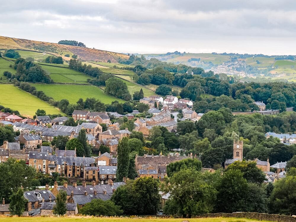
You can start your Kinder Scout walk from multiple places including Hayfield or Edale in Derbyshire. Since we did our circular walk from Hayfield my directions will be on how to get to the village.
By Car: If you’re starting your hike from Hayfield, you can park your car at Sett Valley Car Park (Post Code: SK22 2JG). You can park here all day for £4.80. Please note that the car park is open between 8AM and 8PM, however between November and March it only opens between 9AM and 5PM.
If you don’t have your own car but would like to enjoy the freedom of a private vehicle, then you can always hire a car using this company.
By Public Transport: Since Hayfield doesn’t have a train station, the only public transport option is the bus. Depending on where you’re coming from, you can take Bus 358 from Stockport or Buses 60 and 61 that travel to destinations such as Buxton, Macclesfield and Glossop. These places will have train stations, so if you’re coming from further afield you can always take the train then the bus.
You can also arrive by train to New Mills from where the bus only takes about 15 minutes to Hayfield. Please note that the bus connections between Hayfield and New Mills aren’t great so make sure to plan your journey well.
Useful Information Prior to Your Kinder Scout Walk
Length of the Kinder Scout Circular Trail
The Kinder Scout walk we chose to complete was just over 16 km (10 miles) long. Depending on the weather, your speed or how often you stop for breaks, this route could take approximately 5 hours.
For reference, we started our hike around 8AM and got to the top of Kinder Scout around 10:30AM. This is because we completed the hike during the heather season, so we spent a long time taking photos along Snake Path. We were also filming our hike, which always results in finishing a hiking trail a bit later than we might otherwise. You’ll be climbing uphill along the stream which might slow you down slightly. We also stopped for lunch next to Kinder Downfall and took our time admiring the view from the top. In the end, we completed the walk around 14:30PM.
Top Tip – Make sure you start your walk relatively early if you come on a weekend. Alternatively, I suggest coming on a weekday if you can. This is a very popular walking trail so expect it to be very busy on the top especially on a clear day.
Level of Difficulty
The level of difficulty for completing the Kinder Scout walk really depends on a lot of factors. To me personally it was very easy especially after completing much more difficult ridge hikes such as Crib Goch and Ben Nevis via CMD ridge. The weather conditions on the day we chose to do the hike were also ideal.
However, I do not want you to underestimate Kinder Scout. Whilst 636m doesn’t seem like a very tall peak to conquer, mountain rescue is constantly being called out. This is because whilst Kinder Scout isn’t considered a mountain, its terrain and weather conditions are very similar.
If you’re following the main path along the moorland you should be fine even if the weather conditions aren’t perfect. The issue arises if you try to navigate along the moorland in low visibility and bad weather conditions. Even experienced hikers could easily get disoriented if the weather conditions change suddenly. Which happens more often than not.
Not wearing the right gear is also a cause of many mountain rescue calls. You’ll be pretty exposed on the top of the plateau which can be windy even on a nice day. In bad weather conditions you could get cold very quickly. Therefore make sure to wear weather appropriate clothing and footwear and have enough water and food with you.
Therefore, I would generally rate the Kinder Scout walk moderate to difficult depending on the weather conditions and your level of hiking experience.
Facilities Around Kinder Scout
Cafés and picnic spots: I highly recommend packing your own lunch, water and hot drinks. Kinder Downfall is a great spot to stop for lunch as you can find shelter from the wind within the large rock formations. However, you can stop anywhere along this route to eat. If you’d like to grab a coffee or tea and a light bite or a full meal to eat, you can do that in Hayfield.
Toilets: There are public toilets available close to Hayfield Campsite. In addition, some of the cafés and pubs should have toilets available for their customers.
Best Time to Climb Kinder Scout
Generally speaking, I would plan this Kinder Scout walk during the spring, summer or early autumn months. Unless you’re an experienced hiker I would steer clear from attempting this hike in harsh winter conditions.
Top Tip – If you’d like to make your hike extra colourful, then try to plan it in the heather season towards the end of August.
Even during the warmer months I recommend checking the weather forecast before your hike. It can still be a great activity on a slightly windy and overcast day. However, I highly discourage you to attempt it in bad weather conditions such as fog, heavy rain and when it’s snowing. When visibility is compromised you can easily get lost along the moorland.
Since this is a super popular hike, on weekends, during school half terms and summer holidays the trail will be a lot busier. Therefore I would suggest picking a neutral weekday if you can. I also recommend starting your hike earlier in the day to make sure you won’t run out of daylight.

What to Wear and Bring With You?
You are in the north of England in an area of the Peak District that could experience pretty extreme weather conditions. At the time of our visit at the end of August, it was dry but cold and especially windy along the top. Therefore, I highly recommend weather appropriate clothing when going on the Kinder Scout circular walk. You’ll be exposed pretty much the entire way and even on a sunny day it will be windy on the plateau. So, make sure you check the weather forecast before you set off and have a few layers with you.
A good pair of supportive and possibly waterproof hiking shoes or boots are a must too. Kinder Scout is a peat moorland and can be pretty boggy. Even on a nice day you’ll be walking along the stream so you want to avoid getting wet feet as much as possible.
Also note that you might not have great signal, so having paper or offline maps with you and a compass wouldn’t hurt either.
Although you can stop for food and drinks in Hayfield, I suggest packing enough snacks and having plenty of water with you. Since there are plenty of beautiful places to stop for a picnic I recommend packing your own lunch.
Please Note! – Whatever you bring with you, make sure you either take it home with you or dispose of it responsibly. I suggest bringing a garbage bag with you where you can collect all your waste. Enjoy your time in nature but Leave No Trace!
Kinder Scout Circular Walking Trail
I think the trail is relatively easy to follow, but as usual, I’ve divided the route into 4 different sections:
1. Hayfield to Kinder Reservoir via Snake Path
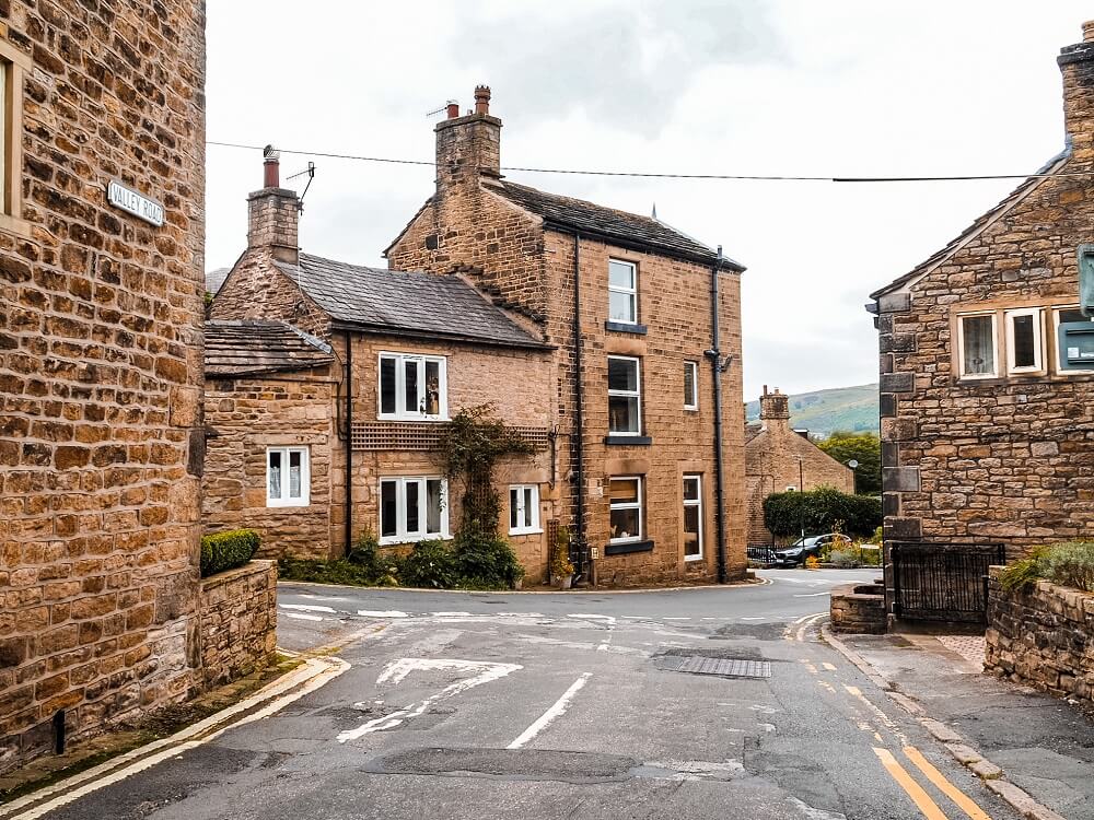
Starting your Kinder Scout walk from the car park in Hayfield, first cross the A624 Chapel Road. Walk past the village church and cross the bridge across the River Sett on your left. Turn onto Bank Street on your right which will merge with Kinder Road. Follow this road until you come across the Snake Path sign on your left. This is actually the route where the trespass went in 1932.
From here you’ll be gradually ascending over Hayfield. The start of the path is pretty rocky so be careful. Soon, you’ll walk through a gate and you have to follow the path through some fields. There might be livestock such as sheep and cows grazing on the fields.
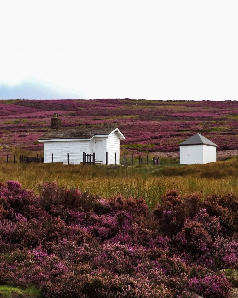
You’ll have a great view over Hayfield and beyond, so make sure to stop for a bit and enjoy it. At this point you should also see a bunch of trees standing tall in the field. These are locally known as Twenty Trees, although you’ll only count a total of 19 trees. Apparently a few years ago someone chopped one down.
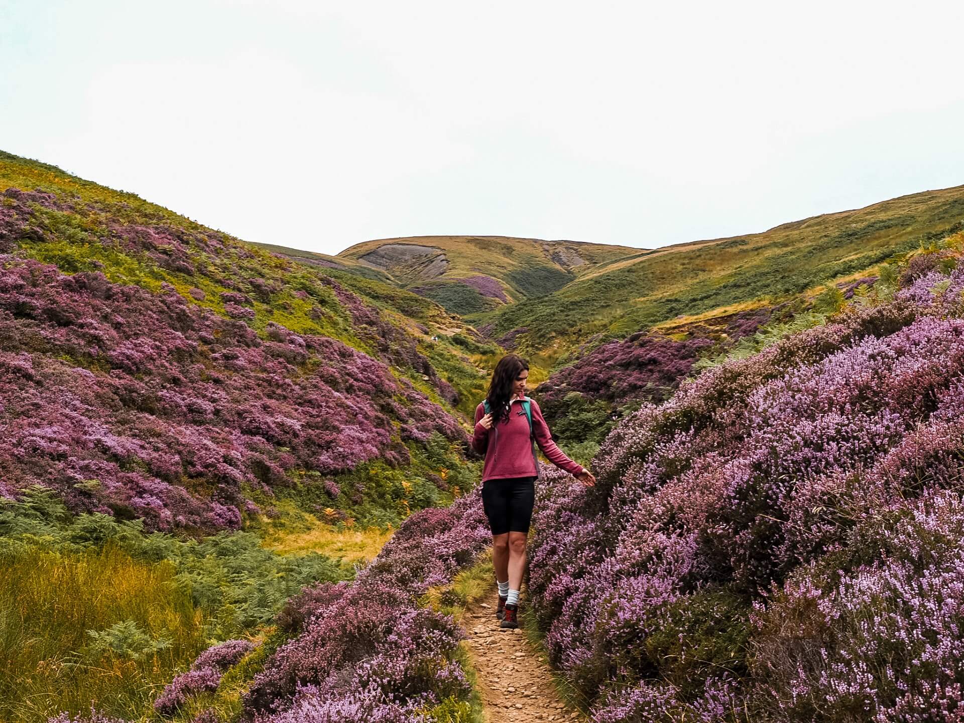
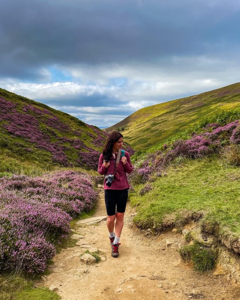
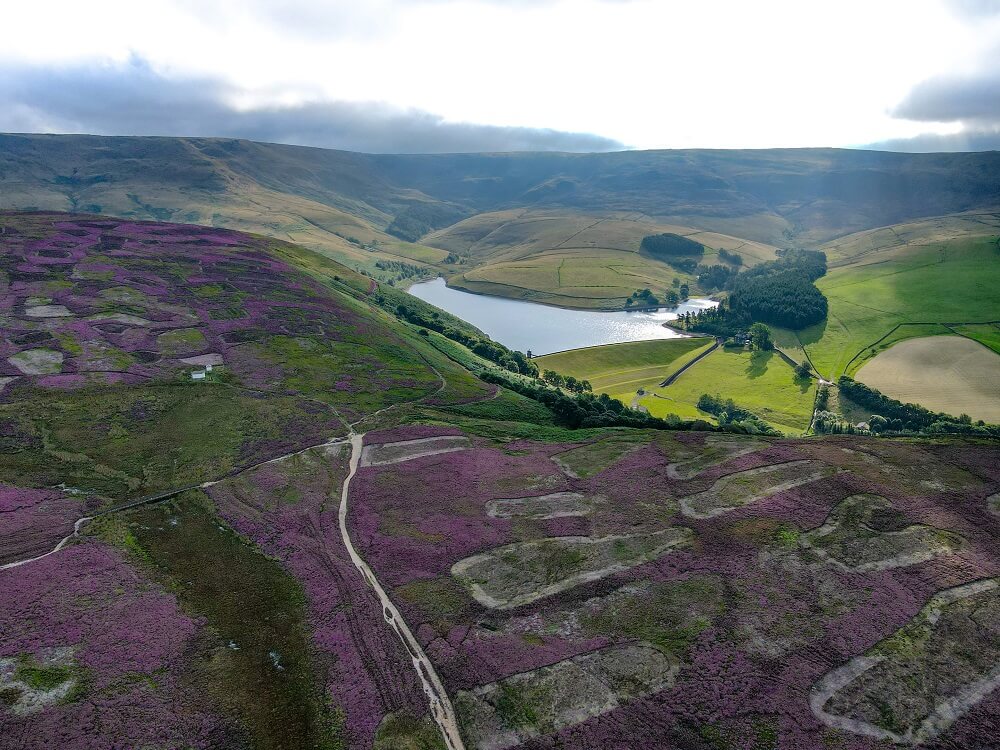
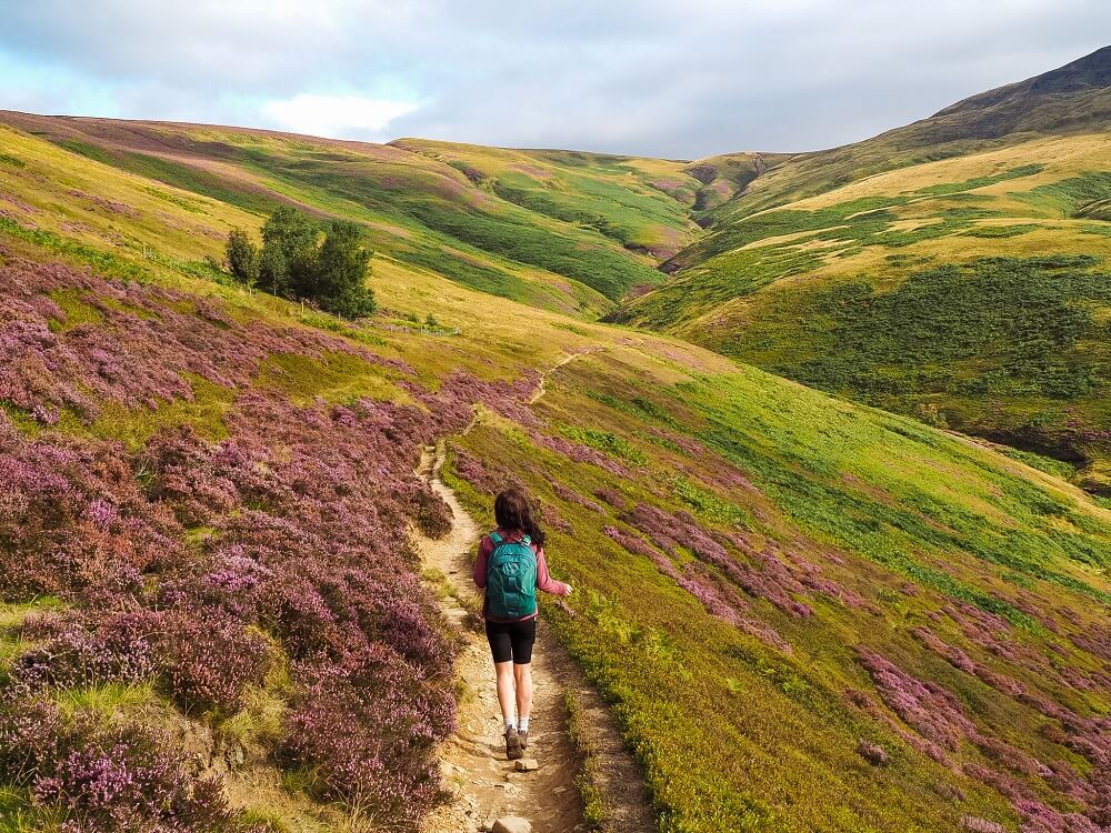
From Twenty Trees the Snake Path will lead you to a rough moorland. Here, you’ll have a great view of Kinder Reservoir and Kinder Scout.
Top Tip – Come in August to see the moorland covered in the beautiful purple/pink coloured heather.
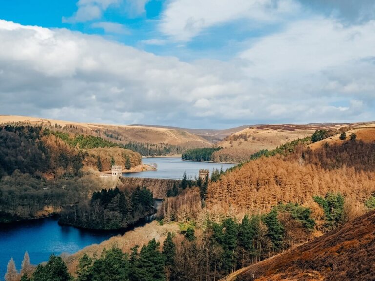
There are some other paths criss-crossing the moorland, but just follow the path towards Kinder Reservoir. After walking through the heather fields, you should get your first peak of Kinder Reservoir. The 44 acre public water reservoir was constructed between 1903 and 1911.
2. Kinder Reservoir to Kinder Downfall
Once you come to a crossroads, you can either take the lower path or stay high. There’s not much difference between the two and the lower will merge with the higher path anyways. So I suggest staying on the higher path. The view over Kinder Reservoir and Kinder Scout is beautiful so make sure to take it all in without rushing too much.
You’ll soon come to the edge of the reservoir from where you’ll have to follow the stream that feeds into it. This is the point where you start your proper ascent to Kinder Scout. Just follow the path that criss-crosses the stream all the way to the plateau. Even on a dry day, the path can be boggy and muddy so wear sensible footwear.
Top Tip – Look out for a few smaller or bigger waterfalls along the stream. Also make sure to look back at the view as you climb higher and higher.
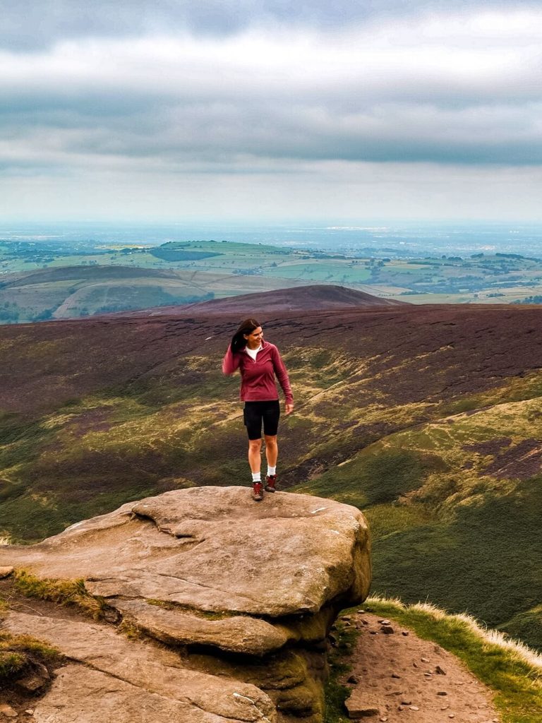
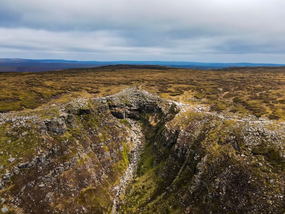
Soon you’ll reach a flat area, which is the meeting point of many different paths. Here, just continue straight up to the plateau. This is your last push to the top. Once on top, just carry on following the clear path along the edge, passing many rock formations. These are great spots for photos but don’t go too close to the edge.
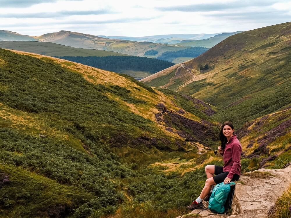
About halfway around your walk along Kinder plateau you will reach River Kinder and Kinder Downfall. At 30m high it is the tallest waterfall in the Peak District. Unfortunately, when we visited in the summer, the weather had been fairly dry, so there wasn’t much water flowing over the falls.
Did you know? – In certain windy weather conditions Kinder Downfall can be seen to blow back on itself, producing a cloud of spray that can be seen for miles. In especially cold winters the downfall sometimes freezes over, providing a great ice climbing challenge for mountaineers.
From Kinder Downfall you can also see Mermaid’s Pool which, according to legend, is the home of a mermaid who will grant you immortality if you spot her on Easter eve!
3. Kinder Downfall to Kinder Low
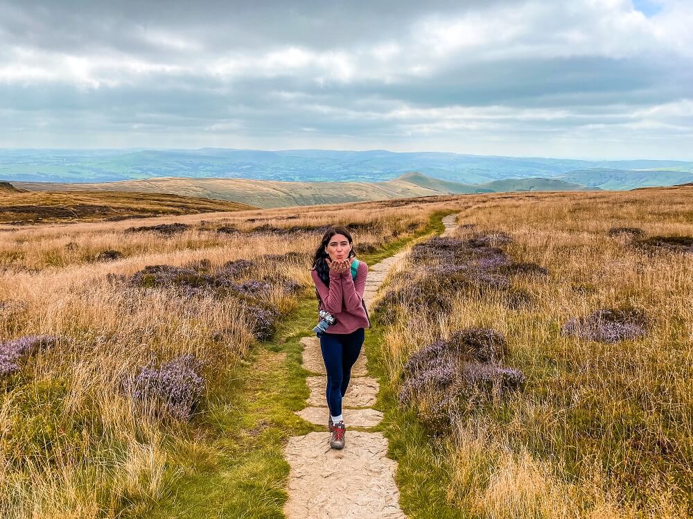
From Kinder Downfall you’ll just have to carry on along the plateau towards Kinder Low. If you’re completing the Kinder Scout walk on a clear day, then you should be able to have some fantastic views over Greater Manchester and even Snowdonia.
There will be plenty of rock formations too where you can stop to take some photos. If the weather is pleasant I suggest taking your time and enjoying the beautiful scenery of the Peak District.
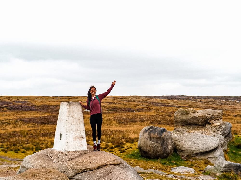
In about 2 km (1.2 miles) you should reach a trig point called Kinder Low. At this point you might think that you’ve reached the summit of Kinder Scout. Actually it’s a common misconception amongst many that Kinder Low is the highest point of Kinder Scout.
Fun Fact – The true summit of Kinder Scout is about 3m higher, located approximately 900m to the north-east of Kinder Low. Since it’s an unmarked point on the flat plateau it’s not the easiest to find.
If you’d like to find it, then make sure to wear the right outdoor gear, have a compass and paper maps and do it on a clear day. When visibility is low it’ll be so easy to get lost on the moorland! Also be prepared to turn around at any point if the weather conditions take a turn for the worse. For the record, we didn’t feel like we were fully prepared to venture into the moorland at the time of our visit.
4. Kinder Low to Hayfield
Soon after leaving Kinder Low, you’ll be descending from Kinder Scout. The descent will be pretty steep and you’ll get down very quickly. Just make sure to mind your step as the path is rocky and can be slippery even on a dry day.
Once you’re down, you can either follow the path straight ahead which will lead you to Hayfield Campsite. If you feel like you still have more energy left, you can take the path on your right. This will be slightly longer but will also lead you to Hayfield Campsite. For reference, we took the longer route because the weather was nicer lower down, plus there were cows blocking the exit on the other route. I’m genuinely afraid of cows so I always try to take an alternative route, especially if they are all gathering at the gates.
This longer route will end up following Kinder Reservoir, so you’ll have a different view of it. You’ll soon meet with the River Kinder again, and will be walking along Kinder Road towards Hayfield Campsite. Kinder Road will lead you back to Hayfield village centre, from where you’ll have to cross the A624 Chapel Road to get back to the car park.
Additional Walks in the Peak District
There are many amazing places and trails located near Kinder Scout. So, if you’d like to see more of the Peak District then make sure to check out the 10 Best Hikes in the Peak District or browse for more hiking trails in the Peak District in my Peak District Hikes Series.
For now, here are some hikes in the Peak District that are approximately 30 minutes’ drive away from Hayfield:
B-29 ‘OVEREXPOSED’ Crash Site Circular Trail – This blog post will help you to find the B-29 ‘Overexposed’ Crash Site on top of Bleaklow moorland. Click here to read it.
Alport Castles Circular Trail – Explore a large landslide feature called Alport Castles, located in Alport Dale to the west of the Upper Derwent Valley in the Peak District. Click here to read it.
Bamford Edge and Ladybower Reservoir – A 7-mile circular trail with stunning views from the top of Bamford Edge looking towards Ladybower Reservoir and the Hope Valley. Click here to read it.
Mam Tor, Winnats Pass and Castleton – A 5.5 mile circular trail which takes you through some of the most scenic places in the Hope Valley: Mam Tor, Winnats Pass and Castleton. Click here to read it.
Final Thoughts on the Kinder Scout Walking Trail
I could never get bored of climbing Kinder Scout for many reasons. First of all, there are many different routes you can take to the top. Secondly, you can make your walk longer or shorter, less or more challenging. Lastly, every season will provide you with a slightly different landscape keeping the same walking route interesting.
Have you ever climbed Kinder Scout or visited the Peak District before? If so, how much of the area did you manage to explore? If not, would you want to complete this Kinder Scout walk? Let me know in the comments below.
Now, let your adventure begin,

Our Top Travel Resources
Accommodation: For hotels we always use Booking.com and Hostelworld for hostels. We also book longer stays on Airbnb or Vrbo.
Flights: To find the best flight prices we always check Skyscanner, Google Flights or WayAway. Then we also check the airlines’ websites too for comparison.
Car Rentals: We use Discover Cars when we want to rent a car as it compares local, national and international companies.
Activities: If we book organised tours we always check either GetYourGuide or Viator.
Foreign Currency: Whenever we can we prefer to pay in local currency and for that we always use our Wise card. We can easily withdraw money from the ATM or pay by card at most shops and restaurants.
Travel Insurance: We never go anywhere without travel insurance. You never know what will happen on your trip, so good travel insurance like SafetyWing can protect you in case of injury, illness, theft and cancellations.
eSIM and VPN: To get data abroad we use Airalo which is an app that allows you to download a prepaid eSIM to your phone in over 190 countries. Make sure to have a VPN to avoid hackers accessing your personal data when using public WIFI. We use Surfshark which is the only VPN that offers one account on unlimited devices.
Remember…It all starts with a Pin…

Wow, this hike sounds incredible. I’ve hiked so much in my own country but haven’t really gone out to other countries and hiked. Definitely adding this one to my list!
Thank you so much for your comment. It’s so great to hear that you enjoy hiking in your own country, I bet it looks amazing. Hiking in a different country can be a bit intimidating at first, but it’s totally worth it 🙂
What amazing views! This hike looks absolutely incredible. I would love to hike this during heather season, those flowers are just gorgeous.
Thank you Kate, I agree the best time to hike Kinder Scout is during the heather season. You won’t regret it.
Wow what a gorgeous hike! I love hiking and this would definitely be something I would like to do. Especially with the heather, it looks so pretty!
Thank you Natalie, great to hear that you love hiking too. Yes, I agree, this hike is best to complete during the heather season.
The scenery is gorgeous. As an avid hiker this is one I plan to add to my hiking bucket list.
Thank you Michelle, I’m so happy to hear that you added this hike to your bucket list.
I have wanted to visit the Peak District for ages! After reading your blog and checking your Youtube video, I need to take some time to go. It looks amazing.
Thank you so much Cristina, I’m so happy to hear that my blog convinced you to visit the Peaks. You won’t regret it, and I’m sure you’ll love this area.
I always love coming across your blog since you share so many cool hikes in the U.K. Next time we visit, we will definitely reference your website! We love to hike.
Thank you so much Ashlee, it means a lot. I hope you can visit the UK in the near future.
Thanks for another great blog! Great photos and views of the reservoir and the heather. Thanks for sharing. 🙂
Thank you so much Karan, I’m happy you enjoyed reading my post 🙂
Kinder Scout isn’t that far from me and I keep meaning to visit! I can’t believe I haven’t got there yet! It looks absolutely magical during heather season! I’ll have to time my visit strategically next year! Thanks for the great guide!
I really hope that you can come and complete the hike next year Hannah. It’s a really great one to do!
Visiting during Heather season looks magical. I especially love all the great views, like looking over Hayfield.
Thank you Megan, I agree, the heather season is so beautiful in this area. I can never get bored of the views over Hayfield either 🙂
The Kinder Scout walking trail looks like it provides so many great spots along the way. And those panoramic views are awesome. It sounds like a hike I could physically do. Planning to do this at heather season would sure make it a colourful trek!
Thank you Linda. This hike is definitely a great trail and not super hard either. I hope you can complete it in the heather season too 🙂
The Peak District has so many beautiful hikes to choose from. Kinder Scout has been on my hiking list for a couple of years now, but I haven’t had the time to go unfortunately. Hopefully next year, so thanks for the handy guide!
Thank you Krista, I’m glad to hear that Kinder Scout has been on your hiking list. I hope you can return in the heather season next year to complete it.
Amazingly useful thread! Thanks so much!
Thank you!