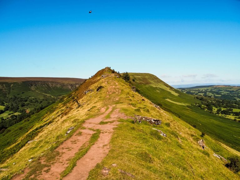
The Ultimate Guide to Climbing Ben Nevis via Carn Mor Dearg Arête
Are you a more experienced hiker who wants to climb Ben Nevis via Carn Mor Dearg Arete, a route that not many people dare to take? If so, look no further because you just found your best guide.
After hiking Scafell Pike, the highest peak in England, and climbing Snowdon via Crib Goch, the highest point in Wales, it was very appropriate to climb Ben Nevis, the highest mountain in both Scotland and in the UK.
We knew that, ideally, we wanted to avoid climbing Ben Nevis via the well know ‘Tourist Route’. So, when I read that there’s another way up to this beautiful mountain, which is also a ridge hike that only about a quarter of the people climbing it take, I knew we had found our ideal hiking trail.
If you’d like to see our Ben Nevis via Carn Mor Dearg Arete hike then make sure to watch our YouTube video by clicking here. You can also watch our full West Scotland Series by clicking here.
Disclaimer – Please note that this is only a guide based on my personal experience and level of fitness. I cannot guarantee that you can do this climb. Therefore, it is your responsibility to decide if this particular hiking trail is for you or not.
Disclosure: This post may contain affiliate links, which means we may receive a small commission if you click a link and purchase something. Clicking these links won’t cost you anything, but it will help us to keep this site up and running! Learn more about our affiliate policy.
Introducing Ben Nevis and Carn Mor Dearg
Ben Nevis
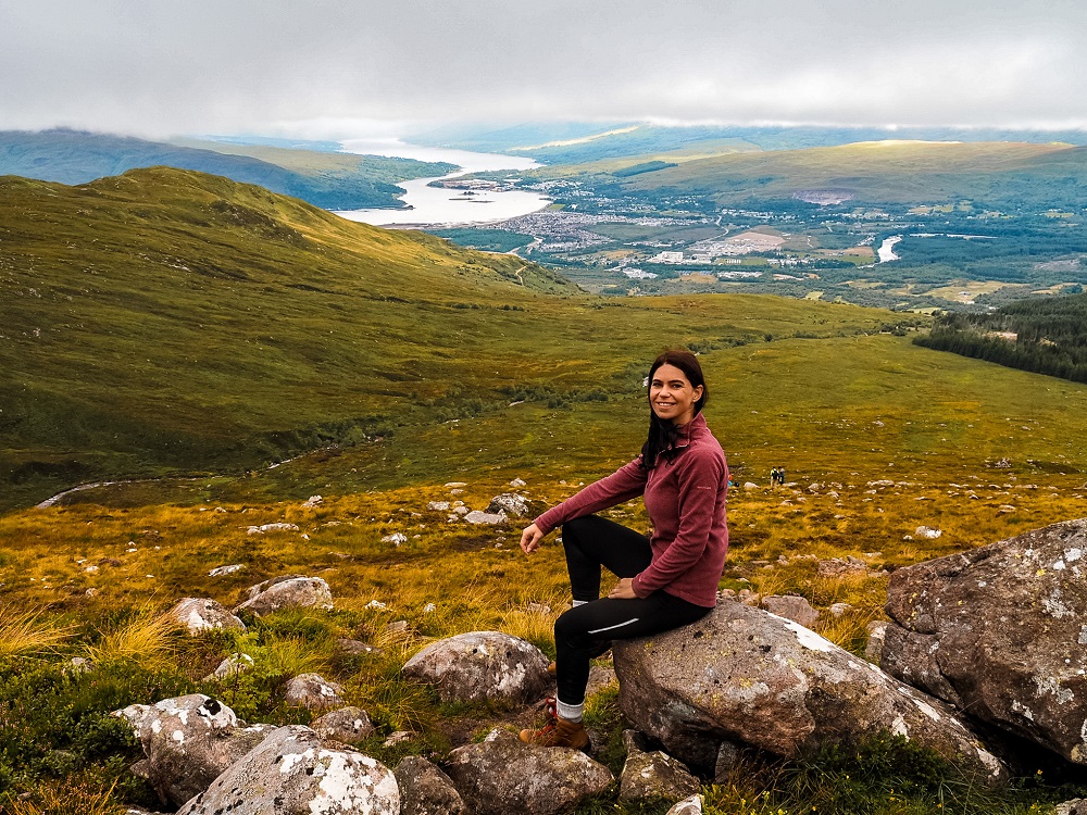
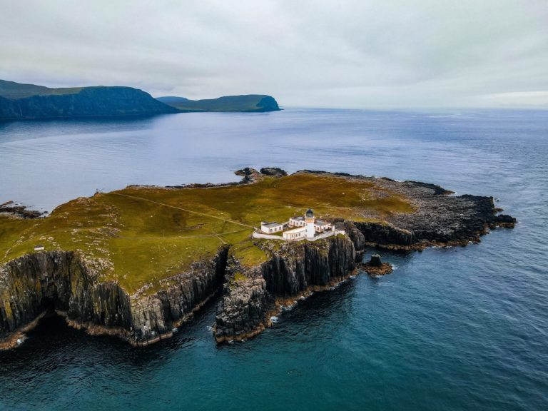
Located in the north west Highlands, near Fort William in Scotland, is the UK’s tallest mountain: Ben Nevis. The mountain is also the highest land in any direction for about 739km (459 miles).
Did you know? – Although the first recorded climb happened in 1771, it wasn’t until 1847 that the Ordnance Survey confirmed Ben Nevis as the highest peak in the UK.
The 1,345m (4,413 ft) tall mountain was once an active volcano. Millions of year ago, in the Carboniferous period, it exploded and collapsed inwards on itself. If you reach its summit you’ll see light-coloured granite, which is evidence of this explosion. In addition, glaciation has also shaped its current form.
Its name actually has two quite appropriate translations. One is ‘mountain with its head in the clouds’ and the other one is ‘venomous mountain’. Which translation do you think is more suitable?
Fun Fact – Today, Ben Nevis attracts at least 125k walkers a year.
Ben Nevis is also part of the National Three Peaks Challenge. As part of the challenge, climbers have to hike the highest points in Wales (Yr Wyddfa / Snowdon), England (Scafell Pike) and Scotland (Ben Nevis) within 24 hours. Altogether, climbers walk about 44km (27 miles) with 3,000m (9,800 ft) of ascent. Many participants use the event to raise money for charities.
Carn Mor Dearg (CMD)
Located to the north-west of Ben Nevis is Carn Mor Dearg. The two mountains are linked together via Carn Mor Dearg Arête. At 1,220 m (4,000 ft) Carn Mor Dearg is the 9th highest mountain in Scotland.
Ascending Carn Mor Dearg from the north, then scrambling across the ridge all the way up to Ben Nevis is definitely considered one of the best horseshoe routes in the country. Despite being a fantastic ridge hike, only about a quarter of the people who climb Ben Nevis attempt ascending via Carn Mor Dearg. This is likely because the route is long and also involves Grade 1 scrambling.
What is scrambling? – Scrambling is somewhere in between walking and climbing. In the UK, scrambles are graded from 1 to 3. A Grade 1 scramble requires you to use both your hands and feet, but it’s the easiest one you can do. Grade 2 and 3 are closer to proper rock climbing, where you will most likely require the use of a rope. Needless to say that Grade 3 scrambles are the hardest and you need to have proper experience.
Both Ben Nevis and Carn Mor Dearg are considered Munros. Munros are mountains in Scotland that are over 3,000 ft (914.4 m).
Did you know? – There are 282 Munros in Scotland with Ben Nevis obviously being the highest. So, I guess it doesn’t come as a surprise when I say that there’s a very popular activity between climbers called ‘Munro bagging’. As part of the challenge, hikers try to climb as many peaks as possible. Apparently there are only just over 6,000 people who have bagged all Munros so far.
So basically, by completing Ben Nevis via Carn Mor Dearg, you can bag two Munros!
How to Get to Ben Nevis
By Car: Ben Nevis is located just outside of Fort William. If you’re planning on completing the Carn Mor Dearg route then the best place to park is at The North Face Car Park (address: Torlundy, Fort William, PH33 6SS). Please note that the road that leads you to the car park isn’t in the best condition so just drive carefully. The good news is that you can park here for free all day.
The car park isn’t massive and since you can park there overnight it tends to get a bit busy.
If you don’t have your own car but would like to enjoy the freedom of a private vehicle, then you can always hire a car using this company.
By Public Transport: If you’re staying in Fort William you can take a bus from the centre. There is a bus stop called ‘Hotel’ located just before the right turn towards Torlundy and The North face Car Park. Make sure to check the frequency of these services when you’re planning your trip by clicking here.
Good to Know Before You Go
Length of the Ben Nevis via Carn Mor Dearg Hiking Trail
The Carn Mor Dearg arete route is a 21km (13 miles) circular trial. Depending on your speed, the weather conditions, how long it takes to walk along the ridge, and how long you’re spending on top of Ben Nevis, this route could take between 10 to 13 hours to complete.
For reference, we got to The North Face Car park around 7:30AM. Climbing up to Carn Mor Dearg might take a bit longer since it’s all uphill plus the terrain can be super boggy. Hiking along the ridge could also slow you down because you want to take it easy and admire the views. If you’re climbing in foggy conditions you’ll inevitably walk slower trying to navigate across the terrain. In the end, we completed the walk around 6:30PM.
I would definitely allow enough time to complete this particular walk and suggest starting earlier rather than later.
Level of Difficulty of the Carn Mor Dearg Arete Trail
I would rate this hiking trail as difficult and I really don’t recommend attempting to reach Ben Nevis via Carn Mor Dearg arete without any prior hiking experience. To complete this trail safely you’ll need to be in good shape and have plenty of hiking and scrambling experience.
This trail can become even more dangerous in bad weather conditions, so you need to be willing to change your plans for your own safety. For reference, we walked in thick clouds for the majority of the trail. This can be very dangerous as poor visibility can really make you disoriented. The only time we felt slightly unsure was when we reached sections where there was no clear path and we had to navigate ourselves. However, once we were on the ridge I personally felt much safer as there’s really not many ways you can go.
The length of the trail is quite long and there are many steep sections right from the start. Your total ascent will be over 1,500m which is more than the height of Ben Nevis. Even if you climb Ben Nevis via the Tourist Route, the start of the walk is basically at sea level, so you’ll walk the whole height of the mountain!
Walking along Carn Mor Dearg arete will require you to be alert and focused at all times which can tire you out quicker. Even after reaching Ben Nevis, you need to watch your step as many accidents happen because people are tired and lose focus.
Top Advice – Since not many people climb via Carn Mor Dearg, the path won’t be as busy as the tourist one. Therefore, you should let someone know that you’re hiking this trail and keep them updated on your progress.
Whilst we don’t enjoy hiking in big crowds, it was reassuring to know that we had a few hikers in front of us and behind us, in case we needed assistance.
Although it’s a demanding route, if you get lucky with the weather, you could be rewarded with the most amazing views of the mountain’s iconic North Face.
Best Time to Climb Ben Nevis
The mixture of Ben Nevis’ altitude, its maritime location and topography leads to poor weather conditions the majority of the time. Apparently fog is present on Ben Nevis approximately 80% of the time during the winter months and about 50% of the time in summer. The summit receives about twice the amount of rainfall Fort William does. The temperature difference between the base and the summit can be 8.5C. In addition, snow can be present pretty much all year round.
So picking a clear day for your climb might be rather tricky. I recommend doing your climb between June and September to avoid very extreme conditions. Having said that make sure to check the weather forecast even on the morning of your planned hike.
I think if you have plenty of hiking and scrambling experience, it’s doable in less ideal weather conditions. However, low visibility, rain and wind can make the climb more dangerous. Therefore, I would proceed with extra caution. You really only need one wrong step!
Unless you’re an experienced mountaineer please do not attempt climbing Ben Nevis via Carn Mor Dearg in snow. A few years ago a few people lost their lives after being caught in an avalanche.
Since this particular way up the mountain is less busy, it doesn’t really matter which day you’re climbing. As with everything, weekends, school terms and bank holidays will attract more people. Whilst Carn Mor Dearg arete will be relatively quiet, I can guarantee that the summit of Ben Nevis will be busy. That’s just something you can’t avoid. If you’d like to touch the trig, you will most likely have to queue too. For this reason, I still recommend picking a normal weekday for your hike, especially if there’s not much difference in the weather forecast, which should be your number one decision making factor.
Facilities Around Ben Nevis
Cafés and Picnic Spots – Please note that the closest pubs, restaurants, shops and cafés are in Fort William. Therefore, I highly recommend bringing your own lunch, snacks and water with you. You can find a great spot to eat or have a coffee break pretty much anywhere along this walk. Although I suggest avoiding stopping at places where midges could eat you alive before you get a chance to open your packed lunch. We had a few coffee and snack breaks further up and lunch on top of Ben Nevis.
Toilets – There are no toilet facilities available along this trail. Please be respectful of both nature and other people when nature is calling as we saw many people doing their business right next to the trail on our way down the Tourist Path.
What to Wear on Your Hike up Ben Nevis?
What to wear depends on the time of year you’re visiting but mainly on the weather conditions on the day of your hike. You’re in the Scottish Highlands where the weather is generally cool, damp and cloudy and the daily weather can be very unpredictable. Therefore, I recommend checking the weather app before your visit and wearing appropriate clothing.
You’ll be exposed along the majority of the trail, so make sure to have a few layers with you. You will feel much cooler as you climb higher and along the ridge but warmer lower down or whilst your ascending.
For reference, we climbed Ben Nevis at the end of August. Although August is technically summer, I was wearing my winter hat and gloves once we got into the thick clouds. The clouds also made us very wet very quickly, therefore, I recommend wearing a waterproof jacket and shoes. In addition, we also used waterproof covers on our backpacks to prevent our camera gear from getting wet. You can check how cloudy the base and the peak of Ben Nevis will likely be by clicking here.
I can’t emphasize enough to wear hiking appropriate footwear when attempting the Carn Mor Dearg ridge. During wetter conditions the rocks can become extremely slippery so you want shoes with good grip. Even the easier tourist path is pretty rocky, so you want shoes with thicker soles.
What to Bring with You on Your Hike up Ben Nevis?
If you’ve ever been to Scotland before you’ve probably heard about the midges. Midges are tiny flying insects that bite…a lot…Basically if you stop anywhere along boggy areas you’re offering them a free all-you-can-eat buffet. The midge season in Scotland is normally between May and September, so don’t forget your midge repellent. You can get further information about midges here.
We only had screenshots of the route map with us and that was enough for us to traverse. However, if you have a compass make sure to pack it as navigating can be tricky if you’re walking in thick clouds.
Since it’s going to be a long day, bring a portable charger with you so you won’t run out of battery life, especially in case of emergency.
Make sure to pack your own lunch and snacks and have plenty of water and hot drinks with you depending on the weather. During your ascents you’ll sweat a lot more, so you want to keep hydrated and have enough energy to carry on.
Please Note! – Whatever you bring with you, make sure you either take it home with you or dispose of it responsibly. I suggest bringing a garbage bag with you where you can collect all your waste. Enjoy your time in nature but Leave No Trace!
Ben Nevis via Carn Mor Dearg Arete
There are two main routes up Ben Nevis. The most popular one is The Mountain Track or Tourist Track and the other one is the Carn Mor Dearg Arête route.
If you’re climbing Ben Nevis via Carn Mor Dearg, you’ll start your hike from the North Face Car Park. You’ll be on the Puggy Line for a short while before you make your way up to Carn Mor Dearg. After reaching the peak, you’ll walk along the arete all the way to Ben Nevis. From the top you’ll make your way down via the Ben Nevis Mountain Path otherwise known as the Tourist Route. At the crossroads, you’ll join onto the North Face Path that will circle around the mountain before it leads you back to the car park.
I divided the route we took into 5 main sections as follows:
1. Car Park to Carn Mor Dearg
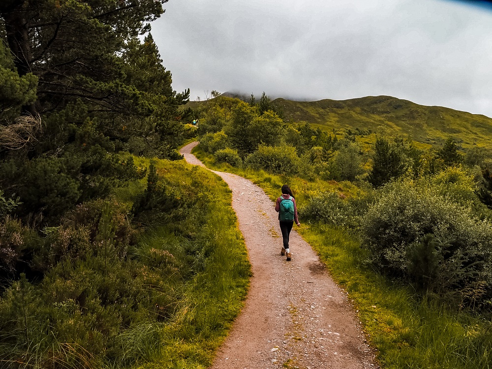
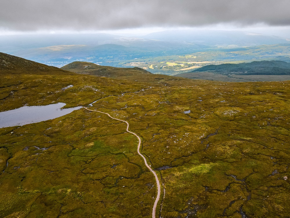
After leaving the car park, cross the bridge and carry on until the first crossroads. Here turn right onto the Puggy Line and follow the sign towards North Face Trail. At this first part you’ll be walking through a very beautiful and dense pine forest. This section will be uphill pretty much all the way.
At the next fork stay right on the main path. Keep left at the next crossroads. At this point the trail will be a bit steep, but it’s a faster shortcut. At the next crossroads you can take either path as they will lead you to the same place. Continue past a T-junction, and then take a right at the next one following Allt a’Mhuilin.
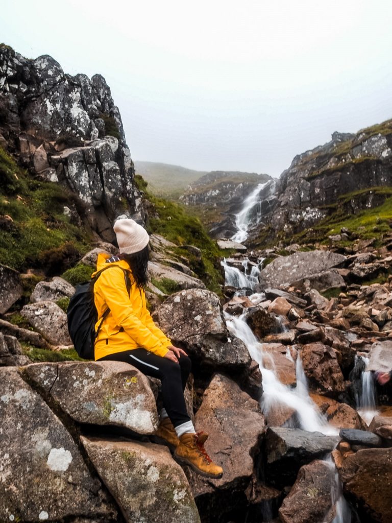
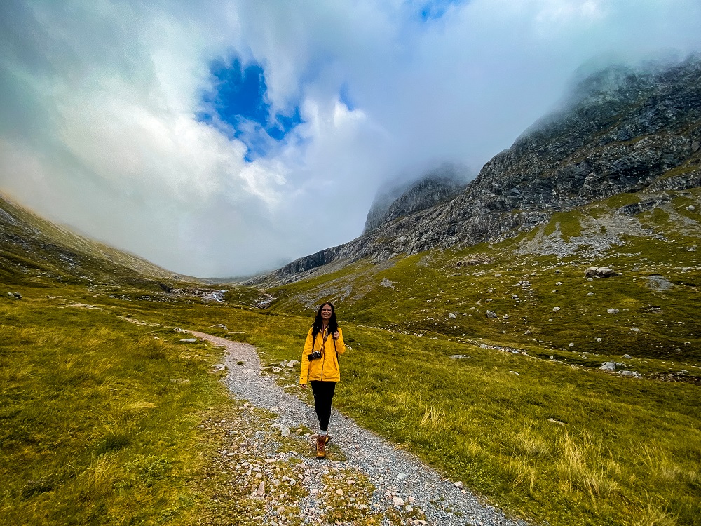
It might sound a bit complicated but trust me it will be pretty obvious where you have to go. Once you’re out of the forest you might hear some waterfalls along Allt a’Mhuilin. As the view opens up you’ll see Fort William and Loch Linnhe and Eil to your right. In front of you, you should see Ben Nevis, unless of course it’s in thick clouds.
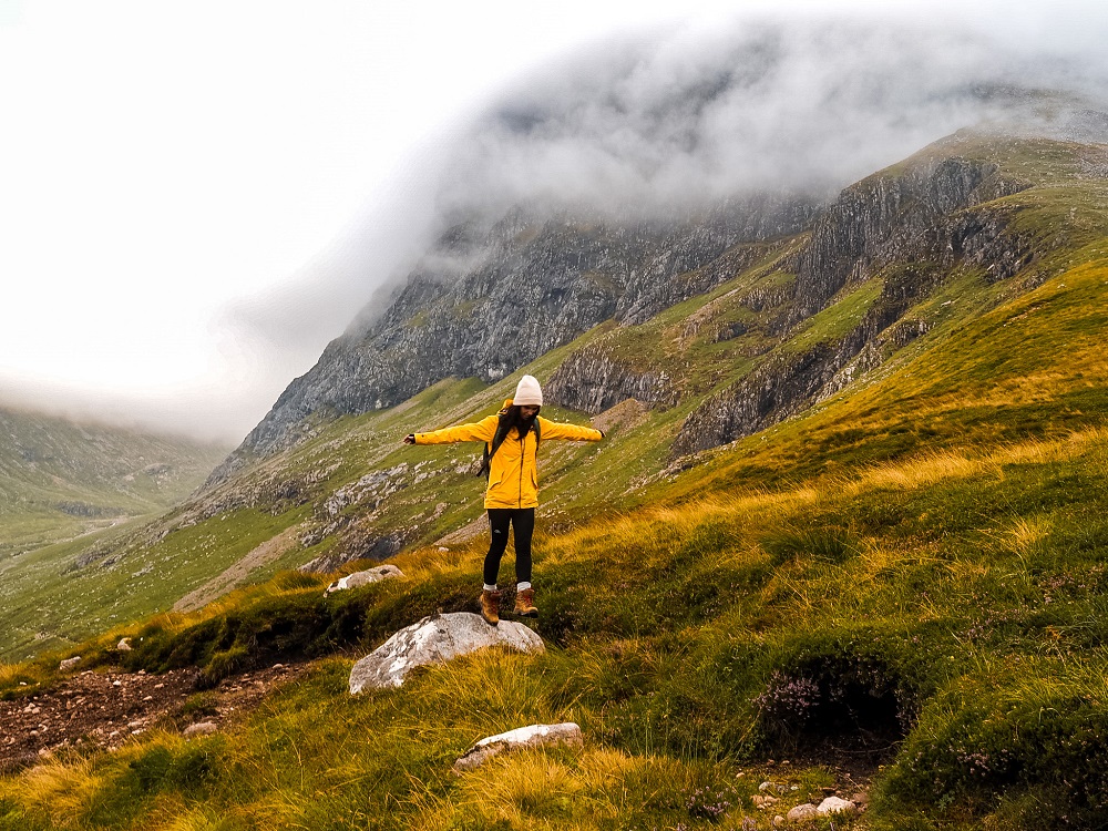
Shortly, the path will divide again which is where you have to turn left. This is where the boggy section and also your ascent to Carn Mor Dearg starts. I wouldn’t stop too often along the bottom, unless you want to serve midges a full English (or in my instance Hungarian…) This part of the walk isn’t much fun as you have to constantly climb and navigate in the bog. Luckily the field will get drier the higher you go and there will be less midges too. The view behind you will also get better, so make sure to turn around and enjoy it whilst catching your breath.
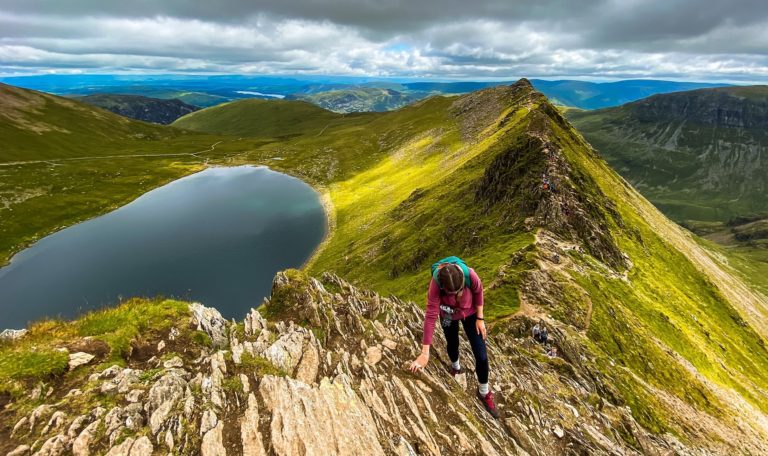
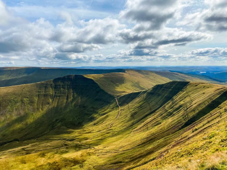
2. Carn Mor Dearg to Ben Nevis via CMD Arete
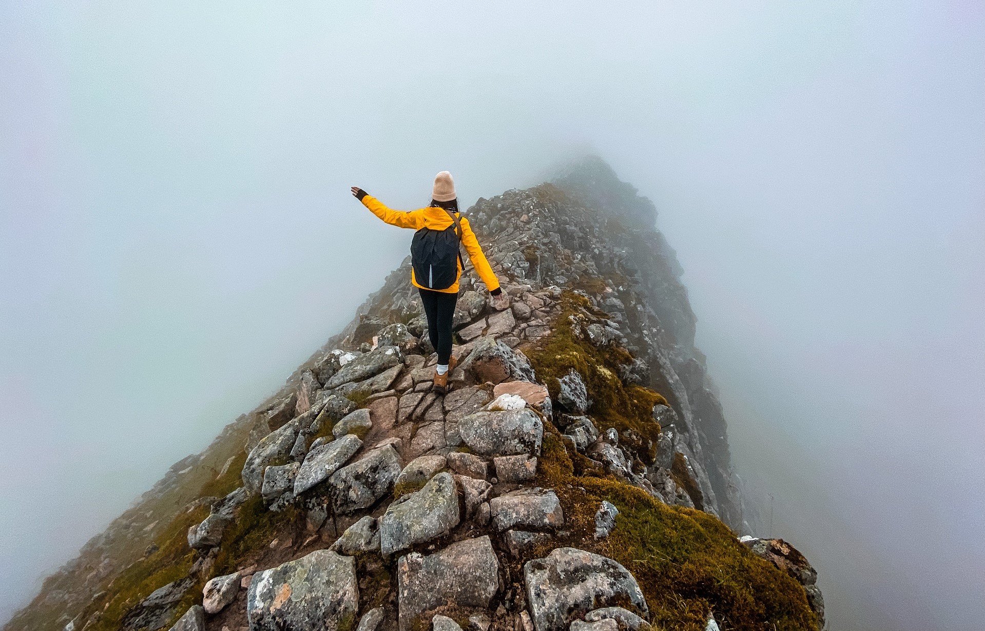
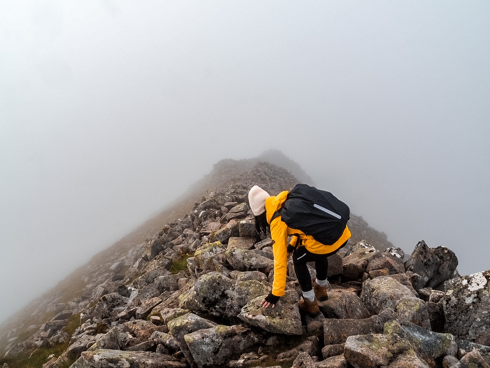
Soon we reached the start of the thickest fog I’ve ever walked in. Therefore, we couldn’t see much of the views for the remainder of the trail.
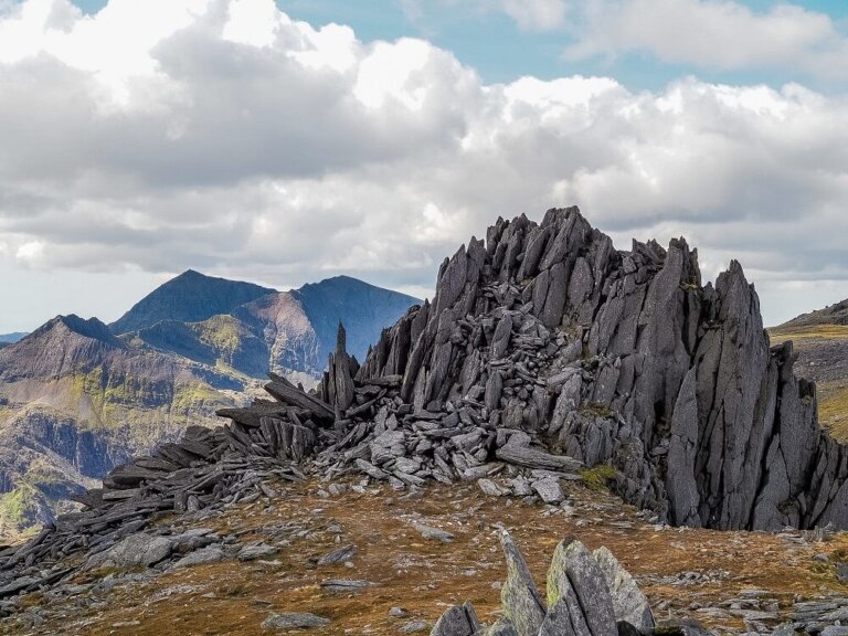
The path will turn a bit rocky but for the most part it should still be obvious where to go even in thick fog. On a clearer day you should get a pretty epic view of Carn Mor Dearg and Ben Nevis in the background. Along the way you’ll reach Carn Dearg Meadhonach which is 1179m (3868 ft) high. It’s marked with a cairn, so even in low visibility it can be identified.
From here the path takes a sharp right turn which you have to follow. In foggy conditions my advice is not to walk beyond the cairn because it also marks the cliff edge. So, you want to go to your right towards Carn Mor Dearg. The path is wide initially, but it will get narrower so make sure to navigate carefully in low visibility.
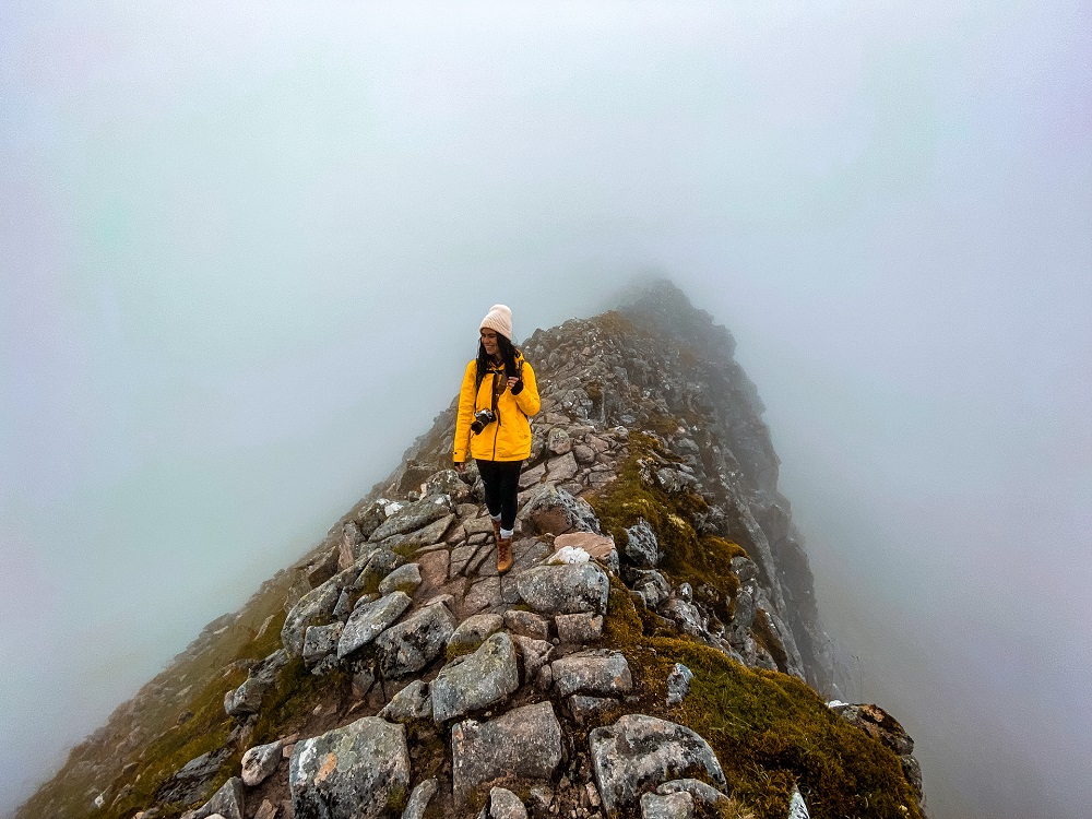
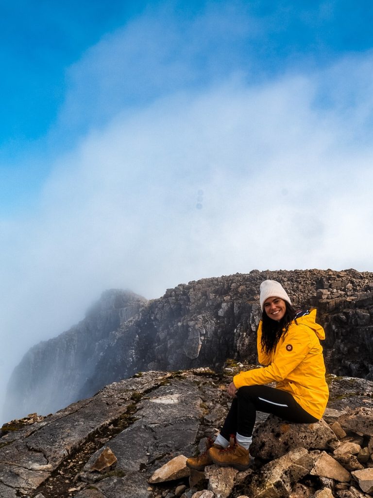
Soon you should reach the 1,223 m (4012 ft) high CMD. This time the path splits, so in low visibility you want to follow the path on your right. On a clear day, you should have the most amazing view of Ben Nevis connected by the magnificent CMD arete. You’ll walk a bit down before you start your ridge scramble. As soon as we reached this stage of the trail, I was calm and my fear of getting lost or walking off the edge disappeared completely. I know some people would probably feel the opposite.
It’s pretty easy to navigate across the ridge. Luckily you can either scramble along the crest or take the bypass to your left. So, take your pick depending on the weather conditions and your ability and enjoy this amazing ridge nature has formed for us.
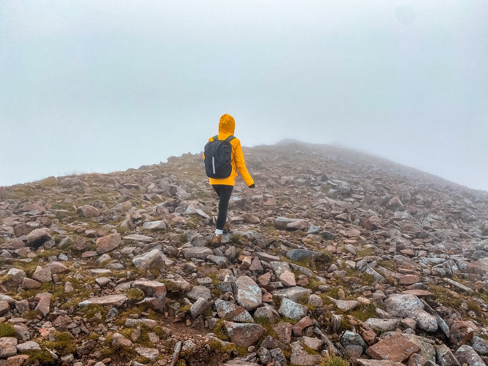
3. Ben Nevis
You’ll have a bit of a descent before you start your climb all the way to the top once again. This section is pretty steep and you’ll have to navigate through a field of boulders. Whilst traversing isn’t the easiest in low visibility, there will be some poles which will guide you to the top.
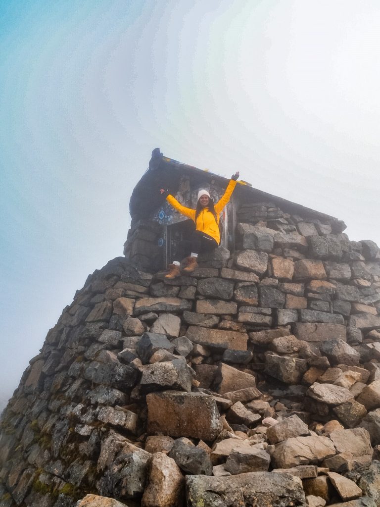
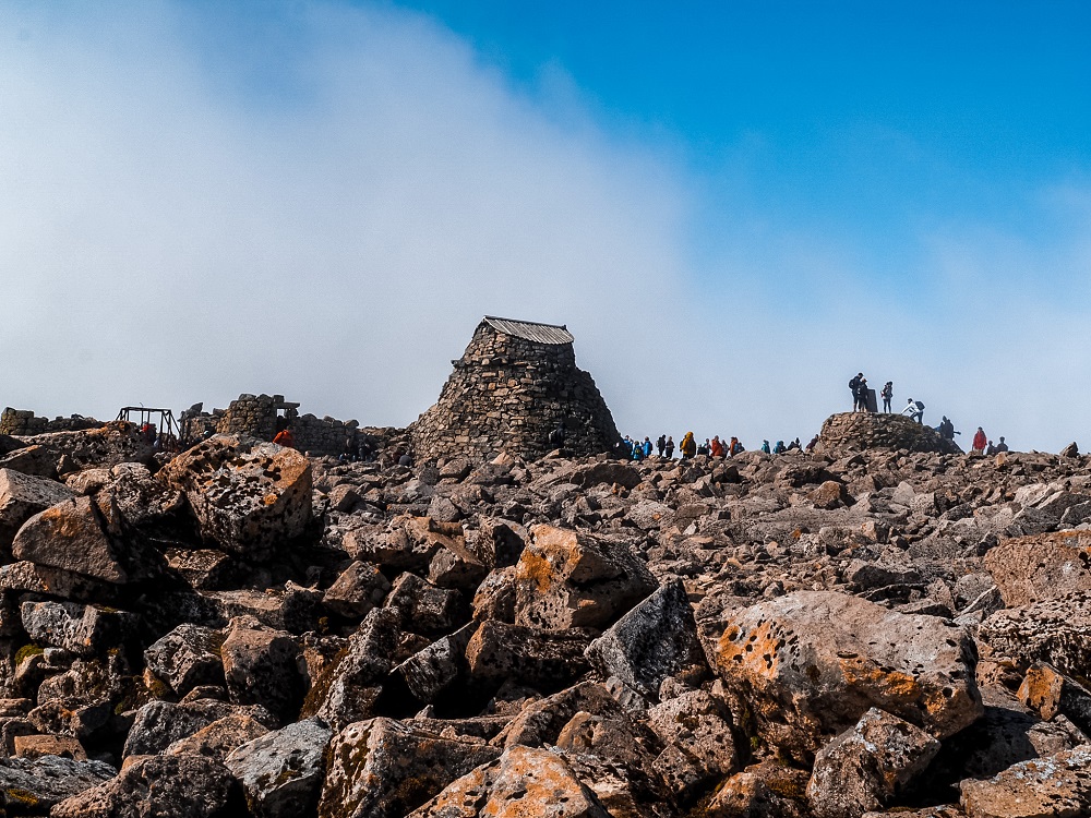
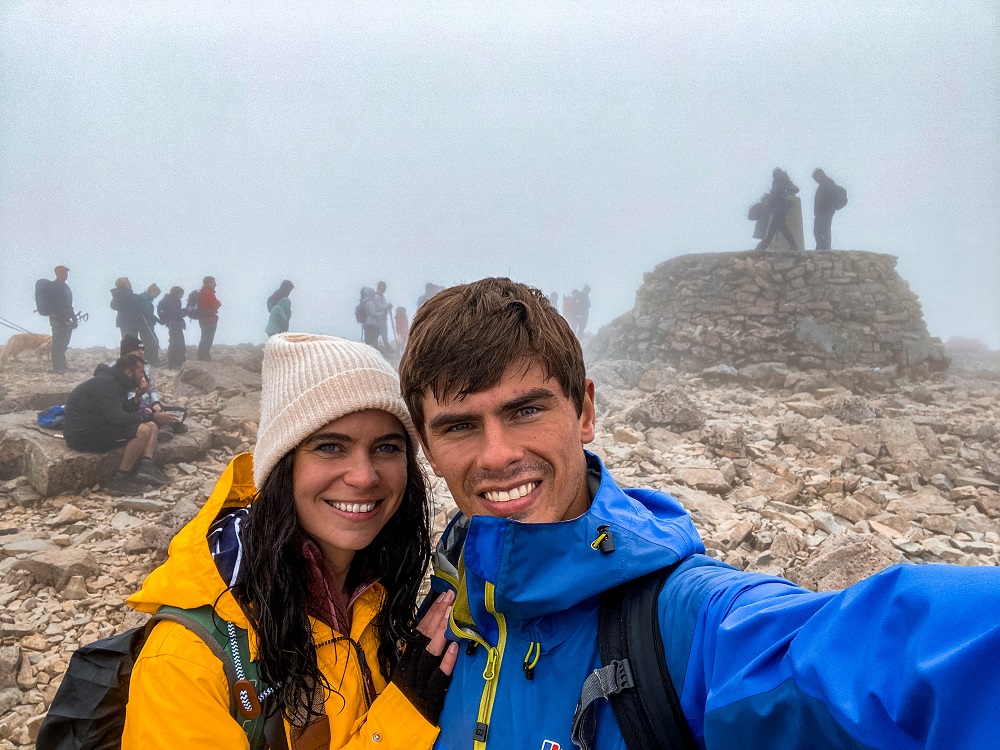
One minute you’re climbing and the next you’ll suddenly reach the summit of Ben Nevis. Since there won’t have been a lot of people on the trail up until this point, it might come as a shock just how busy the summit is.
You might also be surprised to see the clear remains of an old building there. This building was actually an observatory that was used between1883 and 1904 to collect detailed data on mountain weather conditions. The observatory was proposed, then set up and maintained by the Scottish Meteorological Society after many similar observatories were built across the world with the purpose of studying the weather at high altitude.
Did you know? – The collection of the data was done by a few men who lived in the stone hut still standing on the top all year round. It definitely wasn’t an easy task for the weathermen living there, having tinned food and recording data hourly. During the winter months heavy snows, freezing temperatures and high winds made collecting the data extremely dangerous. They would sometimes even have to tie themselves to the observatory so the high winds wouldn’t blow them over the cliff edge!
Unfortunately, the building was forced to close in 1904 due to a lack of government funding but the data collected is still the most comprehensive on mountain weather in Great Britain to this day.
4. Tourist Route to North Face Path
When you start descending Ben Nevis via the Mountain Path, you will realise why most people take this route instead of Carn Mor Dearg. The path is relatively wide and zig-zags all the way to the bottom of the mountain. This definitely makes the climb slightly easier, although I wouldn’t underestimate it.
The path is very stony, so you have to be careful when coming coming down as you can slip very easily. If the path is covered in snow you could easily lose sight of the path and could end up on dangerous terrain.
Did you know? – You might hear the Mountain Path referred to as Pony Track rather than the Tourist Path. It’s because it was initially carved out in 1883 for ponies which supplied the observatory.
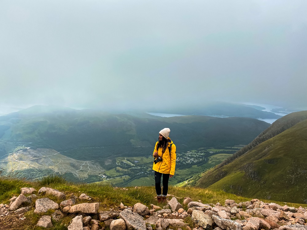
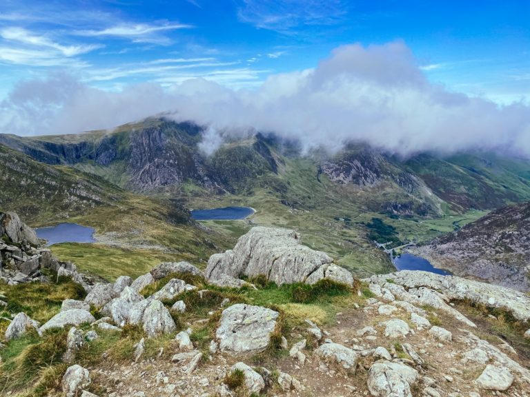
I can pretty much guarantee that the path will be busy until you reach the crossroads with the North Face Path. If you’re lucky with the weather you can just enjoy the views of the surrounding area. You’ll also come across a pretty waterfall at Allt na n-Urchaire. By now you would’ve seen Loch Meall an t-Suidhe in front of you.
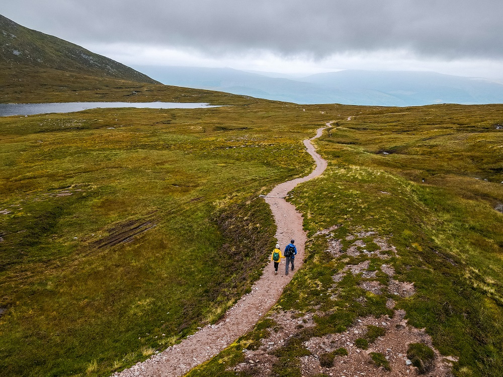
5. North Face Path to Car Park
When you reach the next fork, carry on straight ahead. Suddenly you’ll be pretty much on your own again. The path will run parallel with the loch for a while.
At the next crossroads turn right and follow the path that climbs a bit higher. It will circle around the side of the mountain. It’s a pretty easy path to follow for the most part. When you get a bit closer to Allt a’Mhuilin I suggest finding a suitable section to cross the river. You’ll want to be on the right hand side of the river. This path then eventually joins together with the path where you turned left in the morning. From that point you’ll just have to follow the path back to the North Face Car Park through the forest. Once you reach the car park, you’ve completed the Ben Nevis via Carn Mor Dearg circular trail.
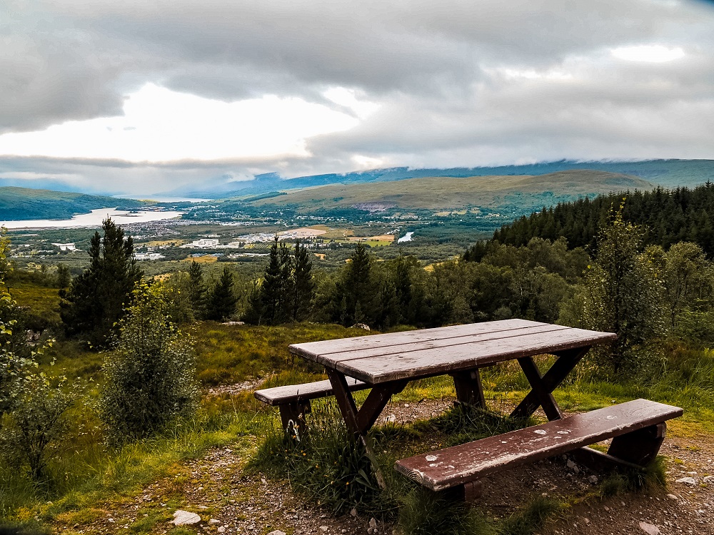
Additional Things to Do Around Fort William
Fort William is a great base if you’re exploring the west side of the Scottish Highlands. There are definitely no shortage of things you can do in the area. So, make sure to check out some of my other blog posts for more inspiration:
Glenfinnan Viaduct Trail – Complete the Glenfinnan Viaduct circular trail to see the Jacobite Steam Train, stunning viewpoints, historic memorials and Harry Potter filming locations. Click here to read it.
Top 9 Places to See in Glencoe – A scenic drive around Glencoe with many beautiful spots you must stop at. Click here to read it.
You can also browse for more Scotland content or more hiking trails in the UK and around the world in my Hiking Adventures Series.
Additional Ridge Hikes in the UK
If you enjoy ridge hikes and scrambles, I highly recommend checking out the following ridge hike posts:
- Hiking up Tryfan in the Ogwen Valley in North Wales
- Climbing Snowdon via Crib Goch, Snowdonia, North Wales
- Hiking the Glyders via Bristly Ridge, Snowdonia, North Wales
- Hiking Helvellyn via Striding Edge and Swirral Edge, Lake District, England
Final Thoughts on Climbing Ben Nevis via Carn Mor Dearg Arete
In short, I’m so happy that we chose to climb Ben Nevis via Carn Mor Dearg. It was definitely a long and challenging hike but to me personally it’s definitely a much more fun way up to Ben Nevis.
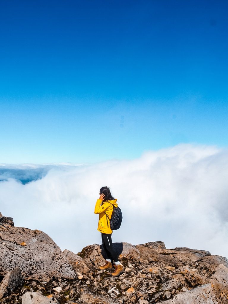
My only disappointment is obviously the thick clouds that prevented us from enjoying the views of the North Face of Ben Nevis. Although the walk was great, I definitely had a few moments where I doubted that we’d make it to the top. Not seeing where you’re going on an exposed mountain definitely makes you appreciate the power of nature. Luckily, the fear of getting lost passed and even the weather conditions improved as we climbed higher and higher.
In addition, the clouds cleared enough for us to enjoy some blue skies and a little bit of a view at the summit. It was definitely amazing to be able to stand above the clouds on top of the highest point in the UK.
Although reaching the top can be a fantastic feeling, I felt the greatest achievement when we got back to our car safe and sound.
Have you ever hiked up to Ben Nevis before? If so, which route did you take and how much of the Highlands did you manage to explore? Let me know in the comments below.
Now, let your adventure begin,

Our Top Travel Resources
Accommodation: For hotels we always use Booking.com and Hostelworld for hostels. We also book longer stays on Airbnb or Vrbo.
Flights: To find the best flight prices we always check Skyscanner, Google Flights or WayAway. Then we also check the airlines’ websites too for comparison.
Car Rentals: We use Discover Cars when we want to rent a car as it compares local, national and international companies.
Activities: If we book organised tours we always check either GetYourGuide or Viator.
Foreign Currency: Whenever we can we prefer to pay in local currency and for that we always use our Wise card. We can easily withdraw money from the ATM or pay by card at most shops and restaurants.
Travel Insurance: We never go anywhere without travel insurance. You never know what will happen on your trip, so good travel insurance like SafetyWing can protect you in case of injury, illness, theft and cancellations.
eSIM and VPN: To get data abroad we use Airalo which is an app that allows you to download a prepaid eSIM to your phone in over 190 countries. Make sure to have a VPN to avoid hackers accessing your personal data when using public WIFI. We use Surfshark which is the only VPN that offers one account on unlimited devices.
Remember…It all starts with a Pin…
WOW! this looks like a serious hike… and the thick fog makes it look almost otherworldly! i have had the highlands on my bucket list for sometime now, and i’ll definitely be scheduling in a trip to ben nevis, and maybe working up the courage to do this route.
Thank you Shelley, I agree it’s a serious but also a rewarding hike. I hope you can book a trip to the Highlands soon and you can climb Ben Nevis.
WOW! This hike sounds amazing! And slightly intimidating haha– but the views are awesome! Loved that you threw in fun facts throughout the post!
Thank you Destiny. This hike was truly amazing. I’m glad you enjoyed my fun facts 🙂
This hike looks beautiful! Definitely think I need more hiking practice before taking on something like this, but I hope to get there soon!
Thank you Alex. I agree, I would recommend completing a few more easier trails before attempting this particular route.
This hike looks absolutely incredible! I love to hike, so I would definitely enjoy hiking Ben Nevis one day. I know it’s a challenging hike, so I’ll have to work up to it! Your photos are also so stunning!
Thank you Kate, I’m happy to hear that you also enjoy hiking. I hope you can complete this trail in the near future.
Gorgeous photos – you’re making me miss my homeland!!
Thank you so much. I hope you can come back to Scotland soon.
Wow, what an impressive route! I’d love to climb Ben Nevis although that ridge trail looks a bit hair-raising for me! Unfortunately, I might need to stick to the tourist path on this one! Thanks for the great guide!
Thank you Hannah, I’m glad you enjoyed my guide. Yes if you have a fear of height I would probably stick to the tourist route too 🙂
Oh this is amazing! I was in Scotland but I just had few time to enjoy the wonderful landscapes around me! I hope I could take an experience like this one day! ❤️
Thank you so much. We spent a week in Scotland but we also felt like that wasn’t enough to see everything, so we want to come back too. I hope you can also return in the near future 🙂
Wow! Talk about knife-edge hiking. What a cool hike. I loved your video as well. 🙂
Thank you Jen, I’m glad you enjoyed watching our video too 🙂
What an incredible hike! I’ve seen Ben Nevis from a distance and heard this was the ultimate Munro to bag! I love the two translations! Haha. I guess it depends on what type of weather you get. I like that there is another route from all the tourists. I’d need to get in better shape but I’d love to try this one day with all these great tips!
Thank you Vanessa, I agree about the two translations lol. I hope you can visit in the near future and complete this trail.
Wow! I never knew this route existed! It looks like a seriously incredible hike. Thanks for putting together this fantastic guide
Thank you so much, I’m so glad you enjoyed the guide.
Congratulations! As one who has been doing a lot of hiking over the past year, your hikes are a big accomplishment. Thanks for all of the great detail, instructions, and pictures.
Thank you so much, I’m so happy to hear that you found my guide useful. I hope you can complete this trail in the future.
I am not an experienced hiker and probably am not up to a climb up Ben Nevis. So it was great to read about this experience. Interesting to read about ratings with “scrambling” so I know that even a Grade 1 scramble might be pretty tough using hands and feet. Great tips for people wanting to do the climb.
Thank you Linda, I’m glad you found it interesting and useful. Yes, sometimes Grade 1 scrambles can be just as scary as higher grades so it’s good to warn people about the level of difficulty before they attempt the hike.
What an incredible experience! I’m a day hiker so am in awe of you hiking Ben Nevis via Carn Mor Dearg Arete. Great guide with lots of fabulous tips and fun facts!
Thank you so much, it was indeed a fantastic experience. I’m glad you found my post useful.
Great guide to climbing Ben Nevis! I had meant to do this while I was at university in Scotland but could never find the time to go unfortunately. This is making me want to start planning!
Thank you Krista I’m glad you enjoyed my guide. I hope you can return to Scotland soon and finally conquer Ben Nevis.
Another excellent guide of the iconic Ben Nevis! I did the tourist route, which was tough enough for me! Set off in warm sunshine and had snow and cloud on the top, with barley visible views! Still felt good though, to have reached the summit. Thanks for the great photos and memories of a great hike.
Thank you Karan, glad to hear about your hiking experience. The weather conditions you had were very similar to what we had.
Wow, what are the chances that I came across your post – we are planning to visit Scotland next summer and definitely need to consider adding this to our itinerary! I had never even heard of this hike before. Thanks for sharing! Xx Sara
Thank you Sara, I’m so happy you found my post before your visit. I’m sure you’ll have the best time exploring Scotland. x
I didn’t realize that this route exists. I climbed Ben Nevis via the tourist path and the number of people getting to the top was huge. I’ll definitely do the hardest one while I get more experience. Thanks for so many tips and informations about that path!
Thank you so much Bernadeta, we’re happy to hear that you’ll use our guide to climb Ben Nevis via CMD. The tourist path is definitely an easier one, but because of that it attracts more people and could feel crowded.