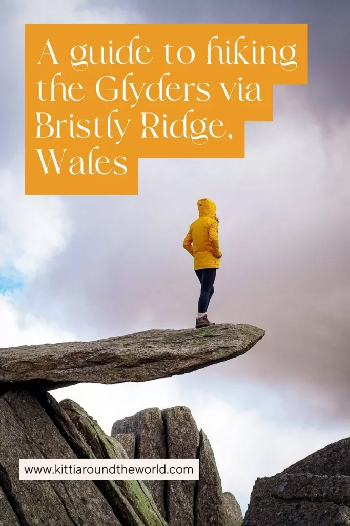
The Ultimate Guide to Hiking the Glyders via Bristly Ridge, Eryri (Snowdonia), Wales
Are you thinking about completing the well-known ‘Glyders’ trail via Bristly Ridge in Eryri (Snowdonia) National Park, North Wales? If so, then you’re in the right place. In this blog post, we’ll give you a detailed guide on everything you need to know about this particular hiking trail including trail length, level of difficulty, best time to hike it, how to get to the trailhead, and of course what to expect once you’re on the trail.
We’re not mountaineers but we do spend the majority of our free time hiking. We absolutely love ridge hikes that include a bit of scrambling and we’ve completed many in the past such as Tryfan via North Ridge, Yr Wyddf (Snowdon) via Crib Goch and even Ben Nevis via Carn Mor Dearg arete just to name a few.
In addition to crazy ridge hikes, we also love trekking and have completed many high altitude multi-day treks in the Andes during our time in South America such as the Colca Canyon trek, Salkantay to Machu Picchu trek and the Ausangate Trek to Rainbow Mountain.
We don’t mention these to brag, but to show that whilst we’re not experts, we’re not novices either and have gained plenty of experience and just as much respect for the mountains over the years.
Disclosure: This post may contain affiliate links, which means we may receive a small commission if you click a link and purchase something. Clicking these links won’t cost you anything, but it will help us to keep this site up and running! Learn more about our affiliate policy.
Introducing the Glyders (Glyder Fach and Glyder Fawr)
The Glyderau (the Glyders) is a mountain range in Eryri (Snowdonia) National Park. The name comes from its two highest peaks, Glyder Fawr (3284 ft / 1,001 m) and Glyder Fach (3261 ft / 994 m).
Glyder derives from the Welsh word Cludair that means a pile or heap of stones. Fawr means big and Fach means small. So, essentially these peaks translate to ‘big pile of rocks’ and ‘small pile of rocks’. The names actually couldn’t be any more fitting as you’ll see when you climb them.
The Glyderau range’s two highest peaks are classed as Welsh 3000er’s, which means they’re two of the 15 mountains in Wales that are over 3,000 ft (914.4 m) high. If you didn’t know, there’s a challenge called the Welsh 3000s Challenge, where you have to climb all 15 peaks in 24 hours.
How to get to the Trailhead of the Glyders
By Car: The most convenient way to reach the trailhead is by private or hire car. For climbing the Glyders via Bristly Ridge, you can park at the Ogwen Car Park (post code: LL57 3LZ). It is a pay and display car park and it costs £3 for up to 4 hours and £6 for all day parking. We recommend getting an all day ticket. There are additional free or paid car parking bays located along the A5. Car parking is a big issue in the national park. If you want to find a spot you have to arrive really (we mean REALLY) early in the morning.
Note. Do not park anywhere along the A5! Many people do that once they see there aren’t any other options left. Firstly, it can be dangerous as the road isn’t very wide. Most importantly, it’s monitored regularly, and you’ll definitely get a parking ticket upon your return. They had police and officials out giving people tickets even if they didn’t park on a double yellow line.
By Bus: If you’re staying within the national park you can actually arrive to the trailhead via local bus. The bus stop is right in front of the visitor centre, so it’s pretty convenient. You can take the T10 between Bangor and Corwen via Betws-y-Coed. In addition, there’s Bws Ogwen shuttle bus that offers services between Bethesda, Lyn Ogwen and Capel Curig between April and October. They run every day but Wednesday and a return ticket is £3 per person.
Useful Information About the Glyders via Bristly Ridge Trail
Since Bristly Ridge is an extension of Tryfan’s North Ridge route many people do them both together. It would be a much longer hike though, so you can just do Bristly Ridge on its own and do Tryfan on a separate day.
Length of the Glyders via Bristly Ridge Trail
The Glyders hiking trail via Bristly Ridge is an approximately 6 mile (9.5 km) long circular route. Depending on your speed, how long it takes to complete the Bristly Ridge section, and how long you’re spending on top of the Glyders, this route could take around 6 hours. The scenery is just breath-taking, so inevitably you’ll want to stop every 5 minutes to admire it.
For reference, we started the trail around 9AM after walking an extra 30 minutes due to the car parking situation. Since we hadn’t scrambled in a while, the Bristly Ridge section of the walk took us a bit longer to complete than we anticipated. We also just tried to enjoy the scenery and the unusual sunshine and windless conditions which we don’t always get in North Wales. Around 12PM we reached the top and stopped for lunch. In the end, we completed the walk around 3:30PM.
We would definitely allow enough time to complete this particular trail and suggest starting earlier rather than later. If you’re buying a parking ticket, we recommend paying for all day parking, so you’re not in a rush.
Level of Difficulty
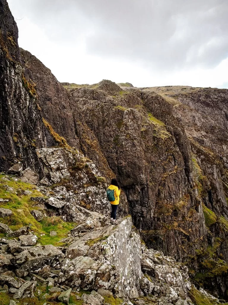
The Glyders via Bristly Ridge hiking trail is considered a difficult route and a Grade 1 scramble. However, this really depends on your fitness level, previous scrambling/hiking experience and even the weather conditions. We really don’t recommend attempting reaching Glyder Fach via Bristly Ridge without any prior hiking or scrambling experience!
What is scrambling? Scrambling is somewhere in between walking and climbing. In the UK, scrambles are graded from 1 to 3. A Grade 1 scramble requires you to use both your hands and feet, but it’s the easiest one you can do. Grade 2 and 3 are closer to proper rock climbing, where you will most likely require the use of a rope. Needless to say that Grade 3 scrambles are the hardest, and you need to have proper experience and gear.
The length of the trail might not seem too long, but there are quite a few technical sections along the ridge that could be difficult to navigate for some. When reaching the top of the Glyders the path is pretty flat, although the terrain is uneven with plenty of loose rocks. You’ll also need to be careful descending the mountains as the way down is steep and slippery. This part can also be quite tiring and hard on your knees.
You also need to have a good head for heights. The ridge has some pretty sheer drops and even experienced hikers can be paralysed with fear or cragfast. Although this trail is nowhere near as busy as Crib Goch can be, sometimes you’ll have to be patient with slower fellow scramblers. If you happen to be the slow one, then make sure to just take your time. Don’t try to rush yourself because of others as rushing can lead to mistakes.
Can you Climb the Glyders without Scrambling up Bristly Ridge
The short answer is yes. If after reading our guide you don’t feel comfortable scrambling up Bristly Ridge, you can go around it. We marked that optional route ‘Blue’ on the AllTrails map above. When you get to the wall between Tryfan and the start of Bristly Ridge, climb over the stile so the wall is on your right hand side.
This path will eventually join together with the main route just before the Cantilever.
Best Time to Hike the Glyders via Bristly Ridge
Best season to hike the Glyders? We personally recommend planning your climb between the end of spring and start of autumn. Good weather conditions are a must for hiking the Glyders via Bristly Ridge. As a general rule of thumb, unless you’re highly experienced we don’t recommend attempting the Glyders via Bristly Ridge during the winter or in snow.
What’s the ideal weather conditions for hiking the Glyders? You’ll be in North Wales, where the weather conditions can change quickly. You essentially want to have a relatively clear day, as missing out on the views would be a shame. You also want a dry day because the rock becomes very slippery when wet. If you have a lot of previous experience, it’s doable in less perfect weather conditions. Nevertheless, low visibility, rain and wind can make the climb more dangerous. Therefore, we would think twice before doing it in bad weather conditions as you really only need one wrong step!
Our biggest advice is to check either the Met Office or the Mountain Weather Information Centre (MWIS) on the morning of your planned hike.
Best time of the day to hike the Glyders? Although Glyder Fach and Glyder Fawr will be nowhere near as busy as Yr Wyddfa (Snowdon), the Owgen Valley does attract a lot more people during school breaks, bank holidays and on any sunny days really. For this reason, we suggest you start your hike as early as possible. Car parks can fill up very quickly, and trust us, you don’t want to add an extra hour to your total hike just to get to where your car is parked.
Facilities Along the Trail
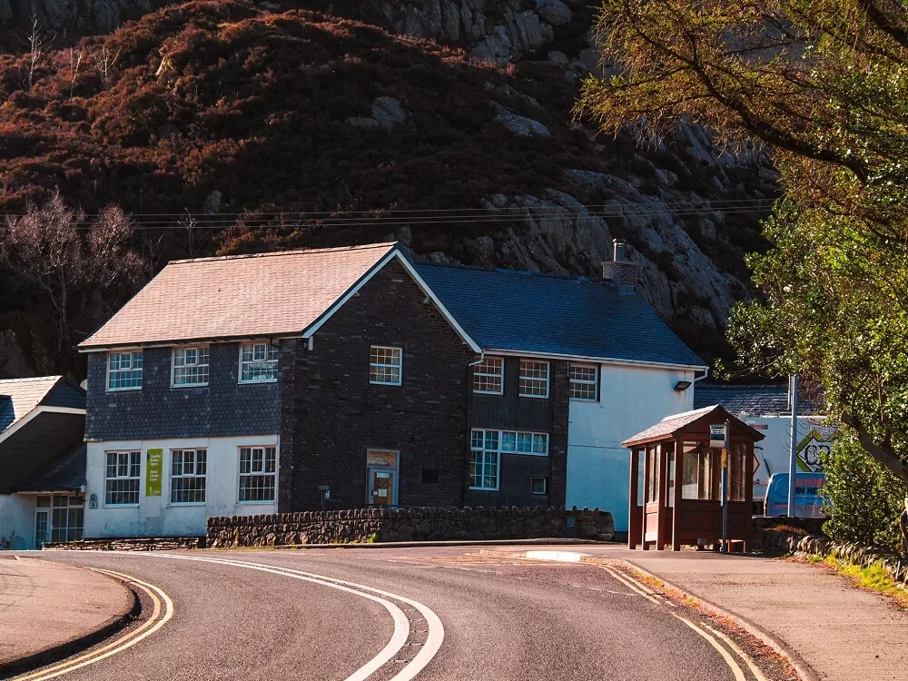
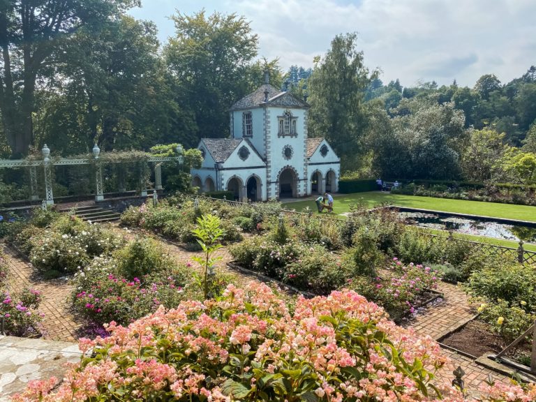
Cafes and Picnic Spots. There’s a visitor centre (Canolfan Cwm Idwal) right next to the A5, approximately 5 miles (8 km) south of Bethesda and about 4 miles (6.4 km) west of Capel Curig. There’s a kiosk serving light refreshments including hot and cold drinks. It’s open between 9AM and 4PM.
We definitely suggest bringing your own lunch with you. There are some pretty fantastic picnic spots along the top between Glyder Fach and Glyder Fawr. You’ll also get an insane 360 degree view of Eryri (Snowdonia).
Toilets. The only toilet facility is at the visitor centre. There won’t be toilets anywhere else along the route. The visitor centre also has one shower.
Accommodation. In case you want to stay close by and complete other trails such as Tryfan or Pen Yr Ole Wen, then you can consider booking the YHA Idwal Cottage, Bryn Tyrch Rooms or The Rocks at Plas Curig Hostel. For a unique stay, you can even spend the night at the Mountain Church. If these are full, you can always check out other locations in the national park. Of course, you can also camp at a camp site too if you already have your own camping gear.
What to Wear and Bring with You?
Normally North Wales is rather wet and conditions can change quickly the higher up you go. Therefore, wear weather appropriate clothing when going on the Glyders via Bristly Ridge hike. You’ll be exposed along the majority of the trail. So, make sure you check the weather forecast before you set off and have a few waterproof and warm layers with you. You might feel a bit cooler along the top but warmer lower down or whilst your descending or ascending.
Many accidents happen due to people not wearing proper walking/hiking shoes or boots. Therefore, we can’t emphasize enough that you should wear hiking appropriate footwear when attempting the Bristly Ridge route. If you get caught in the rain, the rocks can become slippery, so you’ll want shoes with good grip. Even if you avoid the ridge, the other paths are pretty rocky too so you want shoes with thicker soles.
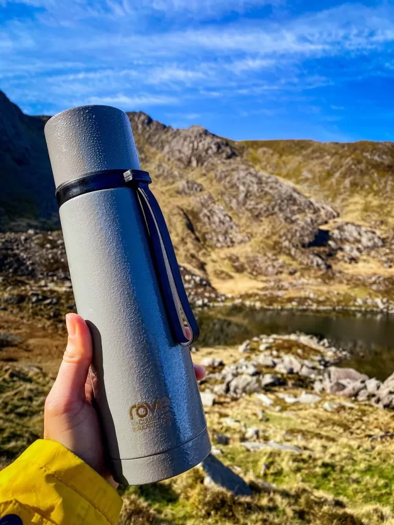
Pack your own lunch and snacks and have plenty of water and hot drinks with you depending on the weather. During your ascent you’ll sweat a lot more, so you want to keep hydrated and have enough energy to carry on. There are plenty of streams, so you can always top up your water bottle there.
During the summer months many people just walk to the lakes and spend a relaxing day there. If it’s a sunny day make sure to wear sun-cream, a hat and sunglasses.
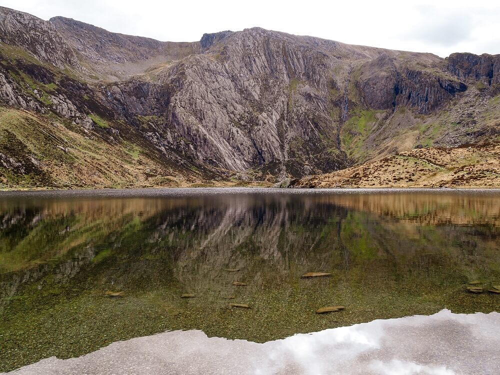
Note that you cannot swim in Llyn Idwal.
Please Note! Whatever you bring with you, make sure you either take it home or dispose of it responsibly. We suggest bringing a garbage bag with you in which you can collect all your waste. Enjoy your time in nature but Leave No Trace!
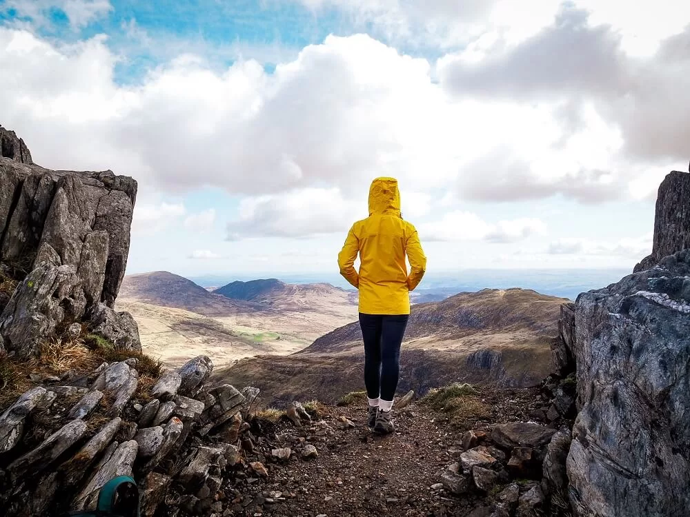
The Glyders via Bristly Ridge Trail
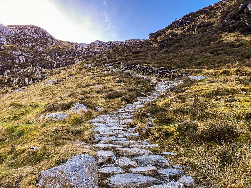
1. Ogwen Car Park to Bristly Ridge
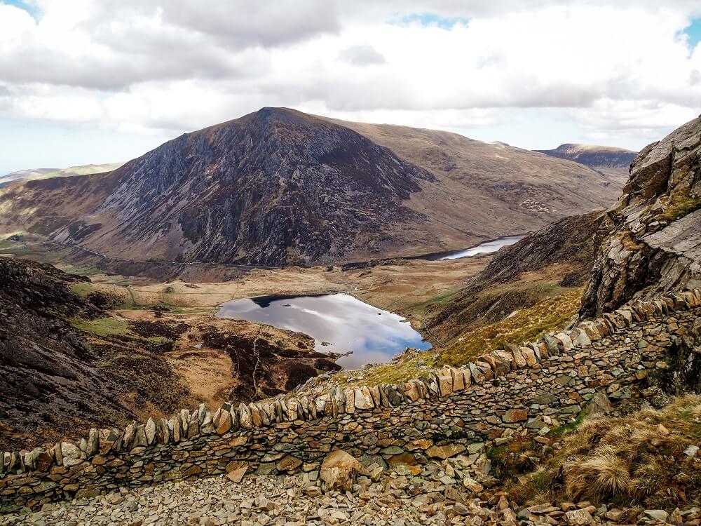
The first section of the trail will take you from the visitor centre to the start of Bristly Ridge. Follow the signs from the car park and you should go through a gate with a lovely waterfall to your right. Soon the path will split and you should keep to the left heading towards Llyn Bochlwyd.
This section of the route has a nice wide path and you’ll possibly see a few more people on it. Many people come out just to stroll around the lakes. The views or the mountains towering over you are absolutely beautiful.
The trail itself will have a gradual incline, so it’s a great way to warm up your body just before you start scrambling. As you walk higher and higher, don’t forget to look back to see Llyn Ogwen and Pen Yr Ole Wen on the other side of the valley. You should also have a great view of Tryfan on your left which you’ll see from a few different angles on this trail.
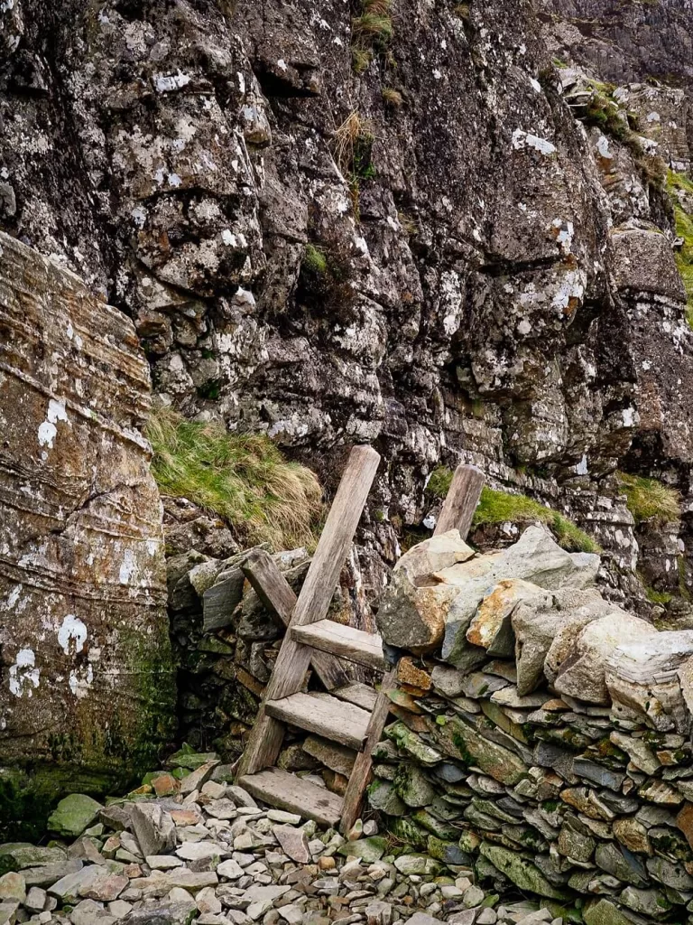
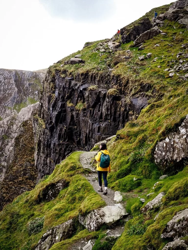
The last part of this section will get a bit steeper and the terrain will become more unstable. You’ll know you’re at the decision making point when you reach the stone wall with the stile.
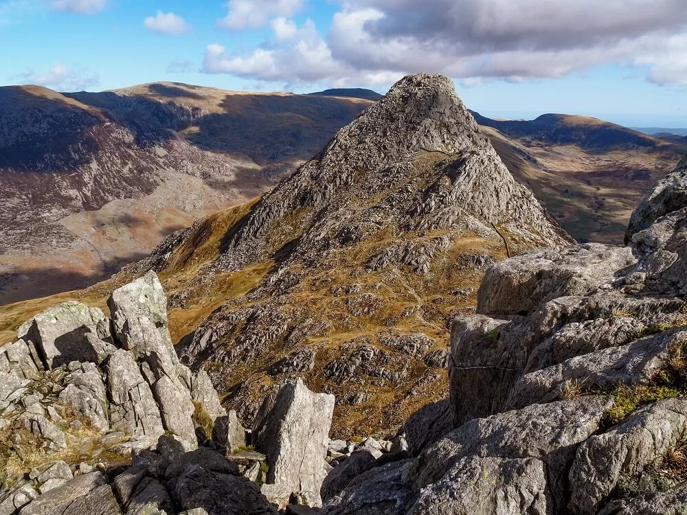
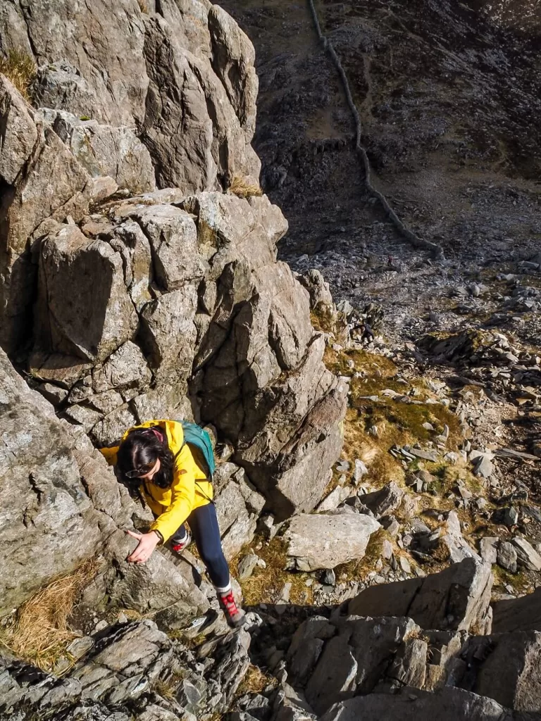
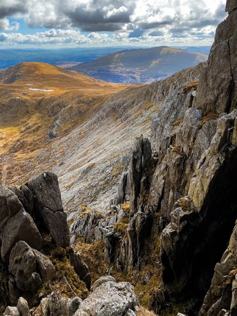
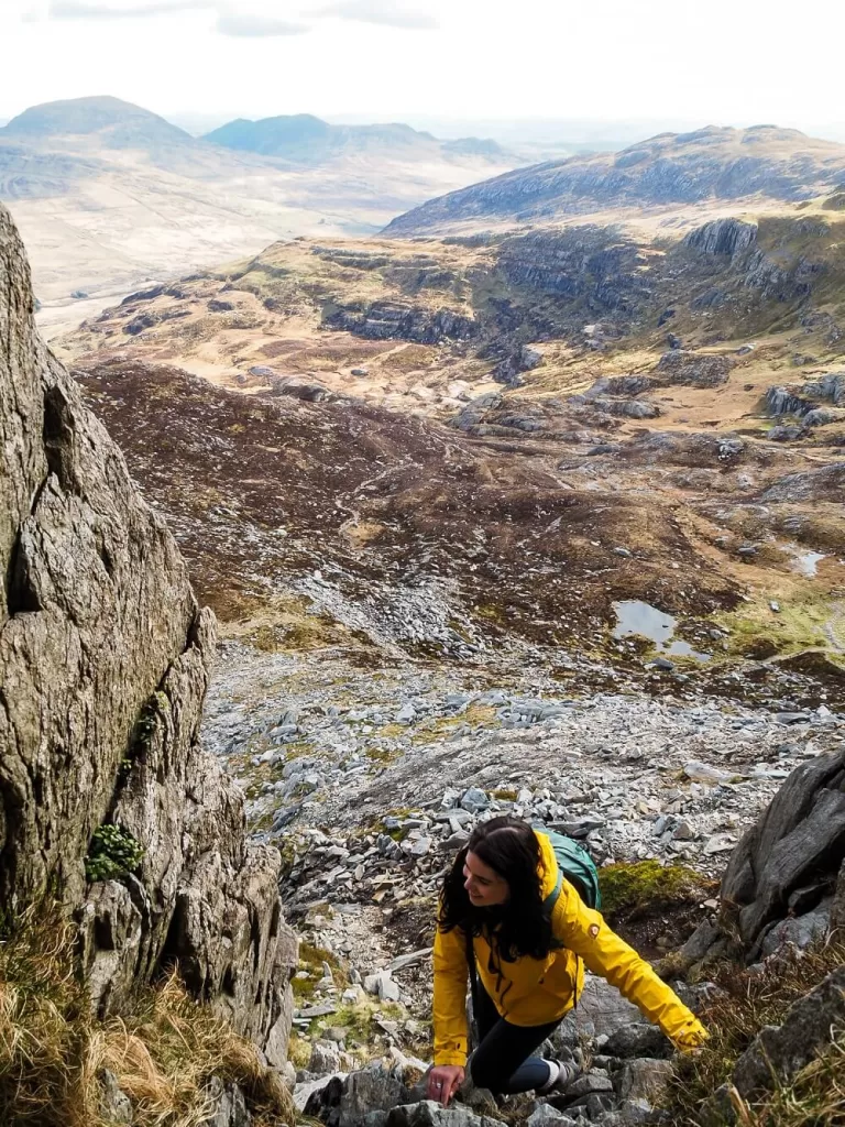
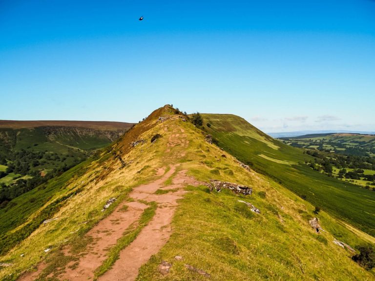
2. Scrambling Bristly Ridge
If you’re challenging yourself with the scramble, then don’t climb over the stile. Instead, carry on ascending with the wall to your left. You’ll know when the scramble starts because you’ll need to start using your hands.
Now, there are two gullies you can consider choosing when you start your scramble up Bristly Ridge. One is called Sinister Gully and the other is called Dexter Gully. Sinister Gully is located to the left, basically directly above you from where the stone wall ends. The Dexter Gully is a bit more to the right.
Okay, we know that naming a gully ‘Sinister’ might put people off. However, in reality the names ‘Sinister’ and ‘Dexter’ just mean left and right in Latin. Sinister Gully apparently has more handholds, so it’s definitely the most popular choice. Dexter Gully has more loose rock, so we recommend sticking to the Sinister one. Unless you’re here to challenge yourself a bit more of course.
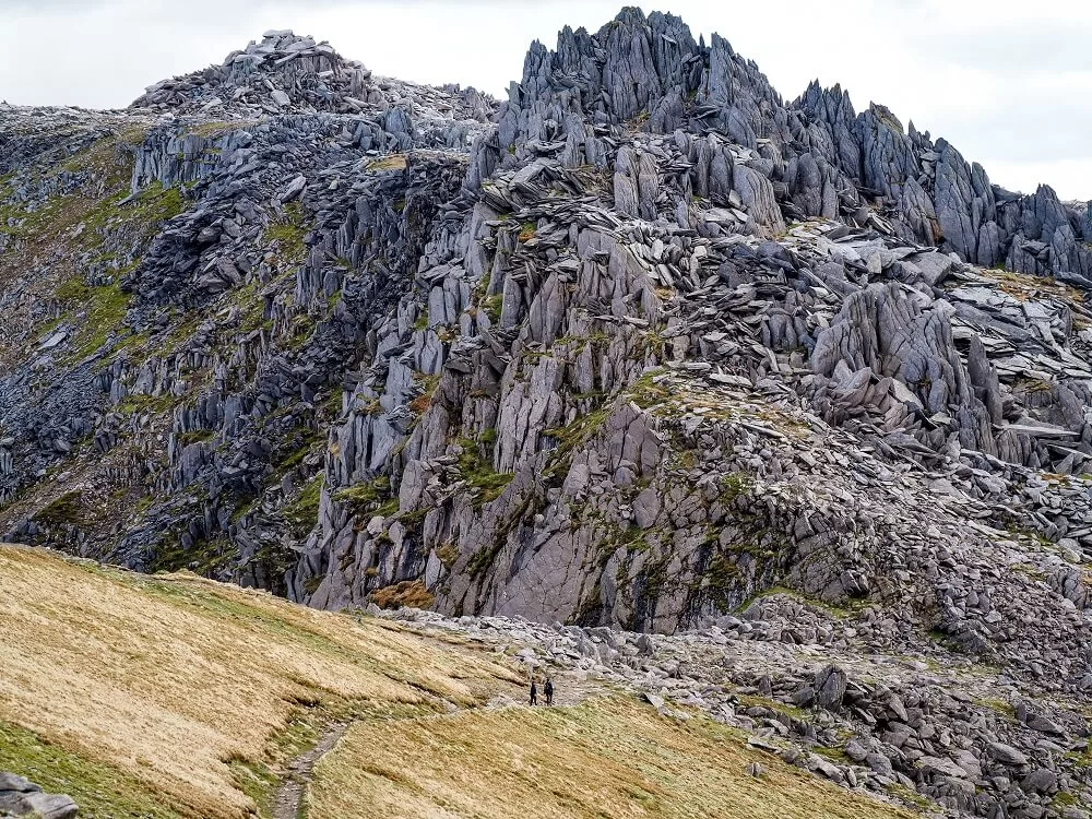
You’ll basically have to scramble up and down a few pinnacles (the ‘Bristles’). Some sections are more exposed than others and some will have some pretty steep drops below. From the first part you get some fantastic views of Tryfan, so don’t forget to look back every so often when it’s safe to do so.
You’ll know you’re nearly at Glyder Fach when you see some other trails joining the one you’re on. This means that you’ve successfully scrambled up Bristly Ridge.
3. Glyder Fach to Glyder Fawr
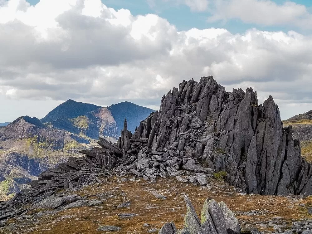
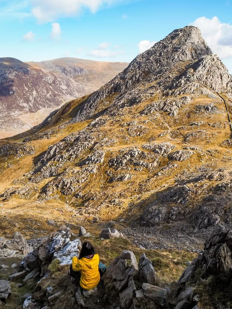
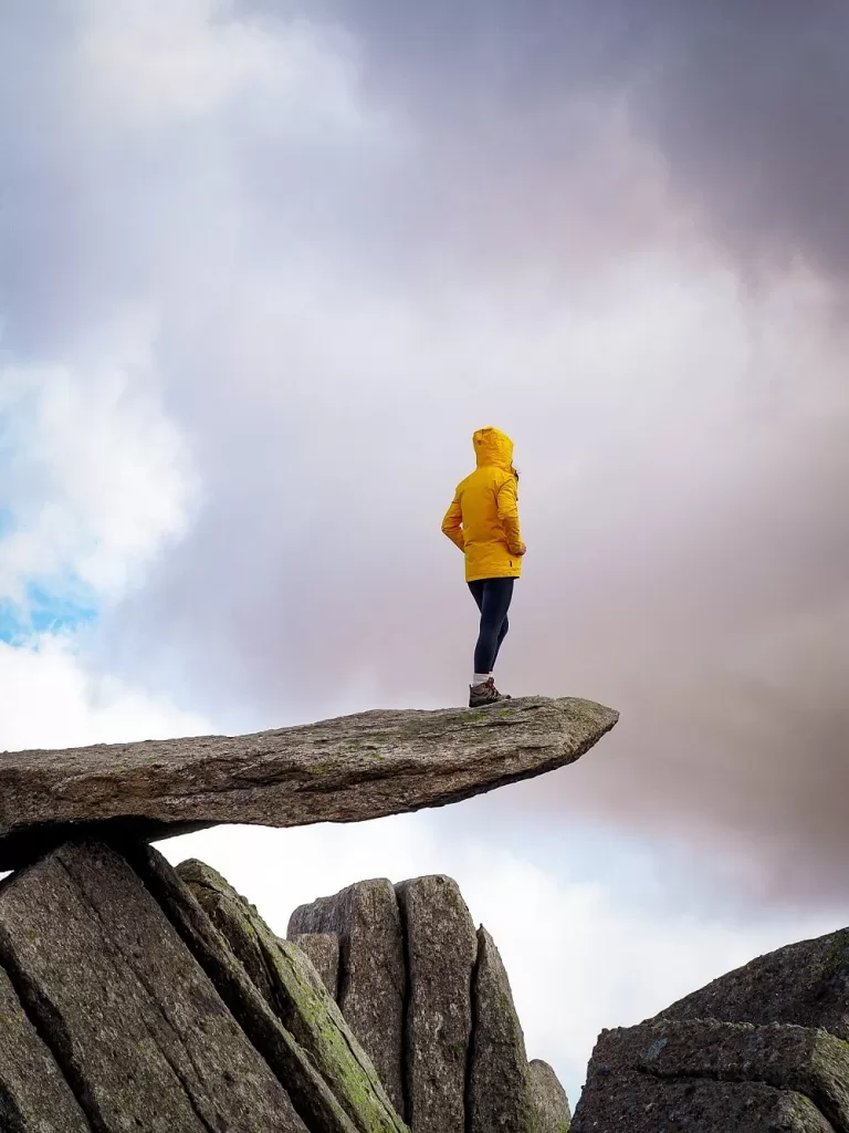
This section of the walk is relatively easy and even more scenic. There are a few highlights between the two mountain peaks such as the Cantilever and Castell y Gwynt.
The Cantilever
Located next to the summit of Glyder Fach is the Cantilever Stone (coordinates: 53.10511, -4.00682). It is a huge rock which looks like it’s balanced precariously from some angles. It’s pretty sturdy to climb on top of though and is screaming out for some creative photos.
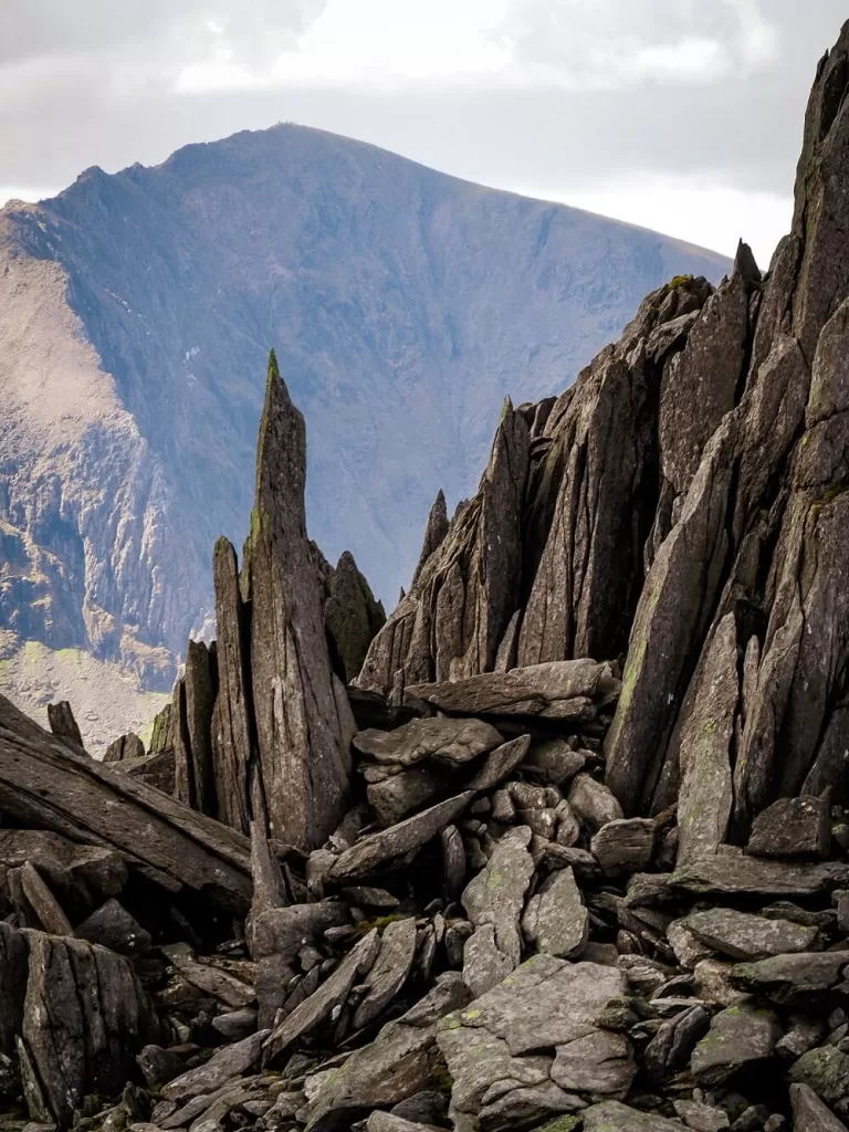
Castell y Gwynt
Just a short walk from Glyder Fach is Castell y Gwynt or Castle of the Wind (coordinates: 53.10374, -4.01206). It is classed as a Nuttall, which are mountains in England and Wales that are over 2,000 ft (610 m). Although Castell y Gwynt has a height of 3188 ft (972 m), it’s actually not included in the Wales 3000s.
The pinnacles rising from the ground look like a dragon’s back from an angle. You can scramble up them if you feel like doing a bit extra after Bristly Ridge, or you can just follow the path round underneath.
Glyder Fawr
You’ll soon reach your next waypoint: Glyder Fawr, the highest of the Glyders. The views from this area are absolutely magnificent with 360 degree views of the Yr Wyddf (Snowdon) massif including our favourite mountain Crib Goch. You can also see the Carneddau and Anglesey to the north. It really is a beautiful spot allowing you to see all the best bits of Eryri (Snowdonia) National Park.
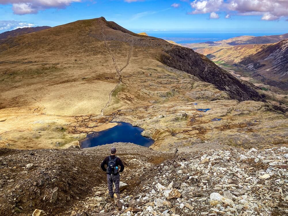
4. Glyder Fawr to the Devil’s Kitchen
From Glyder Fawr, you’ll essentially be descending all the way to the car park. The initial start of the descent is going to probably be the hardest. The path goes pretty much straight down and the terrain is slippery soil mixed with loose rocks that will make you want to crawl on your butt. Whilst we didn’t do that we were pretty close at times.
We completed the Glyders via Bristly Ridge hike on a perfectly dry day, but we can only imagine this section in wet conditions. Proceed with caution, especially if you have knee problems. Well, even if you don’t, we guarantee that by the end your knees will be screaming for a flat surface.
5. The Devil’s Kitchen to Ogwen Car Park
After the slippery slope, take the path off to the right and you’ll eventually climb over a stile and will carry on descending through a section called the Devil’s Kitchen.
The name Devil’s Kitchen is given to the massive dark crack that splits the rock of Clogwyn y Geifr (Cliff of the Goat) between Y Garn and Glyder Fawr. The Welsh name ‘Twll Du’ appropriately translates to ‘black hole’. The English name ‘Devil’s Kitchen’ is also appropriate in our opinion as sometimes you can see steam coming from between the cracks. Many say that the Devil is cooking when you see the steam seeping out.
This section of the Glyders trail is basically a long set of stairs down until you reach Llyn Idwal. It’s definitely more fun at the start especially compared to the previous section. However, after a while, going down stairs will become pretty tiring for sure and your knees definitely won’t like you either. The scenery on the other hand will be pretty stunning, so enjoy that but also watch your step.
Once you reach Llyn Idwal, you’ll just have to walk along the shores and join back up to the path you started on to get back to Ogwen Car Park.
Other Hikes You May Like in Eryri:
Final Thoughts on the Glyders via Bristly Ridge Hike
Prior to completing the Glyders via Bristly Ridge hike, I had no idea just how much fun I’d have along this trail. Jon has done this trail a few times before but it was my first time. We really had the perfect weather conditions for a ridge hike and we didn’t even have any wind on top. What a treat!
I really didn’t expect the views to be this amazing. You really can see the best of Eryri (Snowdonia) National Park, so it’s safe to say that it has now become my favourite trail for views in the UK. Bristly Ridge was definitely just the right amount of challenge for us. It’s a fun ridge to complete, but my ultimate favourite ridge is still Crib Goch.
Have you ever climbed Glyder Fach and Glyder Fawr via Bristly Ridge before? If so, how was your experience? If not, would you add this trail to your own hiking list? Let me know in the comments below.
Now, let your adventure begin,

Remember…It all starts with a Pin…

Fab post with great information, but if you’re planning this trip please don’t swim in Llyn Idwal. It is a nature reserve and swimming is not allowed to protect the species that live in the lake. There are plenty of other lovely lakes around for a wild swim!
Thank you for pointing that out Emily, I updated the post!