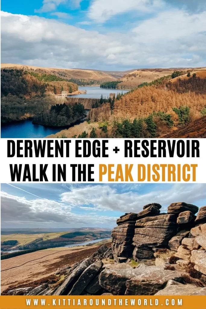
Derwent Reservoir and Derwent Edge Walk in the Peak District
Are you thinking about exploring the area around Derwent Reservoir and Derwent Edge? Then look no further. In this blog post we’ll dive into the rich history of three beautiful reservoirs: Howden, Derwent and Ladybower along with the lost villages of Derwent and Ashopton.
You’ll learn about why Derwent Reservoir was an important location during World War II and obviously you’ll have the chance to chase crazy rock formations and panoramic views on top of Derwent Edge.
If you’d like to see more of our Derwent Reservoir and Derwent Edge walk then make sure to watch our YouTube video by clicking here.
Disclosure: This post may contain affiliate links, which means we may receive a small commission if you click a link and purchase something. Clicking these links won’t cost you anything, but it will help us to keep this site up and running! Learn more about our affiliate policy.
About Derwent Reservoir in the Upper Derwent Valley
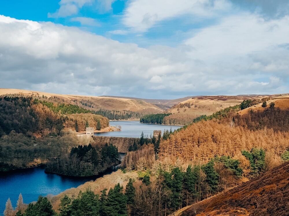
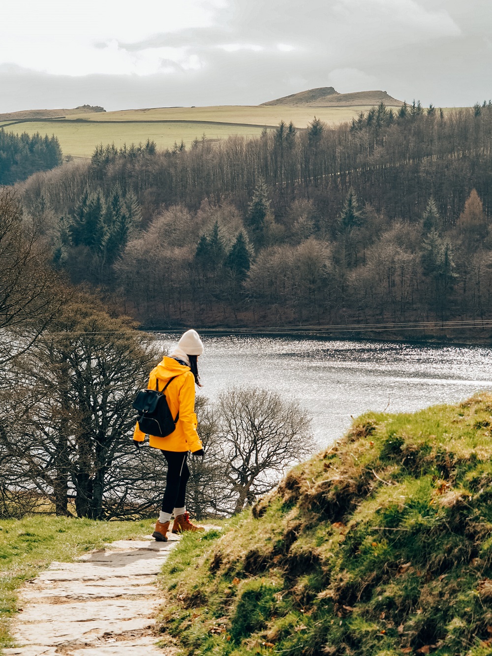
Located approximately 10 miles (16 km) to the west of Sheffield in the north of Derbyshire is Derwent Reservoir. The 1.5 mile (2.4 km) long reservoir is the middle of the three reservoirs that lie in the Upper Derwent Valley.
To the north of Derwent Reservoir is Howden Reservoir, through which the River Derwent flows first. The river then flows into Derwent Reservoir before it carries on to the south, through Ladybower Reservoir. All three reservoirs provide water for Derbyshire, parts of South Yorkshire and even for Nottingham and Leicester.
The need for water massively increased during the Industrial Revolution and urbanisation in the area. Since the Upper Derwent Valley is located close to key cities, it was an ideal place to build these reservoirs. Both Derwent and Howden Reservoirs started being built around the same time in 1901 and began to be filled up in 1914. Ladybower Reservoir on the other hand was built a bit later, between 1935 and 1943.
Did you know? – Pilots of the 617 Squadron RAF used Derwent Reservoir during World War II. Due to the dams similarity to German dams in the Ruhr Valley, the pilots practiced low-level flights here for Operation Chastise. A subsequent movie called Dambusters, dramatising Operation Chastise, was filmed in the Derwent Valley years later (1955).
The Lost Villages of Derwent and Ashopton
Before World War I and II two villages, Derwent and Ashopton, stood in the midst of farmland scattered all across the Upper Derwent Valley. When the need for water arose in the wider area, decisions were made that Howden and Derwent Reservoirs needed to be built. As a result, farmers living in those areas had no choice but to move to the safety of Derwent and Ashopton villages.
Little did they know that their new home would only be temporary. People realised that Howden and Derwent Reservoirs on their own wouldn’t be able to supply enough water. Another reservoir needed to be built. The two villages, Derwent and Ashopton, standing in the way of the approved location of the new reservoir, had to be flooded. Residents of these villages were relocated forever before the works began in 1935. By the time the works finished in 1945, Derwent and Ashopton were submerged under the well known Ladybower Reservoir.
Did you know? – If you’re living in the UK, you’ll probably remember that very hot and dry summer we had in 2018. During that summer the water levels of Ladybower Reservoir fell so much that the lost village of Derwent actually emerged from it. If you were in the area at the time, you could’ve seen the ruins of Derwent church and also some parts of the old cottages.
How to get to Derwent Reservoir
By Car: The most convenient place to park is at either Fairholmes Car Park or Derwent Overlook Car Park. Use S33 0AQ in your SAT-NAV to find it. You’ll have to pay £5 to park at Fairholmes Car Park all day. On the other hand, Derwent Overlook Car Park is free of charge, but it gets full quickly.
If the car park is full, there are plenty of other car parks along the reservoirs. If you don’t have your own car but would like to enjoy the freedom of a private vehicle, then you can always hire a car to get to Derwent Reservoir.
By Public Transport: Unfortunately getting to Derwent Edge by public transport is difficult. Your best option is to arrive to Bamford, located approximately 6 miles to the south of Derwent Edge. Ladybower Reservoir is easily reachable from Bamford and you can walk to Derwent Reservoir from there if you wish. You can also walk up to Bamford Edge from Bamford than make your way to Derwent Edge. Public transport options to reach Bamford are excellent. There are regular train and bus services to places like Sheffield and Manchester.
Make sure to plan your journey with Trainline which also provides information on bus fares.
Top Tip – Click here to check out my Bamford Edge and Ladybower Reservoir blog post if you can only reach those areas. They are just as stunning as Derwent Reservoir and Derwent Edge.
By Bike: If you enjoy cycling than there are plenty of local cycle trails running along Derwent Reservoir and the surrounding area. In addition, National Cycle Route 6 actually runs to the south. There’s also a bike hire shop at Fairholmes Car Park if you don’t have your own bike.
Good to Know Before You Go
Length of the Route
The Derwent Reservoir and Derwent Edge walking route we chose to do was about 14 km (8.6 miles) long. Depending on your speed and how long you are spending taking photos or stopping for a picnic, this route could take around 4 to 5 hours.
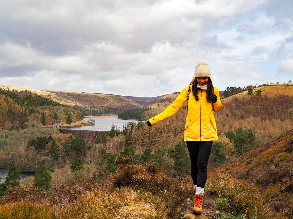
We started from Derwent Overlook Car Park and headed to Derwent Dam, before walking along the eastern side of Derwent Reservoir. Just before we reached Howden Dam we took the footpath to the right through the woodland and moorland. This led us up to a viewpoint of Howden Reservoir before we carried on towards Derwent Edge. Along the route we passed some rock formations such as Lost Lad and Back Tor before reaching Derwent Edge. From Derwent Edge we carried on along the ridge until we reached White Tor from where we started descending. After descending we walked along Ladybower Reservoir for a short time before reaching Derwent Reservoir.
You can extend the walk in multiple ways. If you’re feeling adventurous you can walk to Bamford Edge which is located approximately 4 miles (6 km) to the south of Derwent Edge. Of course, you can also shorten your walk by only walking around Derwent Reservoir.
Top Tip – Make sure you start your walk as early as possible if you come on a weekend. Alternatively, I suggest coming on a weekday if you can. This is a popular area, so expect Derwent Reservoir to be packed with people especially on a nice day.
Level of Difficulty
The route we did is relatively easy and you can complete it with a basic level of fitness. I recommend wearing the right footwear like trainers or boots. It’s steep ascending Derwent Edge and the path can be slippery and muddy when wet.
Please Note! – The wind is constant along the ridge even on a beautiful day. So, if the weather conditions aren’t suitable, please make sure you’re safe and don’t stand on top of the rock formations.
This particular route is only sheltered along the reservoir. You’ll be exposed the rest of the way, especially along the ridge, so wear appropriate clothing. I think this walk could be a great activity even on a slightly windy day but I wouldn’t suggest doing it in the pouring rain.
Facilities Around Derwent Reservoir
Cafés and picnic spots: I highly recommend packing your own lunch and if the weather is lovely stop for a picnic. You’ll be treated with amazing views of the back of Kinder Scout, Mam Tor, Win Hill and Edale. It will be a bit windier and colder up there even on a nice day so try to find some cover between the massive rocks. There are some picnic tables around Derwent Reservoir if you wish to properly sit down with your lunch.
Please Note! – You cannot have BBQ’s or any kind of open fire in the area, so make sure you pack an appropriate picnic.
If you’d like to grab a coffee or tea and a light bite to eat, you can do that at Fairholmes Visitor Centre’s café.
Toilet facilities: There are public toilets available at Fairholmes Car Park. There’s also a water fountain at the toilets, in case you’d like to fill up your water-bottle.
What to Wear and Bring With You?
You are in the north of England so weather conditions can change quickly. At the time of our visit it was dry, the sun was out but it was still windy even around Derwent Reservoir. However, walking along Derwent Edge was a bit of a struggle since the wind was much stronger.
Therefore, I recommend weather appropriate clothing when going on the Derwent Reservoir and Derwent Edge walk. You’ll be pretty exposed on the ridge and even on a sunny day Derwent Edge is windy. Make sure you check the weather forecast before you set off and have a few layers with you.
I also suggest wearing proper walking shoes or boots especially if you’re planning on hiking up to Derwent Edge. The trail is uneven and rain can make it muddy and slippery. Although, if you’re only walking around Derwent Reservoir, you’ll be fine wearing something a bit more casual.
I suggest packing some snacks and having plenty of water with you. Luckily you can fill up your water-bottle from the water fountain at Fairholmes Car Park. There are plenty of places to stop for a picnic or a quick break.
Please Note! – Whatever you bring with you, make sure you either take it home with you or dispose of it responsibly. Enjoy your time in nature but Leave No Trace!
Derwent Reservoir Walking Route
The area around Derwent Reservoir and Derwent Edge is full of amazing walking routes. Since they are relatively easy trails and ideal places for cycling it automatically attracts more people.
Whichever trail you decide to take or end up on, you will be treated with some beautiful landscapes, views and features. However, if you’d like to do the exact route we did, I divided it into 6 main sections.
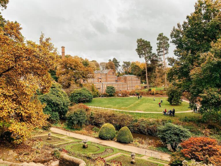
1. Derwent Reservoir to Howden Reservoir
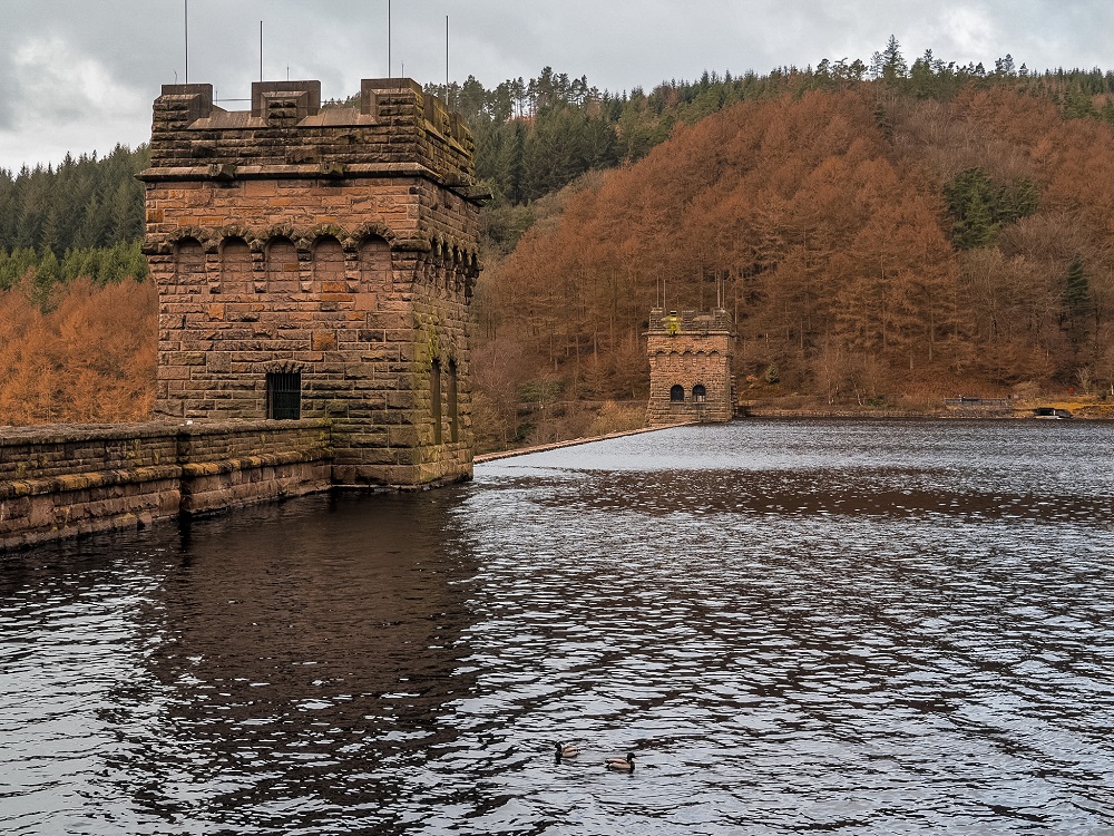
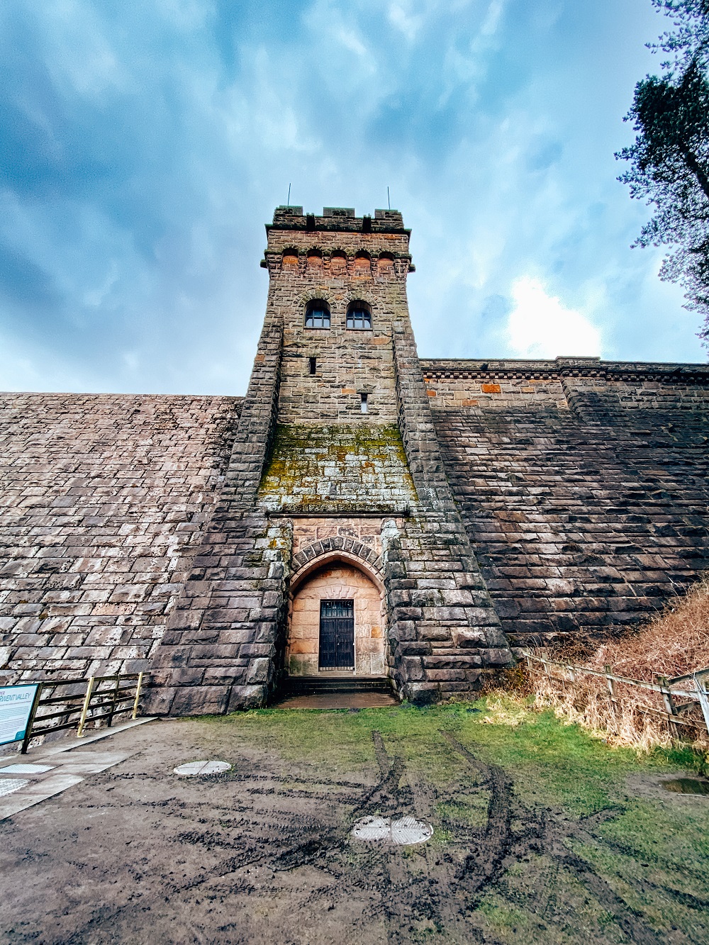
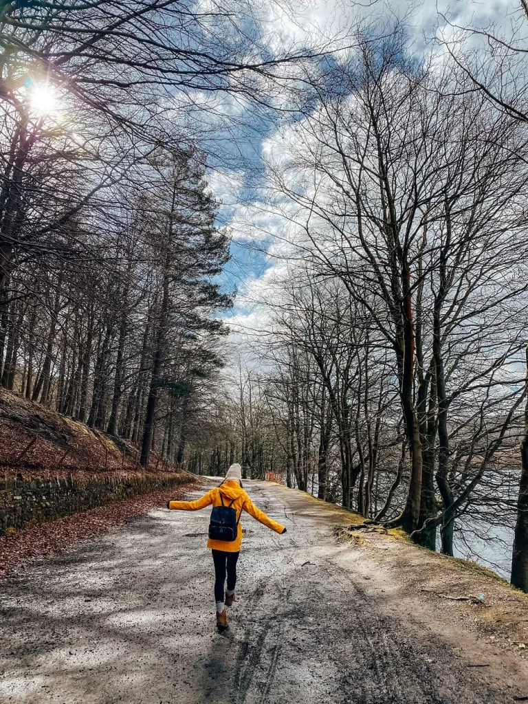
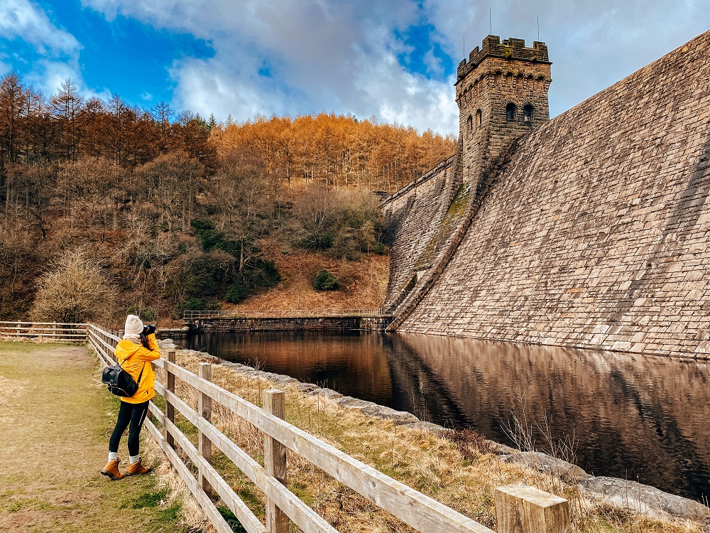
Derwent Reservoir runs in a north-south direction and covers about 70 hectares. From Fairholmes Visitor Centre the trail takes you first to the massive Derwent Dam. The dam is normally dry but after heavy rainfall it can overflow, creating a very powerful and spectacular man-made waterfall.
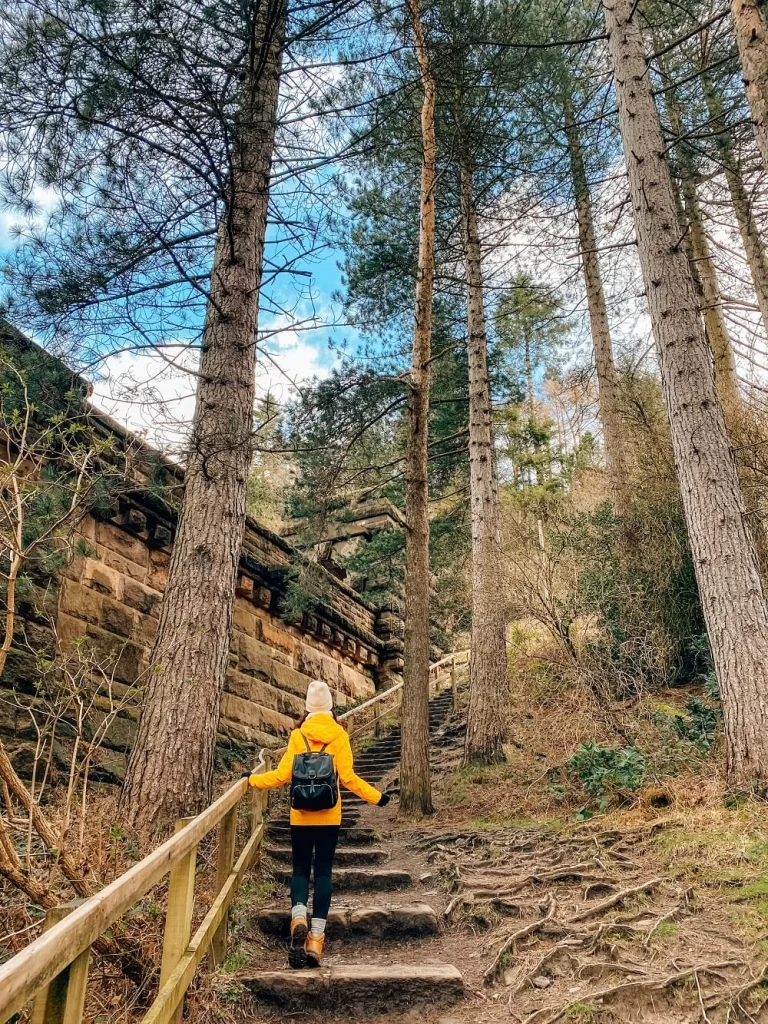
The trail carries on to your right over a set of steps passing the East Tower. From the top, you’ll have a better view of the reservoir and surrounding area.
Top Tip – You can walk up to the West Tower of Derwent Dam to your left first. There you can check out the Monument to the Dambusters and also the Memorial to Tip, a brave sheepdog, who stayed with his owner for 15 weeks in harsh winter conditions after he passed away.
After passing the East Tower just carry on along the northern aspect of Derwent Reservoir. You’ll see a few trails heading up on your right which you can take if you wish. However I recommend staying on the main path for a bit longer especially on a lovely day. Once you’re nearly at Howden Dam, take the footpath on your right straight through Shireowlers Wood. It’s a bit steep and the path is narrow but will be worth your effort.
When you’re nearly at the top make sure to look back and admire the view of Howden Dam, Howden Reservoir and the small island on Derwent Reservoir.
2. Howden Reservoir to Lost Lad
After seeing Howden Dam and Reservoir in the distance your next feature is Lost Lad (coordinates: 53.41731, -1.71061). The 518 m (1,699 ft) hill is a subpeak of the 538 m (1,765 ft) Back Tor.
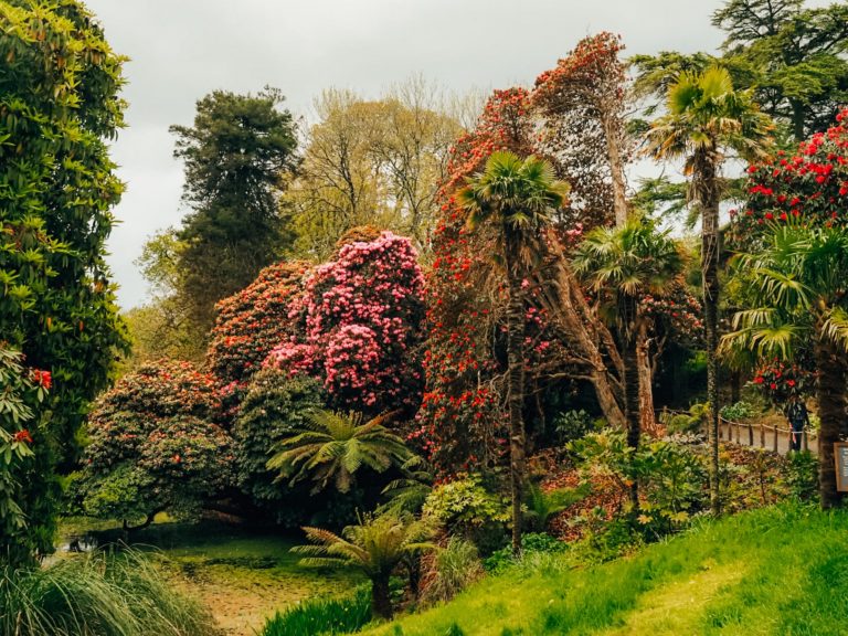
Once you’re on the moorland, you’ll need to go higher and higher until Derwent Reservoir won’t be visible anymore. This area is pretty open, so it can be very windy. I recommend visiting during the summer when the heather is in full bloom as the moorland will look stunning covered in a blanket of purply/pinky flowers.
You know you’ve reached the top of Lost Lad when you see a cairn and also a toposcope. You’ll have a great view of Mam Tor, another iconic walk in the Peak District and Kinder Scout which is the highest point of the national park.
Did you know? – The actual cairn is called Lost Lad, which according to legend is named after a shepherd boy who was originally from the lost village of Derwent. He got lost on the moorland and unfortunately passed away. When they found his body, they also saw ‘Lost Lad’ written on a rock next to him.
3. Lost Lad to Back Tor
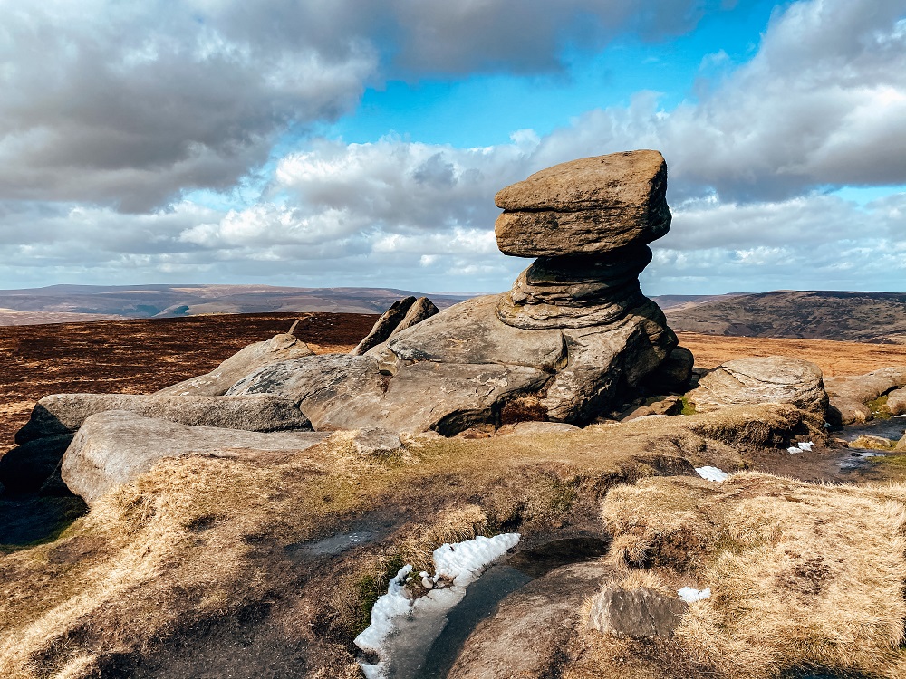
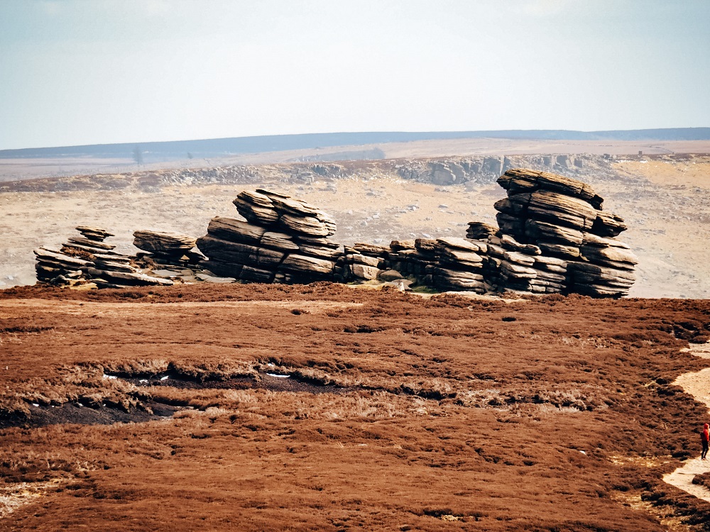
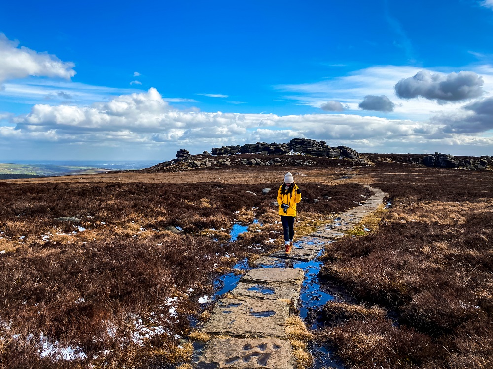
After leaving Lost Lad, you’re next stop along the moorland is Back Tor (coordinates: 53.4152°N 1.7041°W). The 538 m (1,765 ft) high hill is the highest point along Derwent Edge and it also has a cool rock formation. From Lost Lad it only takes about 5-10 minutes to reach Back Tor and you really cannot miss it, since its visible from Lost Lad. You’ll notice that this section on the trail is paved with natural stone slabs. It is to reduce further damage to the path which eroded due to its popularity with walkers.
Please Note! – Make sure to stay on the path to avoid any further damage to the environment!
4. Back Tor to Derwent Edge
Derwent Edge lies less than 1.5 km (0.9 miles) from it’s highest point, Back Tor (coordinates: 53.40351, -1.70581). Again, it’s easy to follow the trail so you can’t get lost.
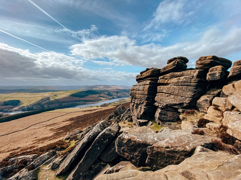
Derwent Edge is a Millstone grit escarpment overlooking Derwent Reservoir and Ladybower Reservoir. Due to the special vegetation and rare animals and birds, the moorland around Derwent Edge is actually considered a Site of Special Scientific Interest (SSSI).
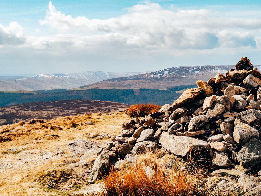
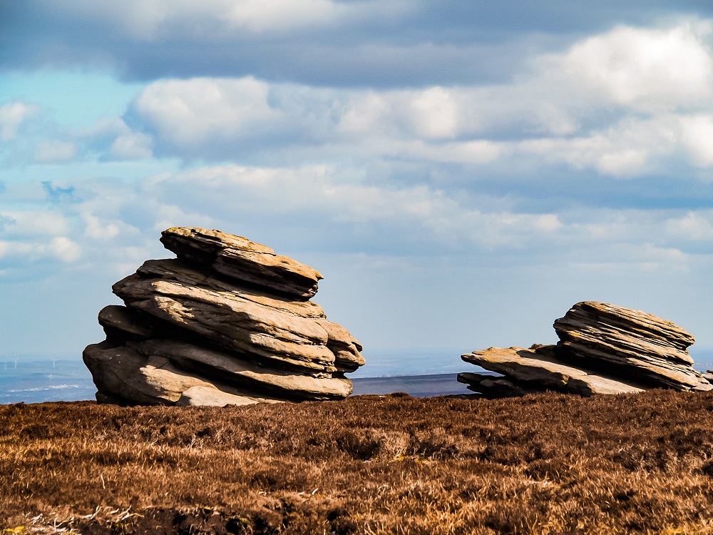
As you’ve noticed by now, the escarpment has many crazy rock formations. One of them is called the Salt Cellar. The name comes from its shape resembling a salt pot. You’ll be treated with some great views with the Salt Cellar and Ladybower Reservoir in the background. Make sure to check out the Cakes of Bread boulder on your left and the Coach and Horses (also known as the Wheel Stones) after passing White Tor.
5. Derwent Edge to White Tor
Only about 0.6 km (0.3 miles) from Derwent Edge is White Tor. Again it has some massive boulders to check out and obviously some great views of the area and Ladybower Reservoir. The 7.6 m (25 ft) high Coach and Horses or Wheel Stones are visible from here.
6. White Tor to Derwent Reservoir
You can carry on along the edge and walk to the Wheel Stones before descending Derwent Edge or you can start making your way down at White Tor.
We did the latter since we were very cold at this point. The path here isn’t super obvious but if you look down from White Tor you’ll see that there’s a path that meanders down the hill. It’s a bit steep going down so if you have knee problems be cautious.
You’ll descend pretty quickly and will reach a crossroads of paths that lead you through a gate. If you decided to walk to the Wheel Stones first you should be joining onto this path at this point too.
After going through the gate just follow the trail through the field, then go through another smaller gate. A little woodland should be on your left. After walking along this woodland, you’ll reach a little farm. Passing the farm you’ll soon see Ladybower Reservoir. You’ll have to walk along Ladybower Reservoir before the path takes you back to Fairholmes Car Park.
Additional Walks in the Peak District
There are many amazing places and trails located near Derwent Edge and Derwent Reservoir. So, if you’d like to see more of the Peak District then make sure to check out the 10 best hikes in the Peak District or browse for more hiking trails in the UK and around the world in my Hiking Adventures Series.
For now, here are some hikes in the Peak District that are either walkable or approximately 30 minutes’ drive away from Derwent Edge and Derwent Reservoir:
Bamford Edge and Ladybower Reservoir – A 7-mile circular trail with stunning views from the top of Bamford Edge looking towards Ladybower Reservoir and the Hope Valley. Click here to read it.
Stanage Edge and Hathersage – A 6-mile circular trail that takes you through the historic village of Hathersage, literary locations, beautiful landscapes and a secret cave called Robin Hood’s Cave. Click here to read it.
Padley Gorge Walk – A magical walk in the Peak District which will make you feel like you’re walking through an enchanted forest. Click here to read it.
Monsal Dale and Wye Valley Walk – A 10 km circular route in Monsal Dale and the Wye Valley along the River Wye and Deep Dale, stopping at Monsal Head and Ashford-in-the-Water. Click here to read it.
Final Thoughts on the Derwent Edge Walk
Although it was uncomfortably windy along Derwent Edge and all I wanted was to shelter from the wind, every time we reached another stunning rock formation I just didn’t want to leave and the wind stopped bothering me (at least for a few minutes…)
Needless to say that I enjoy walks that provide me with panoramic views as a reward for my efforts. This Derwent Reservoir and Derwent Edge trail is definitely a scenic one but there’s also much more to it. There’s a lot of history, myths and legends that make this walk both picturesque, educating and entertaining. Whilst this trail can be done all year round, I highly recommend visiting during the heather season in the summer and also during autumn when the woodland around the reservoirs turns into a magical mix of colours. I’ll definitely return in different seasons to experience how the landscape changes.
Have you ever been to Derwent Reservoir or Derwent Edge before? If so, how much of the area did you manage to explore? Let me know in the comments below.
Now, let your adventure begin,

Our Top Travel Resources
Accommodation: For hotels we always use Booking.com and Hostelworld for hostels. We also book longer stays on Airbnb or Vrbo.
Flights: To find the best flight prices we always check Skyscanner, Google Flights or WayAway. Then we also check the airlines’ websites too for comparison.
Car Rentals: We use Discover Cars when we want to rent a car as it compares local, national and international companies.
Activities: If we book organised tours we always check either GetYourGuide or Viator.
Foreign Currency: Whenever we can we prefer to pay in local currency and for that we always use our Wise card. We can easily withdraw money from the ATM or pay by card at most shops and restaurants.
Travel Insurance: We never go anywhere without travel insurance. You never know what will happen on your trip, so good travel insurance like SafetyWing can protect you in case of injury, illness, theft and cancellations.
eSIM and VPN: To get data abroad we use Airalo which is an app that allows you to download a prepaid eSIM to your phone in over 190 countries. Make sure to have a VPN to avoid hackers accessing your personal data when using public WIFI. We use Surfshark which is the only VPN that offers one account on unlimited devices.
Remember…It all starts with a Pin…
Another beautiful walk! I know that every time I read one of your posts I will be itching to get out my hiking boots! Derwent Dam looks amazing! I could spend the whole length of the walk photographing it! The path from Lost Lad to Back Tor looks incredible too…you’d think you were the last person left on earth! Thanks for the great guide, I hope I get a chance to try it out soon!
Thank you Hannah, I’m so so happy you enjoy my posts and they inspire you to go out for a walk too 🙂 Yes I agree, some parts of the Peak District can really look like you’re in a different planet!
I have to admit, Sheffield is one area that I have never really explored. It seems like there are some great hikes there, so I’ll have to add it to the post lockdown list.
Yes there are lots of amazing hikes in the area, and I still have many more to explore myself too. I’m sure you’ll enjoy this part of England 🙂
Not much of a hiker , but I will definitely tell some friends about these trials. I love that you added the level of difficulty.
Thank you Kayy, I’m happy you’ll share this hike with your friends. Even if you’re not a hiker, I think strolling around the reservoirs is a great and fun adventure.
You sure manage to find some beautiful hikes. I love the rock formations on this one. Very interesting history as well. I imagine it must have been very cool to see the tops of some of the old buildings like the cathedral when the reservoir levels dropped in 2018.
Thank you Ildiko, I just love scenic hikes with plenty of interesting facts. Yes I’m a bit gutted that I didn’t know about the drop in water level that summer and completely missed seeing the lost villages.
This looks like a fantastic hike in Derbyshire! I love the mix of history and nature.
Thank you Brianna, I’m glad you enjoyed my post 🙂
Wow! Now those are some beautiful hikes! Looks like such an interesting spot to explore, with all the neat rock formations – I love hikes like this!
I’m glad you enjoyed this hike Melissa. It’s definitely a scenic one, and I agree the rock formations are crazy around here. Hope you can complete the trail too in the future.
This hike looks absolutely beautiful and I love that you included some history about Derwent Reservoir. Thank you for such a great recommendation!
Thank you Lily, so happy to hear you enjoyed my post.
Your blog captures the ‘other worldly’ character of the high peak! I loved the photo’s and the video too, which give a really good experience of what to expect on the walk. I will be going in late summer, to see the heather!
Thank you Karan, I’m so glad you enjoyed both the post and the video. I’m also dying to see this area in the heather season, I’m sure it will look gorgeous 🙂
Omg! This place looks so dreamy. Are these all your pictures? They look so stunning, I bet you have great photography skills.
Thank you so much for the compliment! Just bought my first camera recently so I’ve been trying to learn all the functions to start taking more creative photos 🙂
I am fascinated by how familiar and yet different these landscapes are. For instance, here in Arizona, we have alot of dam/reservoir hikes, but absolutely none with that kind of architecture. We also have arid grasslands, but of course, the Peaks District has that beautiful UK quality. I am definitely looking forward to the day when we can all travel again to see this beautiful landscape.
I totally agree, when I see a photo of another place I always feel the similarity to somewhere I’ve visited before. Just crazy how amazing our Mother Nature is! I hope you can soon come over to the UK and explore it 🙂
These are fabulous photos! I adore the Peak District – it’s one of my favourite places! Clearly I need to do a lot more exploring on my next trip over to visit my family!
I’m so glad to hear you love the Peak District just as much as I do! I can’t get enough of it either and always find a new place even after exploring it for 5 years now. I hope you can come and visit your family soon 🙂
The Derwent Reservoir and Derwent Edge Walk looks like such a neat place to visit. The Lost Lad to Back Tor hike looks like one I would enjoy!
Glad to hear you would like to complete this hike Francesca! I’m sure you’ll enjoy it a lot.
I hadn’t heard of Derwent before, but this looks like a gorgeous place with fun things to do outdoors- our favorite!
Happy to hear you love the outdoors too Daphna. This area is packed with great walks for all levels and you can also learn many historical facts from the area.
I have never read a blog on reservoirs, enjoyed reading about the historical significance and lovely hikes in the region!
I’m so happy you click on my post and you enjoyed it Lekha. I hope you can visit this area in the future.