Stanage Edge Walk from Hathersage in the Peak District
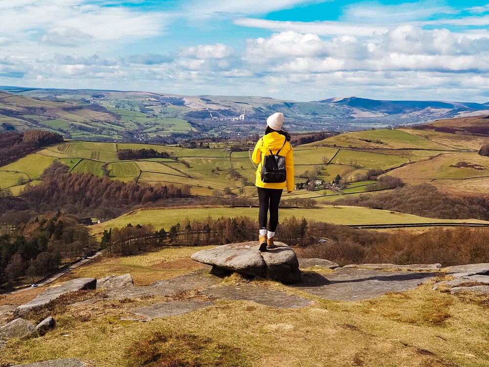
This Stanage Edge walk through the Dark Peak area of the Peak District National Park is filled with many interesting features. This circular walk takes you through the historic village of Hathersage, passes iconic buildings that inspired the British author Charlotte Bronte, treats you with beautiful landscapes, panoramic views and a secret cave called Robin Hood’s Cave.
If you’d like to see more of our Stanage Edge walk then make sure to watch our YouTube video by clicking here.
Disclosure: This post may contain affiliate links, which means we may receive a small commission if you click a link and purchase something. Clicking these links won’t cost you anything, but it will help us to keep this site up and running! Learn more about our affiliate policy.
About Hathersage and Stanage Edge
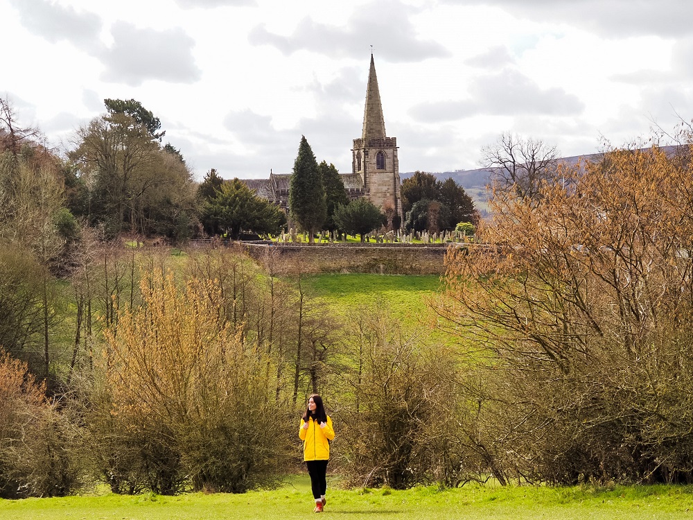
Located about 10 miles (16 km) south-west of Sheffield is the beautiful historic village of Hathersage. Although the village was first recorded in 1066, remains of a settlement dating back to the Roman period have been found in the area.
Hathersage is also connected to some famous historic figures such as Charlotte Bronte and Little John, Robin Hood’s companion. Charlotte Bronte lived in Hathersage during the time she wrote her well-known novel, Jane Eyre. The British author was definitely inspired by the area and North Lees Hall, for example, was the inspiration for Mr. Rochester’s home, Thornfield Manor. In addition, Little John’s final resting place is at St Michael’s Church churchyard.
Due to its location to some of the most beautiful places in the Peak District such as the Hope and Derwent Valleys, it’s historical and literary connections and easy accessibility from big cities such as Manchester and Sheffield, Hathersage became a popular tourist destination.
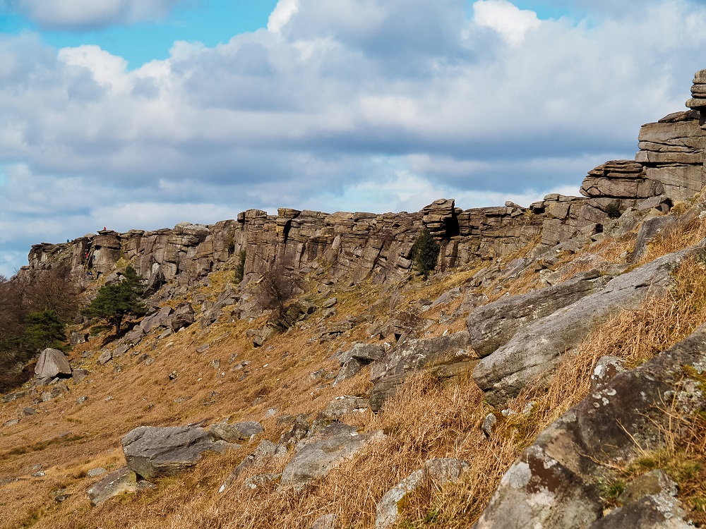
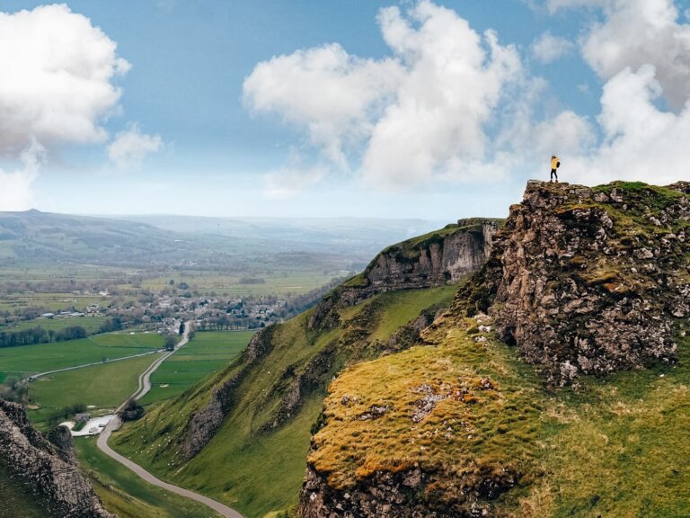
Located to the north of the village of Hathersage in the Peak District is a walker’s, runner’s and climber’s paradise: Stanage Edge.
The 3.5 mile (5.6 km) long gritstone escarpment runs between Sheffield and the High Peak. It used to be quarried for grindstone and some of the marks are still visible. Today, however, Stanage Edge is popular with day hikers, walkers, runners and definitely rock climbers. You can also see some of the remains of an ancient Roman Road on the top.
How to get to Hathersage and Stanage Edge?
By Car
The most convenient place to park is at Hathersage Village Car Park just off Oddfellows Road. Use S32 1DU in your SAT-NAV to find it. You’ll have to pay £6 to park there all day.
You can also park at Hollin Bank Car Park (S32 1 BR) along North Lees Road or along The Dale Road which is closer to Stanage Edge. These fill up quickly so make sure to arrive early.
If you don’t have your own car but would like to enjoy the freedom of a private vehicle, then you can always hire a car to get to Hathersage and Stanage Edge.
By Public Transport
Luckily, public transport options to reach Hathersage are great. If you’re from the area, you can take Buses 257, 271, 272 and 772 which provide services to destinations such as Bakewell, Sheffield, Castleton and Hope. Bus stops are located along the A6187 Main Road in Hathersage Village Centre.
You can also arrive to Hathersage by train. Regular train services run between Sheffield and Manchester. However, if you’re arriving from further afield, I recommend travelling to either Manchester or Sheffield first, then taking the train to Hathersage. Make sure to plan your journey with Trainline which also provides information on bus fares.
Top Tip – If you’re planning on travelling across the UK by train a lot, then check out some Railcard options which allow you to save some pennies on your train fares.
By Bike: National Cycle Route 6 runs along the small North Lees Road underneath Stanage Edge and along The Dale Road. Therefore, if you enjoy cycling, then definitely take your bike with you. Obviously, you can’t cycle up onto Stanage Edge, but you can leave your bike at a safe place in Hathersage and walk up to Stanage Edge from there.
Good to Know Before You Go
Length of the Route
The Stanage Edge walking route we chose to do was about 9 km (6 miles) long. Depending on your speed and how long you are spending taking photos or stopping for a picnic, this route could take at least 3 to 4 hours.
We started from Hathersage Village Car Park and visited Little John’s Grave, before passing North Lees Hall and heading straight up to Stanage Edge. As we walked along the ridge, we stopped by Robin Hood’s Cave. After descending Stanage Edge we walked through some fields before the footpath took us back to Hathersage.
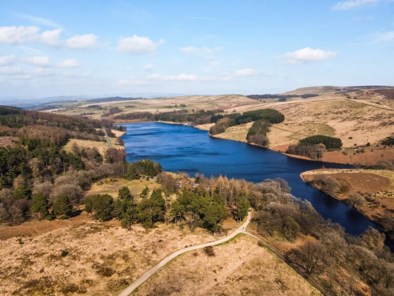
You can extend the walk in multiple ways. If you’re feeling adventurous you can walk to Bamford Edge which is located approximately 4 miles (6 km) to the west of Stanage Edge. You can also walk to Surprise View and Padley Gorge located 4 miles to the south. Of course, you can also shorten your walk by approaching Stanage Edge from The Dale Road if you park there.
Top Tip – Make sure you start your walk as early as possible if you come on a weekend. Alternatively, I suggest coming on a weekday if you can. This is a popular area, so expect it to be packed with people especially on a nice day. I always feel more connected to nature if I don’t have to pass a constant stream of walkers. Robin Hood’s Cave will always be a bit busier, but there are plenty of impressive rocks you can snap a photo of with equally impressive views.
Level of Difficulty
The route we did is relatively easy and you can complete it with a basic level of fitness. I recommend wearing the right footwear like trainers or boots. It’s steep ascending Stanage Edge and the path can be slippery and muddy when wet. You’ll also have to cross and/or walk along the road and cross some fields with livestock in them.
Please Note! – The wind is constant along the ridge even on a beautiful day. So, if the weather conditions aren’t suitable, please make sure you’re safe and don’t stand too close to the edge!
This particular route is only sheltered between North Lees Hall and the North Lees Road. Otherwise you’ll be exposed along the rest of the way especially along the ridge so wear appropriate clothing. I think this walk could be a great activity even on a slightly windy day but I wouldn’t suggest doing it in the pouring rain.
Facilities Within Hathersage and Stanage Edge
Cafés and picnic spots: I highly recommend packing your own lunch and if the weather is lovely stop for a picnic somewhere along Stanage Edge. You’ll be treated with a panoramic view of the area. It will be a bit windier and colder up there even on a nice day, so try to find some cover between the massive rocks. You can also try to have a picnic below the rock formations.
If you’d like to grab a coffee or tea and a bite to eat, you can do that in Hathersage. There are plenty of cafés and pubs in the village to choose from.
Toilet facilities: There are public toilets available in Hathersage village centre (as marked on the map above).
What to Wear and Bring With You?
You are in the north of England so weather conditions can change quickly. At the time of our visit it was dry and pleasantly warm. However, along Stanage Edge the wind was much stronger.
Therefore, I recommend weather appropriate clothing when visiting Stanage Edge. You’ll be exposed on the ridge and even on a sunny day Stanage Edge tends to be windy. Make sure you check the weather forecast before you set off and have a few layers with you.
I also suggest wearing proper walking shoes or boots. The trail is uneven and rain can make it muddy and slippery.
I suggest packing some snacks and having plenty of water with you. There are plenty of places to stop for a picnic or a quick break.
Please Note! – Whatever you bring with you, make sure you either take it home with you or dispose of it responsibly. Enjoy your time in nature but Leave No Trace!
Hathersage and Stanage Edge Walking Route
The area around Hathersage and Stanage Edge is full of amazing walking routes. Since they are relatively easy trails, an ideal place for rock climbing and Cycle Route 6 runs in the vicinity, it automatically attracts more people.
Whichever trail you decide to take or end up on, you will be treated with some beautiful landscapes, views and features. However, if you’d like to do the exact route we did, I divided it into 5 main sections.
1. Hathersage Car Park to Little John’s Grave
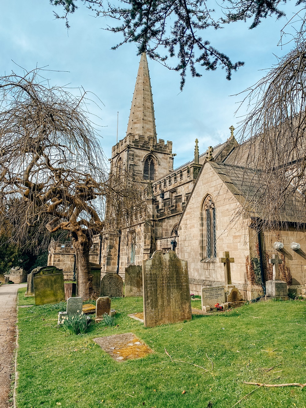
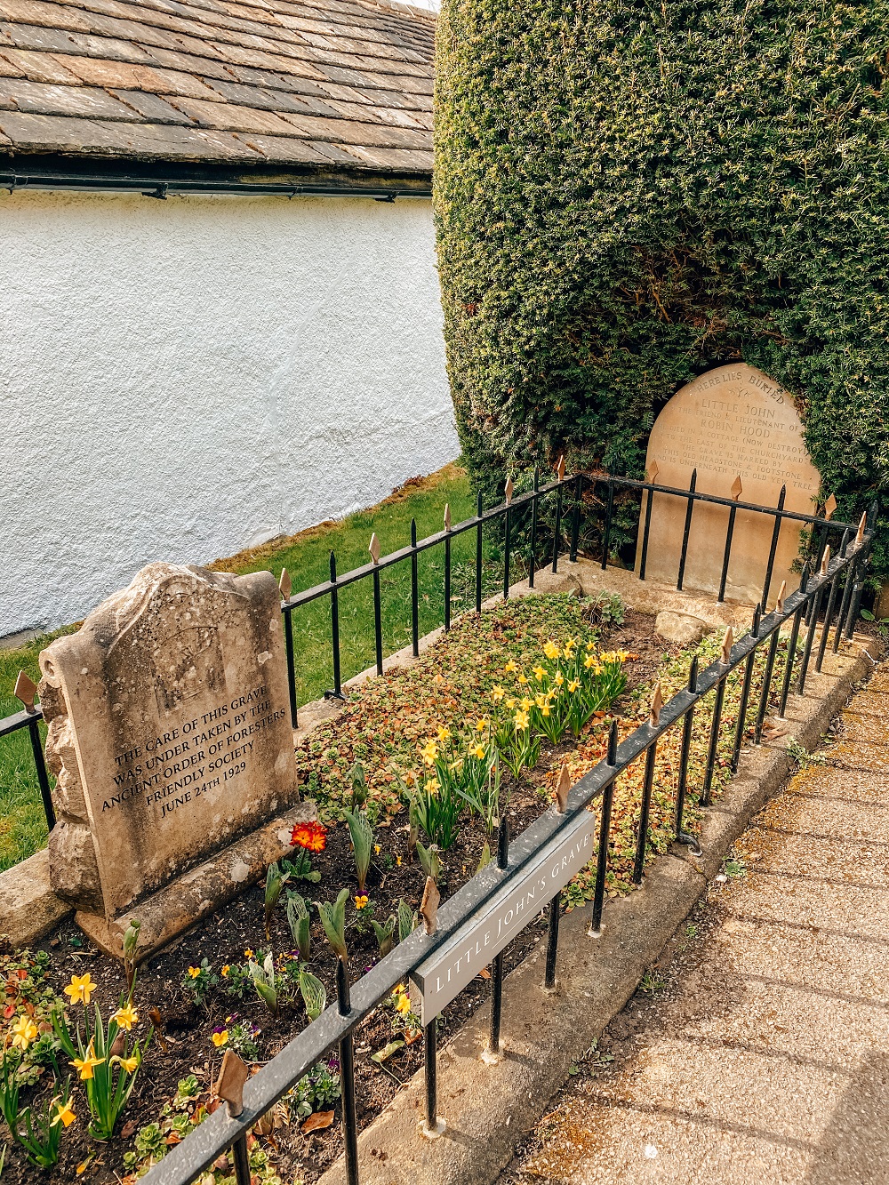
Start your walk from Hathersage Village Car Park by following the short footpath passing Hathersage Methodist Church leading into the village centre. If you wish to use the toilet facilities they will be located on your left across the A6187 Main Road. If not, you need to follow the road to your right. Turn left onto School Lane and follow the road which will turn into Church Bank. There will be a clear sign towards Little John’s Grave and to St Michael’s Church.
When you reach the church there will be signs leading you to the grave in the churchyard so you can’t miss it. As you probably know Little John was actually a giant man, and the size of his final resting place definitely indicates that a tall man was buried there.
Donations are welcomed which are used to maintain his grave and the churchyard.
Did you know? – St. Michael’s Church was used in some of the scenes of the Let Sleeping Corpses Lie horror film.
2. Little John’s Grave to North Lees Hall
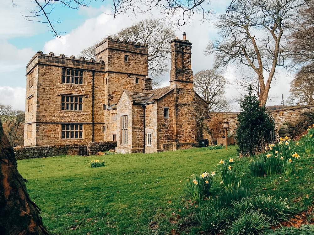
After leaving Little John’s grave, head towards the next feature along the trail: North Lees Hall. Carry on along Church Bank after leaving the church, then take the first footpath on your right. At this point go left, down some steps and cross some fields until you eventually pass a few farm houses. After reaching Birley Lane, cross the road and head up on the road that leads to North Lees Hall.
North Lees Hall itself lets as a residential property, so you won’t be able to fully explore it. However, you can still have a good view of the hall and the surrounding area.
In 1845 Charlotte Bronte visited the hall whilst she was staying in Hathersage. She was also writing her famous novel ‘Jane Eyre’ at the time, therefore, the Grade II listed building was the inspiration for Thornfield Manor, the home of Mr. Rochester.
3. North Lees Hall to Stanage Edge
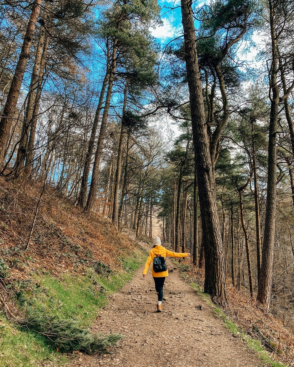
After leaving North Lees Hall carry on along the footpath that will be on your right. Cross a small field then enter into a wooded area.
You’ll soon reach North Lees Road from where you’ll see Stanage Edge. Be careful when crossing this road since it’s used by cars and it’s also part of Cycle Route 6, so it can be relatively busy.
After crossing the road you can just hike straight up to the escarpment. There are lots of different paths that you can take up so just follow the obvious looking trail. You can climb straight to the top, but you can also walk along the bottom of the rock formations.

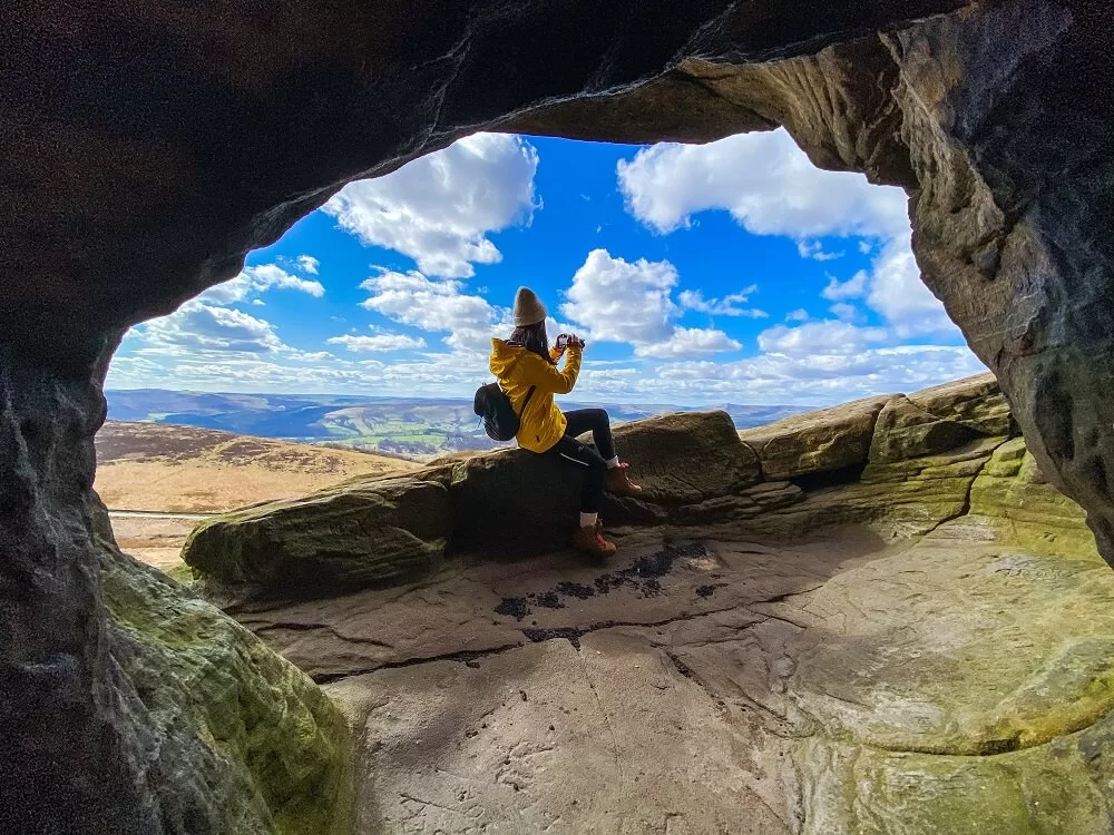
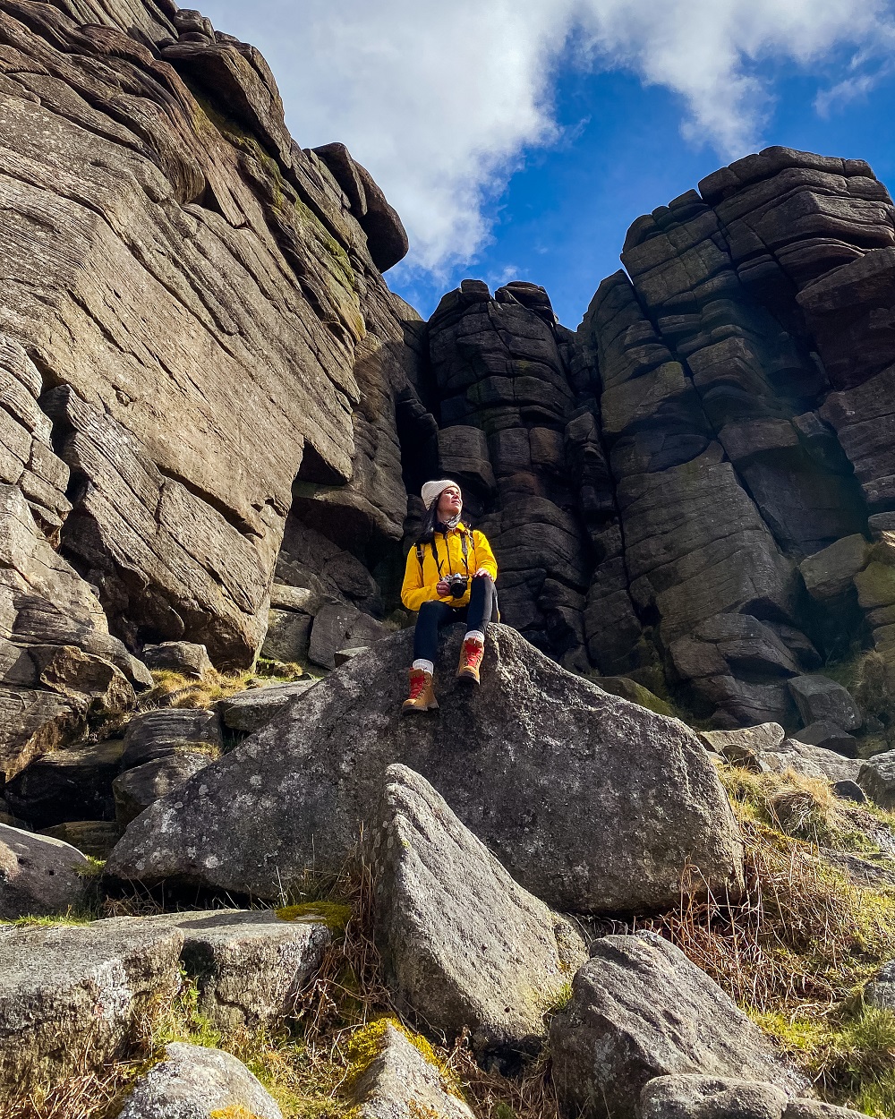
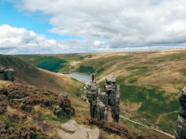
4. How to Find Robin Hood’s Cave?
Robin Hood’s Cave is the coolest feature on this trail so you should definitely try to find it. Although it’s a popular spot, finding Robin Hood’s Cave is not the easiest thing to do so here are the coordinates: 53.34734, -1.64804. The cave is also marked on the map above.
The best advice I can give for finding it is to really look between the beautiful rocks. You’ll know immediately that you’ve found it as it has a larger gap between the boulders and you can climb down to it easily.
To get to the cave you’ll need to squeeze through some rocks, and the cave’s ceiling is relatively low. What makes this cave unique is that it has its own balcony with the most amazing views across the Peaks.
If you’d like to see more of Robin Hood’s Cave and why you should make an effort finding it than make sure to watch our YouTube video.
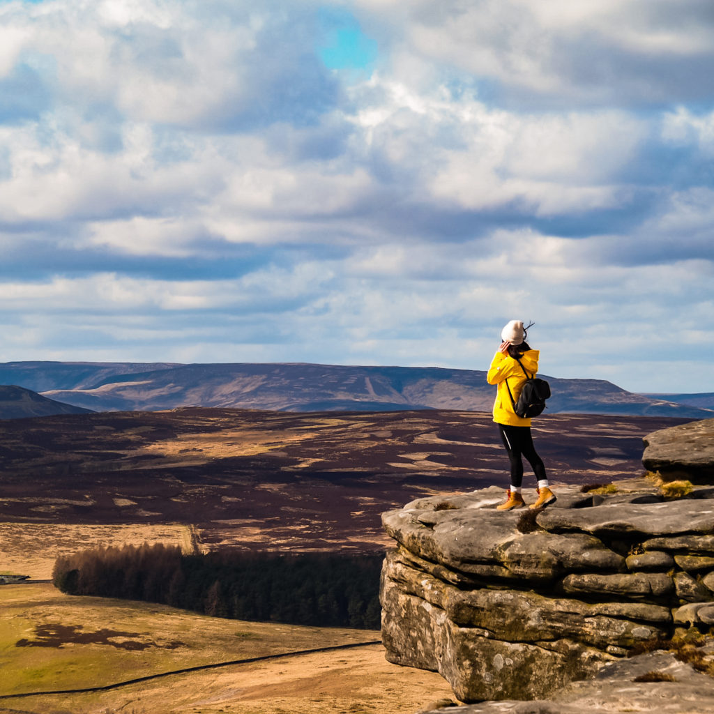
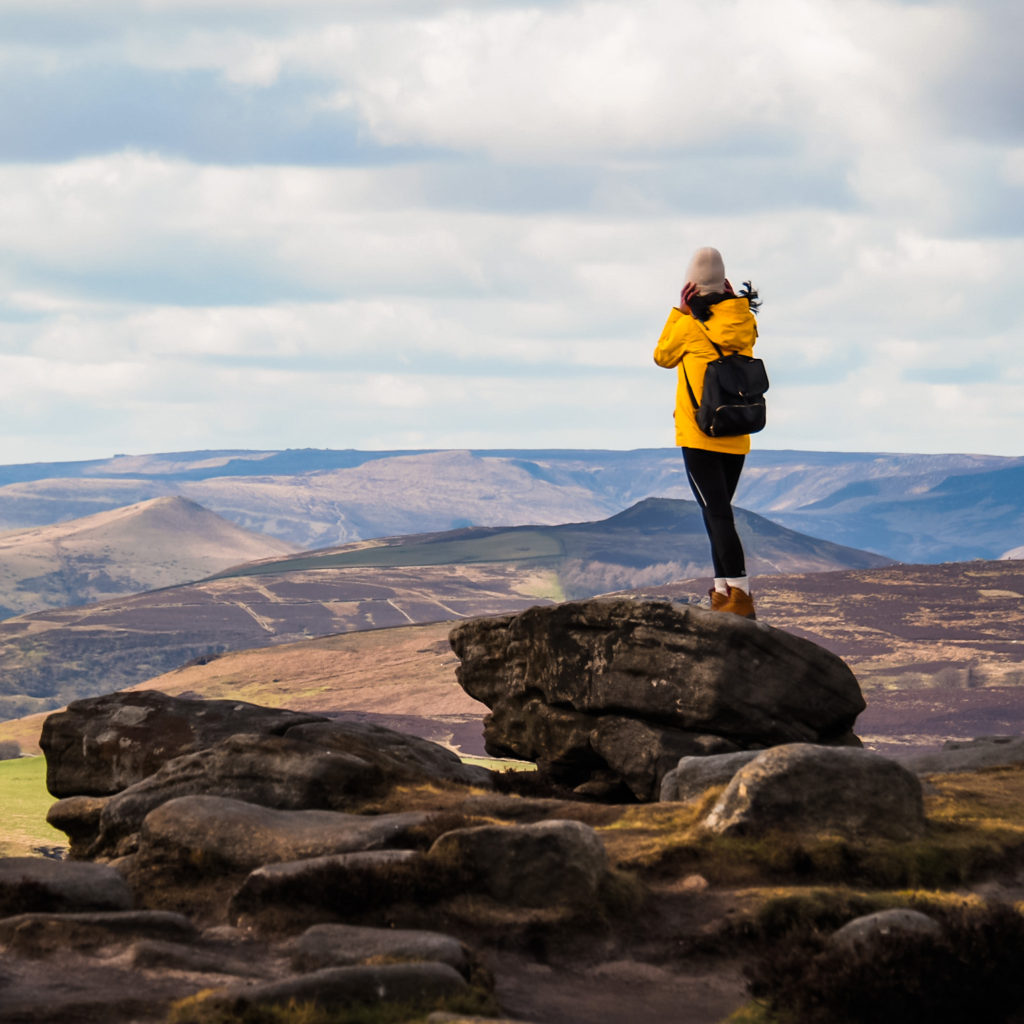
5. Stanage Edge to Hathersage
After admiring the view from Robin Hood’s Cave carry on along the ridge. Just enjoy the view and the amazing rock formations and don’t forget to turn around every so often because the view is amazing in both directions.
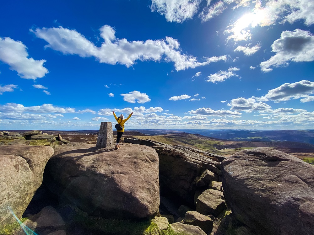
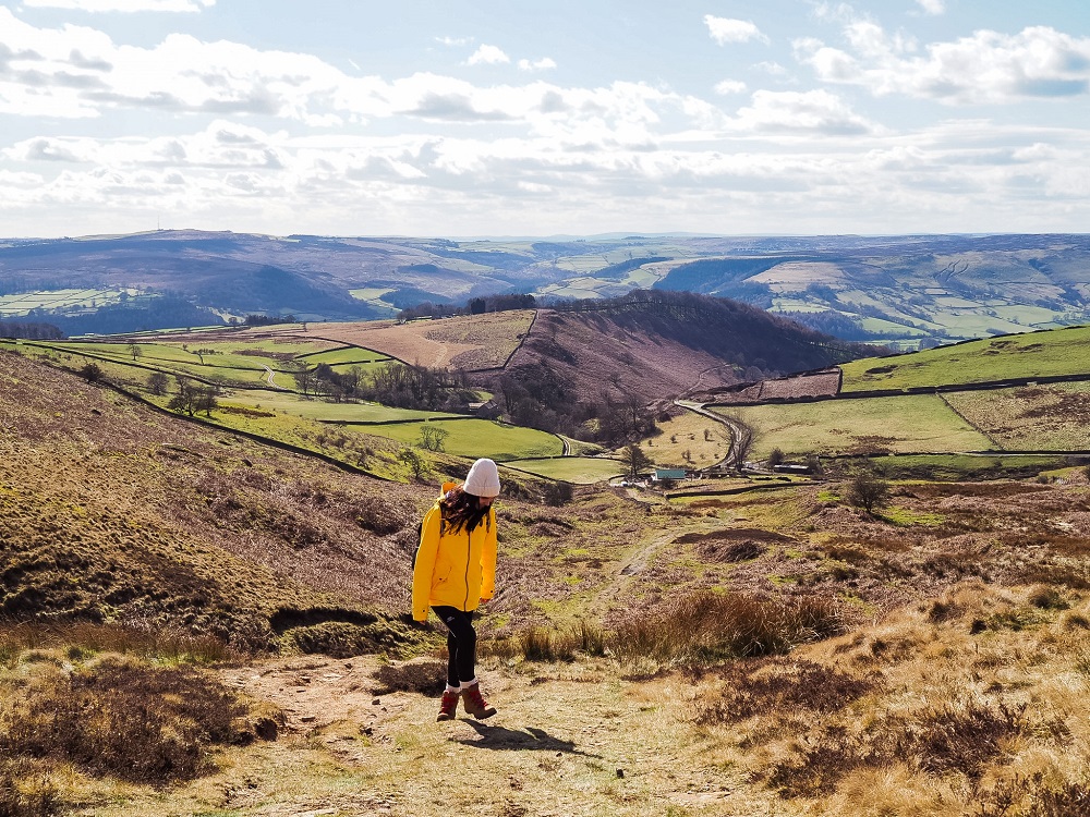
You’ll also reach the highest point of Stanage Edge called High Neb, which sits 458 m (1502 ft) above sea level. After that point you’ll soon start descending from Stanage Edge. Slowly make your way down and carefully cross The Dale Road. Follow the footpath through some fields parallel to the valley. Once again you’ll reach The Dale Road and have to walk along it until you see a footpath on your right. Follow the footpath which should take you back to St Michael’s Church. From there just walk back to Hathersage and either grab something to eat in one of the pubs or just head back to the car park.
Additional Walks in the Peak District
There are many amazing places and trails located near Stanage Edge and Hathersage. So, if you’d like to see more of the Peak District then make sure to check out the 10 best hikes in the Peak District or browse for more hiking trails in the UK and around the world in my Hiking Adventures Series.
For now, here are some hikes in the Peak District that are either walkable or less than 30 minutes’ drive away from Stanage Edge and Hathersage:
Padley Gorge Walk – A magical walk in the Peak District which will make you feel like you’re walking through an enchanted forest. Click here to read it.
Bamford Edge and Ladybower Reservoir – A 7-mile circular trail with stunning views from the top of Bamford Edge looking towards Ladybower Reservoir and the Hope Valley. Click here to read it.
Monsal Dale and Wye Valley Walk – A 10 km circular route in Monsal Dale and the Wye Valley along the River Wye and Deep Dale, stopping at Monsal Head and Ashford-in-the-Water. Click here to read it.
Final Thoughts on the Stanage Edge Walk
I truly enjoy walks that provide me with panoramic views as a reward for my efforts and this Stanage Edge walk didn’t disappoint. Although I knew about Robin Hood’s Cave, the feeling of actually finding it and stepping onto that natural balcony with a view across my favourite national park was fantastic. We had such a beautiful day, that even the strong wind on the top couldn’t ruin the experience. Whilst the Stanage Edge circular walk can be done all year round, I highly recommend visiting during the heather season in the summer. I’ll definitely return in different seasons to experience how the landscape changes.
Have you ever been to Stanage Edge or Hathersage before? If so, how much of the area did you manage to explore? Let me know in the comments below.
Now, let your adventure begin,

Our Top Travel Resources
Accommodation: For hotels we always use Booking.com and Hostelworld for hostels. We also book longer stays on Airbnb or Vrbo.
Flights: To find the best flight prices we always check Skyscanner, Google Flights or WayAway. Then we also check the airlines’ websites too for comparison.
Car Rentals: We use Discover Cars when we want to rent a car as it compares local, national and international companies.
Activities: If we book organised tours we always check either GetYourGuide or Viator.
Foreign Currency: Whenever we can we prefer to pay in local currency and for that we always use our Wise card. We can easily withdraw money from the ATM or pay by card at most shops and restaurants.
Travel Insurance: We never go anywhere without travel insurance. You never know what will happen on your trip, so good travel insurance like SafetyWing can protect you in case of injury, illness, theft and cancellations.
eSIM and VPN: To get data abroad we use Airalo which is an app that allows you to download a prepaid eSIM to your phone in over 190 countries. Make sure to have a VPN to avoid hackers accessing your personal data when using public WIFI. We use Surfshark which is the only VPN that offers one account on unlimited devices.
Remember…It all starts with a Pin…
Wow, what an incredibly hike. The different kinds of stone and cliffs on Stanage Edge Walk are beautiful. I love that you showed what to do on the hike as well as the towns around it!
Thank you for the lovely comment Catherine, I’m so happy you enjoyed my post. I hope you can visit the Peaks in the future.
This route looks spectacular! Those views are incredible! I especially love the views from Robin Hood’s Cave. What an amazing hidden gem! Thanks for sharing this beautiful route, I hope I get a chance to try it out soon!
Thanks Hannah, my favourite feature was the cave without a doubt. I hope you can visit the Peaks this spring/summer 🙂
Such hike with less efforts but stunning views are always my favorite. The views from above and especially Robinhood Cave is spectacular! Would love to do this hike some day!
Thank you Suentra I’m so happy you enjoyed my post. These types of easy hikes are my favourite too. I hope you can explore the Peaks in the near future.
You had me at Robin Hood cave! But seriously this looks like a great hike. I hope I get a chance to visit.
Thanks Jamie, I’m glad to hear that you would like to complete this trail too. Robin Hood’s Cave is definitely the highlight of it.
Looks like some outstanding scenery! Thanks for sharing this gorgeous gem! We love hiking and this looks like something we would love!
I’m happy to hear that you enjoy hiking too Deb. I hope you can visit the Peak District soon, you’ll love this area I’m sure.
There are so many great photo stops along this route that I would love to visit! Thanks for sharing this epic hiking location.
Thank you Krista. I love trails that have many great features, views, myths and legends 🙂
Love the Robin Hood cave . This route looks so scenic . Thanks for the detailed post. Maybe one day I’ll visit.
Thank you Keena, I’m so happy you enjoyed my guide and that you’d love to visit the Peaks.
I really need to get out more when we’re traveling through England. Love when bloggers include coordinates for hard-to-spot places like the Robin Hood cave vs. like “We had to wander around a bit to find it.” Great post!
Thank you Agnes, I’m so happy that you found the coordinates useful. I’d like to give as much and as real information as possible 🙂 Hope you can explore England more in the future.
Wow! What a scenic trail. You inspired me to travel back to the UK in the future and do some hikes in the Peak District! 🙂
Thank you Taylor I’m so glad to hear that you would love to explore the Peaks in the future 🙂
A really interesting walk, combining literary and historical information, with the beauty of the landscape. The photo’s of the views are stunning. The map really helps too, to highlight the route and points of interest. 😊
Thank you Karan, I’m happy to hear that you found my map useful. I love walks that have a mixture of features to see and interesting facts to learn about.
I love a good walk and this sounds and looks so perfect! Thanks for sharing!
Thank you so much, I’m glad you enjoyed my guide.
This is such a beautiful walk! Walkabouts are my absolute favorite way to see any new (or familiar) location. Thank you for this. Saving for later!
Thank you Jen, it’s always great to learn something new and also enjoy the great outdoors.
Oooh what a perfect adventure for after lockdown! It’s not too long, and those views are spectacular! Plus a bit of robin hood history makes walks more interesting. 🙂
Yaaay that you found the cave! I will totally have to attempt this when we can finally get vaccinated and come home to the the UK again.
Thank you Josy, I’m so happy to hear that you enjoyed this hiking trail and you would love to complete it once you can return to the UK. I hope it won’t be long before we can all travel again 🙂
This seems like such a fun adventure!
Thank you, it’s definitely a good mixture of facts, myths and views 🙂
This looks incredible! Your photos are amazing ~ definitely adding Stanage Edge to my list of places to see 🙂
Thank you Sarah, I’m glad you enjoyed my post 🙂