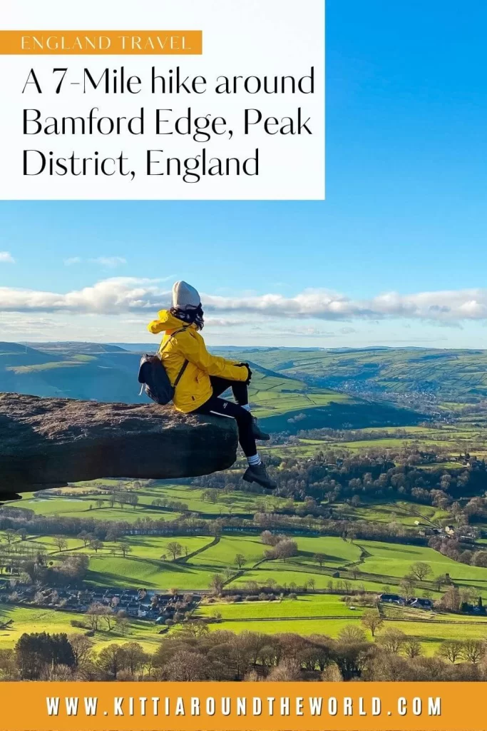
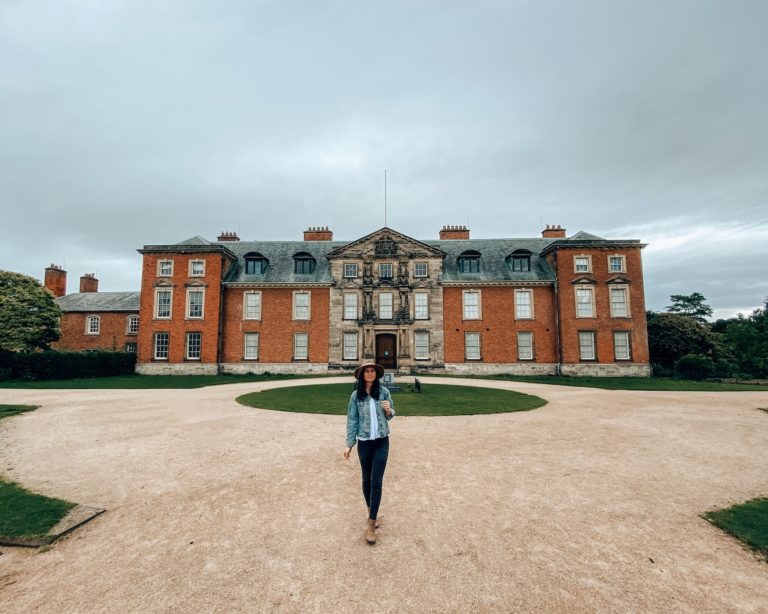
Bamford Edge Walk in the Peak District
The Peak District National Park in the north of England has many stunning vistas but, without doubt, Bamford Edge offers possibly some of the greatest views in the area. You will be spoilt by walking trail options in the vicinity and at the end you’ll just want to return in every season to see how the landscape changes during the year. (Trust me, this was at least my fifth time at Bamford Edge and I still managed to experience something new!)
If you’d like to see our walk then make sure to watch our YouTube video by clicking here.
Disclosure: This post may contain affiliate links, which means we may receive a small commission if you click a link and purchase something. Clicking these links won’t cost you anything, but it will help us to keep this site up and running! Learn more about our affiliate policy.
Introducing Bamford Edge
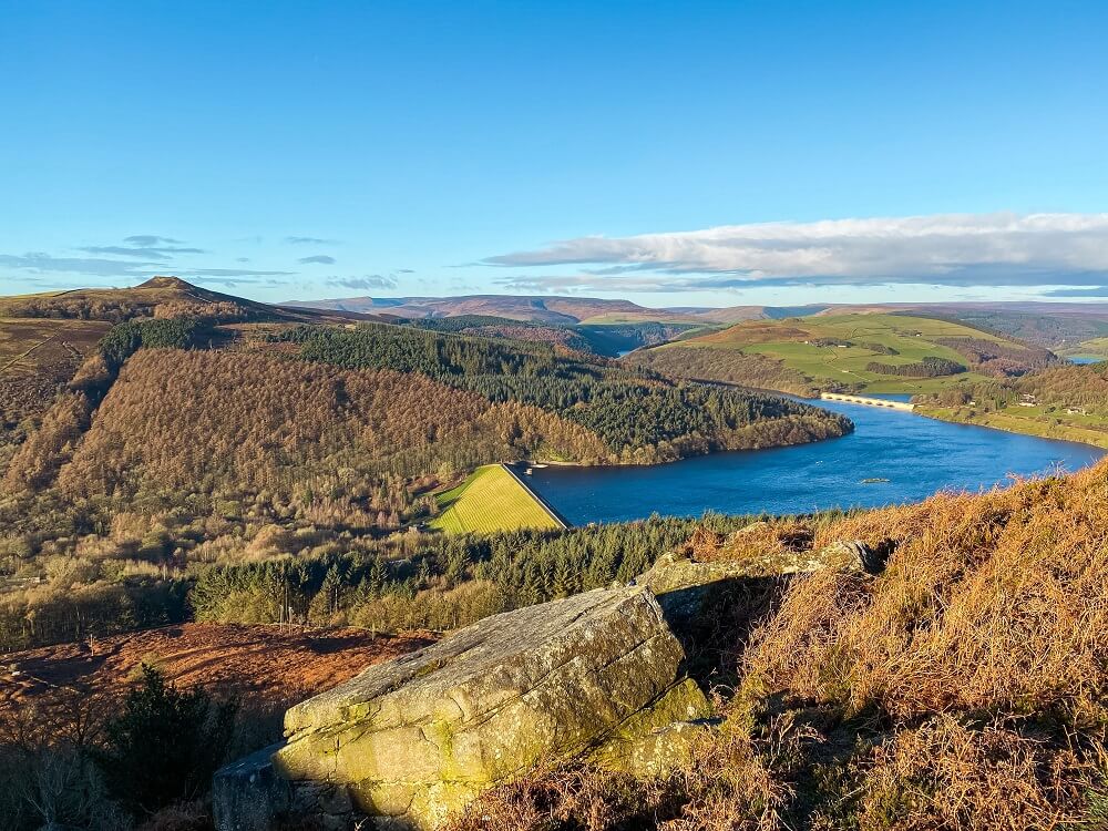
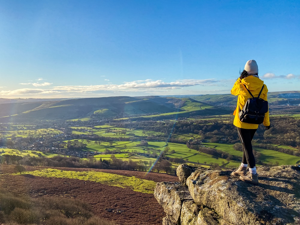
Bamford Edge is an overhang of gritstone rock located to the north of the village of Bamford in Derbyshire. With an elevation of 1381 ft (420 m) Bamford Edge offers the most iconic views of the Peak District National Park. On a clear day you’ll see the also very popular Hope Valley and Ladybower Reservoir.
The village of Bamford is a popular starting point for day hikers, since it has excellent accessibility by multiple modes of transport and also provides visitors with a great variety of walking routes. Bamford is a great place to stop for a meal, attend annual festivals or explore a bit of history.
Another well visited place within the area is Ladybower Reservoir. It is a massive Y-shaped reservoir which was built between 1935 and 1943. It took another two years to fill.
Ladybower Reservoir is the lowest of the two other reservoirs – Howden and Upper Derwent – that are in the Upper Derwent Valley. Ladybower was built to supplement the other two reservoirs which are suppling water to the East Midlands.
How to get to Bamford Edge?
By Car
The most convenient place to park is at Heatherdene Car Park across from Ladybower Reservoir. Use S33 0BY in your SAT-NAV to find it. You’ll have to pay £3 to park there all day.
If you don’t have your own car but would like to enjoy the freedom of a private vehicle, then you can always hire a car to get to Bamford Edge.
Top Tip – Make sure you have £3 in change! Also come early in the day especially on a weekend. Bamford Edge and Ladybower Reservoir are one of the most popular areas in the Peak District, so the car park will get full pretty quickly.
If the car park is full, you can try to park either along the A6013 road or a bit further to the north-east at Cutthroat Bridge Car Park. Use SK33 0AX in your SAT-NAV to find it.
By Public Transport
Luckily, public transport options to reach Bamford Edge and Ladybower Reservoir are excellent. If you’re from the area, you can take Bus 257 which provides services between Bakewell and Sheffield. Bus stops are located along the A6013 and you can get off at the Heatherdene stop. Since the bus runs through Bamford you can easily do a circular walk and catch your return bus from there.
You can also arrive to Bamford by train. Regular train services are running between Sheffield and Manchester. However, if you’re arriving from further afield, I recommend travelling to either Manchester or Sheffield first, then taking the train to Bamford.
Make sure to plan your journey with Trainline which also provides information on bus fares.
By Bike: National Cycle Route 6 actually forms part of the walking route we did. This includes Thornhill Trail, Ladybower Dam, a small section of the A6013 and New Road. Therefore, if you enjoy cycling, then definitely take your bike with you. Obviously, you can’t cycle up onto Bamford Edge, but you can leave your bike at a safe place in Bamford and walk up to Bamford Edge from there.
Useful to Know Before You Set Off
Length of the Route
The route we chose to do was about 10 km (6-7 miles) long. Depending on your speed and how long you are spending taking photos or stopping for a picnic, this route could take at least 3 to 4 hours.
We started from Heatherdene Car Park and headed straight up to Bamford Edge then walked along the ridge. After descending we walked along New Road for a while before taking a footpath into Bamford. From there we walked along Thornhill Trail before reaching Ladybower Reservoir. After crossing Ladybower Dam, Heatherdene Car Park will be just across the A6013.
You can definitely extend the walk by walking around Ladybower Reservoir. If you’re feeling adventurous you can extend your walk to Stanage Edge which is located approximately 4 miles (6 km) to the east of Bamford Edge. You can also extend your walk by climbing up to Win Hill from Thornhill Trail. Win Hill has some great views over Bamford Edge and Ladybower Reservoir too. Of course, you can also shorten your walk by approaching Bamford Edge from the southern part. You can even park along New Road if that’s all you wish to do.
Top Tip – Make sure you start your walk as early as possible if you come on a weekend. Alternatively, I suggest coming on a weekday if you can. This is a VERY popular area, so expect it to be packed with people especially on a nice day. I always feel more connected to nature if I don’t have to pass a constant stream of walkers. The most popular photo spots along Bamford Edge will always be a bit busier, but there are definitely other just as impressive rocks you can snap a photo of.
Level of Difficulty
I think the route we did is relatively easy and you can complete it with a basic level of fitness. I recommend wearing the right footwear like trainers or boots and not flip flops and fancy sandals. (Trust me I seen some people in them before!) It’s slightly steep and the path can be slippery and muddy when wet but still doable. You’ll also have to cross and/or walk along the road and cross some fields with livestock in them.
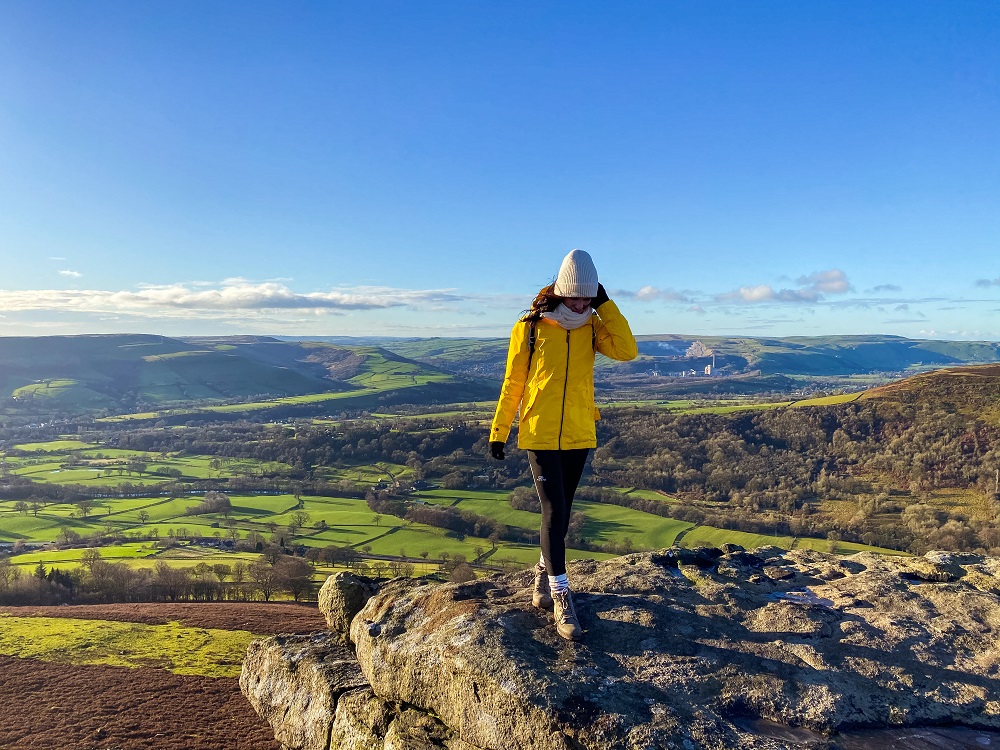
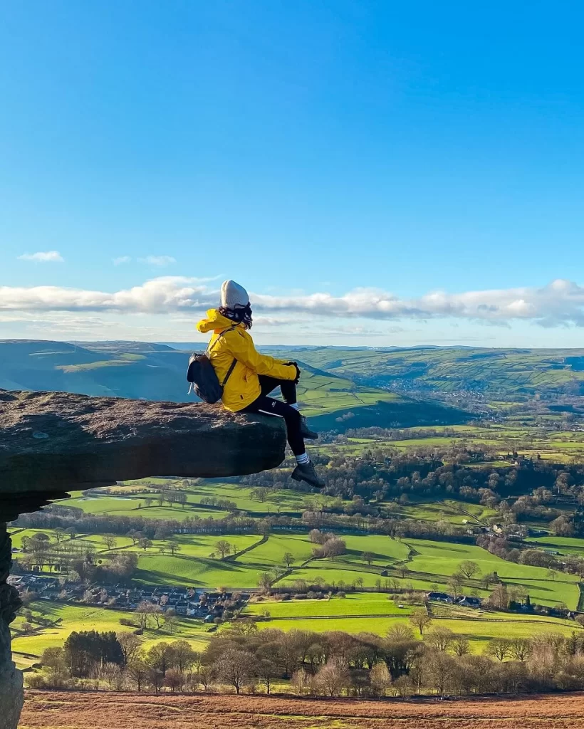
Please Note! – Bamford Edge is a beautiful photo spot and became very popular on Instagram. It has many amazing rock formations which you can stand on and take some very creative photos with Hope Valley and Ladybower Reservoir in the background. However, the wind is constant along the ridge even on a beautiful day. So, if the weather conditions aren’t suitable, please make sure you’re safe and don’t stand too close to the edge!
If you’re approaching from Heatherdene Car Park the walk is sheltered for the first part until you basically reach Bamford Edge. Obviously, you’ll be exposed along the ridge so wear appropriate clothing. If you do the full circle like we did, you’ll be covered again along Thornhill Trail. I think this walk could be a great activity even on a slightly windy or rainy day. (I wouldn’t suggest doing it in the pouring rain though!)
Facilities Within Bamford Edge
Cafés and picnic spots: I highly recommend packing your own lunch and if the weather is lovely stop for a picnic on top of Bamford Edge. You’ll be treated with an excellent view of the Ladybower Reservoir and the Hope Valley. It will be a bit windier and colder up there even on a nice day so try to find some cover between the massive rocks. There are some picnic tables within Heatherdene Car Park if you wish to properly sit down with your lunch.
Please Note! – You cannot have BBQ’s or any kind of open fire in the area, so make sure you pack an appropriate picnic.
If you’d like to grab a coffee or tea and a bite to eat, you can do that in Bamford. There are a few cafés and pubs in the village to choose from.
Toilet facilities: There are public toilets available at Heatherdene Car Park (Ladybower Reservoir) and in the village of Bamford. There’s also a water fountain at the toilets, in case you’d like to fill up your water-bottle.
What to Wear and Bring With You?
You are in the north of England so weather conditions can change quickly. At the time of our visit the ground was luckily frozen, otherwise the whole trail would’ve been incredibly muddy. Therefore, I highly suggest you wear proper walking boots. (You’ll see many people walking up in less suitable clothing. I think this is because Bamford Edge is just way too picturesque and therefore became a very popular ‘Insta-spot’.)
I still think that weather appropriate clothing is a must when visiting Bamford Edge and Ladybower Reservoir. You’ll be exposed on the ridge and even on a sunny day Bamford Edge tends to be windy. (On the day we did the walk we ended up in a quick snow storm even though it was sunny when we set off…) So, make sure you check the weather forecast before you set off and have a few layers with you.
I recommend packing some snacks and having plenty of water with you. Luckily you can fill up your water-bottle from the water fountain at Heatherdene Car Park.
Bamford Edge Walking Route
The area around Bamford Edge and Ladybower Reservoir is full of amazing walking routes. Since they are relatively easy trails and parts of the route can be shared with cyclists it automatically attracts more people.
Whichever trail you decide to take or end up on, you will be treated with some beautiful landscapes and views. However, if you’d like to do the exact route we did, I divided it into 4 main sections.
1. Heatherdene Car Park to Bamford Edge
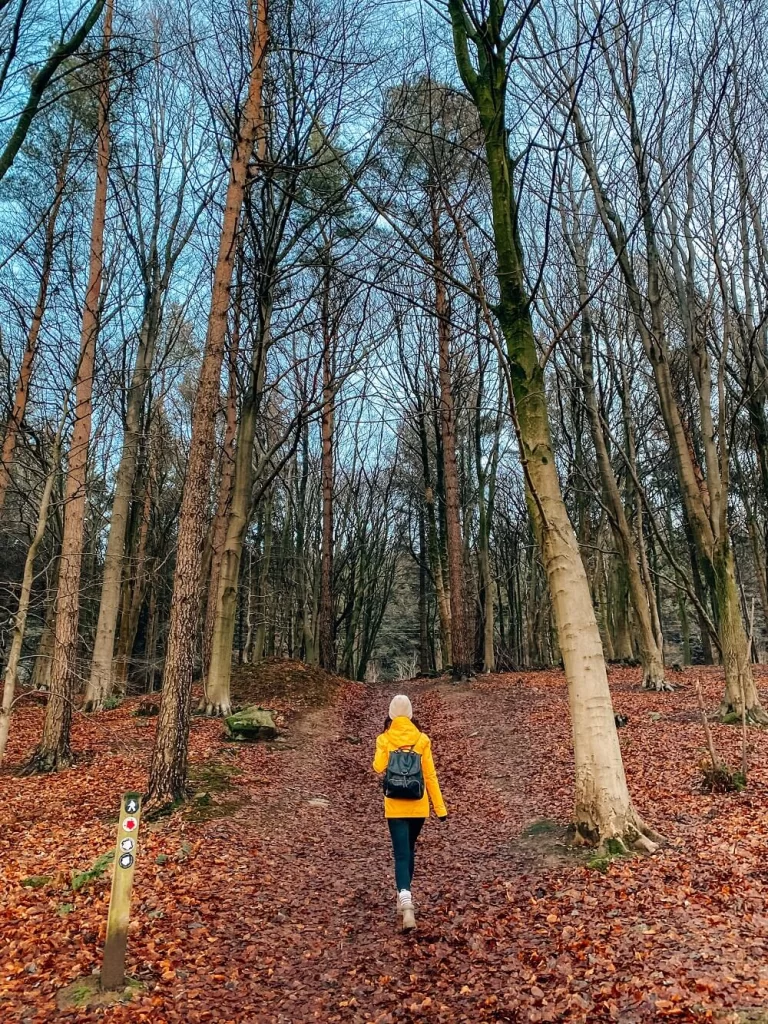
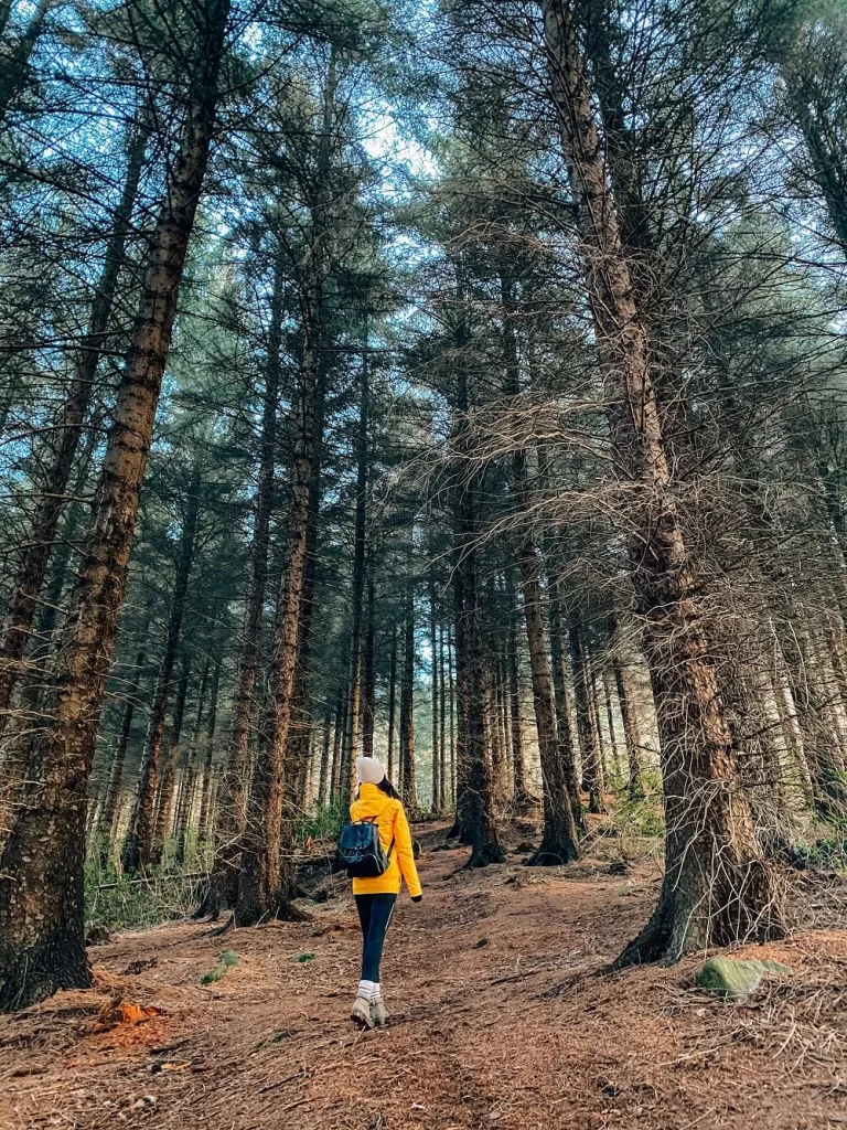
After leaving the car park, walk along the footpath to the south. You’ll have a sneak peak of Ladybower Reservoir on your right. The path will lead you through a thick pine forest first. We were so drawn to exploring the dark pine forest that we completely got off the path and had to trace back a little. But this section just reminded us so much of the dark wood we saw in Macclesfield Forest that we couldn’t resist exploring it a little.
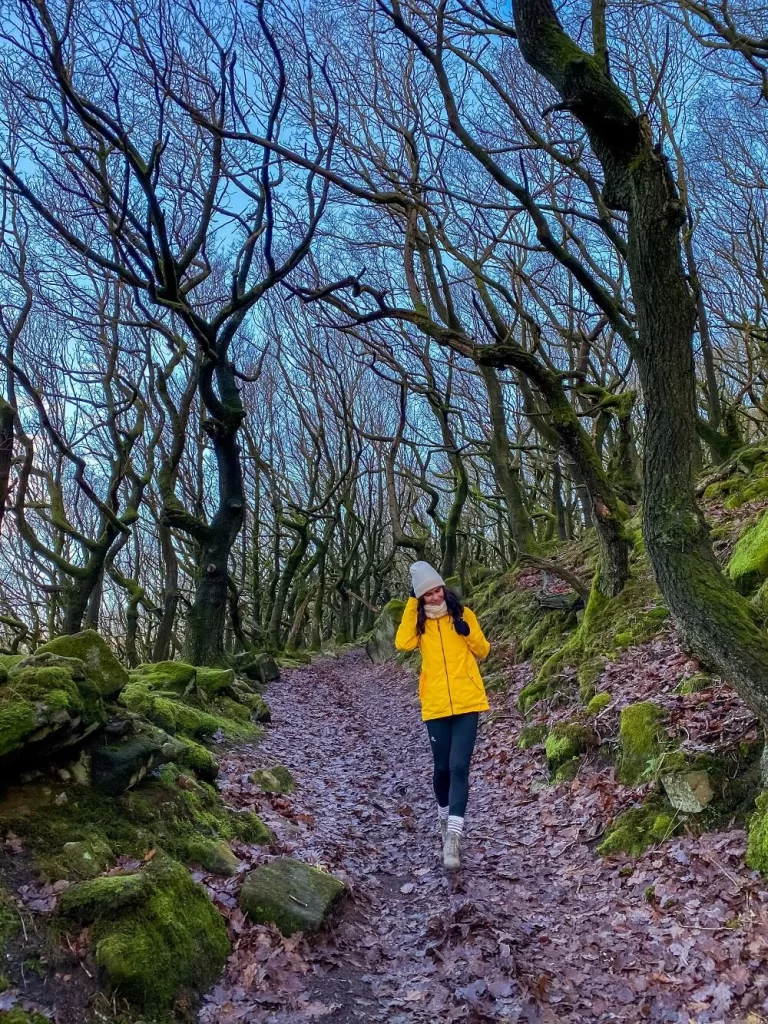
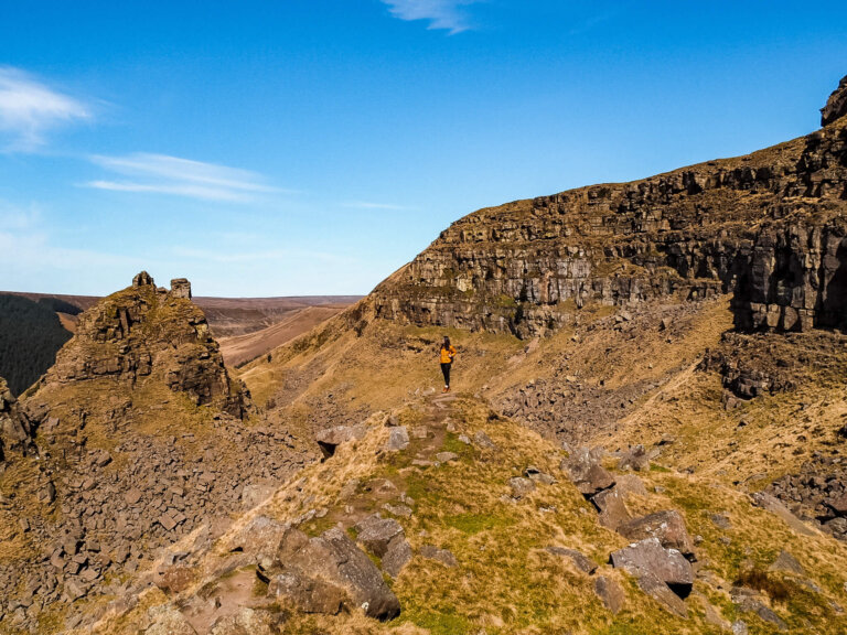
The footpath leading up to Bamford Edge will be on the right hand side of the stone wall. The path will get slightly steeper from here. Suddenly, you’ll find yourself walking through a stunning gnarled oak tree section. I absolutely loved this part of the trail and obviously took one too many photos.
What I loved about this section the most is that the beauty of the gnarled oak trees covered in thick moss made me forget the fact that I was trekking uphill. Once you’re out of the forest, Ladybower Reservoir will appear in front of you. This means that you’ve basically reached the ridge of Bamford Edge.
2. Bamford Edge to Bamford
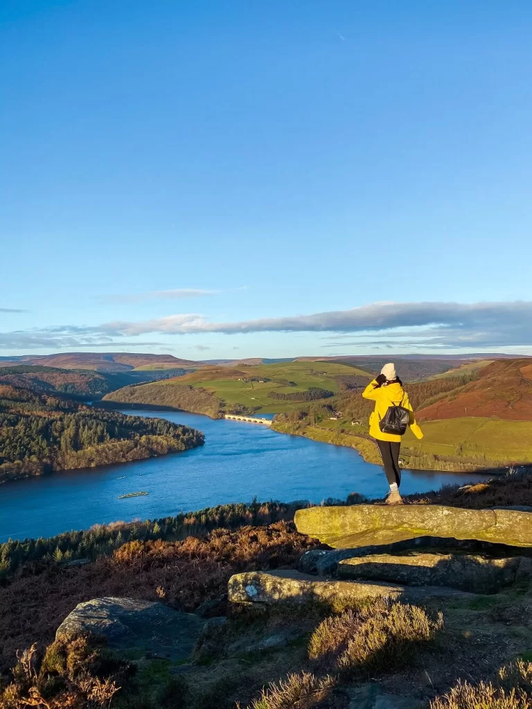
From this point you’ll need to carry on along the ridge. You’ll soon see some of the most amazing rock formations. Make sure to stop and turn around to see the iconic views of Bamford Edge with Ladybower Reservoir in the distance.
If you carry on further along the ridge you’ll see more of Hope Valley in the distance. This section is also very popular so make sure to stop and take in the magnificent views Bamford Edge provides you with.
You can either stop for a picnic or start making your way down Bamford Edge to Bamford. The descent is a bit steep so make sure you don’t lose your footing. Soon you’ll reach New Road which you have to cross so be careful. The official footpath leading to Bamford should be on your left a bit further along (called The Clough on the map).
At the time of our visit this was closed due to construction. If this is still the case, then you can just walk along New Road for a good mile (1.5 km), until you see a clearly marked footpath sign on your left. The footpath will take you back to Bamford through some fields. It’s a bit of a detour, but we couldn’t find a shorter option.
3. Bamford to Ladybower Reservoir
Once you’re in Bamford, you can stop here for a cuppa or some lunch if you didn’t bring your own. Once you’re ready for the last section of the trail, you’ll need to follow the A6013 which runs through Bamford towards the Railway Station. Stay on the right side of the footway as the path you have to take will be on that side, starting from where the actual footway ends.
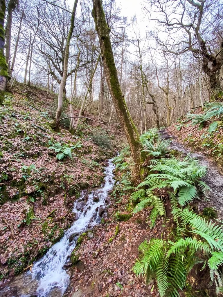
After crossing the bridge over the River Derwent you’ll need to walk along Water Lane for about 0.3 miles (500 m) before reaching Thornhill Trail. The trail is clearly marked and will start just after you’ve passed Quaker Community’s building on your right.
From here it’s pretty easy as you just have to follow Thornhill Trail all the way to Ladybower Dam. I must admit this section is a bit boring, but there are a few other paths running parallel with Thornhill Trail that you can take. (You can even extend your walk toward Win Hill). Thornhill Trail also forms part of National Cycle Route 6, so you’ll need to share it with – and watch out for – cyclists.
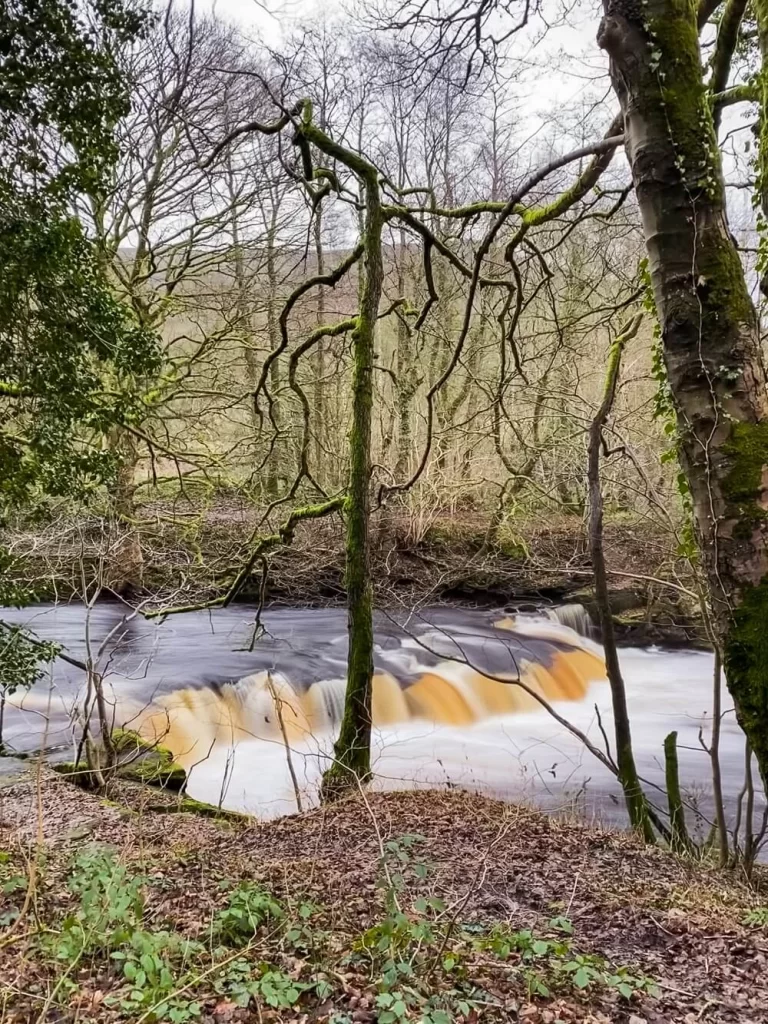
Even though this section isn’t the most exciting one there are a few features you should look out for. Obviously, you’ll be walking parallel with Bamford Edge, so you’ll have some great views of it to your right. In close proximity to Ladybower Reservoir there’s a place called the Yorkshire Bridge. The trail splits into 3 paths at this point. To your left, you’ll see a pretty waterfall with a trail leading up to it beyond. If you took the footpath above Thornhill Trail, that’s the footpath you’ll be coming down on. On your right there are some steps leading down to another waterfall.
4. Ladybower Reservoir
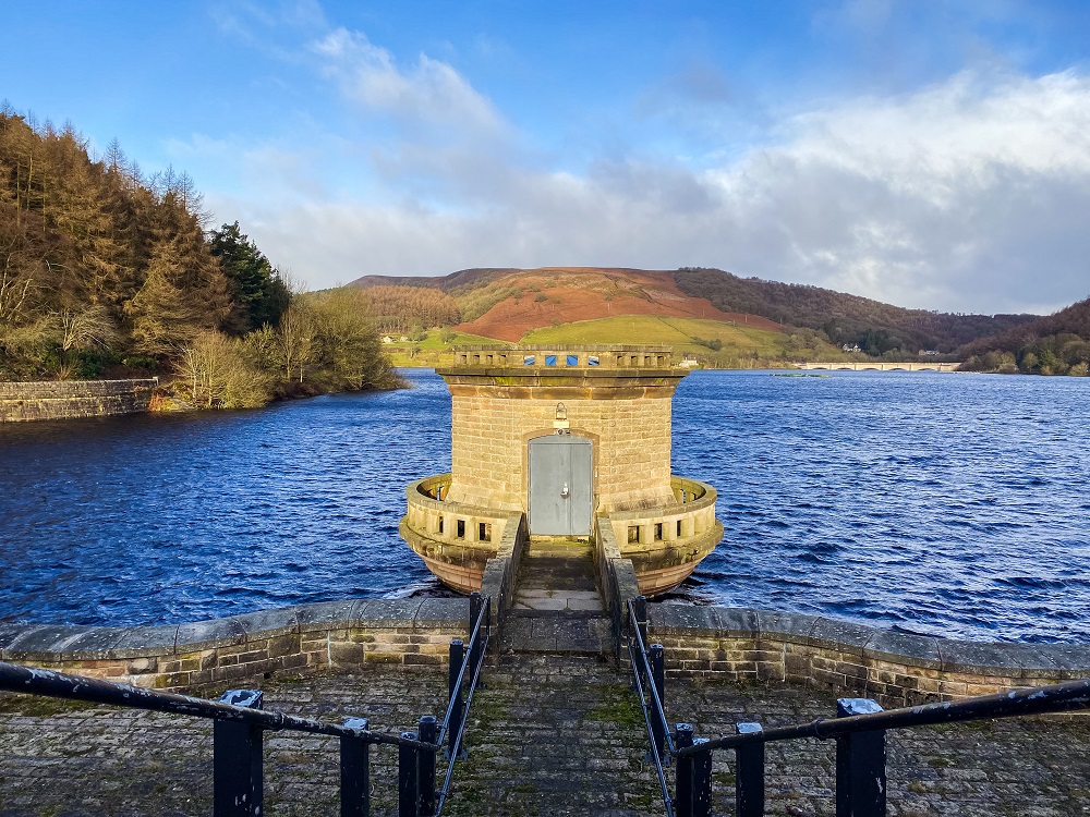
After admiring the waterfalls, carry on along the trail. You’ll reach Ladybower Dam in just a few minutes.
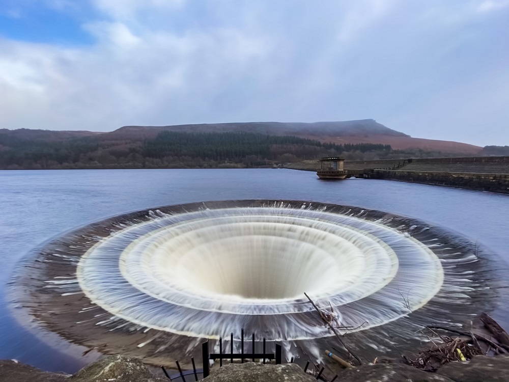
I highly recommend spending a little time around this section and enjoying the view. Ladybower Reservoir looks stunning plus the two plugholes on each side of the dam are another iconic feature. The two plugholes (or enclosed bell mouth overflows) are 80 feet (24 m) in diameter with outlets 15ft in (4.6 m) diameter. They are often out of the water however after heavy rainfall they can be submerged. This was the case at the time of our visit which made these plugholes pretty impressive.
From here you can either extend your walk and walk around the reservoir, or just head back to the car park by crossing over Ladybower Dam. As you walk through the dam you’ll have a lovely view of Bamford Edge and the valley you just walked through.
Additional Walks in the Peak District
If you’d like to see more of the Peak District make sure to check out some of my other blog posts:
Dovedale Stepping Stones – A 6-mile circular route with beautiful views, stepping stones and the coolest limestone formations. You can read the blog post by clicking here.
Chrome Hill and Parkhouse Hill – A 10 km circular route with a good mixture of trails, fields and ridges with some magnificent views of the surrounding area and beyond. You can read the blog post by clicking here.
Macclesfield Forest – A 10 km circular route filled with unique features from dense pine forestation to an abandoned farmhouse, and even a miniature Matterhorn. You can read the blog post by clicking here.
Monsal Dale and Wye Valley Walk – A 10 km circular route in Monsal Dale and the Wye Valley along the River Wye and Deep Dale, stopping at Monsal Head and Ashford-in-the-Water. You can read the blog post by clicking here.
Padley Gorge Walk – A magical walk in the Peak District which will make you feel like you’re walking through an enchanted forest. You can read the blog post by clicking here.
Three Shires Head Walk – A picturesque waterfall, located at the meeting point of three counties in the north of England: Cheshire, Derbyshire and Staffordshire. You can read the blog post by clicking here.
The Trinnacle Walk at Dovestone Reservoir – See some picturesque landscapes and do some cool things like climbing on top of a three-pronged grit-stone stack called the Trinnacle. You can read the blog post by clicking here.
Final Thoughts on Bamford Edge
I absolutely love Bamford Edge, even though it can get very busy with tourists. It’s easily accessible and offers some really great walking trails in the vicinity so you can increase the level of difficulty if you wish. The views from the top of Bamford Edge never disappoint me, and every season the landscape changes which keeps the same walk fresh.
Have you ever been to Bamford Edge or Ladybower Reservoir before? If so, how much of the area did you manage to explore? Let me know in the comments below.
Now, let your adventure begin,

Our Top Travel Resources
Accommodation: For hotels we always use Booking.com and Hostelworld for hostels. We also book longer stays on Airbnb or Vrbo.
Flights: To find the best flight prices we always check Skyscanner, Google Flights or WayAway. Then we also check the airlines’ websites too for comparison.
Car Rentals: We use Discover Cars when we want to rent a car as it compares local, national and international companies.
Activities: If we book organised tours we always check either GetYourGuide or Viator.
Foreign Currency: Whenever we can we prefer to pay in local currency and for that we always use our Wise card. We can easily withdraw money from the ATM or pay by card at most shops and restaurants.
Travel Insurance: We never go anywhere without travel insurance. You never know what will happen on your trip, so good travel insurance like SafetyWing can protect you in case of injury, illness, theft and cancellations.
eSIM and VPN: To get data abroad we use Airalo which is an app that allows you to download a prepaid eSIM to your phone in over 190 countries. Make sure to have a VPN to avoid hackers accessing your personal data when using public WIFI. We use Surfshark which is the only VPN that offers one account on unlimited devices.
Remember…It all starts with a Pin…


I can see why Bamford Edge is getting popular on instagram now! The views up high are incredible (the Peak District is such a lovely area!)
Are more people getting out and about and enjoying the wilderness these days? A few years ago when my husband and I hiked a lot in England, we hardly ever met other hikers (just older men really…) It’s great to hear some of these beauty spots are getting busier with people enjoying them!
Thank you for your comment Josy. Since Bamford Edge is very accessible, an easy hike with great views it was inevitable to become popular on social media. I’ve noticed this year that the number of people on the trails are a lot higher than before. It’s good that more people connect with nature.
Wow, the views at Bamford Edge look incredible! I’m not sure I’m brave enough to get as close to the edge as you did though! Ladybower Reservoir looks really dramatic too! Thanks for the instructions for such a beautiful walk, I can’t wait to try it out!
I’m glad you enjoyed my post and hopefully you can see the views too soon. Of course better to be safe than sorry, I wouldn’t recommend climbing them if you’re unsure. Always see how you feel on the day and what the weather conditions are like 🙂
Wow! This is a stunning destination for sure. I can see why it’s popular. The Peak District is definitely on my list for a return visit to England. I’m saving your post for this walk as well as the others.
Thank you for your comment Lynne. I’m happy you enjoyed my post and I hope you can return to England soon to explore the Peak District.
Oh how beautiful the Peak District looks! I would love to walk and hike around there. Also, the Ladybower Resevoir looks so beautiful. 🙂
Thanks Taylor! When the sun is out the Peak District looks so lovely even on a cold wintery day!
Great photo’s of views from the top of the Edge! A little too close to the edge for me! :-/ But will def., get there in 2021! Will take your advice and go early, through the week and out of season, as I know it does get busy! But well worth it for the views. 🙂
Bamford Edge looks amazing!!! I pinned it for later so I’ll definitely put it on my list the next time I visit the UK.
That Ladybower Reservoir looks so cool! Thank you!
I am really keen on getting to Northern England, Ireland and Scotland, I have only been to London which is great, but my hubby and I like to get out into the outdoors and explore!
I’m all about the day hike and would love to explore Peak District. Such stunning views at Bamford Edge! Gorgeous pics!
I love a good hike. Your photos here are beautiful, and your tips are really helpful! It seems like it’d be pretty easy to adapt a hike in this area based on time constraints and physical fitness. I love that it’s easily accessible with public transit too!