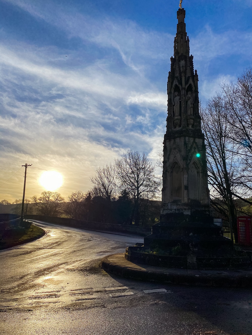
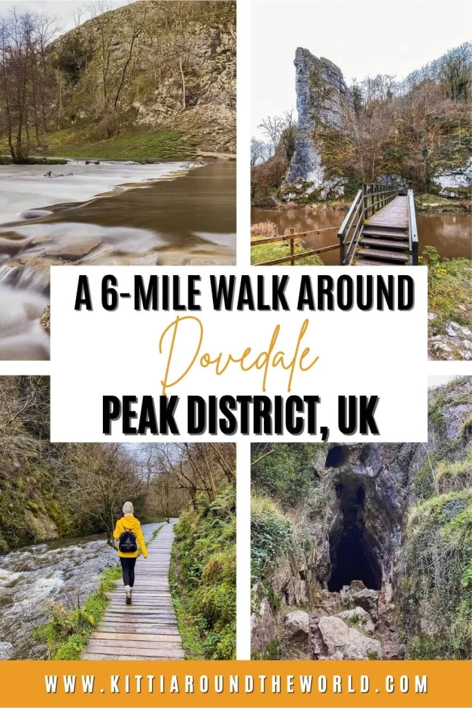
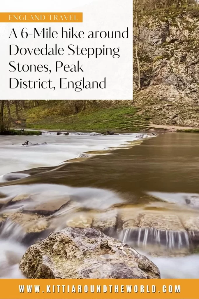
Dovedale Stepping Stones Walk in the Peak District
Visited by millions of people every year, Dovedale is a stunning area in the Peak District National Park. Obviously, it hasn’t become this popular for no reason. There are many natural wonders to see and plenty of walking trails to choose from which makes Dovedale very attractive to a large variety of people.
You can hike up to Thorpe Cloud for a view, jump across Dovedale Stepping Stones or just take a stroll and explore some of its amazing limestone formations. There’s just something special about this place that stole my heart instantly.
If you’d like to see our walk then make sure to watch our YouTube video by clicking here.
Disclosure: This post may contain affiliate links, which means we may receive a small commission if you click a link and purchase something. Clicking these links won’t cost you anything, but it will help us to keep this site up and running! Learn more about our affiliate policy.
Introducing Dovedale
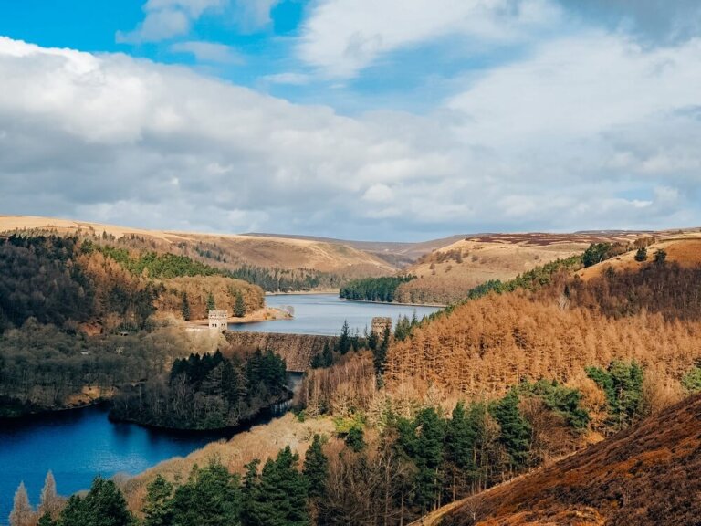
Located 4.5 miles (7 km) to the north of Ashbourne and 20 miles (32 km) to the south of Buxton, Dovedale is one of the most popular places in the Peak District. It has been owned by the National Trust since 1934. Due to its diverse wildlife, plant life and numerous rock formations, Dovedale became a National Nature Reserve in 2006.
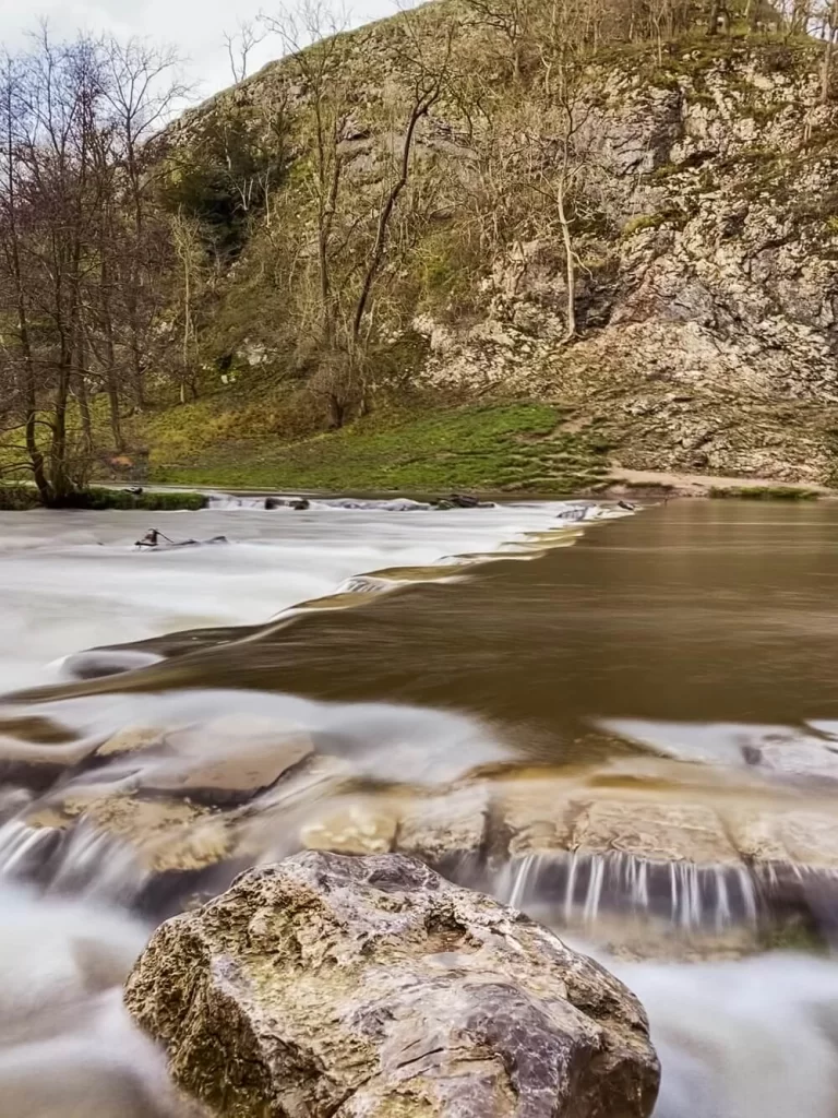
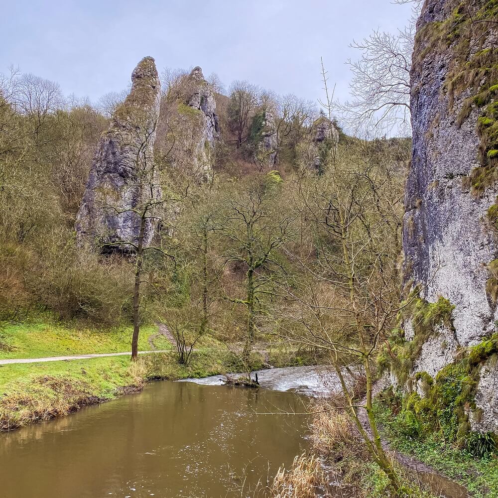
Dovedale’s geology is the same as Chrome Hill’s and Parkhouse Hill’s, another must see place in the Peak District. The limestone rock (or reef limestone) is the remains of the sea creatures that lived in the tropical sea covering the Peak District – and much of Britain – during the Carboniferous period . During the ice ages the glacial meltwater cut the limestone rock into different shapes, and eventually created some of the most popular attractions in Dovedale such as the Dove Holes, and Reynard’s Cave.
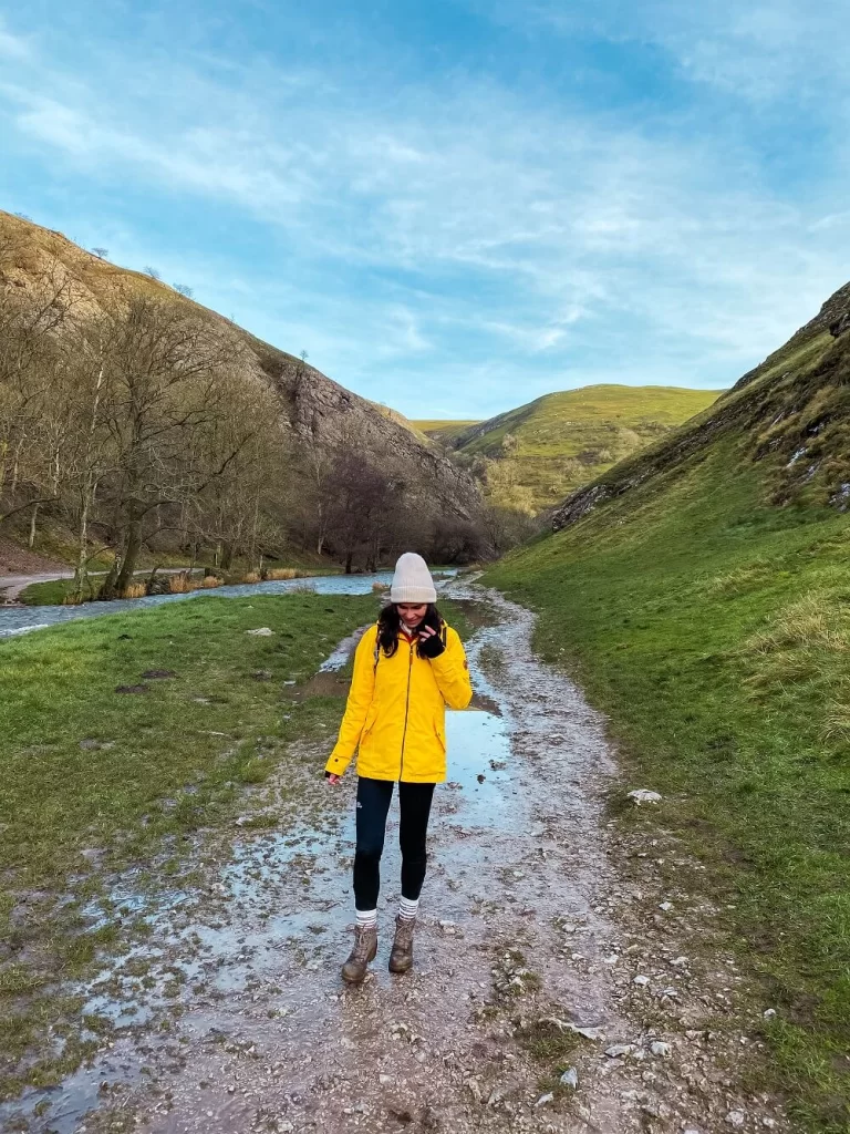
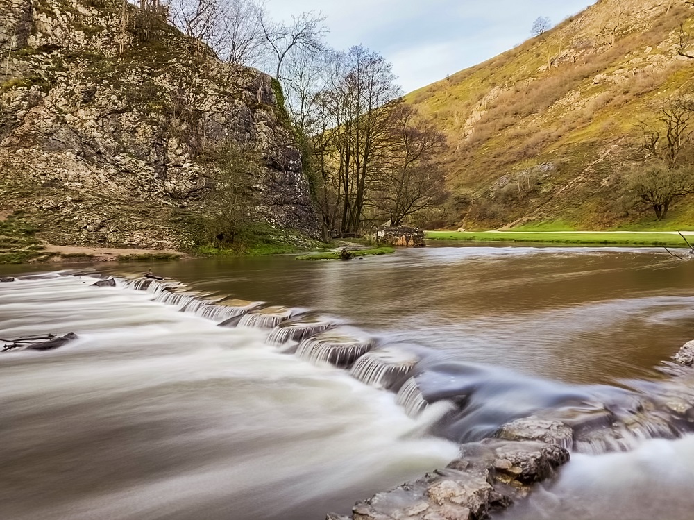
However, the most iconic feature of Dovedale is hands down the Dovedale Stepping Stones. These set of stepping stones cross the River Dove which runs through Dovedale valley.
How to get to Dovedale?
By Car: If you arrive by car, Dovedale is located to the north of Ashbourne and to the southeast of Macclesfield and Buxton. The most convenient place to park is at Dovedale Car Park. Use DE6 2AY in your SAT-NAV to find it. You’ll have to pay £3 to park there all day.
If you don’t have your own car but would like to enjoy the freedom of a private vehicle, then you can always hire a car to get to Dovedale.
Top Tip – Make sure you have £3 in change!!! There’s no staff around and you can’t use card or mobile apps to pay for parking. Also come early in the day especially on a weekend. Dovedale is one of the most popular areas in the Peak District, so the car park will get full pretty quickly.
Don’t worry if you don’t have the right change or it’s full. You can try to park either in the village of Ilam or in Milldale.
By Public Transport: Public transport options to reach Dovedale are very limited. Your only option is to get Bus 108 running between Leek and Ashbourne. You’ll need to get off at Calton Moor Farm Stop and make your way to Ilam and then to Dovedale. This is a nearly 4 mile long walk plus you need to get back too. So I must admit it’s not the most accessible of places.
By Bike: There are some National Cycle Routes running in the vicinity of Dovedale. However, you’re not supposed to cycle through Dovedale Valley.
Useful to Know Before You Go
Length of the Dovedale Stepping Stones Walking Trail
The route we chose to do was about 6-7 miles (10 km) long. Depending on your speed and how long you are spending taking photos or stopping for a picnic, this route could take at least 4 hours.
You can definitely extend the walk by carrying on towards Milldale or Stanshope. This was our original plan, however, we forgot to take screenshots of the route and there was no signal in the area to use Google Maps. To avoid our mistake, make sure to either take an actual map with you or screenshot the route before your walk!
Top Tip – Make sure you start your walk as early as possible if you come on a weekend. Alternatively, I suggest coming on a weekday if you can. This is a very popular area, so expect it to be packed with people especially on a nice day. I always feel more connected to nature if I don’t have to pass a constant stream of walkers.
Level of Difficulty
I think the route we did is relatively easy and you can complete it with a basic level of fitness. If you don’t climb up Thorpe Cloud, the route is even easier. The only issue you might have is flooding, so just be prepared.
If you decide to climb Thorpe Cloud, I recommend wearing the right footwear. It’s a bit steep and the path can be slippery when wet but still doable.
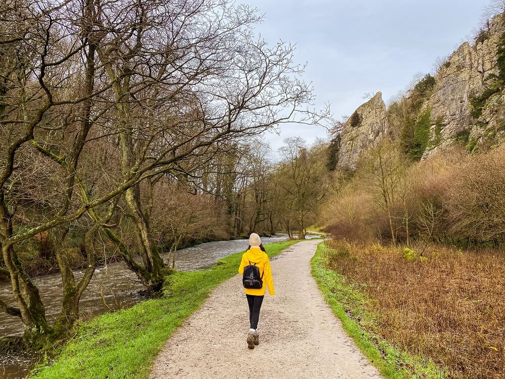
The walk is sheltered for the most part after passing Dovedale Stepping Stones. Obviously, you’ll be exposed climbing up Thorpe Cloud so wear appropriate clothing. I think this walk could be a great activity even on a slightly windy or rainy day. (I wouldn’t suggest doing it in the pouring rain though!)
Facilities Within Dovedale
Cafés and picnic spots: I highly recommend packing your own lunch and if the weather is lovely stop for a picnic. There are plenty of picnic places along this route. The best one is obviously at Dovedale Stepping Stones providing you with a nice open space and a great view. You can also sit somewhere on top of Thorpe Cloud where you’ll be treated with an excellent view of the valley. (It might be a bit windier and colder up there though so pick a nice sunny day to do that!) If you carry on along the trail there will be some other openings where you can stop for a picnic.
Please Note! – You cannot have BBQ’s or any kind of open fire in the area, so make sure you pack an appropriate picnic basket.
If you’d like to grab a coffee or tea and a bite to eat, you can do that at the Manifold Tea-room at Ilam Park in the village of Ilam. Ilam Park is run by the National Trust and has a beautiful Italian Garden so you can enjoy both the garden view and the view of Thorpe Cloud with your cuppa. Alternatively, if you’re walking to Milldale you can stop at Polly’s to grab something from their café.
Toilet facilities: Although there are no public toilets along the trails, there are public toilets available at Dovedale car park (yippie). However, you have to pay 20p to use these facilities. You also have to have some change on you as there are no dedicated staff working there. Otherwise, you’ll need to find a private spot somewhere along the trail which won’t be easy since it’s a rather open and popular route.
What to Wear and Bring With You?
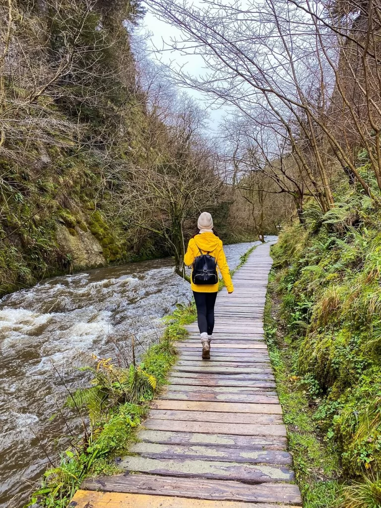
You are in the north of England so weather conditions can change quickly. At the time of our visit the River Dove was incredibly high which made parts of the trail leading to Dovedale Stepping Stones flooded. Therefore, if you’re only planning on having a stroll around the Stepping Stones area I recommend wearing waterproof boots or even wellies.
However, if you’d like to climb up Thorpe Cloud and do a longer walk, I suggest you wear proper walking boots. Weather appropriate clothing is a must when visiting Dovedale. Whilst the valley could feel warmer especially during the summer months, the top of Thorpe Cloud will be cooler. So, make sure you check the weather forecast before you set off and have a few layers with you.
I recommend packing some snacks and having plenty of water with you. There are plenty of beautiful picnic areas along the trail as outlined above. You won’t have much signal, so bring a map or screenshot your route in advance.
Dovedale Walking Routes
Dovedale has many amazing features you cannot miss when walking around. I’ve assembled 5 of the most unique sights below in the order we saw them on our walk. I have also described the route itself.
1. Dovedale Stepping Stones
Probably the main reason why Dovedale became popular is its picture perfect stepping stones. Even if people aren’t planning on doing a big walk, they will definitely make their way to Dovedale Stepping Stones. In 2010 the National Trust and Derbyshire County Council decided to renovate these stones by topping them with mortar and limestone slabs. The aim was to make it more accessible and safer for visitors. However, many people thought that this ruined the natural beauty of these stepping stones.
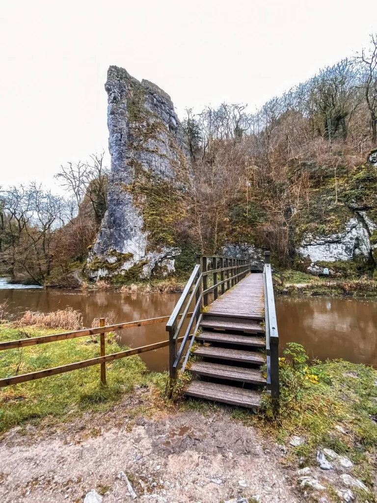
Dovedale stepping stones are located only about 0.5 miles from Dovedale car park and they’re easily accessible through two footpaths that run along both sides of the River Dove. The footpath that runs along the northern aspect of the river is better maintained, however, the day we visited Dovedale large parts of it were under water. If that’s the case when you’re visiting, I suggest you take the path running along the southern side of the river. This one is more like a natural trail than a well maintained footway.
Please Note! – If the River Dove is high, there’s a high chance that the stepping stones will be flooded too and not be crossable. Of course, if you wear wellies and are feeling confident you can attempt to walk across them, but please be cautious as these rocks can be very slippery.
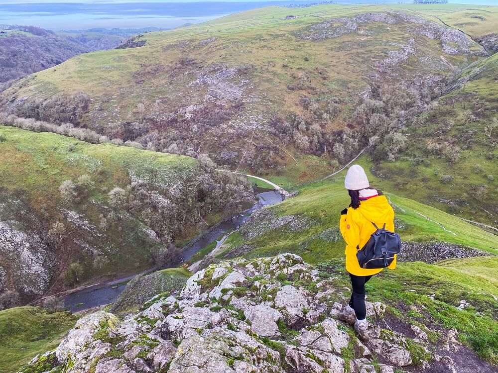
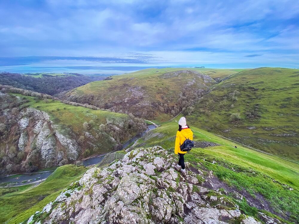
2. Thorpe Cloud
If you decide to do some hiking, then I highly recommend climbing up to Thorpe Cloud. The 942 ft (287 m) limestone hill can be accessed from two directions. You can walk up to it by starting from the little bridge that crosses the River Dove just after you leave the car park. If you take this route, after reaching the top you can walk down the other side of the hill and end up at Dovedale stepping stones. From there, you can carry on further along the trail towards the other limestone formations. Alternatively, you can just head back through Dovedale Valley to the car park.
If you walked to Dovedale Stepping Stones first, you can just take the trail leading up to the summit of Thorpe Cloud from there too.
The trail itself might feel a little bit steep but trust me, you won’t regret a bit of exertion once you reach the summit and see the magnificent view Thorpe Cloud provides you with. You’ll be able to see the River Dove meandering below you and the contrast between the Dales to the north and Midlands plain to the south. Opposite you is another reef knoll called Bunster Hill. The 1,079 ft (329 m) hill together with Thorpe Cloud are owned by the National Trust.
Did you know? – In 1997 Jeff Kent discovered that you can see a double sunset against Thorpe Cloud. Apparently you can only see this from the top of Lin Dale for a short period around the summer solstice. The only other place you can see a double sunset in Derbyshire is at Chrome Hill and Parkhouse Hill.
Fun Fact – Thorpe Cloud and Dovedale were actually used as filming locations in Robin Hood (2010) starring Russell Crowe.
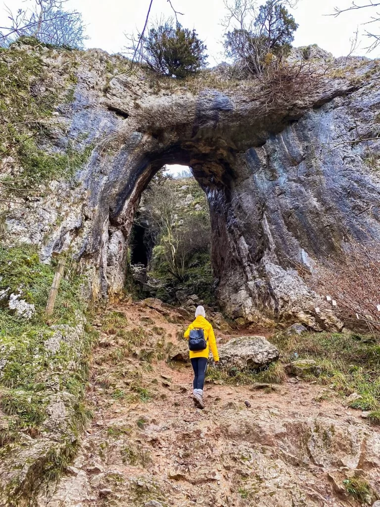
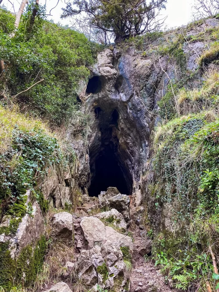
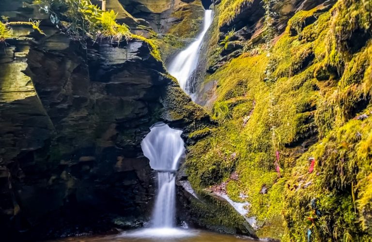
3. Reynard’s Cave and the Natural Arch
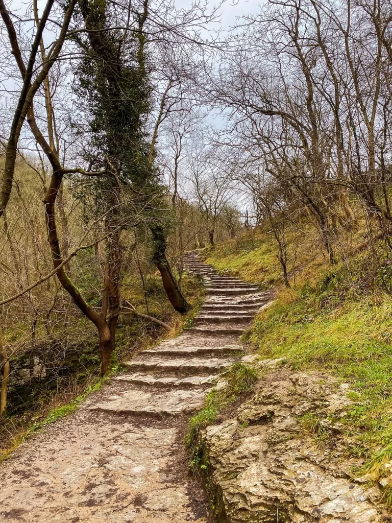
After climbing Thorpe Cloud and jumping across Dovedale Stepping Stones, you can carry on along the well maintained trail to see a few more natural wonders. The first one will be a massive natural arch with Reynard’s Cave behind it. It’s very easy to miss, so keep your eyes peeled for a trail leading off the path to your right. It will be approximately 1 miles (1.5 km) from Dovedale Stepping Stones.
You’ll immediately see the natural arch from the side-path which is otherwise covered by trees. Make sure you climb up to it and appreciate just how massive it is from every angle. Once you reach the arch you’ll see a cave further up called Reynard’s Cave. After passing the arch there’s anther cave to your left called Reynard’s Kitchen Cave.
All of these features were formed during the last ice age, when the glacial meltwater cut through the rocks leaving behind the arch and caves. In 1959, excavations revealed that these caves were used as a temporary shelter during the Neolithic, Roman and Medieval periods.
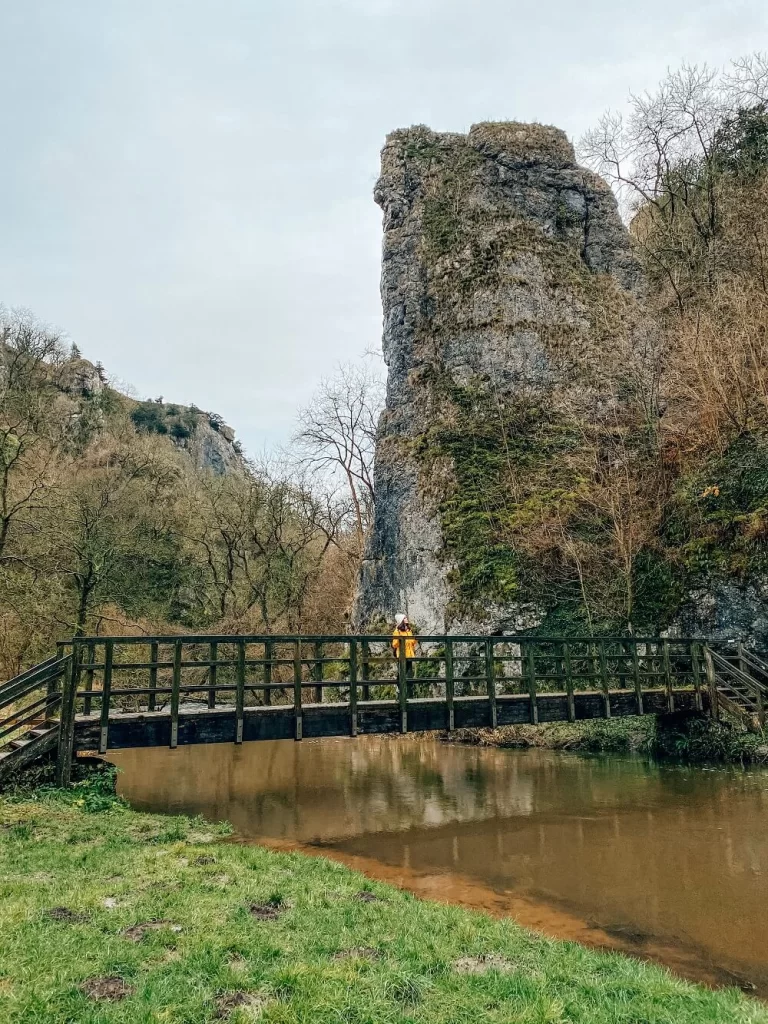
4. Lovers Leap or Ilam Rock
After exploring Reynard’s Cave and the natural arch return to the official trail and just carry on to the north. Approximately 0.4 miles (650 m) from the caves you’ll reach a massive limestone rock, called Ilam Rock or Lover’s Leap. This is another iconic feature of the Dovedale trail.
The Story of Lover’s Leap – Apparently during the Napoleonic Wars a young woman who’d thought that her lover had gotten killed decided to end her life. She climbed on top of the rock and leaped. Luckily, her skirt got caught in some tree branches which saved her life. She returned home where she was welcomed with the news that her lover was actually still alive, turning an almost tragic story into a happy one. There are other accounts placing these events during World War II.
Apparently, you can access Lover’s Leap by a set of steps which were built by Italian prisoners captured during World War II. It is now maintained by the National Trust.
5. The Twelve Apostles
As you walk along the trail, make sure you look up every so often on your right. You’ll see some other limestone formations known as the Twelve Apostles. (Of course, they are nowhere near as magnificent as the Twelve Apostles in Australia, but I can totally see why they share the same name.)
Again, like all other limestone formations in Dovedale Valley, these pillars were created by the erosion of the soil caused by the river. Since they are a bit hidden, the National Trust keeps the surrounding plants clear so these rocks are visible to anybody who walks along the trail.
You can get a better look at them when you stand on the bridge crossing over the River Dove in front of Lover’s Leap.
After this point the trail splits and you can either carry on towards Milldale or Stanshope. Since we didn’t have a map or signal to check the trail and had very limited daylight left, we decided to turn back and head back to the car park.
Additional Walks in the Peak District
There are many amazing places and trails located near Dovedale. So, if you’d like to see more of the Peak District then make sure to check out the 10 Best Hikes in the Peak District or browse for more hiking trails in the UK and around the world in my Hiking Adventures Series.
For now, here are some hikes in the Peak District that are approximately 30 minutes’ drive away from Dovedale:
The Roaches and Lud’s Church Walk – The Roaches and Lud’s Church circular trail in the Peak District in England is filled with stunning views, history and legends. Click here to read it.
Chrome Hill and Parkhouse Hill – A 10 km circular route with a good mixture of trails, fields and ridges with some magnificent views of the surrounding area and beyond. Click here to read it.
Monsal Dale and Wye Valley Walk – A 10 km circular route in Monsal Dale and the Wye Valley along the River Wye and Deep Dale, stopping at Monsal Head and Ashford-in-the-Water. Click here to read it.
Matlock and Matlock Bath – A 10 km circular sightseeing trail exploring Matlock and Matlock Bath. Click here to read it.
Three Shires Head Walk – A picturesque waterfall, located at the meeting point of three counties in the north of England: Cheshire, Derbyshire and Staffordshire. Click here to read it.
Final Thoughts on the Dovedale Stepping Stones Walk
What I loved the most about Dovedale is the variety of trails you can choose from to explore the area. Not to mention the different natural wonders you’ll see along this trail.
Have you ever been to Dovedale before? If so, how much of the area did you manage to explore? Let me know in the comments below.
Now, let your adventure begin,

Our Top Travel Resources
Accommodation: For hotels we always use Booking.com and Hostelworld for hostels. We also book longer stays on Airbnb or Vrbo.
Flights: To find the best flight prices we always check Skyscanner, Google Flights or WayAway. Then we also check the airlines’ websites too for comparison.
Car Rentals: We use Discover Cars when we want to rent a car as it compares local, national and international companies.
Activities: If we book organised tours we always check either GetYourGuide or Viator.
Foreign Currency: Whenever we can we prefer to pay in local currency and for that we always use our Wise card. We can easily withdraw money from the ATM or pay by card at most shops and restaurants.
Travel Insurance: We never go anywhere without travel insurance. You never know what will happen on your trip, so good travel insurance like SafetyWing can protect you in case of injury, illness, theft and cancellations.
eSIM and VPN: To get data abroad we use Airalo which is an app that allows you to download a prepaid eSIM to your phone in over 190 countries. Make sure to have a VPN to avoid hackers accessing your personal data when using public WIFI. We use Surfshark which is the only VPN that offers one account on unlimited devices.
Remember…It all starts with a Pin…

Thanks for this, great area and amazing views from the top of Thorpe cloud!
Thank you Karan! Yes Thorpe Cloud has a stunning view.
The stepping stones look straight off a postcard! (But knowing me, I would slip off the first one and land right in the river!)
Haha yes that sounds like me too, so I didn’t attempt hopping over them when they were flooded 🙂
Wow I loved reading about the story behind Lover’s Leap! It sounds similar to Romeo and Juliet except the ending wasn’t as fortunate.
Yes I enjoyed the happy ending to the story too 🙂
Stepping stones underwater might be an issue. Great info. Paying for bathroom, yikes.
Yes we decided not to cross them due to the flood. Unfortunately there are many places where you have to pay for public toilets in England.
Anywhere you hike in the Peak District is just so pretty! I haven’t been on this one before though, so I’m pinning it for later!
Thank you Krista. There are so many stunning places in the Peaks and I still need to visit many of them, even though I’ve been exploring it for nearly 5 years!
The Peak District is an area I really need to explore! I have never really ventured over even though I don’t live too far away. Dovedale looks stunning! And the view from Thorpe Cloud looks incredible! I can’t wait to visit! Thanks for the great guide!
Thank you for your comment Hannah. I really hope that you can start exploring the Peaks pretty soon. Once you visit it once you won’t be able to stop exploring it 🙂
My girlfriend lives just out of Manchester and we were talking about a visit to the Peak District so this post has really come at the perfect time!!
Hi Amy, I’m so happy that you live close to the Peaks and are planning on exploring it. I cannot recommend it enough. Let me know if you have any questions about any of the locations.