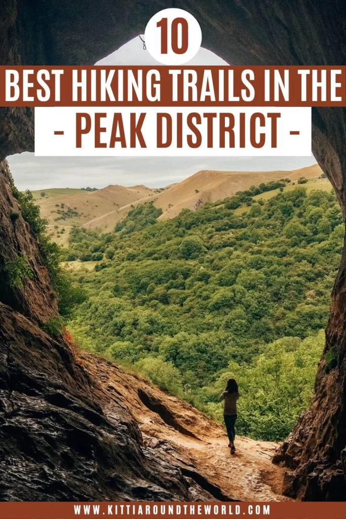
10 Best Hikes in the Peak District
In this blog post I’ll show you 10 of the best and most scenic hikes you can do in the Peak District National Park in the heart of England. The Peak District is the oldest national park in the UK, full of scenic hiking and walking trails, natural wonders, a rich history and is home to many myths and legends.
I only provide 10 iconic hiking trails in this post. However, make sure to check out my Peak District Hiking Series for more hikes in the Peak District. You can also check out our Peak District Playlist for more hiking adventures.
Disclosure: This post may contain affiliate links, which means we may receive a small commission if you click a link and purchase something. Clicking these links won’t cost you anything, but it will help us to keep this site up and running! Learn more about our affiliate policy.
About the Peak District National Park
Located in the heart of England at the southern edge of the Pennines is the Peak District National Park. It became Britain’s first national park in 1951. Covering an area of 555 sq miles (1,438 sq km) the Peak District covers most of Derbyshire, parts of Cheshire, Greater Manchester, Yorkshire and Staffordshire. Since it’s easily accessible from multiple big cities such as Manchester, Sheffield, Derby and Nottingham, it’s one of the most visited national parks in Britain.
The Peak District is split into two very distinct regions: the Dark Peak and the White Peak. Dark Peak lies to the north, east and west and is comprised mainly of moorland and open, heather covered landscape with gritstone. The White Peak forms the central and southern part of the national park. This is a limestone area, therefore it is comprised of stunning valleys, gorges, caves and picturesque little towns.
Some interesting / fun facts:
- Over 35% of the Peak District is designated as Sites of Special Scientific Interest (SSSI);
- It has more active and disused quarry sites than all other UK national parks together;
- At 636 m (2086 ft) the highest point is Kinder Scout;
- At 141.5 m (464 ft) the tallest cave is the Titan Shaft in Castleton which is taller than the London Eye;
- Apparently, nearly 20 million people live within an hour’s journey of the national park.
Things to Do Before and During Your Hike
There are a few things you should always do before and during your hike. They are as follows:
- Always check the weather forecast before your hike and come prepared or postpone the hike in case of bad weather.
- Wear weather appropriate clothing and footwear! The weather can change drastically whilst you’re on the trail so always have a few layers with you.
- Bring enough water and food with you because we all have different levels of fitness and experience and can complete the same hike in different times.
- Take screenshots of your planned route and directions or have an actual map with you. Using the internet is second nature, but often you won’t have signal to look something up. (Also if you’re relying on your phone have a portable charger with you!)
- Pack a basic first-aid kit, because you just never know!
- Most importantly, make sure you don’t leave your rubbish behind! Always pick it up and dispose of it responsibly!
Now that you’re all set, let’s pick which one of the best hikes in the Peak District you’ll complete next shall we?
10 Best Hikes in the Peak District
There are MANY stunning hikes in the National Park! However, the ones I’m listing below are some of the BEST hikes in the Peak District. Here is why:
These are the ones I’ve completed multiple times over the years. You can hike along these trails in any season and you’ll be treated with completely different scenery each time. The different seasons transform the Peak District completely and you can enjoy blooming flowers in spring, heather covered fields in summer, millions of shades of autumnal leaves and of course snow covered landscapes in winter.
Most of the trails I’ve listed are around 10 km (6.2 miles) circular walks. Each trail below is surrounded by other amazing walking trails. Therefore, every trail I detail below can easily be extended or shortened. Last, but by no means least, these hiking trails will provide you with the best views of the Peak District.
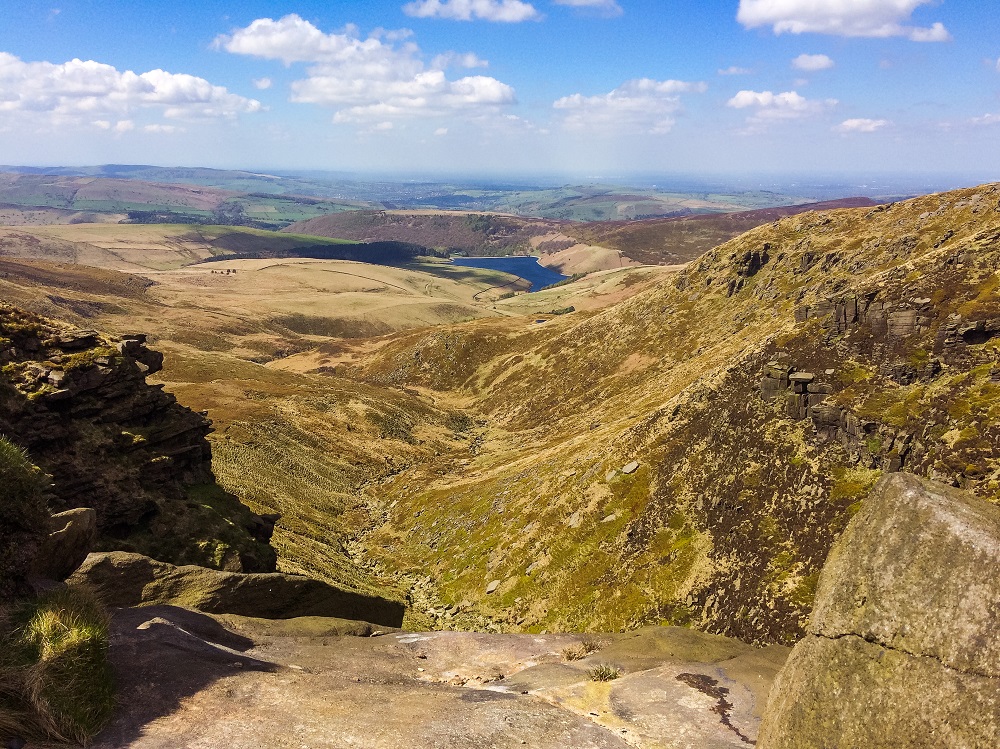
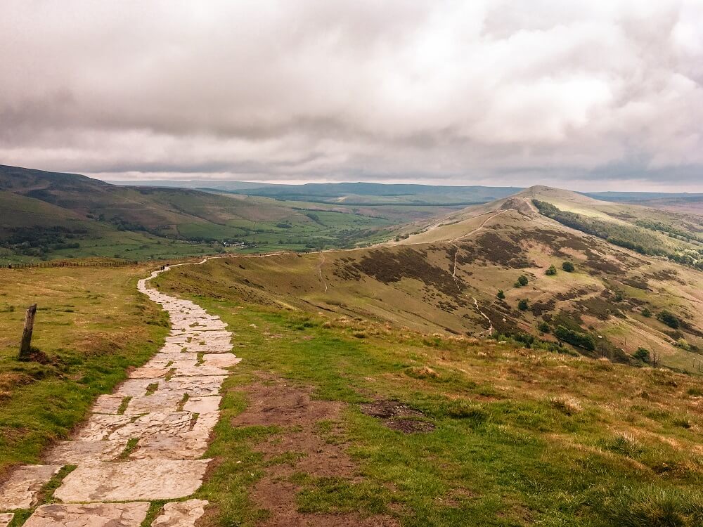
1. Kinder Scout
Located in the Dark Peak of the Peak District is Kinder Scout, a moorland plateau. At 636 m (2,087 ft) above sea level, it’s also the highest point in the Peak District National Park. Although it’s one of the most challenging terrains, Kinder Scout is still one of the most popular hiking trails. The majority of the walking trail is part of the Pennine Way which is England’s first National Trail and also a well enjoyed long-distance walk in the UK. The area around Kinder Scout is also filled with myths, legends and countless stunning landmarks such as Kinder Downfall, Kinder Reservoir and the Mermaid’s Pool.
This combination of hiking to the highest point in the Peaks, along the oldest and most iconic national trail, without doubt makes Kinder Scout one of the best hikes in the Peak District. Wouldn’t you agree?
The Route Stats
- Length: 14.5 km / 9 miles
- Elevation: 625 m / 2050 ft
- Completion Time: 5 to 6 hours
- Difficulty: Moderate to Difficult
Kinder Scout Circular Trail Description
Starting from the village of Hayfield, make your way out of the village down Kinder Road then join Edale Road. At the end of Edale Road, walk past a farm house from where the trail leads you through some fields before slowly starting to ascend Kinder Scout. The trail will get steeper but soon you’ll be on the top and reach Kinder Low, Trig Point. This is where the path joins with the official Pennine Way. From there, make your way across the Plateau until you reach Kinder Downfall. Kinder Downfall will provide some epic views across Kinder Reservoir, Hayfield and beyond.
Carry on along the Plateau by following the Pennine Way. You’ll pass some rock formations along the way and will have an option for descent just after that section. Stay on the Pennine Way and carry on until you reach the next option for descending which is a stream called William Clough. Make your way down the stream until you reach Kinder Reservoir. From there just follow the path that leads you back onto Kinder Road from where you can get back to Hayfield.
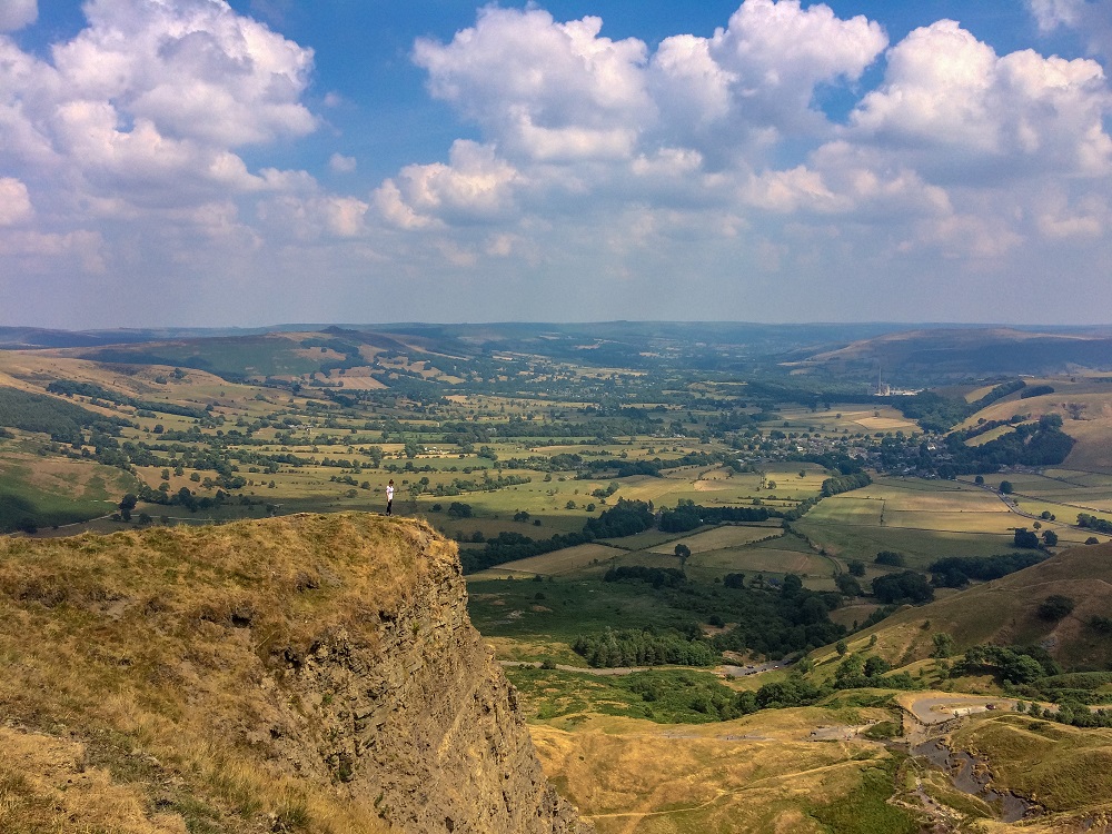
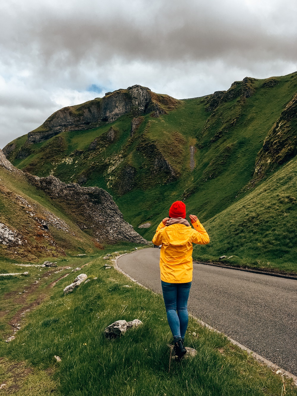
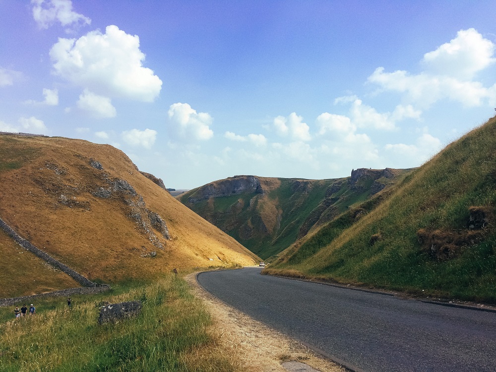
2. Mam Tor and Winnats Pass
Two iconic and must-see places in the Peak District are Mam Tor and Winnats Pass. Both are located in the White Peak area, in close proximity to each other just outside the village of Castleton.
This area is extremely popular due to its beauty and the endless things you can do whilst there. You can hike, paraglide, visit iconic caves such as the Blue John Cavern, Speedwell Cavern, and Treak Cliff Cavern; you can shop and eat; the list is basically endless!
The Route Stats
- Length: 8 km / 5 miles
- Elevation: 409 m / 1,342 ft
- Completion Time: 3 to 4 hours
- Difficulty: Moderate
Mam Tor and Winnats Pass Trail Description
Start your walk from Mam Tor Car Park and head straight up to the summit of Mam Tor via a series of steps. It’s steep, but can be reached in 10-15 minutes. From the top of Mam Tor you’ll have a fantastic view of the Vale of Edale and the Hope Valley. From there follow the flagstones along the ridge until you reach a gate onto the Great Ridge. Start descending at this point via a path on the right and make your way into Castleton.
You can stop for a break and refreshments in Castleton. From the village head towards Winnats Pass. You can either climb to the top of it and make your way back to Mam Tor through the fields after reaching the summit. Or you can also walk along the road and reach Mam Tor Car Park that way.
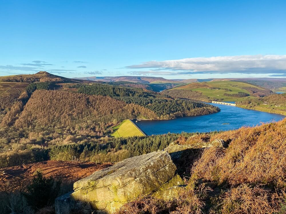
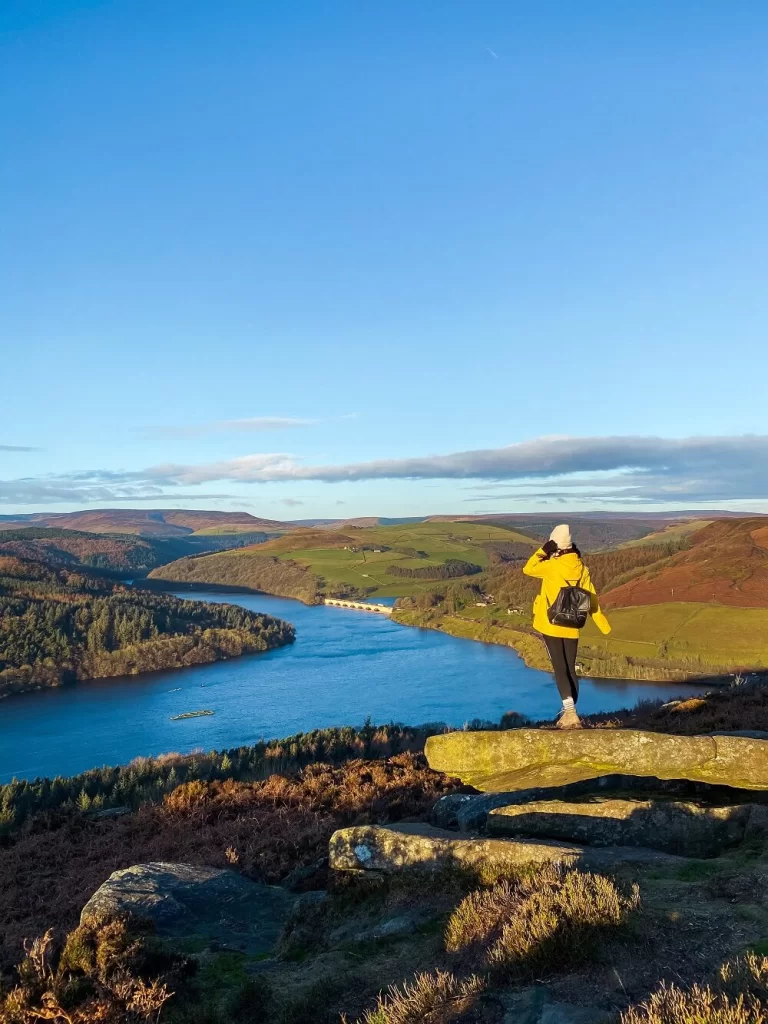
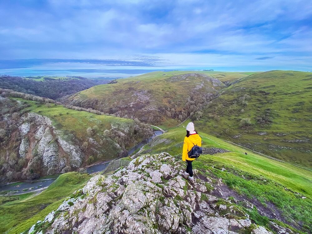
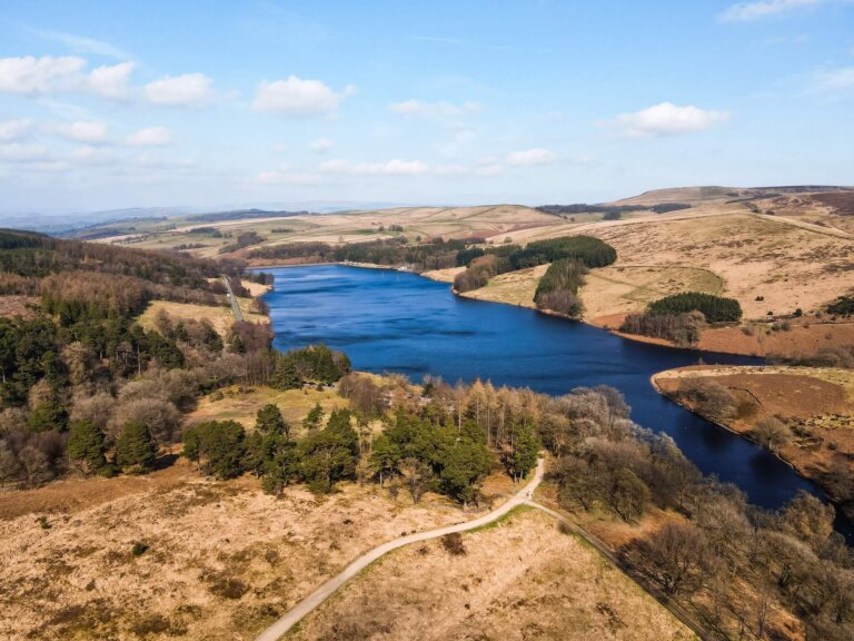
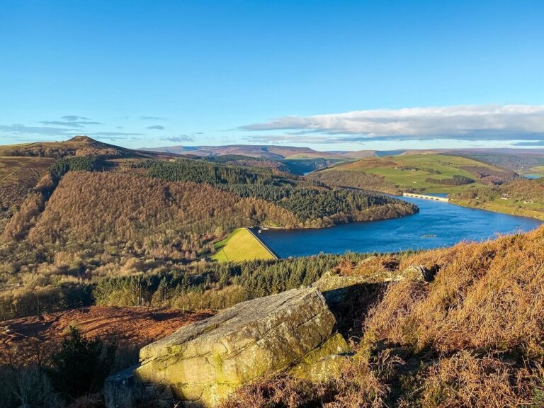
3. Bamford Edge and Ladybower Reservoir
Bamford Edge is an overhang of gritstone rock located to the north of the village of Bamford in Derbyshire. With an elevation of 1381 ft (420 m), Bamford Edge offers the most iconic views of the Peak District National Park. On a clear day you’ll see the very popular Hope Valley and Ladybower Reservoir. Ladybower Reservoir, a massive Y-shaped reservoir, is a popular place to walk around within the area.
The Route Stats
- Length: 10 km / 6-7 miles
- Elevation: 420 m / 1381 ft
- Completion Time: 3-4 hours
- Difficulty: Moderate
Bamford Edge and Ladybower Reservoir Trail Description
Starting from Heatherdene Car Park head straight up to Bamford Edge through the forested area then walk along the ridge. After descending, walk along New Road for a while before taking a footpath into Bamford. You can stop here for some rest and refreshments. From Bamford, walk along Thornhill Trail before reaching Ladybower Reservoir. You can extend your walk by walking around Ladybower Reservoir or just cross Ladybower Dam and head back to the car park.
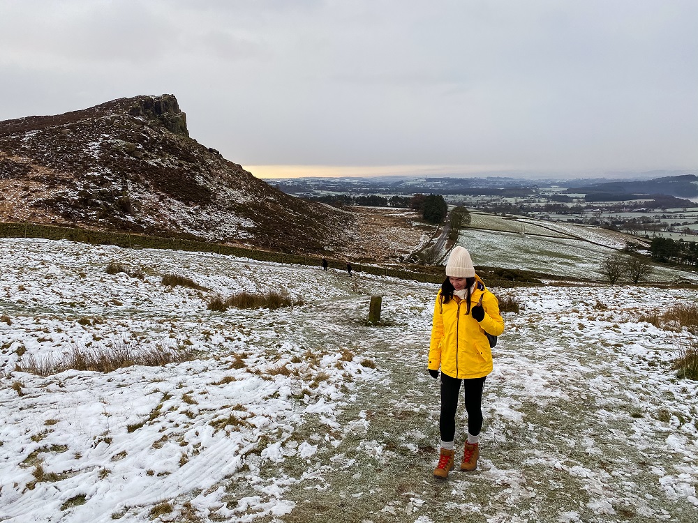
4. The Roaches and Lud’s Church
The Roaches and Lud’s Church are two very well known and visited parts of the Peak District. Day hikers, rock climbers and people seeking to learn about history and legends all come to visit these spectacular spots.
Like many walking trails in the Peak District, The Roaches is a place that you can visit in any season and still go home wanting to see more. Since it’s easy to access and complete for any level of hiker, whilst providing many different walking trail options, most people (like me) do return on a regular basis.
The Route Stats
- Length: 10 km / 6.2 miles
- Elevation: 375 m / 1230 ft
- Completion Time: 3 to 4 hours
- Difficulty: Easy to Moderate
Roaches and Lud’s Church Trail Description
Start the walk from Roach Road and head straight up to the Roaches then walk along the ridge. After descending, carry on along the trail towards Lud’s Church. From there circle back through Back Forest to the Roaches.
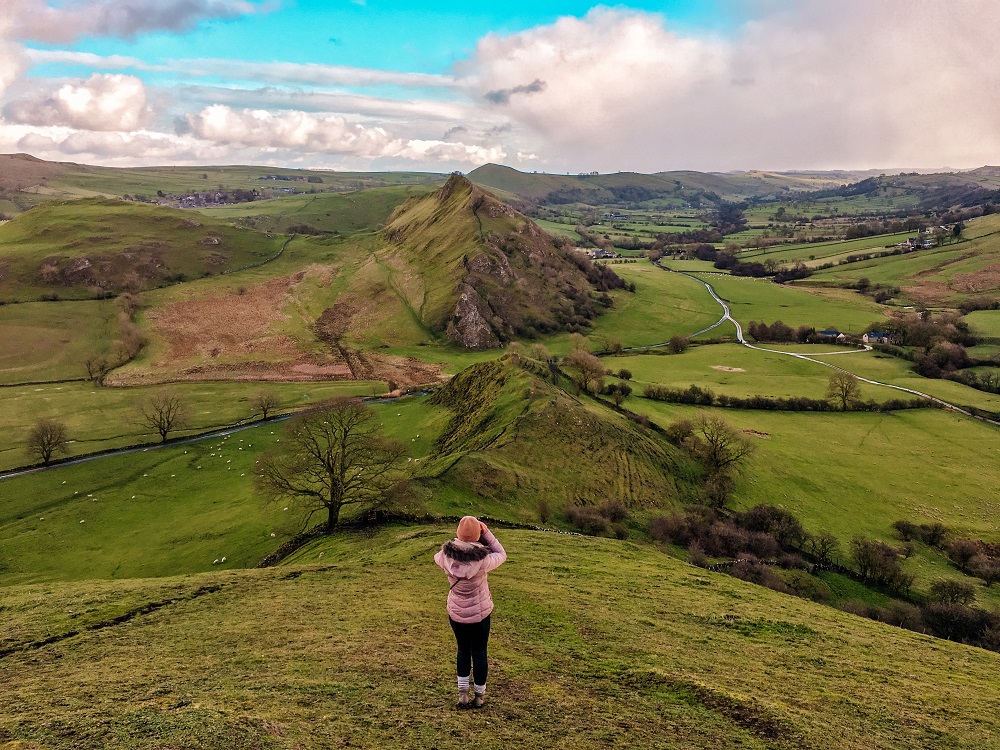
5. Chrome Hill and Parkhouse Hill
There are two iconic hills, called Chrome Hill and Parkhouse Hill, that are considered a must hike in the Peak District.
This walk is a good mixture of trails, fields and ridges with some magnificent views of the surrounding area and beyond. The limestone hills have an interesting history and a unique double sunset phenomenon occurs here during the summer months which adds to their charm.
The Route Stats
- Length: 10 km / 6.2 miles
- Elevation: 425 m / 1394 ft (Chrome Hill); 360 m / 1,180 ft (Parkhouse Hill)
- Completion Time: 4 to 5 hours
- Difficulty: Moderate
Chrome Hill and Parkhouse Hill Trail Description
Start your walk from the Quiet Woman Pub in Earl Sterndale and walk through some fields following the public footpath signs. Once you reach Parkhouse Hill, you can either climb it or go around it first. If you complete the walk in a clockwise direction then follow the signs towards Hollinsclough. After leaving the tiny settlement, follow the footpath signs leading to Chrome Hill through some fields. Soon you’ll start ascending Chrome Hill. After climbing Chrome Hill, you can climb Parkhouse Hill and return to Earl Sterndale the way you came.
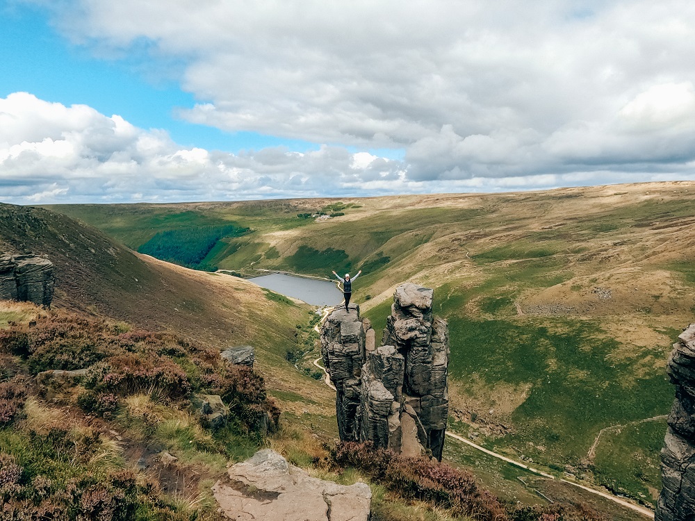
6. The Trinnacle at Dovestone Reservoir
Located on the north-western edge of the Peak District National Park is a very popular area called Dovestone Reservoir, which offers adventures to suit everybody. You can just stroll around Dovestone Reservoir but if you wish to do more than a stroll, then there are countless circular walks along the open moorland above the reservoirs. One of the most popular hikes in this area is definitely the one that includes the three-pronged grit-stone stack called the Trinnacle along Saddleworth Moors.
The Route Stats
- Length: 6 km / 3.7 miles
- Elevation: 411 m / 1348 ft
- Completion Time: 3 to 4 hours
- Difficulty: Easy to Moderate
Trinnacle Circular Trail Description
You can reach the Trinnacle in two ways by starting your walk from Binn Green Car Park. You can either go clockwise and walk past Greenfield Reservoir then climb Greenfield brook up onto the moors. Likewise, you can approach the Trinnacle anticlockwise by walking along the dam wall separating Dovestone and Yeoman Reservoirs. If you choose the latter, once you’ve walked along the dam, you will need to head straight up. After reaching the top the trail is rather relaxing. You’ll soon come across some amazing rock formations. The Trinnacle will be just around the corner. From there you can carry on following the trail and start to descend through Greenfield Brook. After you’ve reached the bottom, you can just walk along the reservoirs before returning to your car.
7. Dovedale Stepping Stones
Dovedale is one of the most popular places in the Peak District. There are many natural wonders to see and plenty of walking trails to choose from which makes Dovedale very attractive to a large variety of people.
You can hike up to Thorpe Cloud for a view, jump across Dovedale Stepping Stones or just take a stroll and explore some of its amazing limestone formations. There’s just something special about this place that makes it one of the best hikes in the Peak District.
The Route Stats
- Length: 10 km / 6.2 miles
- Elevation: 287 m / 942 ft
- Completion Time: 4 hours
- Difficulty: Easy
Dovedale Stepping Stones Trail Description
Start the walk from Dovedale Car Park then walk along one of the paths on either side of the River Dove. Dovedale Stepping Stones are located only about half a mile from the car park. From there you can hike up to Thorpe Cloud to have a view over Dovedale Valley. After descending Thorpe Cloud, carry on along the footpath to see some natural wonders such as Reynard’s Cave, the Natural Arch, the Lovers Leap (or Illam Rock) and the Twelve Apostles. You can carry on towards Milldale and Stanshope and circle back to Dovedale.
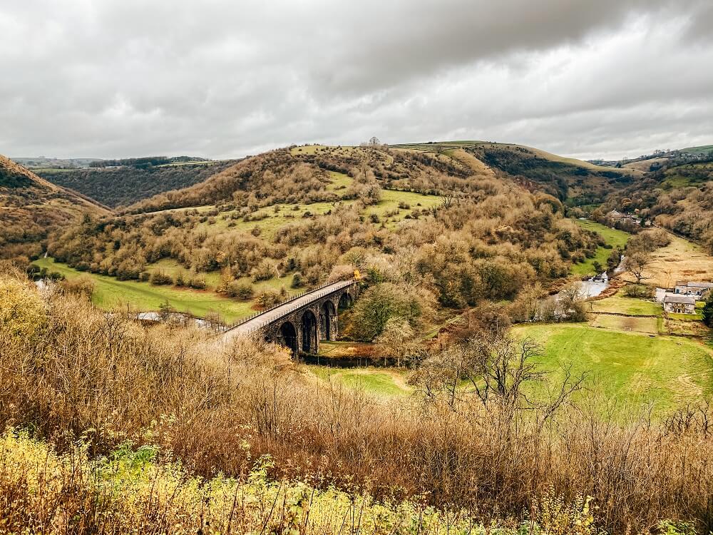
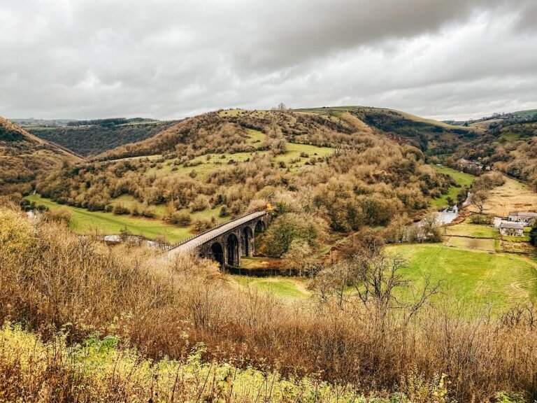
8. Monsal Dale and Wye Valley
Monsal Dale is located in the White Peak area of the Peak District National Park. This particular circular route is another great hike in the Peak District because it will show you the iconic view from Monsal Head, will take you along the meandering River Wye all the way through the magnificent woodland of Deep Dale. You’ll have the chance to stop at Ashford-in-the-Water, a picturesque village, before you return to your starting point.
The Route Stats
- Length: 10 km / 6.2 miles (or full Monsal Trail 13.7 km / 8.5 miles)
- Elevation: approx. 140 m / 460 ft
- Completion Time: 4 hours
- Difficulty: Easy to Moderate
Monsal Dale and Wye Valley Trail Description
Start the walk from Monsal Head Viewpoint and start descending towards the Headstone Viaduct. From the Headstone Viaduct walk along the River Wye and follow the path into the woods. The trail will lead you to the A6 road. The trail here enters the Deep Dale Nature Reserve. Follow the signs towards Ashford through a woodland area. You can stop in Ashford-in-the-Water for some rest and refreshments. From Ashford, find Vicarage Lane and follow the footpath signs towards Monsal Dale through some fields. The footpath will lead you back to Monsal Head Viewpoint.
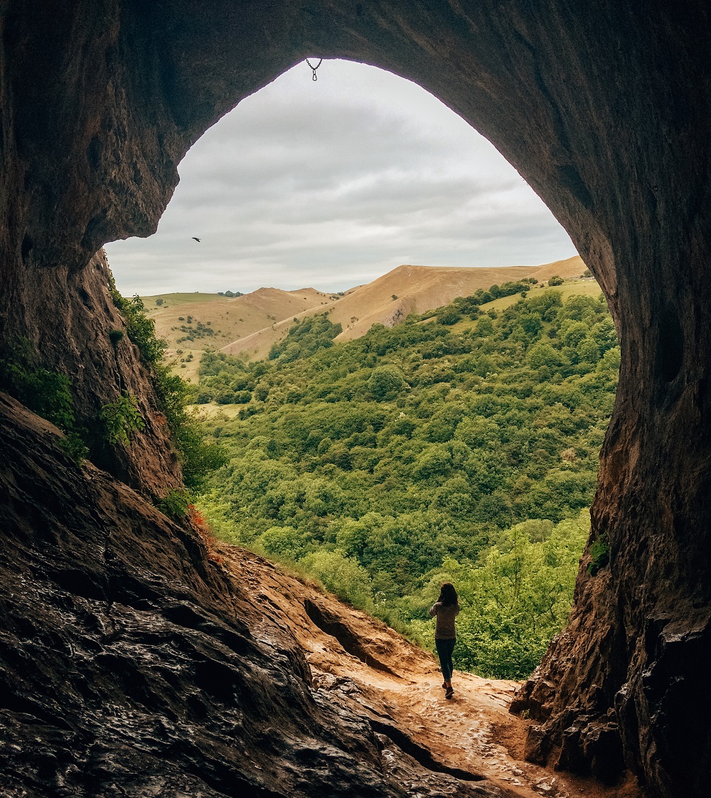
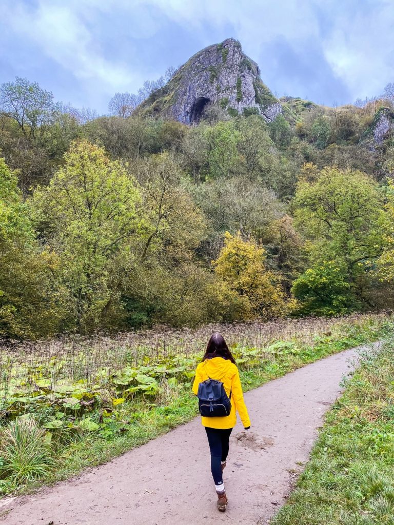
9. Thor’s Cave and The Manifold Valley
Located in the White Peak area of the Peak District, Thor’s Cave is another iconic landmark of the national park. The Kast cave has a symmetrical arch which is 7.5 m wide and 10 m high and can been seen from the Manifold Valley below it. It can be easily reached from a well maintained path called The Manifold Way, which makes it very popular amongst tourists. From inside Thor’s Cave, you get a stunning view over the Manifold Valley.
The Route Stats
- Length: 5.5 km / 3.4 miles
- Elevation: 304 m / 997 ft
- Completion Time: 3 hours
- Difficulty: Easy to Moderate
Thor’s Cave and Manifold Valley Trail Description
You can start your walk from the small village of Wetton. From Leek Road take the signposted public footpath towards Thor’s Cave which you’ll see in the distance. This path will take you to the entrance of Thor’s Cave. Once you’ve explored the cave make your way down the steps and follow the Manifold Way towards Wetton Mill. There are two more caves you can explore above Wetton Mill. From Wetton Mill, make your way towards Wetton Hill. First cross the stone bridge over the River Manifold then follow the signed footpath through the farmyard. The footpath will lead you to a valley between Sugar Loaf and Wetton hills. You’ll reach Manor House from where the path will lead you back to Wetton.
Stay tuned for a detailed blog post about the trail, history and amenities within the area!
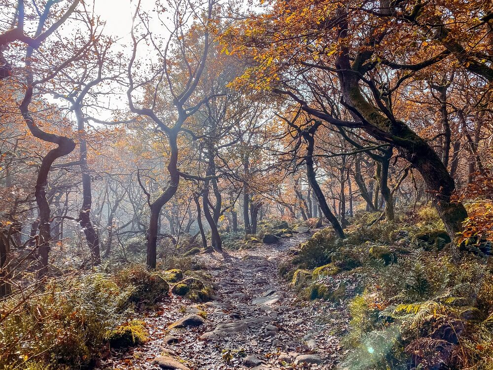
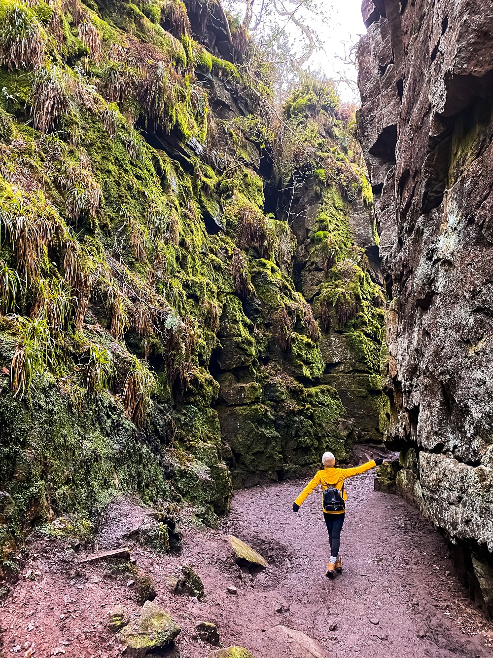
10. Padley Gorge
One of the most magical places and therefore one of the best hikes in the Peak District is Padley Gorge. I’ve been exploring the national park for years now and I can confidently say that it would be hard to find a more mystical spot than Padley Gorge.
The area around Padley Gorge is full of amazing walking routes. So whichever you decide to take or end up on, you will be treated with some beautiful landscapes and views.
The Route Stats
- Length: 8 km / 5 miles
- Elevation: 196 m / 643 ft
- Completion Time: 4 hours
- Difficulty: Easy to Moderate
Padley Gorge Circular Trail Description
Start the walk from Haywood Car Park in a clockwise direction. The first part of the walk will take you through a forest, mainly downhill, into Grindleford village. Head towards Grindleford Train Station where Padley Gorge officially starts. From here just walk up through Padley Gorge towards Longshaw Estate. From Longshaw Estate you’ll circle back towards Haywood Car Park.
Have you ever been to the Peak District National Park before? If so, which season did you go in and how much of the area did you manage to explore? Which was your favourite hike or walk? Let me know in the comments below.
Now, let your adventure begin,

Our Top Travel Resources
Accommodation: For hotels we always use Booking.com and Hostelworld for hostels. We also book longer stays on Airbnb or Vrbo.
Flights: To find the best flight prices we always check Skyscanner, Google Flights or WayAway. Then we also check the airlines’ websites too for comparison.
Car Rentals: We use Discover Cars when we want to rent a car as it compares local, national and international companies.
Activities: If we book organised tours we always check either GetYourGuide or Viator.
Foreign Currency: Whenever we can we prefer to pay in local currency and for that we always use our Wise card. We can easily withdraw money from the ATM or pay by card at most shops and restaurants.
Travel Insurance: We never go anywhere without travel insurance. You never know what will happen on your trip, so good travel insurance like SafetyWing can protect you in case of injury, illness, theft and cancellations.
eSIM and VPN: To get data abroad we use Airalo which is an app that allows you to download a prepaid eSIM to your phone in over 190 countries. Make sure to have a VPN to avoid hackers accessing your personal data when using public WIFI. We use Surfshark which is the only VPN that offers one account on unlimited devices.
Remember…It all starts with a Pin…

I love the Peak District and my go to places are Padley Gorge (I agree it is magical) and Ladybower that you mention. I also love Crowden and Stanage Edge. Have you visited the B29 crash site? It is so eerie!!
I’m so glad to hear that you love Padley Gorge and Ladybower. They are stunning. I’m yet to do Crowden and Stanage Edge and yes the B29 crash site has been on my list too 🙂
What a beautiful collection of hikes! I want to try out so many of these! Bamford Edge and Ladybower Reservoir, The Trinnacle at Dovestone Reservoir and Thor’s Cave and The Manifold Valley all look stunning! I really need to see more of the Peak District. I can’t wait until lockdown is lifted and we can get out and explore again! Thanks for the great guide!
Thank you Hannah it’s lovely to hear that many of these trails are now on your itinerary too. I’m sure they will be so great to do during spring time when the restrictions are finally eased!
I’ve been to Bamford Edge and it was amazing! I loved the views even though it was a wet day when we went.
Great to hear that you loved Bamford Edge. Yes the weather can be unpredictable, but the views will never disappoint…unless it’s foggy 🙂 Hope you can visit more places in the Peaks soon.
I live in London and I love walking, I haven’t been to Peak District yet but I save your article for when the lockdown ends. It will be very useful
Thank you Miriam, I’m glad to hear that you enjoy walking. The Peak District will be the perfect place for a staycation in the summer when the restrictions are finally lifted.
This is great thank you! I’m thinking we won’t be getting abroad this year so aiming to explore more of the peak District. Have saved this as a reference for when I get out! Love the videos too!
Yes I agree Bea, I think this year we just have to explore more of the UK. Thank you for checking out the videos too it means a lot.
Wow! The Peak District is so beautiful! Great to see so many amazing locations in one place. I am so lucky to live in this area and to have done many of the walks, it is good to be reminded of its beauty and to share it with others.
Thank you for the lovely comment Karan. I really enjoyed putting together this post and hopefully I can inspire many others to enjoy the outdoors.
Thanks so much for sharing these! I’ve only done the Roaches and Lud’s Church walk so far and it was brilliant. Once the lockdown is over, will definitely head back to the Peak District for more adventures…
Hi Ksenia, so happy to hear that you enjoyed the Roaches and Lud’s Church. Such and easy but beautiful walk with lots of myths and legends. I hope you can explore the Peaks a bit more this spring/summer.
wow those views are really something! 😍😍
Thank you, I just cannot get bored of them no matter how many time I’ve done these walks 🙂
Beautiful hiking. I particularly liked Thor’s Cave and Padley Gorge. The videos are awesome to get a closer look at the different hikes.
Thank you Karen, I’m so glad you enjoyed the post and you liked the videos too 🙂
All of these hikes look amazing! I would love to complete the Bamford Edge and Ladybower Reservoir hike as well as the Thor’s Cave and The Manifold Valley hike.
Thank you Francesca I’m so glad to hear you enjoyed the post. Yes those two trails are very amazing, I’m sure you’ll enjoy both the walk and the views.
Oh I miss hiking so much! We are having winter storms here in Boston and trail conditions are not so good. Love the hikes you have mentioned in this blog, saving this one for my long due trip to England.
Glad to hear you enjoyed my post and would want to visit the Peaks. I can imagine how dangerous the trails can get in a snow storm, but hopefully you’ll be able to get back on the trails soon.
Great guide on hikes in the Peak District! I’m hoping to visit this summer when restrictions ease up and will definitely go back to this guide for tips.
Thank you Char, I’m happy to hear that the Peaks are now on your itinerary. Yes, I think this year we just need to explore more of the UK and the Peaks will be a great staycation destination.
Your picture on the Trinnacle is everything. I must follow in your footsteps! Thank you for these tips!
Thank you Jen, it’s lovely to hear that you would love to complete a few of these hikes 🙂