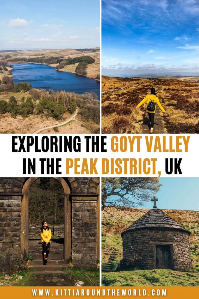
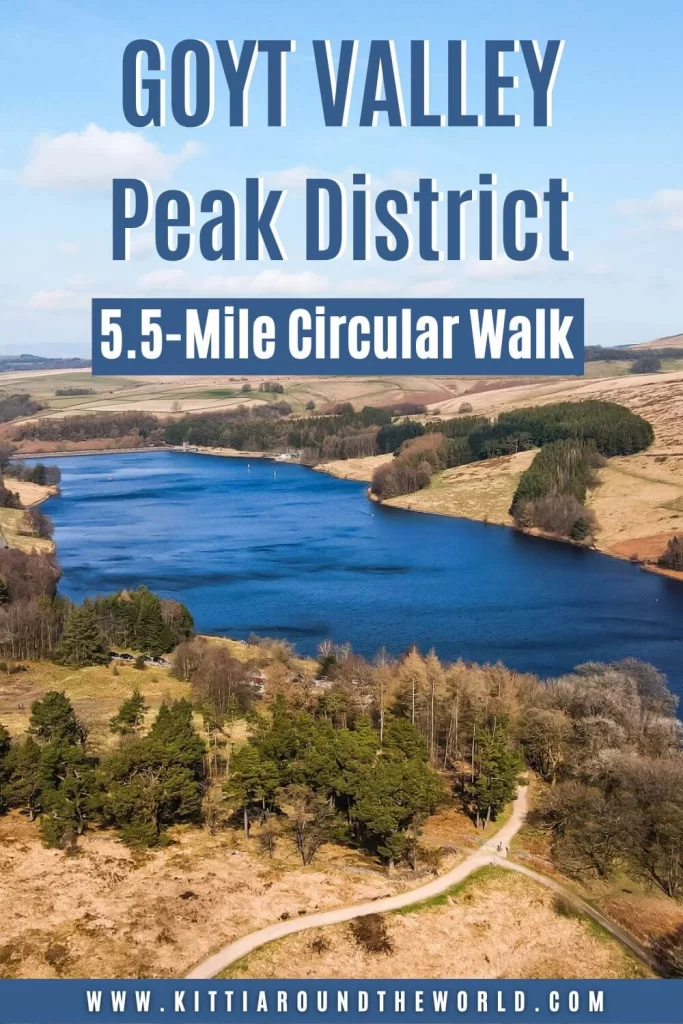
Goyt Valley Circular Walk in the Peak District
The Goyt Valley is filled with many picturesque walking and hiking trails offering something for everybody. You can create your own walking route to be as easy or as challenging as you wish, depending on the reason for your visit. It’s a great area for families, couples, solo walkers, photographers or other sport lovers like sailors.
In this blog post, you’ll have the chance to explore the main historic features; the remains of the once thriving Errwood Estate. Along this walking trail you’ll also have a glimpse at the reservoirs, reach a trig point and admire the stunning views over the area, including the popular Shutlingsloe aka ‘Cheshire Matterhorn’.
If you’d like to see our Goyt Valley walk then make sure to watch our YouTube video by clicking here.
Disclosure: This post may contain affiliate links, which means we may receive a small commission if you click a link and purchase something. Clicking these links won’t cost you anything, but it will help us to keep this site up and running! Learn more about our affiliate policy.
About the Goyt Valley
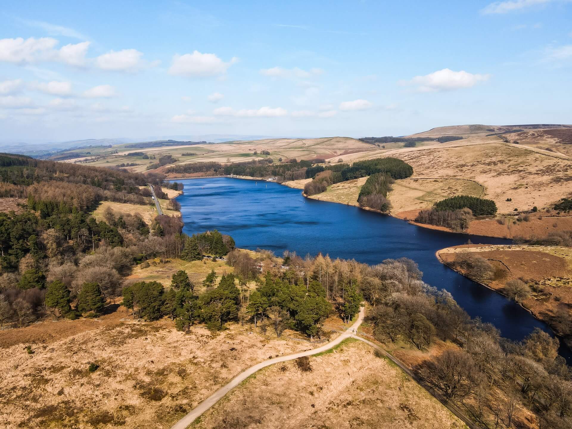
Located only a few miles to the north west of Buxton is the Goyt Valley. The valley is now home to two big drinking-water reservoirs called Fernilee and Errwood Reservoirs. They are both fed by the River Goyt and provide drinking water for Stockport and its surrounding areas. They were built by the Stockport Corporation Waterworks and are currently owned by United Utilities.
Brief History of the Errwood Estate in the Goyt Valley
Before the reservoirs were built, the Goyt Valley was dominated by a thriving estate. Errwood Estate was founded by a wealthy businessman called Samuel Grimshawe back in 1843. The more than 2,000 acre (8.1 sqkm) estate had just about everything. It was comprised of several farms, a private coal mine, a school, the Cat and Fiddle Inn and the hamlet of Goyt’s Bridge. The Grimshawe family also planted azaleas and rhododendrons.
Unfortunately, the booming estate only survived about 100 years before the two reservoirs had to be built. Similar to what happened to a lot of farmland and villages in the area, parts of the estate had to be submerged. The once magnificent Errwood Hall had to be demolished to avoid contamination to the drinking water. The picturesque Goyt Bridge and its farmlands had to be flooded. Today only a few features remain from the once thriving estate, including the ruins of Errwood Hall, a shrine and the Cat and Fiddle Inn.
Did you know? – The Cat and Fiddle Inn is the second highest public house in England. It had to be closed in 2015 and its future was uncertain until just recently. In 2020, the pub was taken over by Forest Distillery who converted it to a whiskey distillery, offering tours and tastings as part of their existing business use.
Further Reading Option – If you’d like to read more about the history of similar villages that stood in the way of a reservoir, then check out the story of the lost villages of Derwent and Ashopton.
How to get to the Goyt Valley?
By Car: If you’re arriving by car, you can park at Errwood Hall Car Park just across from Errwood Reservoir. Use SK17 6GJ in your SAT-NAV to find it (coordinates: 53.27062, -1.98324). You can park there for free all day.
Alternatively, you can also park at The Street Car Park, located just at the junction of Goyt’s Lane and The Street road. Use SK17 6SX in your SAT-NAV to find it.
If you don’t have your own car but would like to enjoy the freedom of a private vehicle, then you can always hire a car to get to the Goyt Valley.
By Public Transport: Unfortunately getting to Errwood and Fernilee Reservoirs by public transport is a bit tricky. Your best option is to take Bus 58 which runs between Buxton and Macclesfield and disembark at the Cat & Fiddle Inn along the A357. Bus 58 runs an hourly service and the timetable can be viewed by clicking here. If you’re visiting from further afield, I recommend arriving into either Macclesfield or Buxton first via train. Train services to these two cities are excellent. Make sure to plan your journey with Trainline which also provides information on bus fares.
Please Note! – This will add an extra 1.5 km (0.9 miles) to your route. It’s not that much really and as I mentioned above, the Cat & Fiddle Inn was actually part of the Estate and also the second highest pub in England.
By Bike: National Cycle Routes run through Buxton and Macclesfield with additional Local Cycle Routes running to the west of Errwood and Fernilee Reservoirs close to Macclesfield Forest.
Good to Know Before You Go
Length of the Goyt Valley Walking Route
This Goyt Valley walking trail was about 9 km (5.5 miles) long. Depending on your speed and how long you are spending taking photos or stopping for a picnic, this route could take around 3 hours.
We started the walk from the free Errwood Hall Car Park and headed up the hill towards St Joseph’s Shrine. From there, we were descending to our next stop; the ruins of Errwood Hall. After exploring the ruins, we visited the Grimshawe family’s cemetery located just above the hall. We then started the steep ascent to our next stop; Shining Tor. After Shining Tor, we circled back towards Errwood Reservoir.
You can extend your walk by walking to the Cat & Fiddle Inn, located only about 1.5 km (0.9 miles) to the south east of Shining Tor. In addition, you can also walk around Errwood and Fernilee Reservoirs. If you’re adventurous, you can also walk to Burbage Edge located to the east or even to Macclesfield Forest located to the west of Shining Tor. Of course, you can also shorten your walk by only visiting the ruins of Errwood Hall or just walking around Errwood Reservoir.
Top Tip – Make sure you start your walk as early as possible if you come on a weekend. Alternatively, I suggest coming on a weekday if you can. This is a popular area, so expect the interesting features such as Errwood Hall to be busy especially on a nice day.
Level of Difficulty
The route we did is easy and you can complete it with a basic level of fitness. It’s steep ascending from the car park to St Joseph’s Shrine and to Shining Tor. The footpath can be uneven and dotted with tree roots and is muddy when wet. The path on top of the moorland leading towards Shining Tor is paved with stone slabs but can still be uneven. Therefore, I recommend wearing the right footwear like trainers or boots.
Please Note! – The wind can be pretty strong up at Shining Tor once you leave the wooded area. We had a gorgeous day, but the wind was so strong along the ridge that even our drone wouldn’t take off the first time!
On this particular route you won’t be too exposed around the ruins of Errwood Hall. However, you’ll be exposed when walking along the ridge to Shining Tor, and to St Joseph’s Shrine, so wear appropriate clothing. I think this walk could be a great activity even in slightly worse weather conditions. If the weather is bad, I wouldn’t suggest walking to Shining Tor as you’ll be exposed and the wind is very strong.
Facilities Around the Goyt Valley
Cafés and picnic spots: I highly recommend packing your own lunch and if the weather is lovely stop for a picnic. The best picnic spot is probably at the ruins of Errwood Hall. You’ll be a bit sheltered there. Alternatively, you can stop around Shining Tor, if it’s not super windy. You’ll be treated with a lovely view over the area.
Top Tip – There’s a stone wall running alongside the path towards Shining Tor, so if it’s windy try to sit underneath the wall where you will have some shelter from the gusts.
Please Note! – You cannot have BBQ’s or any kind of open fire in the area, so make sure you pack an appropriate picnic.
If you’d like to grab a coffee or tea and a bite to eat, you can do that at the Cat & Fiddle Inn. We also spotted an ice cream van in Errwood Car Park upon returning, serving ice cream (obviously) and other refreshments.
Toilet facilities: The Cat & Fiddle Inn will have customer toilets, but there are no other toilet facilities along this route. However, there are plenty of wooded areas to find a private spot.
What to Wear and Bring With You?
You are in the north of England so weather conditions can change quickly. At the time of our visit it was dry and sunny. It was nice and warm around Errwood Hall and the reservoirs, but it was incredibly windy on our way to Shining Tor. Therefore, I recommend weather appropriate clothing when going on this particular walk. Make sure you check the weather forecast before you set off and have a few layers with you.
I also suggest wearing supportive walking shoes or boots as the path can be uneven and muddy when wet. I also suggest packing some snacks and having water with you. There are plenty of beautiful places to stop for a picnic or a quick break.
Please Note! – Whatever you bring with you, make sure you either take it home with you or dispose of it responsibly. Enjoy your time in nature but Leave No Trace!
The Goyt Valley Walking Trail
This area of the Goyt Valley is full of amazing walking routes and features to see, therefore it attracts a great amount of people especially on a lovely day.
If you’d like to do the exact route we did, I divided it into 5 sections following the main attractions along the trail.
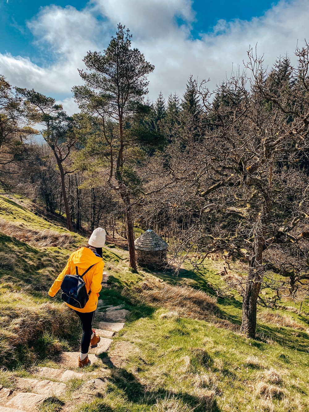
1. St Joseph’s Shrine
After leaving the car park, head to your left and walk along the road for a few minutes. After crossing the bridge, take the footpath immediately to your left. This section of the path will lead you through the forest and will be steep. Just before the forested area ends, there will be a path to your left. This leads you to the ruins of Errwood Hall. If you’re following our trail, then don’t go left here, instead just follow the path further up. Soon, you’ll be treated with a lovely view over the Goyt Valley.
You’ll reach the top soon and you should be walking pretty much parallel to The Street road. The wind can be a bit stronger here, but the path will circle back soon and you’ll be sheltered.
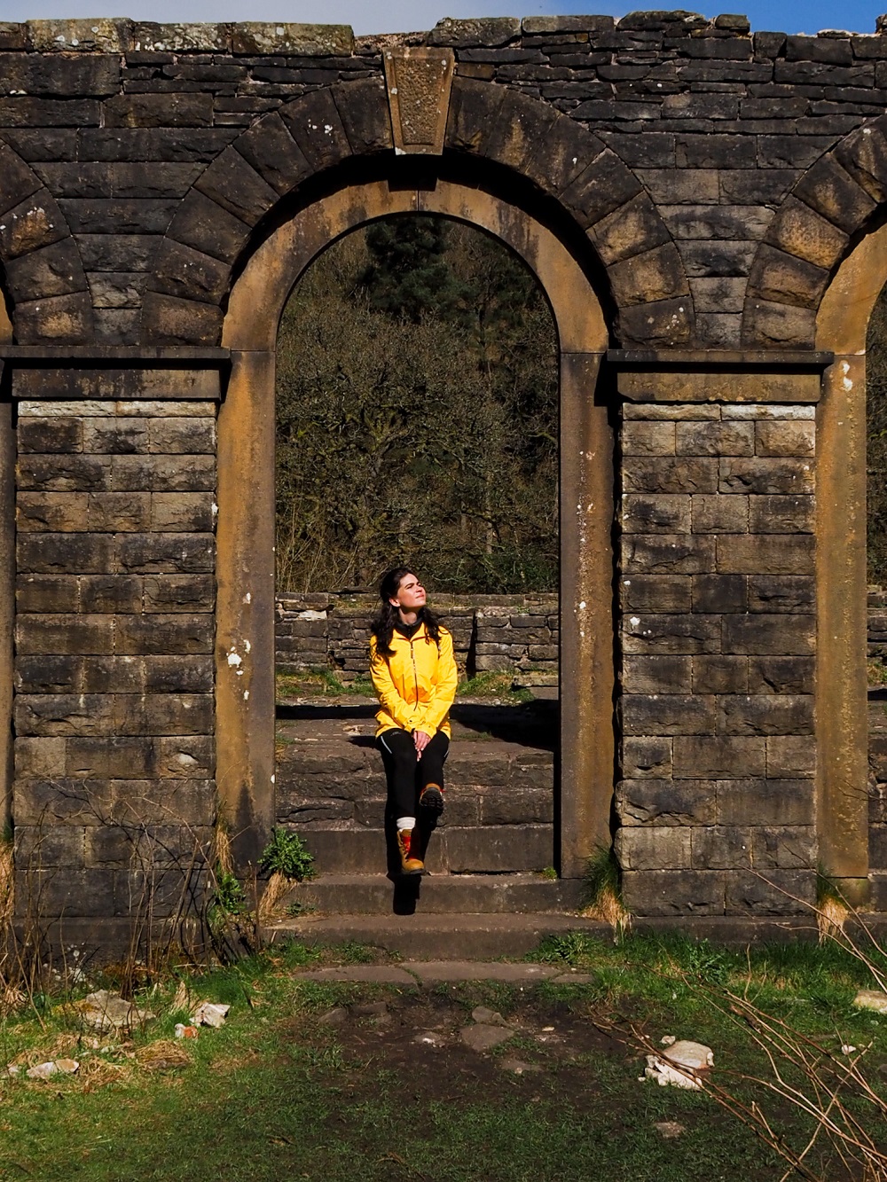
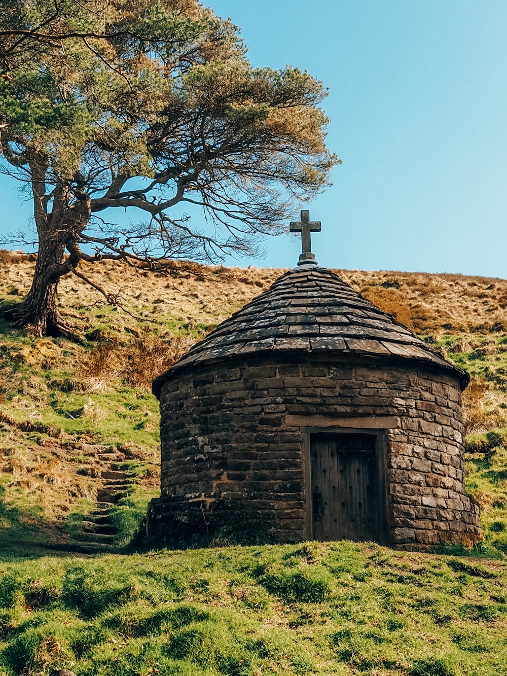
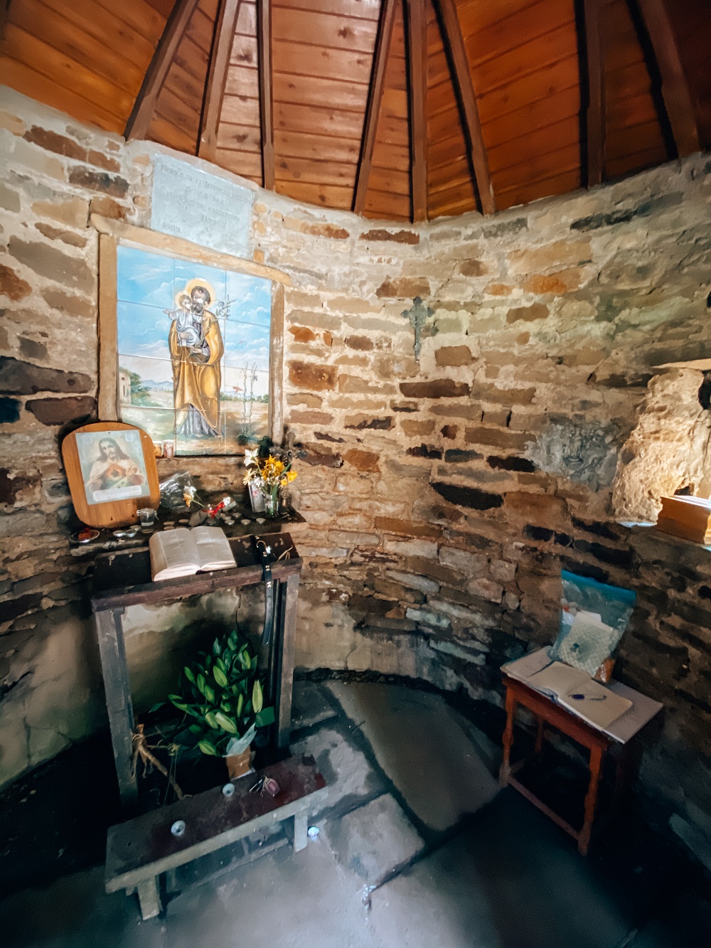
The first feature along the trail, a little shrine or chapel hiding between some pine trees, will be just at the turning point. It’s a tiny round building with a conical roof. It has an oak door, which you might need a bit of effort to open. Once you enter the tiny area, you’ll see a small altar with a picture of St. Joseph holding baby Jesus.
The shrine stands at Miss Dolores de Ybarguen’s favourite place. She was a governess for the family and was also the teacher at the estate’s school. She came to the Grimshawe Estate in 1883 as a companion to Samuel Grimshawe’s wife after his death. Unfortunately, her health was poor and she passed away at only 35 on a visit to Loudres in France.
People still use the little shrine for private acts of devotion and remembrance.
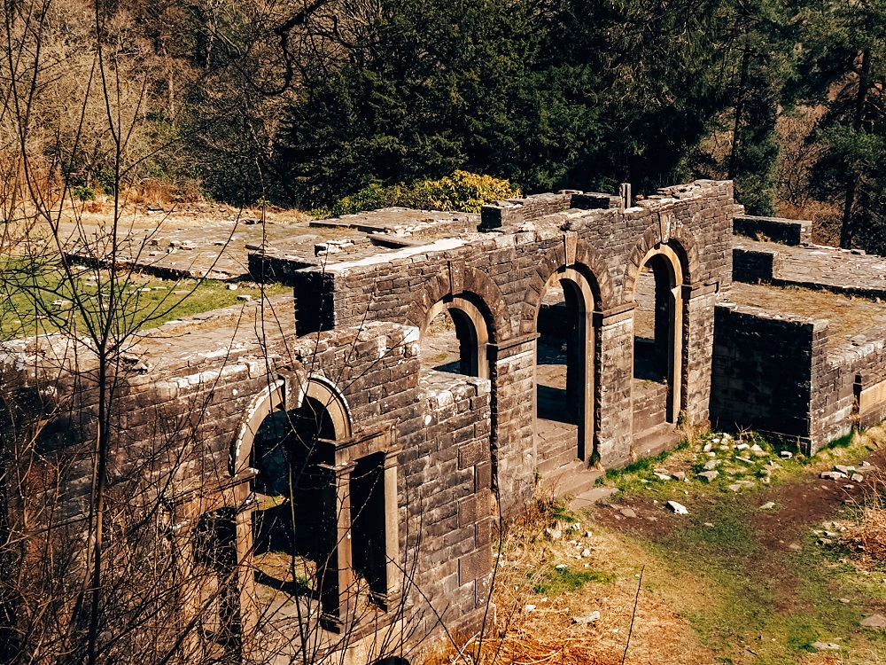
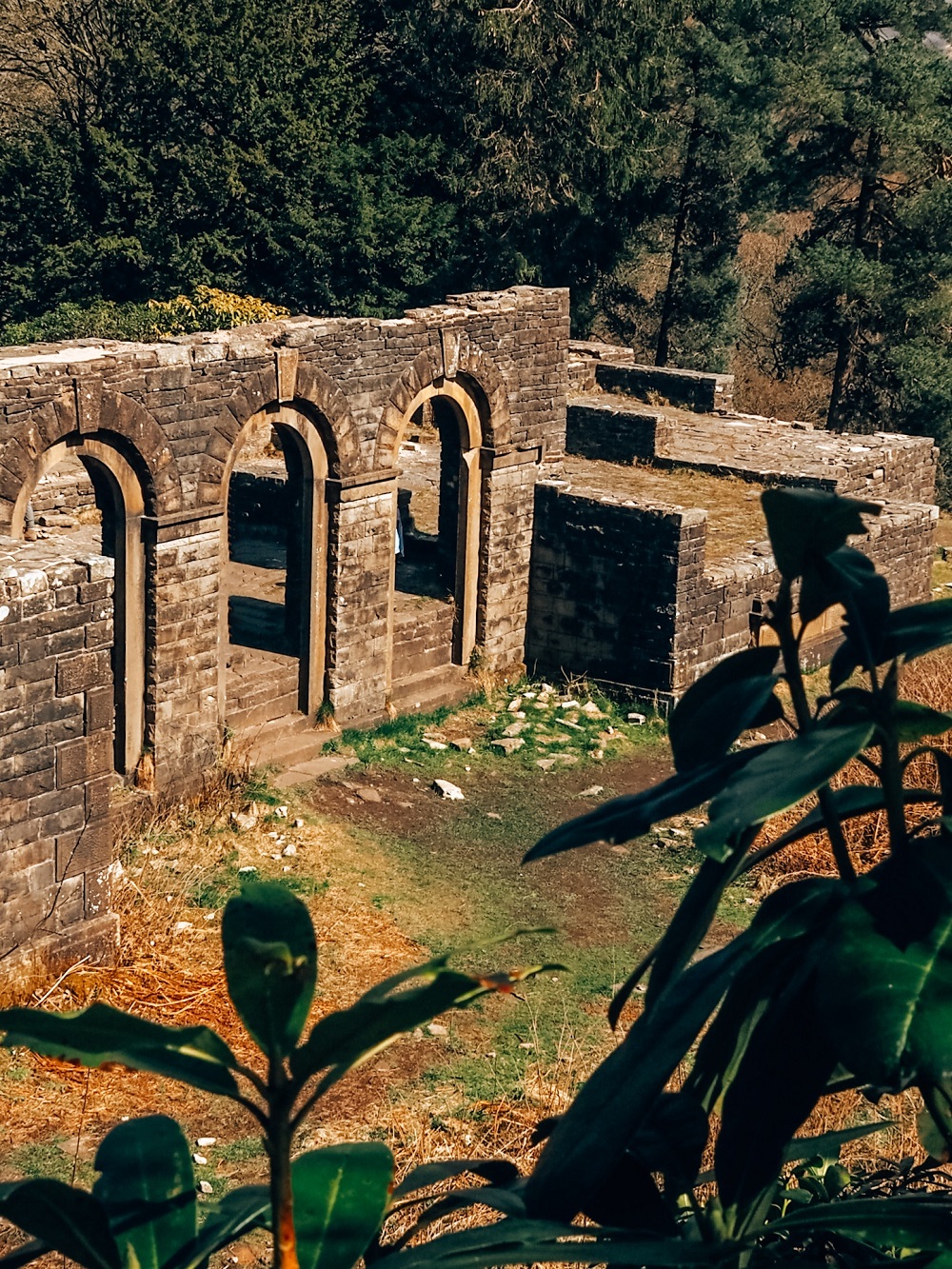
2. Ruins of Errwood Hall
After leaving the shrine, just carry on along the footpath towards the ruins of Errwood Hall. You’ll be basically walking back on yourself just through the valley not on top of the ridge. The path here is a bit narrow and can be muddy when wet. However, you’ll be sheltered here from the wind. The valley is gorgeous here so make sure to take your time walking through it.
Soon, the footpath will lead you all the way down to the stream and you’ll see a bridge. Don’t cross the bridge, just follow the path to your left. It will lead you to the ruins of Errwood Hall.
Errwood Hall was erected in the 1830s by Samuel Grimshawe. It belonged to the Grimshawe family for approximately 100 years before it was demolished in 1934. The reason why the hall had to be demolished is because construction work had started on Fernilee Reservoir.
Did you know? – The stones from the hall were used to build the water treatment works just below Fernilee Reservoir.
Today only the foundations and a few sections of the wall still remain of the once magnificent hall.
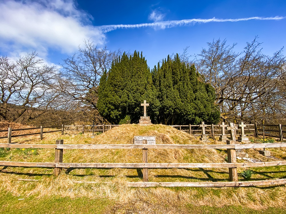
3. Errwood Estate Cemetery
Located on a hilltop to the west of Errwood Hall ruins is the family graveyard. To find it just follow the path that circles around the ruins. The views from here are pretty amazing, so it’s definitely worth a visit.
The graveyard is the final resting place of the Grimshawe family and their favourite servants. It was restored by North West Water in the 1980s.
Apparently the restless spirits of the Goyt Valley can be heard here at night. My internet research revealed that many people had heard strange roars in the valley after dusk. Someone saw a couple of shifty-looking men meeting up in the car park exchanging bags. Farmers who lived in the valley before the reservoirs were built believe that it’s home to a four-legged beast.
I enjoy reading about ghost stories and I even went on a ghost hunting tour at Bolsover Castle last Halloween, however, I wouldn’t come out here on my own at night. Would you dare?
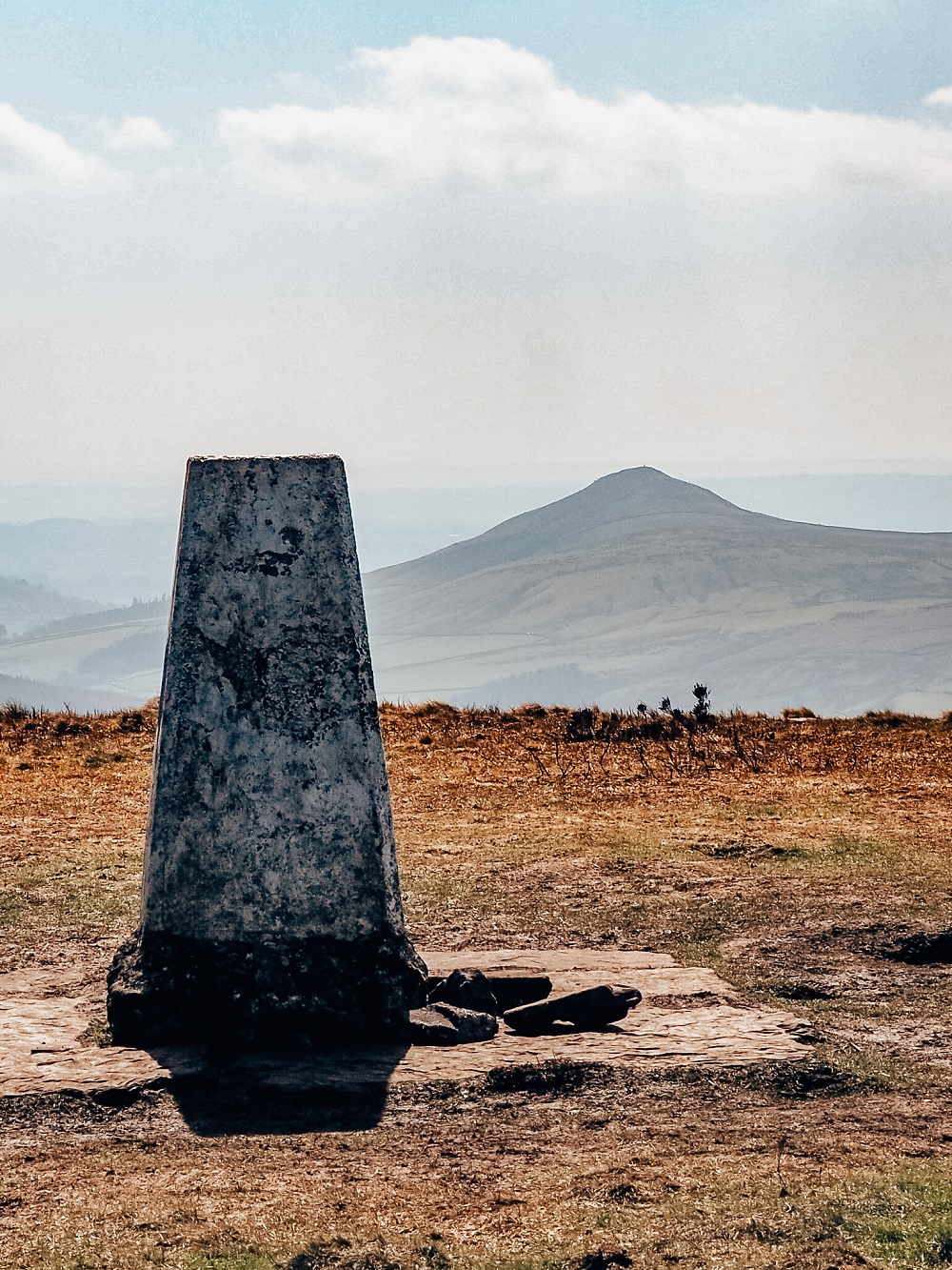
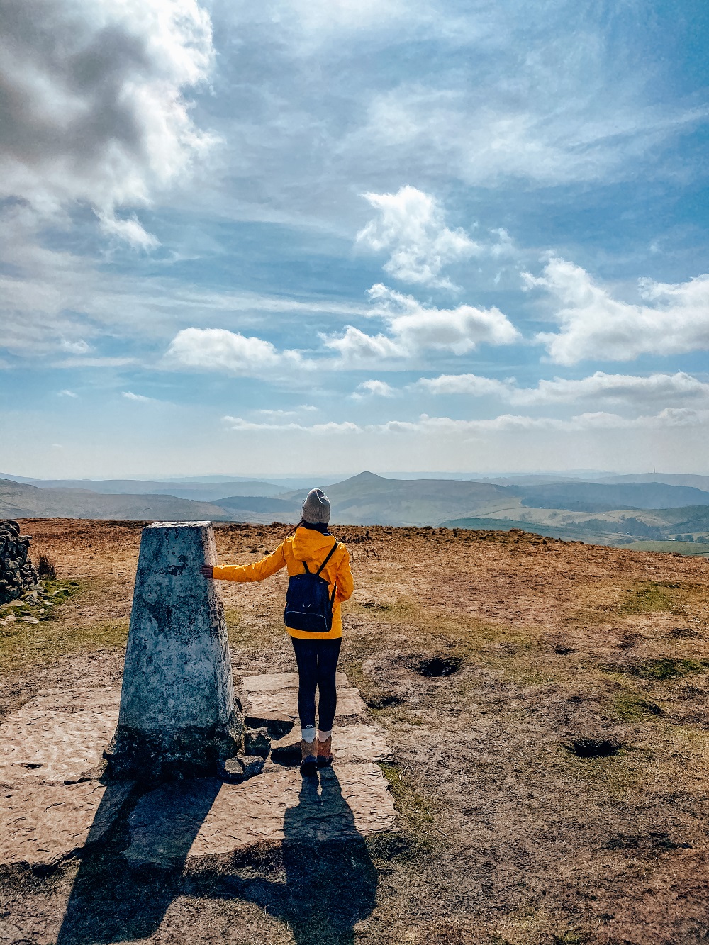
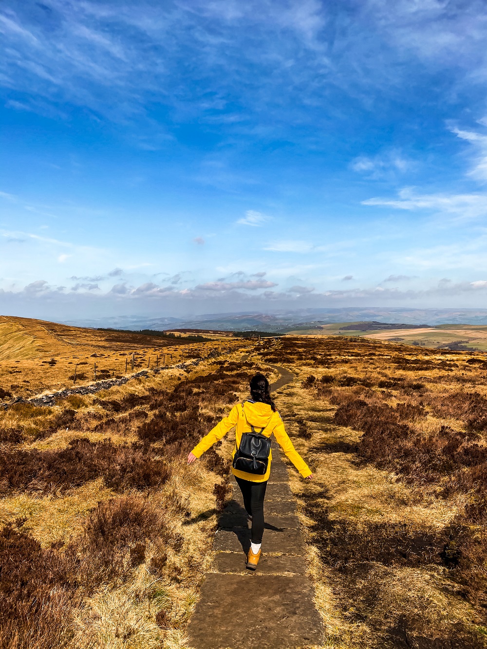
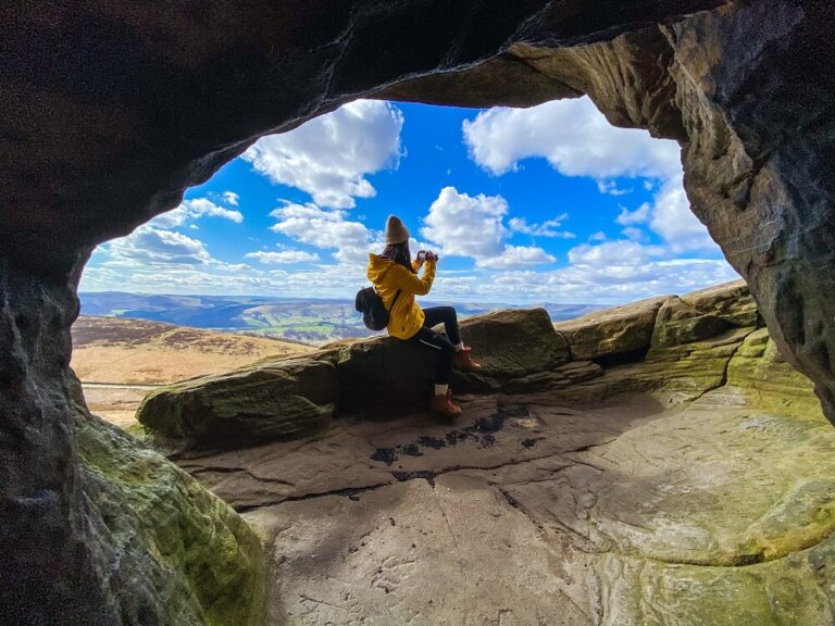
4. Shinging Tor Trig Point
Once you’ve left the cemetery, you’ll pass the ruins of a farmhouse. There are a few paths crisscrossing here. If you go right you’ll end up at the little bridge that crosses the stream I told you not to cross before. If you go left you’ll be walking around the estate and will eventually circle back towards the reservoirs. As the Alltrails Map shows above, you’ll need to go straight ahead.
You’ll be zig-zagging through a cool forested area, but it’s pretty steep. Stop often for water breaks, and don’t forget to look back. As you climb higher and higher the views of Errwood Reservoir will appear.
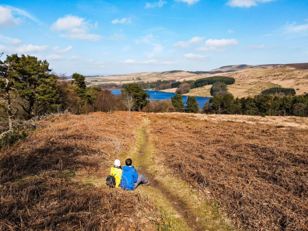
Once you think you cannot walk any higher, you’ll come across a stone slab path on top of the moorland. Here, turn left and just walk along it until you reach Shining Tor. A stone wall should be running parallel on your right.
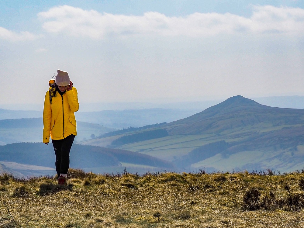
After walking for a while you’ll reach Shining Tor trig point, which will be on the other side of the wall. The views from here are magnificent. You can see the Cat & Fiddle Inn on your left; you can also see Shutlingsloe and Macclesfield Forest.
Please Note! – The wind can be very strong here, so be careful and don’t stand too close to the edge!
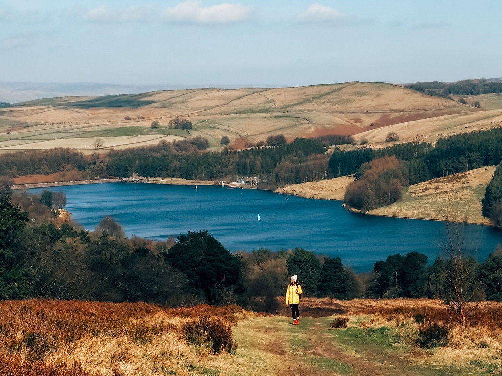
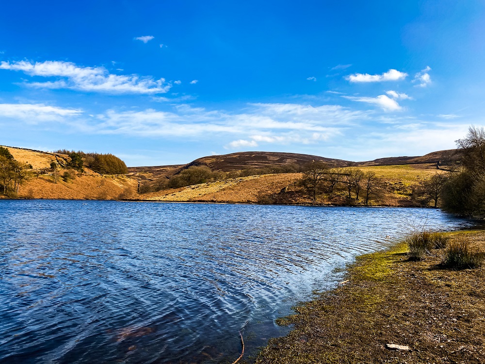
5. Fernilee and Errwood Reservoirs
After leaving Shining Tor, carry on along the footpath to your left. You’ll be descending here until you reach another cross roads. If you go right here the path will lead you to the Cat & Fiddle Inn. If you don’t intend to visit the pub, then go left. This route will take you back to Errwood Car Park. This part of the walk is very pretty with Errwood Reservoir getting closer and closer to you.
Both Fernilee and Errwood Reservoirs are drinking-water reservoirs, providing water supply to Stockport and the surrounding areas. Fernilee Reservoir was built first between 1932 and 1938. Then in the 1960s construction work started on Errwood Reservoir too.
Local farming families based in the way of Fernilee Reservoir were forced to leave their homes behind. To avoid any pollution of the water, Errwood Hall also had to be destroyed.
Additional Walks in the Peak District
There are many amazing places and trails located near the Goyt Valley. So, if you’d like to see more of the Peak District then make sure to check out the 10 Best Hikes in the Peak District or browse for more hiking trails in the UK and around the world in my Hiking Adventures Series.
For now, here are some hikes in the Peak District that are either walkable or approximately 30 minutes’ drive away from the Goyt Valley:
Mam Tor, Winnats Pass and Castleton – A 5.5 mile circular trail which takes you through some of the most scenic places in the Hope Valley: Mam Tor, Winnats Pass and Castleton. Click here to read it.
The Roaches and Lud’s Church Walk – The Roaches and Lud’s Church circular trail in the Peak District in England is filled with stunning views, history and legends. Click here to read it.
Macclesfield Forest – A 10 km circular route filled with unique features from dense pine forestation to an abandoned farmhouse, and even a miniature Matterhorn. Click here to read it.
Chrome Hill and Parkhouse Hill – A 10 km circular route with a good mixture of trails, fields and ridges with some magnificent views of the surrounding area and beyond. Click here to read it.
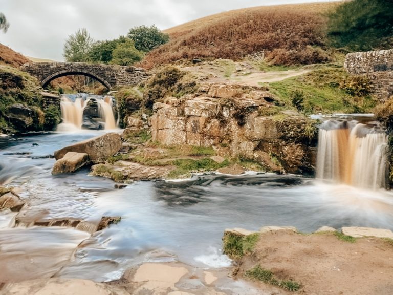
Three Shires Head Walk – A picturesque waterfall, located at the meeting point of three counties in the north of England: Cheshire, Derbyshire and Staffordshire. Click here to read it.
B-29 ‘Overexposed’ Crash Site – A guide on how to find the B-29 ‘Overexposed’ Crash Site on top of Bleaklow moorland. Click here to read it.
Final Thoughts on the Goyt Valley Walk
I always enjoy walks where I can come across multiple unique features, have a chance to expand my knowledge on a place and obviously be treated with some great views. The Goyt Valley definitely ticked off all my preferences.
Although we had to drive through the thickest fog in the morning which almost made us do a U-turn, I’m so glad that we decided to give the weather a chance. After all, you’re in England and literally anything could happen with the weather right? As you saw from my photos, the weather cleared, blue sky appeared and we had (almost) the best conditions to explore Goyt Valley’s hidden gems.
P.s. The ‘almost’ is referring to the crazy strong wind we had on top of the moorland towards Shining Tor. But again, we’re in England so I really cannot complain.
Have you ever been to the Goyt Valley before? If so, how much of the area did you manage to explore? Let me know in the comments below.
Now, let your adventure begin,

Our Top Travel Resources
Accommodation: For hotels we always use Booking.com and Hostelworld for hostels. We also book longer stays on Airbnb or Vrbo.
Flights: To find the best flight prices we always check Skyscanner, Google Flights or WayAway. Then we also check the airlines’ websites too for comparison.
Car Rentals: We use Discover Cars when we want to rent a car as it compares local, national and international companies.
Activities: If we book organised tours we always check either GetYourGuide or Viator.
Foreign Currency: Whenever we can we prefer to pay in local currency and for that we always use our Wise card. We can easily withdraw money from the ATM or pay by card at most shops and restaurants.
Travel Insurance: We never go anywhere without travel insurance. You never know what will happen on your trip, so good travel insurance like SafetyWing can protect you in case of injury, illness, theft and cancellations.
eSIM and VPN: To get data abroad we use Airalo which is an app that allows you to download a prepaid eSIM to your phone in over 190 countries. Make sure to have a VPN to avoid hackers accessing your personal data when using public WIFI. We use Surfshark which is the only VPN that offers one account on unlimited devices.
Remember…It all starts with a Pin…
What a beautiful hike! This trail seems to have a bit of everything! The scenery is stunning and I’d love to visit St Joseph’s Shrine – what a lovely hidden gem! Thanks for sharing this route with us, I’d love to try it out!
Thank you Hannah, I agree this trail definitely has a bit of everything. I’m sure you’ll have fun exploring it 🙂
There are so many great walks in the UK. I can’t wait to get back so I can get on some of these trails. This one looks like such a lovely short day walk with some beautiful scenery. As a photographer, I’m sure I’d love it!
I agree Lynne, there are plenty of scenic walking trails in the UK. It’s definitely an ideal place for photographers.
What a great guide to the Goyt Valley. I think packing a picnic to really enjoy and soak up these views sounds wonderful. I love that there is so much to see along these trails!
Thank you Megan. Having a picnic in the UK when the sun is out is definitely a must 🙂
Ooooh these are all stunning! I’d love to hike up to Shining Tor, and I didn’t know there was a new distillery in the Peak district. Now I like the idea of explore near the The Cat and Fiddle Inn! 😀
The entire Goyt Valley looks perfect for a circular walk.
Yees I didn’t know about the new ownership and their new plans for the Cat and Fiddle Inn either! this is amazing and you bet I’ll have a tour there as soon as I can. There are many amazing trails around the pub so it’s the perfect area to explore.
You always find such pretty hikes! This is another great one for the list! I’d love to see St Joseph’s Shrine.
Thank you Deb, I love hikes with plenty of features. I agree the little shrine is definitely a hidden gem!
This hike looks incredible! I am a sucker for hikes, so I’ll have to add this one to my bucket list.
So happy to hear that my post inspired you to visit this place Krystianna. I hope you can come soon.
What a beautiful walking trail! I love that it has a combination of history and gorgeous views. I wish I had known about this hike when I lived in England!
Thank you Susan, I agree this area has a lot of interesting features. I hope you can return to the UK in the near future and explore the Peak District a bit more.
Wow, what a gorgeous destination! I love the beautiful view from Shinging Tor Trig Point. This looks like such a lovely walk to take on a nice day. Thanks for sharing!
Thank you Brittany, I’m glad you enjoyed my post. I agree, the views from Shining Tor are magnificent.
Wow! It looks so breathtaking there. You definitely inspired me to visit the Peak District when I eventually make my way back to the UK. It looks like the ultimate spot for hiking and enjoying beautiful views. 🙂
Thank you Taylor, I’m so happy to hear that I inspired you to visit the Peak District. The list of scenic hikes here are endless, so I’m sure you’ll have so much fun exploring it 🙂
I love all of the unique stops you can take along this route. And the views look amazing on a nice day!
What a lovely hike! It’s so nice that there’s so much to see on the walking trail. The Ruins of Errwood Hall look especially interesting!
Your blog makes me want to explore more natural parks in the UK. The Peak District isn’t very far from where I live, so I am definitely saving this post for a future trip there! 🙂
Wow! I love this place already! Errwood Hall Ruins seems like my kind of place–I love ruins and historic sites.