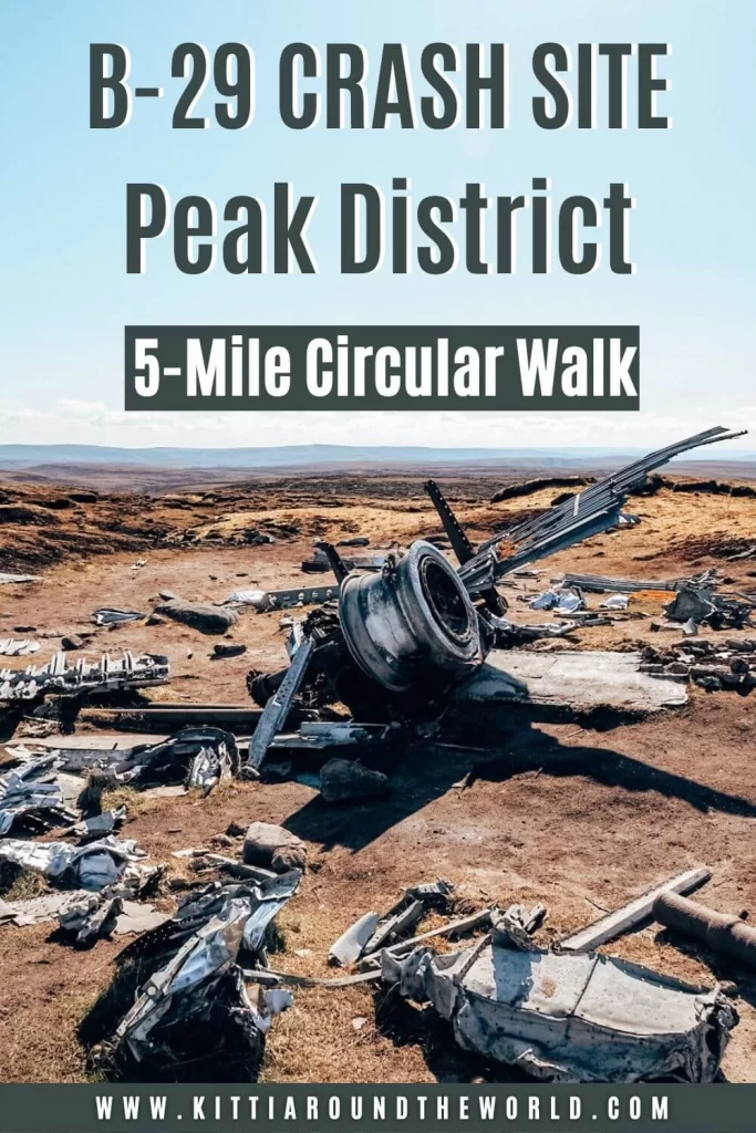
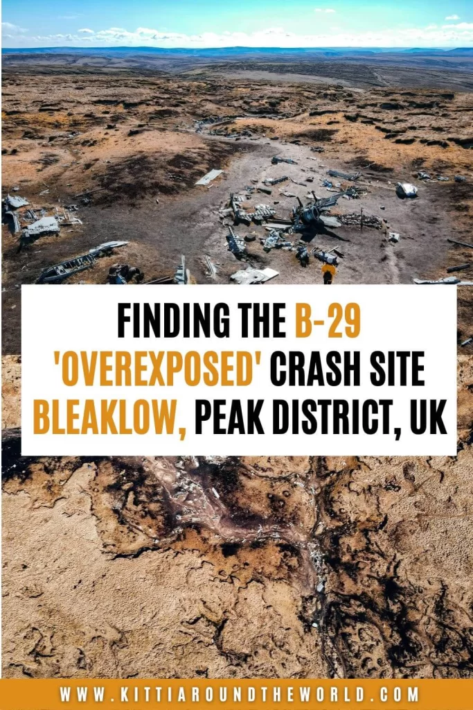
Finding the B-29 ‘OVEREXPOSED’ Crash Site on Bleaklow, Peak District
This blog post will help you to find the B-29 ‘Overexposed’ Crash Site situated high on top of Bleaklow moorland in the Peak District National Park.
The post will introduce you to Bleaklow moorland and what to expect on your hike. It will describe what the B-29 ‘Overexposed’ Superfortress bomber actually was and will also provide some details around why the aircraft crashed.
If you enjoy hiking, then this blog post will also provide you with some other cool points of interest you can see along this route, including trig points and crazy rock formations.
If you’d like to see how to find the B-29 ‘Overexposed’ Crash Site with some epic drone footage then make sure to watch our YouTube video by clicking here. You can also check out our Peak District Playlist for more adventures.
Disclosure: This post may contain affiliate links, which means we may receive a small commission if you click a link and purchase something. Clicking these links won’t cost you anything, but it will help us to keep this site up and running! Learn more about our affiliate policy.
About the B-29 ‘Overexposed’ Crash Site
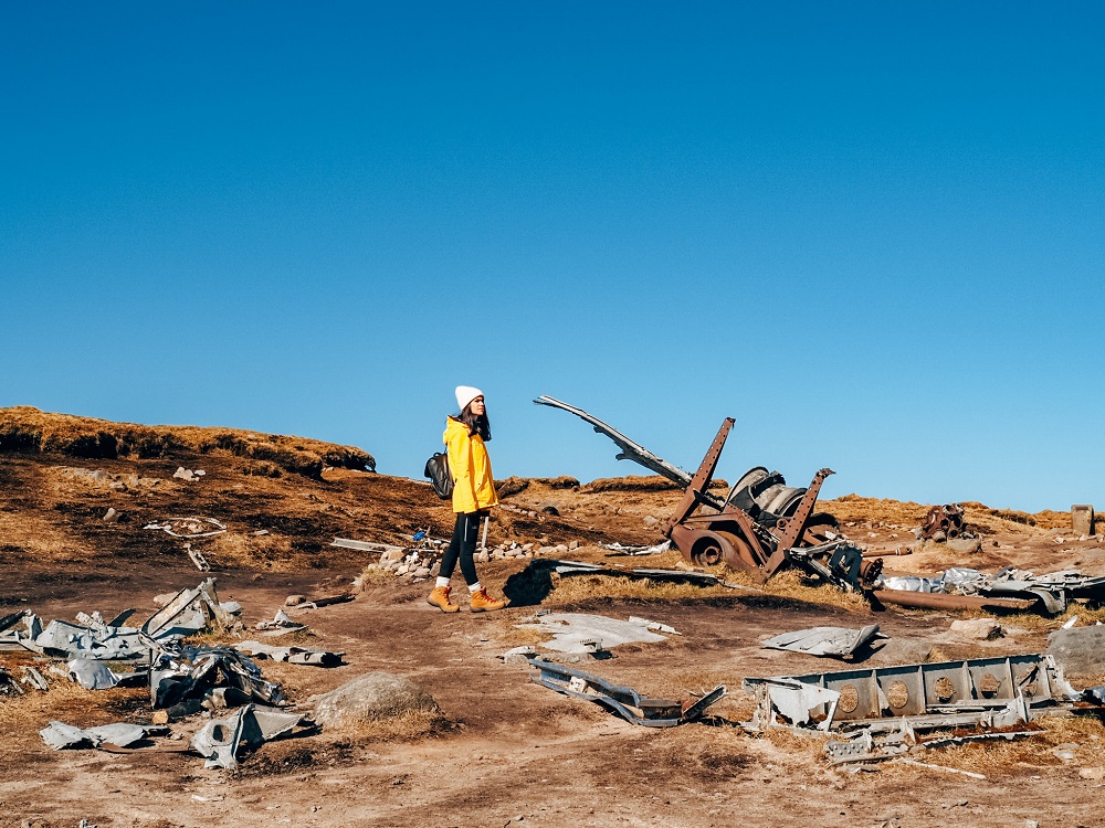
Just a few miles to the east of Glossop, off the A57 Snake Pass is Bleaklow moorland. Scattered across an area of Bleaklow moorland is the remains of the American World War II era Boeing Superfortress bomber called the B-29 ‘Overexposed’.
This area is 610 m (2,000 ft) above sea level, making the moorland the second highest point in Derbyshire. It’s important to mention that the Pennines here are the first range of hills that clouds travelling from the Irish Sea run into after the flat coastal plain. Therefore, the weather around here is often extremely wet and windy.
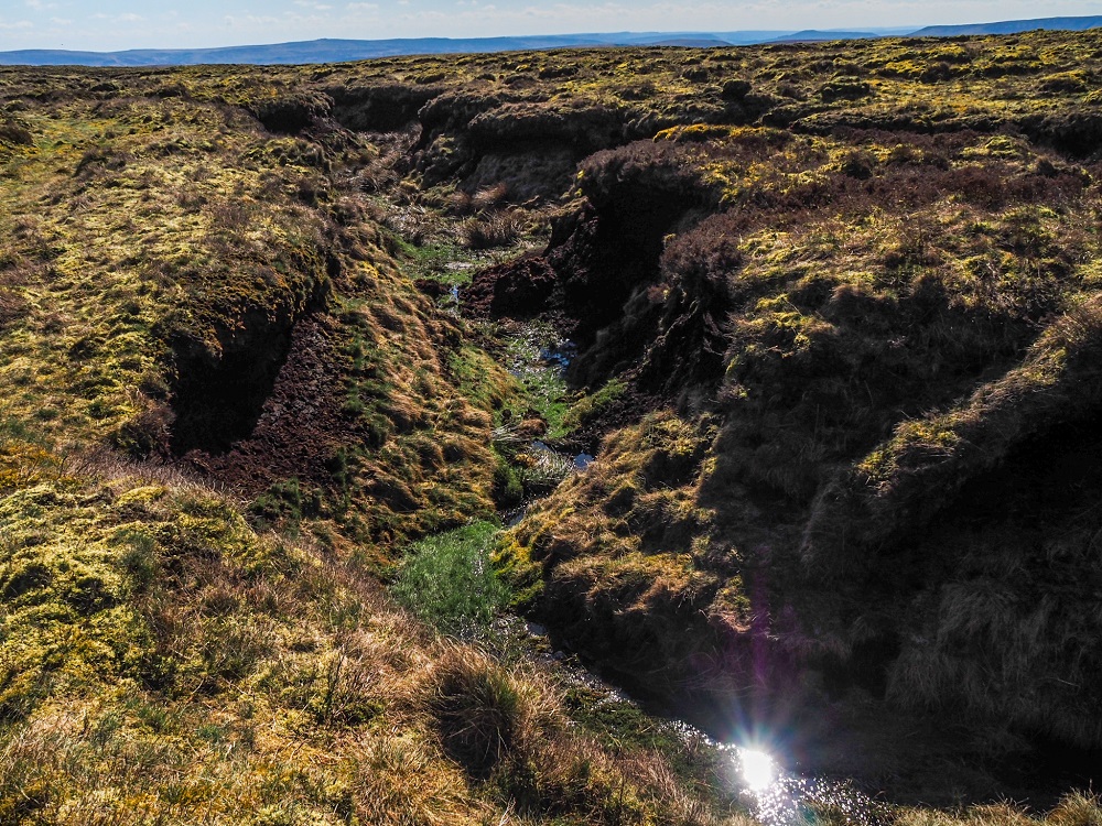
In addition, the ground of Bleaklow moor is composed of boggy peat and seamed by deep ‘groughs’ which are water-eroded channels in the peat. The combination of the ground and harsh weather conditions make this area of the Peak District one of the most challenging places to navigate.
The B-29 ‘Overexposed’ Superfortress bomber, on its way to Burtonwood from RAF Scampton in Lincolnshire, crashed on the moorland on 3rd November 1948. Unfortunately, all 13 crew members lost their lives in the crash. For some reason many parts of the aircraft have survived the harsh weather conditions of Bleaklow and are still very well preserved today.
Did you know? – American pilots had a tradition of naming their aircraft and also decorating the nose or cockpit sides with artwork. This particular aircraft was named ‘Overexposed’ by the pilots.
Did you know? – Just a few miles to the east of the B-29 Crash Site are Howden, Derwent and Ladybower Reservoirs, which were used by the RAF’s 617 “Dambuster” squadron to practice low-level flights. If you’d like to read more about the history of these reservoirs then check out my blog post by clicking here.
What is a B-29 Superfortress?
A B-29 Superfortress is a four-engine propeller-driven heavy bomber. It was designed by Boeing and it was mainly used in late World War II. These particular models were actually one of the largest aircrafts that were used during the war. It was originally designed to be a high-altitude daytime bomber. However, in reality, it was used at night for low-altitude incendiary bombing missions.
Although the B-29 was a rather advanced bomber for its time, it had its flaws. The heavy bomber’s iconic four-engines had a tendency to burst into flames causing major problems for these types of aircrafts.
It’s also worth noting that the B-29 ‘Overexposed’ Superfortress wasn’t a standard heavy bomber. It was modified as a photographic reconnaissance variant of the B-29, called an RB-29. This version of the aircraft was mainly used to monitor the build up of Soviet troops after World War II. Photo missions were flown from air bases in the UK until the end of the Cold War.
Why did the B-29 ‘Overexposed’ Superfortress crash?
The squadron was based at RAF Scampton in Lincolnshire at the time of the crash in 1948, but ‘Overexposed’ had already flown many miles in her life. She was actually one of three RB29’s which had accompanied the B29 tasked with deploying the “Able” atomic bomb in 1946 at Bikini Atoll in the Pacific.
Although I mentioned above that the B-29 models had engine issues, engine malfunction wasn’t known to be the cause of the crash. After doing some online research, many sources indicate that the actual reason for the crash is still not 100% clear. However, some reasonable assumptions can be made.
First of all, the weather on 3rd November 1948 was very bad. In those conditions, the cloud would have made visibility at that altitude almost zero, plus the aircraft would have been flying into a very strong headwind. This headwind could have thrown off the navigator’s positional calculations, meaning Captain Landon Tanner probably started his descent too soon. He possibly believed that the plane had already cleared the moors and was making its final approach to Burtonwood. By the time the crew had realised their error it was unfortunately too late.
Sadly, all 13 crew members were on the aircraft on the day of the crash although the mission could’ve been handled by a smaller crew. This wasn’t uncommon as RAF Scampton was very small with limited facilities available. On the other hand, Burtonwood had much more to offer. Therefore, all 13 members of the crew decided to board the plane that day to enjoy some downtime.
How to get to the trail head of the B-29 Crash Site?
By Car: The most convenient place to park is at designated lay-bys along the A57 Snake Pass. Use SK13 7PQ in your SAT-NAV to find it (coordinates: 53°25’58.7″N 1°52’08.7″W). You can park there for free all day.
If you don’t have your own car but would like to enjoy the freedom of a private vehicle then you can always hire a car to visit the B-29 Crash Site.
Top Tip – Since the B-29 ‘Overexposed’ Crash Site has become extremely popular, the car park can fill up quickly especially during weekends. Therefore, make sure to get there early or come during the weekday if you can.
By Public Transport: There is now a bus stop on either side of the A57 Snake Pass near the layby’s, so you can visit the crash site even without a private vehicle. Bus X57 runs a 2-hourly service between Manchester City Centre and Sheffield and you can get off at the Pennine Way bus stop at the start of the trailhead.
If you’re visiting from further afield, I recommend arriving into either Manchester or Sheffield first via train. Train services to these two cities are excellent. Make sure to plan your journey with Trainline which also provides information on bus fares.
By Bike: Both National and Local Cycle Routes run through Glossop and along Bottoms, Valehouse, Rhodeswood and Torsides Reservoirs. These reservoirs are located to the north of the B-29 ‘Overexposed’ Crash Site.
Good to Know Before You Go
Length of the Route
The B-29 ‘Overexposed’ Crash Site walking route we chose to complete was just over 8 km (5 miles) long. Depending on the weather, your speed, how easily you can navigate the moorland or how long you’re spending at the crash site, this route could take approximately 3 hours. During a slightly worse day it can take a bit longer due to potential navigation issues.
For reference, we had the most clear and gorgeous day we could’ve wished for, however we still managed to get confused by the trail! So I can only imagine how difficult low visibility would make this route.
If you’re adventurous, you can extend the walk in multiple ways. You can walk to Bottoms, Valehouse, Rhodeswood and Torsides Reservoirs which are located approximately 5 miles (8 km) further north. This would basically double the length of the route we did. Of course, you can also shorten your walk by only walking to the B-29 Crash Site and back, which is what most people do.
Top Tip – Make sure you start your walk as early as possible if you come on a weekend. Alternatively, I suggest coming on a weekday if you can. This has recently become a very popular area, so expect both the trail and the B-29 ‘Overexposed’ Crash Site to be packed with people especially on a nice day.
Level of Difficulty
Okay, this is a bit tricky. Some sections of the trail are basically paved and in good condition. This of course would make the trail relatively easy. However, if you’d like to do a circular route, and visit some other spots further along, then the trail will be a bit more difficult. This is due to four main reasons:
Firstly, the trail across the moorland won’t be as clear, and you will need to navigate yourself. Even we had navigation issues on a clear and sunny day! Also note that you might not have great signal, so have paper maps or offline maps with you.
Secondly, Bleaklow is a boggy peat moorland so walking on it when wet can be difficult. Thirdly, as I mentioned above, the area is seamed by ‘groughs’, water-eroded channels in the peat. These can be quite deep in places and in poor weather conditions could be dangerous. Lastly, this particular route is exposed the whole way, which could be unpleasant in windy, rainy and snowy conditions.
Therefore, I would rate the trail easy if you only walk along the paved section to get to the crash site, then walk back along it. However, if you’re doing a circular walk, then I would rate it moderate to difficult depending on the weather conditions.
This walk could be a great activity even on a slightly windy day. However, I highly discourage you to attempt it in bad weather conditions such as fog, rain and when it’s snowing. When visibility is compromised you can easily get lost along the moorland. In addition, if you don’t notice the deep ‘groughs’ in time you could seriously injure yourself by falling.
Facilities Around the B-29 ‘Overexposed’ Crash Site
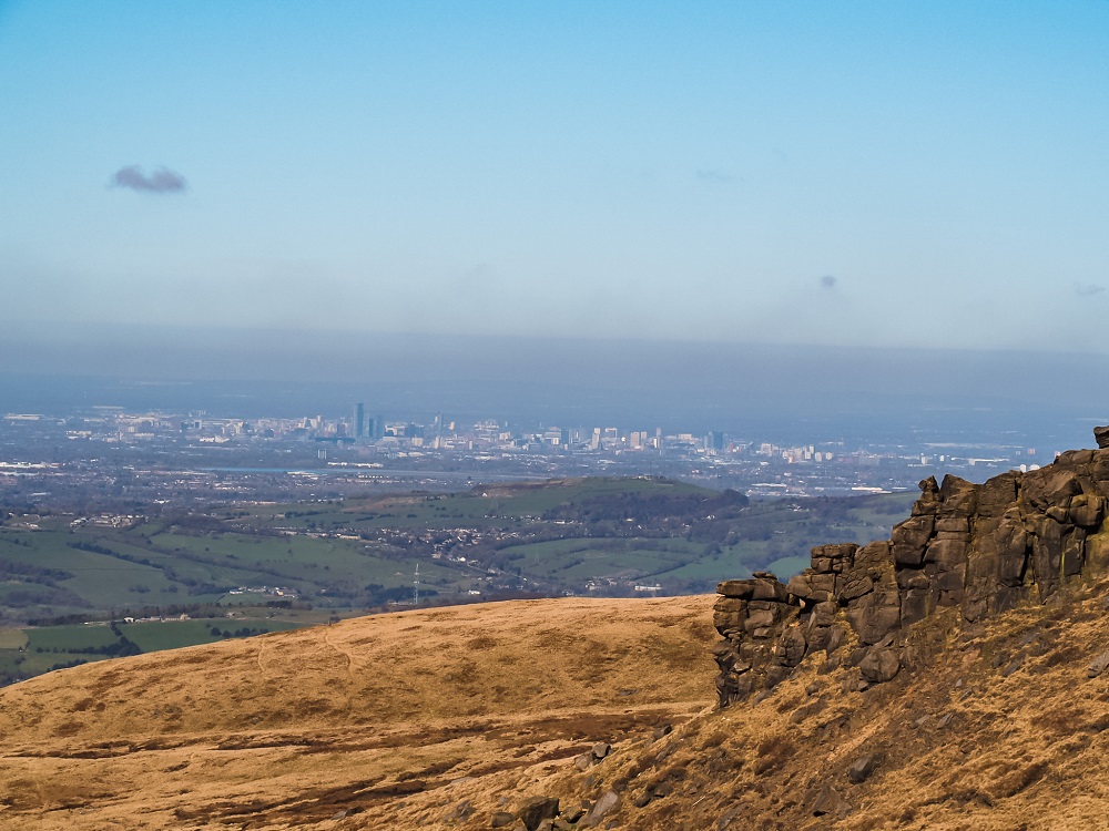
Cafés and picnic spots: This walk is very limited in terms of facilities. The closest place for pubs and cafés is in Glossop. Therefore, I highly recommend packing your own lunch, water and hot drinks. You can stop for a picnic basically anywhere along the trail. However, if you’d like to eat your lunch with a view, I recommend stopping either at Higher Shelf Stones with a view over Glossop and Manchester or at the B-29 Crash Site itself. You can also stop at the rock formations further along the trail.
Toilet facilities: There are no public toilets along the trail so you’ll need to find a private spot somewhere along it. It might be a bit challenging, since it’s pretty open and popular.
What to Wear and Bring With You?
You are in the north of England and an area that has possibly one of the most extreme weather conditions in the Peak District. At the time of our visit it was a dry, sunny and warm day with hardly any wind. This is however very rare and we felt incredibly lucky. You can imagine how extreme the weather conditions can be if they played a part in crashing an aeroplane.
Therefore, I recommend weather appropriate clothing when going on the B-29 ‘Overexposed’ Crash Site walk. You’ll be pretty exposed on the moorland and even on a sunny day it can be windy. Make sure you check the weather forecast before you set off and have a few layers with you.
I also suggest wearing proper walking shoes or boots. Whilst the start of the trail is basically paved it can still be uneven. Rain can also make parts of the trail muddy and slippery. Therefore, I suggest wearing supportive walking shoes or boots. Especially if you’re planning on venturing further out than the crash site. The moorland is uneven and the trail isn’t always clear.
Since there are no facilities along this trail I suggest packing your own lunch and snacks and having plenty of water and hot drinks with you. There are plenty of places to stop for a picnic or a quick break.
Please Note! – Whatever you bring with you, make sure you either take it home with you or dispose of it responsibly. Enjoy your time in nature but Leave No Trace!

How to Find the B-29 ‘Overexposed’ Crash Site
Although there are now signs leading you to the crash site, some people still find it a bit tricky to find the remains of the B-29 ‘Overexposed’ aircraft. Therefore, I try to give you as much detail as possible to guide you. I also suggest watching our YouTube video by clicking here, if you prefer a more visual explanation.
As usual, I divided the route into 5 smaller sections which follow some cool point of interests.

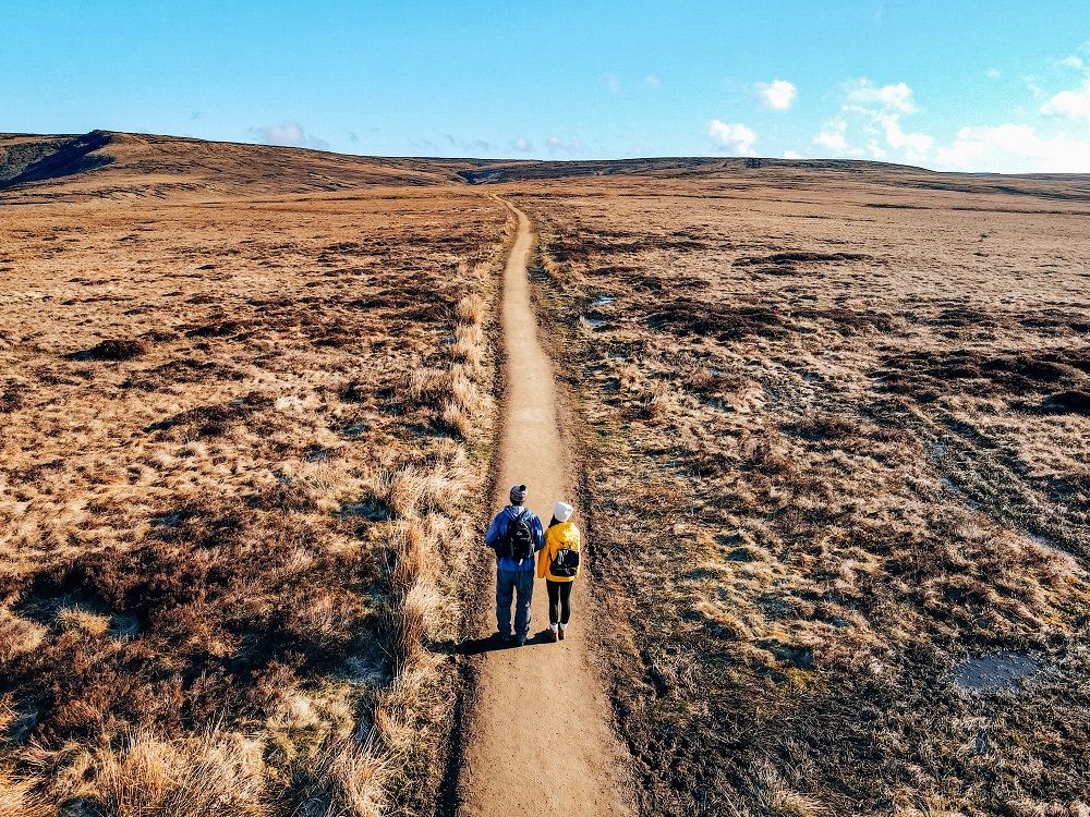
1. A57 Snake Pass to Higher Shelf Stones
From the A57 Snake Pass layby head through the gate and follow the straight path to the first crossroads. Here, you can choose to follow the signs towards the crash site. This will keep you on the main path for a bit longer. However, if you’d like to follow our trail, then your first goal is to reach Higher Shelf Stones Trig point (Coordinates: 53.44998, -1.86742). To do that, head left along an old cart track which will take you to the rim of a valley.
Once you get to the valley rim, head right and follow the valley all the way up. The views from here are amazing and it is a quieter path than the main one! This path is actually easy to follow.
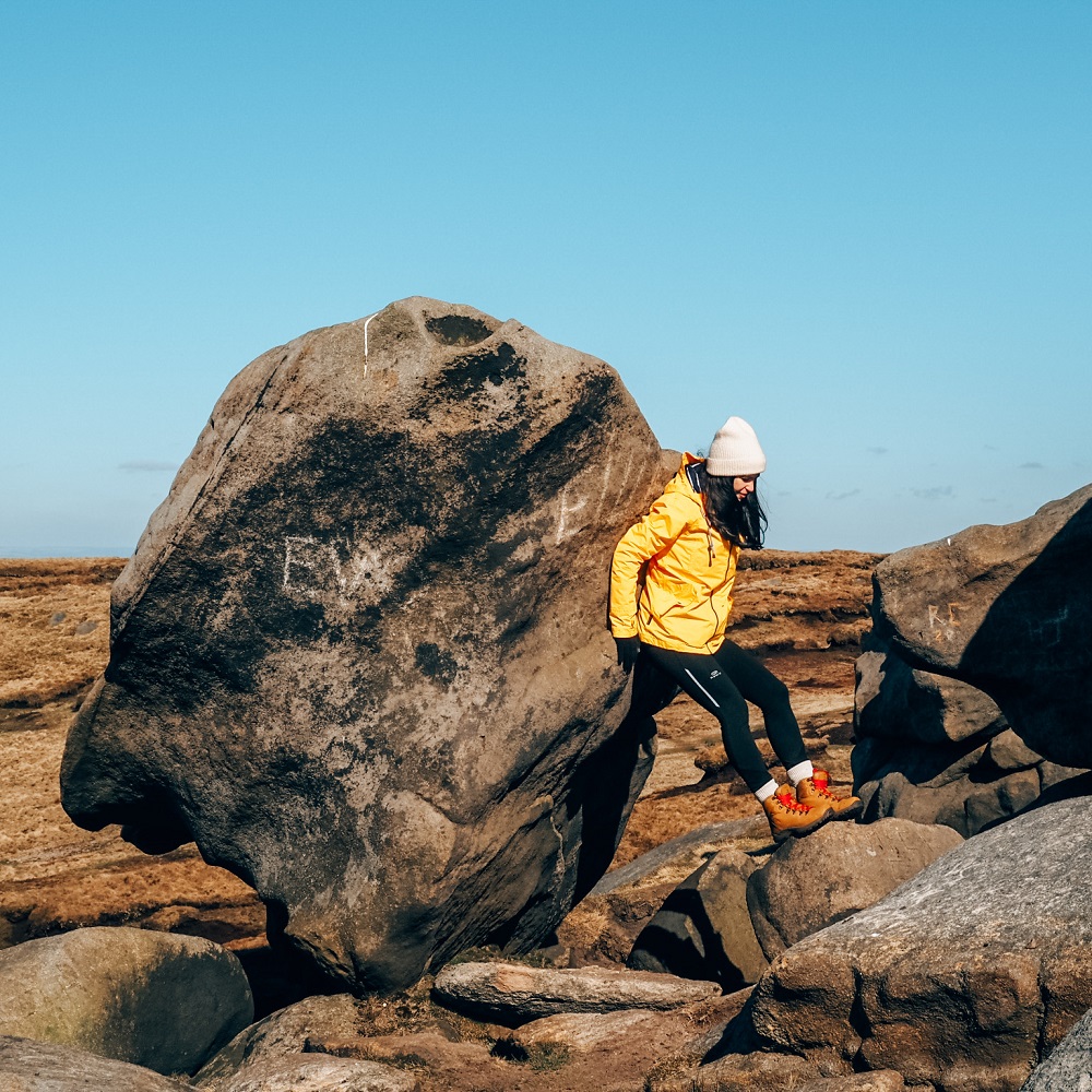
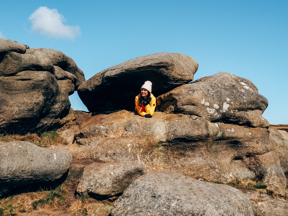
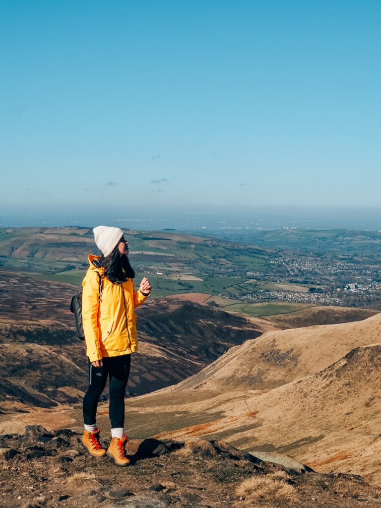
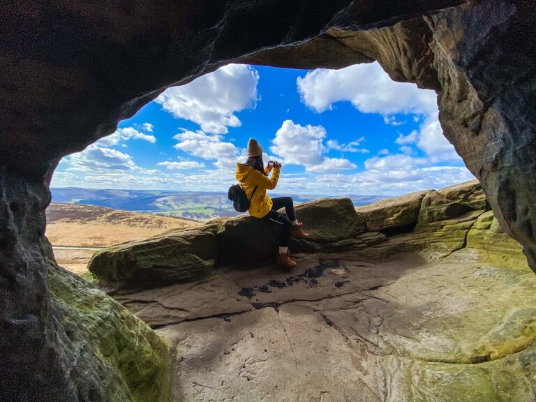
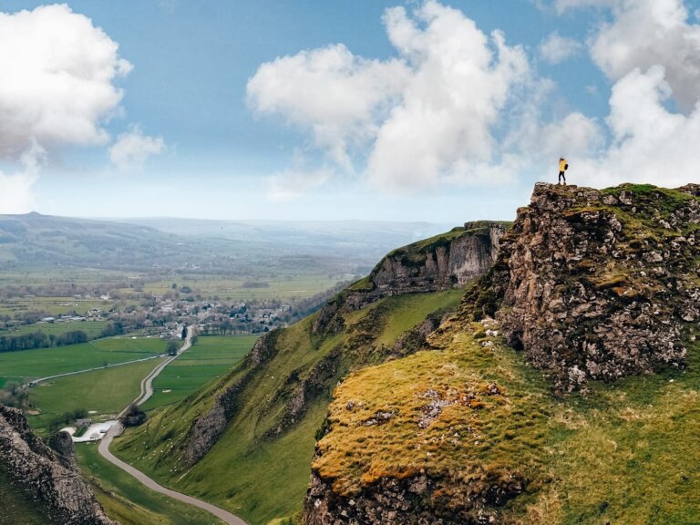
You will come to a small waterfall on your left. Just after passing this waterfall the path will become slightly less clear but it is still there! You’ll need to cross over to the other side of the valley and head upwards towards Higher Shelf Stones in a north westerly direction. You will eventually reach the ridge and see the white trig, crazy rock formations and be treated to amazing views over Glossop and Manchester!
Higher Shelf Stones is located 1.5 km (0.9 miles) south of Bleaklow Head. At 622 m (2,040 ft) it is one of the three summits on this plateau that are over 610 m (2,000 ft) above sea level.
Top Tip – The crazy rock formations at this point just scream for some cool photos so make sure to get creative.
2. Higher Shelf Stones to the B-29 ‘Overexposed’ Crash Site
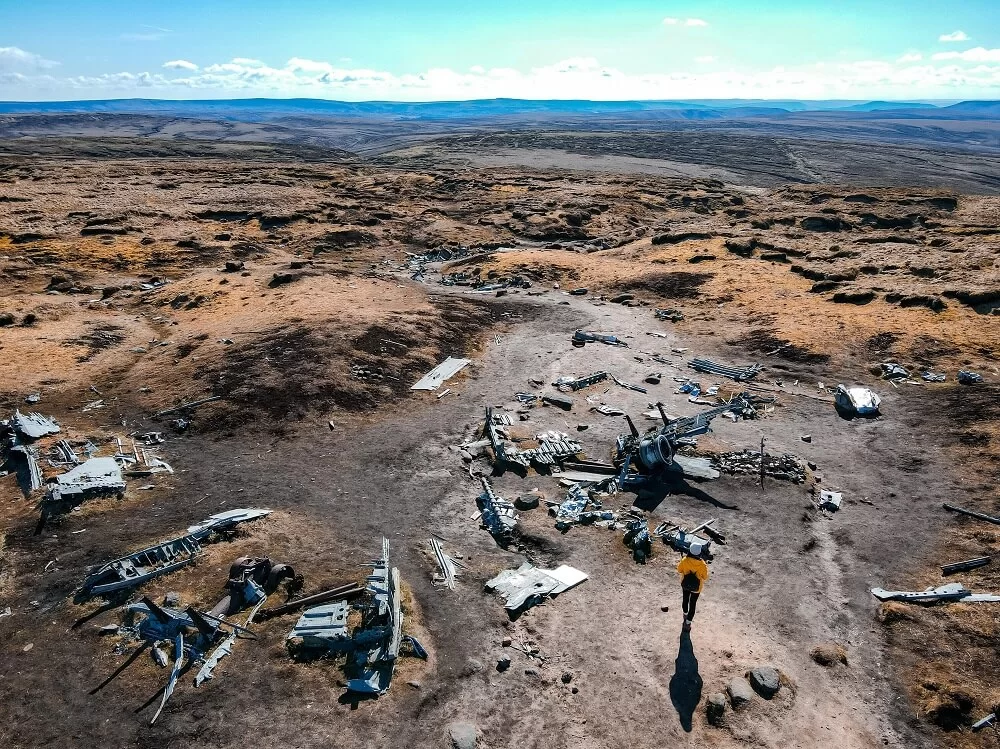
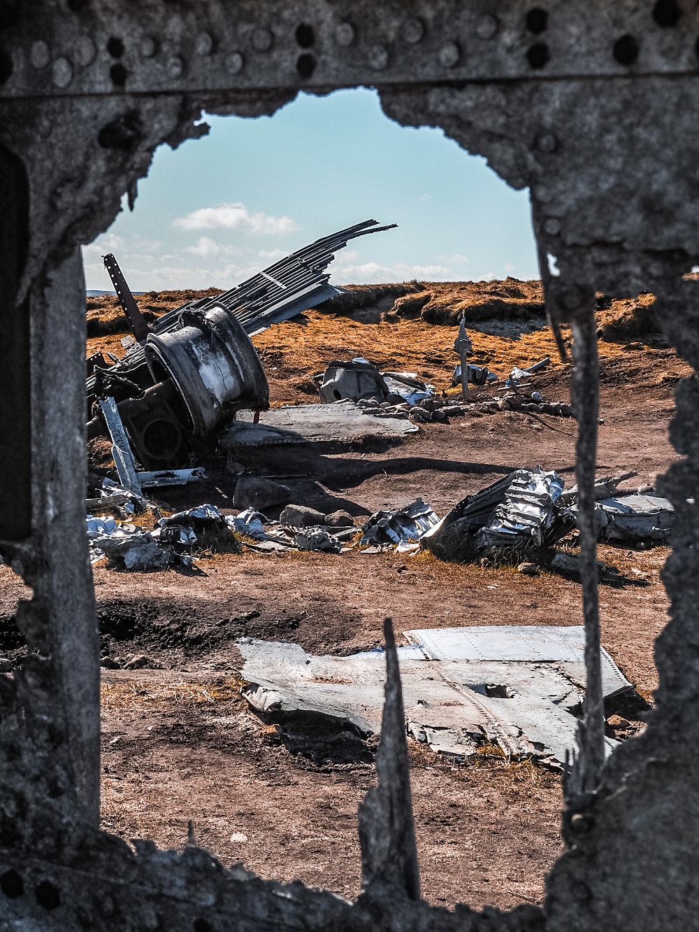
The B-29 ‘Overexposed’ Crash Site (Coordinates: 53.45091, -1.86542) will be only a few hundred yards to the east of Higher Shelf Stones. From the trig point you can actually just about see the first few remains of the plane.
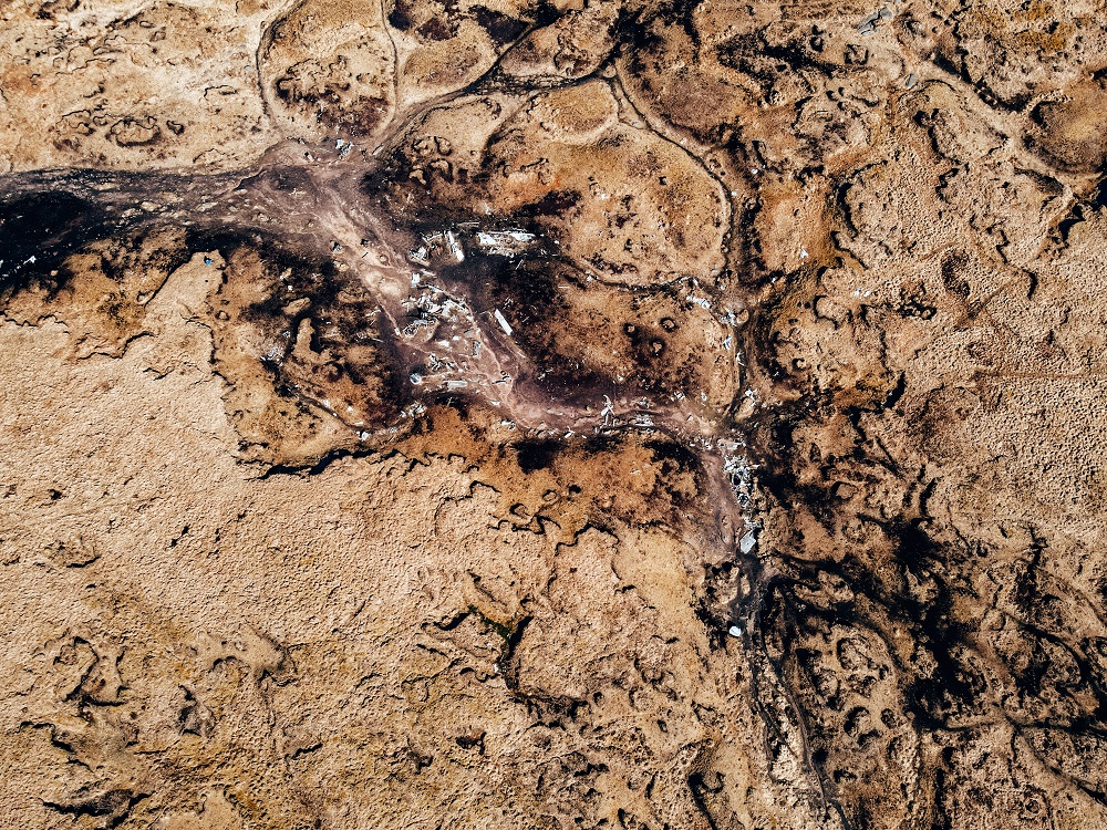
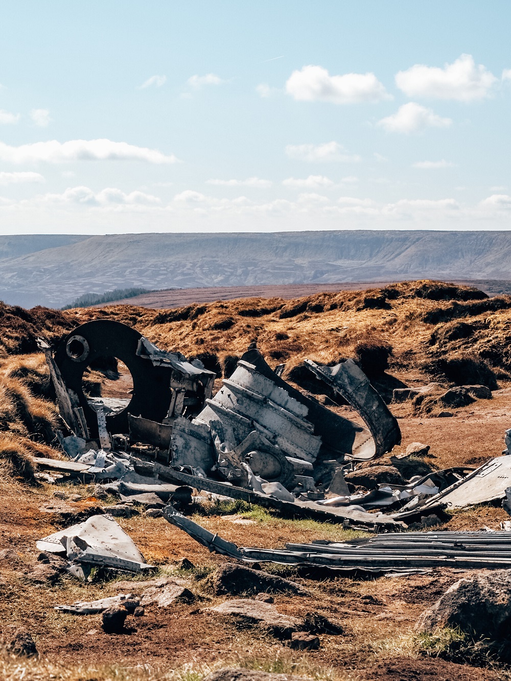
The crash site itself covers a relatively wide area and it has an eerie feel to it. As you walk around the wreckage you’ll see many recognisable structural spars such as undercarriage struts, pulley wheels, large sections of the light aluminium alloy and the four cylinder engines.
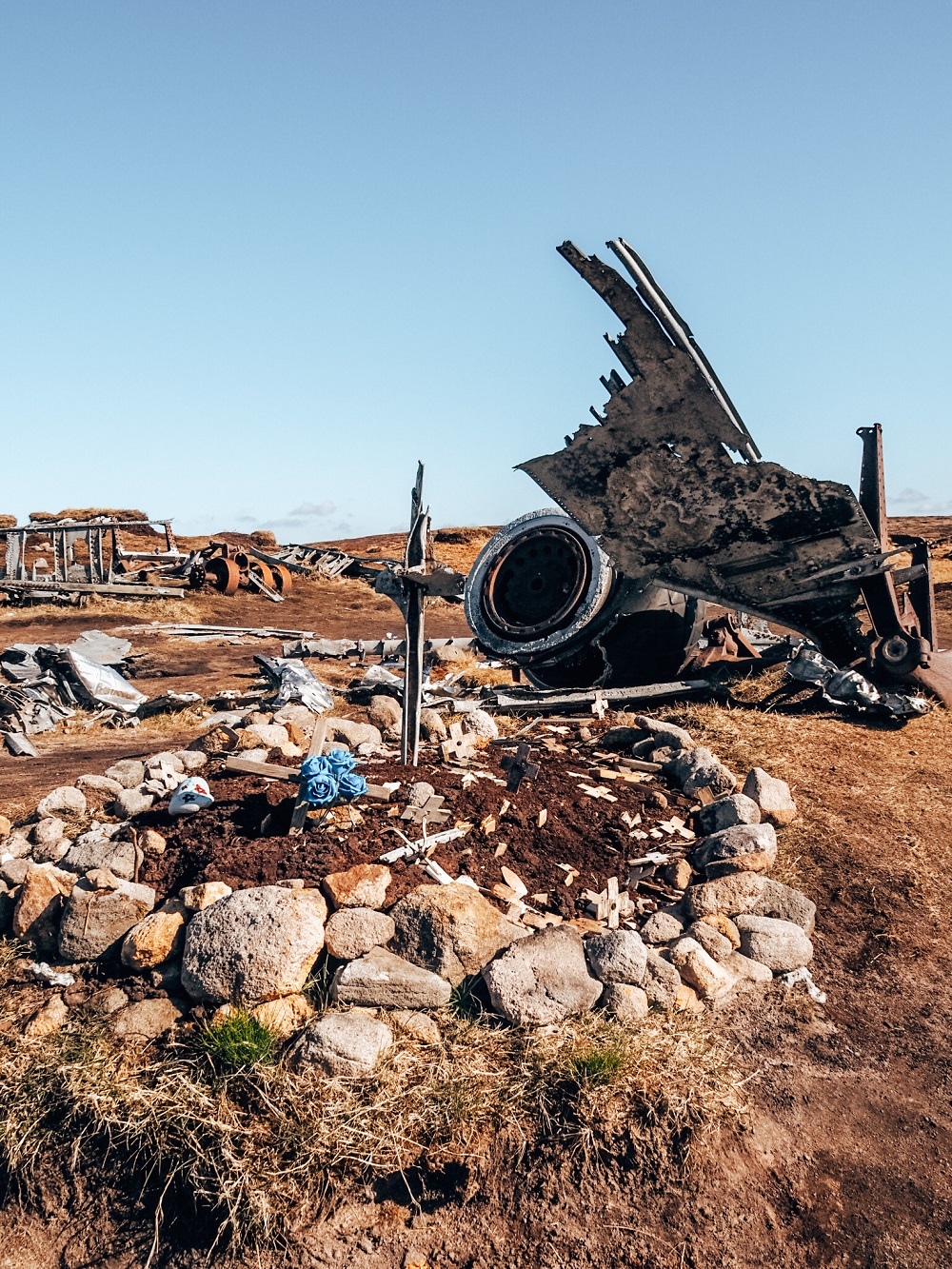
A memorial was also erected at the site by the Royal Air Force Finningley back in 1988.
Please Note! – Please be respectful when visiting the B-29 ‘Overexposed’ Crash Site. Walk around it, appreciate how well preserved the remains of the aircraft are, but don’t take any of its parts home! I enjoy taking photos, but personally I think this should NOT be the place for selfies or inappropriate photos in general. After all, 13 people lost their lives here and whilst the wreckage is in the middle of nowhere, it’s still a memorial for the crew members.
3. B-29 Crash Site to Hern Stones Formation
From the B-29 Crash Site your next stop will be Hern Stones Rock Formation (Coordinates: 53.45488, -1.86255). Even if you’re just visiting the crash site, the easier path will lead you through this cool rock formation.
You can actually see Hern Stones from the crash site, so you just need to head in a north-easterly direction. You might need a bit of navigation to get there but the path is visible in places. This section of the walk is where all the ‘groughs’ will appear, so proceed with caution, especially on a day when visibility is lower.
Again, it’s another great rock formation to have a quick snack or water break at. From here you can either circle back through the easy path or carry on a bit further. If you’re ready to head back then you need to go in an easterly direction until you reach the paved path that will take you back to the A57 Snake Pass layby. However, if you’re ready for more adventures then you need to head north.
4. Hern Stones to Wain Stones and Bleaklow Head
From Hern Stones you want to head in a northerly direction to reach Wain Stones and Bleaklow Head.
This is where in my opinion the trail gets a bit more tricky. Our intention was to find Wain Stones (Coordinates: 53.45988, -1.86322). It’s also know as the Kissing Stones, since this rock formation looks like two heads that are about to kiss.
Unfortunately, we got a bit disoriented as the path wasn’t very clear with the ‘groughs’ sometimes blocking our view. So, before we realised our mistake we were at Bleaklow Head and completely missed Wain Stones. My advice is to head north but try to keep to a westerly direction. Our mistake was that we kept going east which led us to Bleaklow Head.
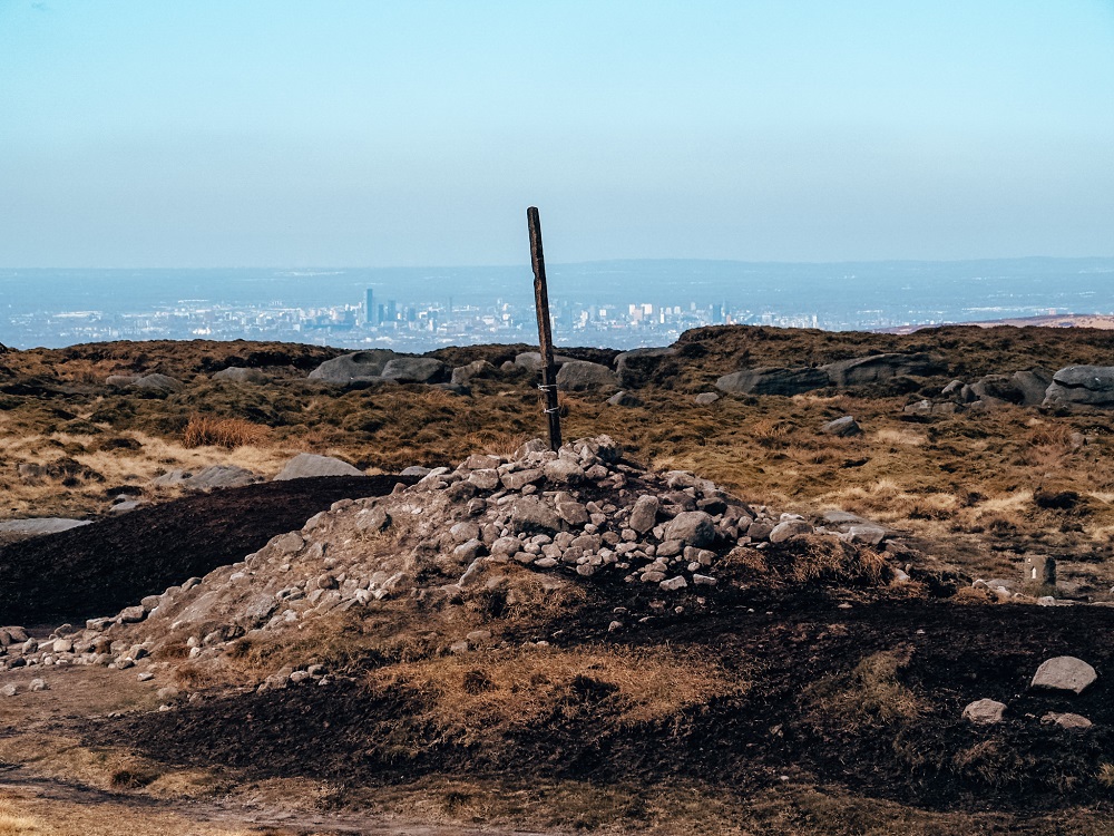
If you’re lucky enough to get to Wain Stones you will need to go in a slightly north-easterly direction and you should reach Bleaklow Head (Coordinates: 53.46116, -1.86009). It’s marked by a huge cairn of stones, so you’ll recognise it easily. Located 633 m (2076 ft) above sea level, Bleaklow Head is the highest point on Bleaklow moorland and is considered a Hewitt.
Did you know? – A Hewitt is a Hill in England, Wales or Ireland over 2,000 feet (609.6 m) in height. There are 524 Hewitts all together, and those who climb them all are called Hewitteers.
5. Bleaklow Head to A57 Snake Pass
From Bleaklow Head start walking in a southerly direction. You’ll start down the main path back to the A57 layby. In the distance Hern Stones Rock formation should appear on your right. This trail will lead you all the way back to the A57 Snake Pass Road. This section is definitely busier, especially later in the day, so you can’t get lost too easily. Since it’s relatively easy to navigate from here, the path felt a bit monotonous. However, all the adventures before that made up for this slightly boring section. The views are still amazing towards Kinder Scout and the Snake Woodland in the distance. Also, if you get lucky and visit on a gorgeous day, it is a nice and relaxing walk.
Additional Walks in the Peak District
There are many amazing places and trails located near the B-29 Overexposed Crash Site. So, if you’d like to see more of the Peak District then make sure to check out the 10 Best Hikes in the Peak District or browse for more hiking trails in the UK and around the world in my Hiking Adventures Series.
For now, here are some hikes in the Peak District that are either walkable or approximately 30 minutes’ drive away from the B-29 ‘Overexposed’ Crash Site:
Bamford Edge and Ladybower Reservoir – A 7-mile circular trail with stunning views from the top of Bamford Edge looking towards Ladybower Reservoir and the Hope Valley. Click here to read it.
Derwent Edge and Derwent Reservoir – A 9-mile circular trail with rich history of the Upper Derwent Valley reservoirs, myths, legends, stunning views and crazy rock formations along Derwent Edge. Click here to read it.
Stanage Edge and Hathersage – A 6-mile circular trail that takes you through the historic village of Hathersage, literary locations, beautiful landscapes and a secret cave called Robin Hood’s Cave. Click here to read it.
Mam Tor, Winnats Pass and Castleton – A 5.5 mile circular trail which takes you through some of the most scenic places in the Hope Valley: Mam Tor, Winnats Pass and Castleton. Click here to read it.
Padley Gorge Walk – A magical walk in the Peak District which will make you feel like you’re walking through an enchanted forest. Click here to read it.
Final Thoughts on the B-29 ‘OVEREXPOSED’ Crash Site
The fact that we had a gorgeous day with only a slight breeze definitely meant this walk exceeded my initial expectations. Obviously, the experience might’ve been very different in worse weather conditions. Finding the B-29 crash site was actually easier than I initially thought. However, I can totally understand why this area is considered one of the hardest places to navigate in the Peak District.
I was also shocked by how well preserved the wreckage was, especially on terrain like Bleaklow. I just hope that with more people visiting this site, the wreckage will stay the same, and people will be respectful around the site.
Have you ever been to the B-29 ‘Overexposed’ Crash Site before? If so, how much of the area did you manage to explore? Let me know in the comments below.
Now, let your adventure begin,

Our Top Travel Resources
Accommodation: For hotels we always use Booking.com and Hostelworld for hostels. We also book longer stays on Airbnb or Vrbo.
Flights: To find the best flight prices we always check Skyscanner, Google Flights or WayAway. Then we also check the airlines’ websites too for comparison.
Car Rentals: We use Discover Cars when we want to rent a car as it compares local, national and international companies.
Activities: If we book organised tours we always check either GetYourGuide or Viator.
Foreign Currency: Whenever we can we prefer to pay in local currency and for that we always use our Wise card. We can easily withdraw money from the ATM or pay by card at most shops and restaurants.
Travel Insurance: We never go anywhere without travel insurance. You never know what will happen on your trip, so good travel insurance like SafetyWing can protect you in case of injury, illness, theft and cancellations.
eSIM and VPN: To get data abroad we use Airalo which is an app that allows you to download a prepaid eSIM to your phone in over 190 countries. Make sure to have a VPN to avoid hackers accessing your personal data when using public WIFI. We use Surfshark which is the only VPN that offers one account on unlimited devices.
Remember…It all starts with a Pin…


What a hauntingly beautiful place to visit! It’s so interesting to read about the B29 Overexposed crash site and learn about the history. I’d definitely love to see it in person but it is devastating that 13 people died in the crash. Thanks for this sympathetic guide.
Thank you Hannah, I’m happy you liked my guide on how to find the crash site and its history. It’s a sad story, but definitely worth a visit as the moorland is so beautiful.
Can’t believe I missed this adventure when I lived in Manchester. I ever went trail running in the Peak District a few times. It is crazy to think how the ruins have survived the weather and elements for so many years!
I bet it must’ve been cool to do trail running in the Peaks. Trust me, I’ve been exploring the this area for years now and only just heard about this crash site. Crazy to think how well preserved the remains are, and just hope that people will leave it as is when visiting.
That looks like a fascinating hike! So interesting to learn the history. Thank you for sharing!
Thank you Deb, I’m glad you enjoyed learning about the history of this crash site.
Wow, I love your blog! And this is a really great post – super interesting and informative and full of helpful information. Nailed it!
Really want to go here now, I love ruins and abandoned things!
Thank you so much Bella, it means a lot! I’m so happy that you found my blog useful and I hope you can visit this crash site soon. I also love visiting abandoned places and ruins so I’m sure you’ll enjoy exploring this area.
What a unique place to hike to! My friends were actually just talking about hiking up here yesterday and I had never heard of it before – now I know what it looks like!
I didn’t know about this place either, but have been seeing photos on social media, so I wanted to explore it myself. I hope my guide will help you to find the crash site easily! Enjoy your hike 🙂
I love this post. I appreciate your detailed directions, glimpses into the aircraft’s history, and the importance of treating the site with the respect it deserves. Thank you.
Thank you Anne I’m glad to hear that you found my post useful. I think with the growing number of people on these trails it’s so important to emphasize that this place should be treated with due respect. Nature managed to preserve it for so long, so I hope it won’t get ruined by people.
This sounds like such a great hike. while the crash is tragic, it’s interesting to hear the history and would be neat to see the crash site.
Thank you Sue. It’s definitely a unique place to visit and learning about the site’s history was very interesting.
What an interesting place to visit. I like when there’s something unique to see on a hike to really make it a bit different. While this is obviously a sad and tragic tale, it was good to learn a bit more about the plane and this history too
I’m the same Emma, I love hiking trails that have some interesting features with stories, myths and legends. I hope you can also visit this site in the future.
Thank you Kitti for this very respectful and interesting blog. It is a haunting place, in more ways than one! And like you I hope that visitors will enjoy the history of the place, whilst leaving everything as is it, with no trace of their visit. Lots of useful info. and facts too.
Thank you Karan, I’m glad you enjoyed my post. I hope that the remains will stay intact so our future generations can also learn about what happened here and see the wreckage.
A bleak haunting spot not been there for good few years .there a good few crash sites in the area
Wow! I had never heard of this before, and this post was so informative and thorough! Thank you so much for sharing
Thank you Destiny I’m so happy you found my post informative. I hope you can visit this site in the near future.
An interesting history and also how well preserved the wreckage was. I would like to hike here. Thank you for giving your reader a detail guide.
Thank you Umiko, I’m glad you found my blog useful and interesting. Hope you can hike here in the future too.
So interesting and I’ve never heard of this site!
Thank you Denise, I’m glad you found my post interesting.
This is such a cool wreck! Thank you for also detailing the history and tragedy behind it to put it in perspective.
Thank you Xin, I’m so glad you enjoyed reading my post and also found it informative. I hope you can visit it one day too.
This is truly fascinating! Again, I hadn’t heard of this spot until reading your blog post. Wow! I will definitely be referring back to this again in the future. Thanks so much for sharing! Xx Sara
Very interesting read, my daughter has asked if I knew of a crash site as she would like to visit.
I did visit the Overexposed some 43 years ago while walking the penine way, It was a bright day and the wreckage was reflecting the light.
The final coincidence is that I now live on the site of Burtonwood Airbase,
Thank you for your comment Steve. Crazy to think that the wreckage survived the harsh environment for so long. We also had a very sunny day on our visit which is very rare around there. Also what a coincidence that you actually live at the airbase site! Thanks for sharing your story.
Great post! Just fyi – I was there yesterday and the bus stop had closed.
Thanks for you comment Joe and for the update about the bus stop. Could be because they closed the snake pass recently?
Where did you go when you took them photos
The place is called B-29 Overexposed Crash site on Bleaklow moor in the Peak District National Park.
Hey Kitty! Thank you for uploading this! It really helped me find the wreck. In the link below are two YouTube links of short films that I have made about the B29. I hope that you find them interesting!
I’ve also subscribed to your excellent blog!
https://youtu.be/vzBZV0wuDLo
https://youtu.be/SnEIC3NjVPI
Best wishes,
Paul
Thank you Paul, I’m glad to hear that you managed to find the wreck following my directions. Take Care, Kitti