

Best Hikes in El Chalten, Argentine Patagonia

Surrounded by some of the Andes mountain’s most impressive peaks, as well as glaciers, blue glacier lakes and beautiful waterfalls, El Chalten is a hiker’s paradise. In fact, since 2015, El Chalten has been known as the National Capital of Trekking in Argentina. If you’re planning a visit to Patagonia, then you’re most likely going to visit this small mountain town in Los Glaciares National Park. So, in this guide, we’ve put together a list of the best hikes in El Chalten and arranged them by their level of difficulty, so you can pick the most suitable ones based on your experience.
There are also many things you may want to know before visiting El Chalten, so don’t forget to read our dedicated guide on that in conjunction with this one.
If you’d like to see the hikes we did in El Chalten, make sure to watch our Los Glaciares National Park video, which we shared on our YouTube channel Kitti and Jon. For more videos from the country, check out our Argentina playlist.
Disclosure: This post may contain affiliate links, which means we may receive a small commission if you click a link and purchase something. Clicking these links won’t cost you anything, but it will help us to keep this site up and running! Learn more about our affiliate policy.
Easy Hikes in El Chalten, Argentina
1. Chorrillo del Salto Waterfall
- Distance: 6.5 km / 4 miles (Out-and-back)
- Elevation: 132 m / 433 ft
- Trailhead: Sendero Fitz Roy Car Park
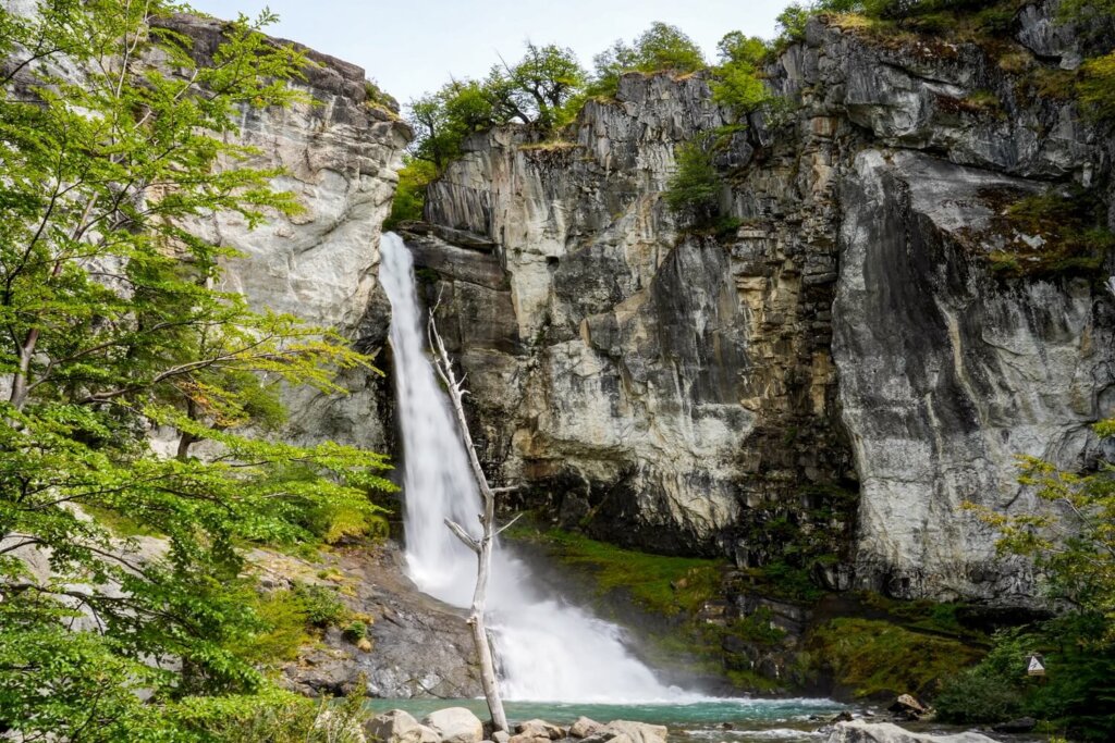
The Chorrillo del Salto waterfall hike is a short and easy trail, perfect to do on your first afternoon after arriving in El Chalten, or as a “rest-day” hike between the longer, all-day treks. It’s a great one to do if the weather conditions aren’t great for the Laguna de los Tres hike, as well as other more scenic hikes.
Starting from around the same point you would start the Mount Fitz Roy hike from, follow the trail to your right. This trail will lead you to a viewpoint of the Las Vueltas River before the path merges with Ruta 41 down in the valley. Walk along the road for a bit before joining a trail on the right side of the road. This will eventually lead you back across the road, where the trail runs parallel with the main road until you pass the official car park. Chorrillo del Salto is about 500 m further up the trail. The waterfall drops about 20 metres into a small pool and is surrounded by the typical vegetation of this area.
2. Mirador de los Condores
- Distance: 2.5 km / 1.5 miles (out-and-back)
- Elevation: 130 m / 426 ft
- Trailhead: Los Condores Trailhead
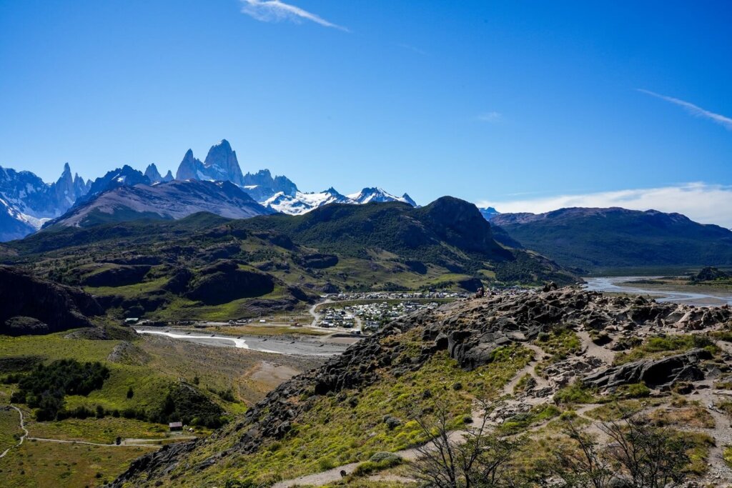
A beautiful viewpoint of both El Chalten and Mount Fitz Roy with minimal effort. The hike starts from the visitor centre to the south of El Chalten. Passing the ticket control booth, follow the signs towards Mirador de los Condores at the first and second fork. Whilst it’s a short trail, it’s going to be a bit steep to get up to the viewpoint. However, your efforts will be rewarded with panoramic views of El Chalten, the confluence of the Fitz Roy and Las Vueltas Rivers and of course Mount Fitz Roy in the background. The viewpoint gets its name because condors can often be spotted here, so keep your eyes peeled for these massive birds.
Read Next: A Guide to the Mirador de los Condores Hike
3. Mirador de las Aguilas
- Distance: 5.5 km / 3.4 miles (Circular)
- Elevation: 226 m / 741 ft
- Trailhead: Los Condores Trailhead
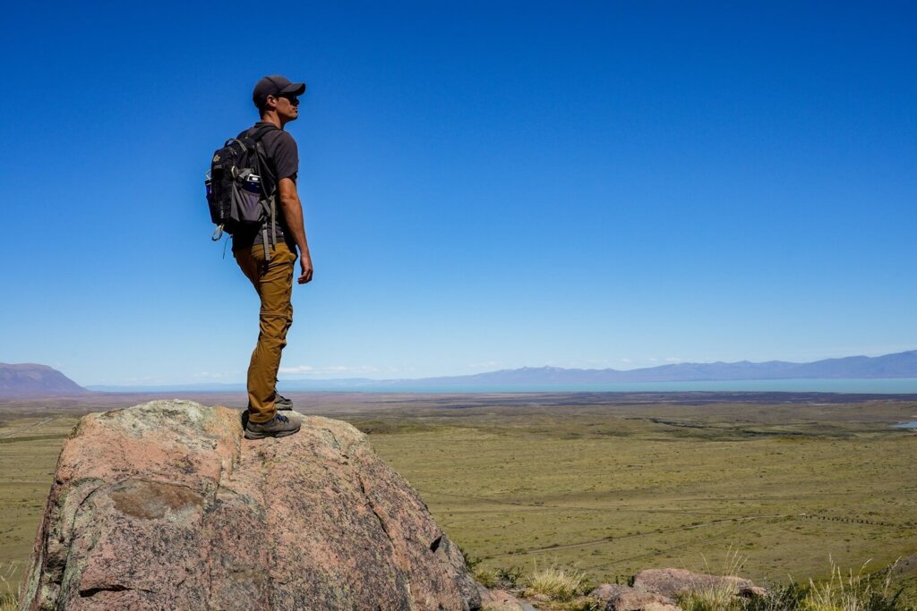
A less popular but easy hike in El Chalten is to Mirador de las Aguilas. This trail is essentially an extended version of the Mirador de los Condores hike. Starting off from the same trailhead, take the first fork towards Los Condores, then the second one to Las Aguilas. The path carries on across the plateau, with Mount Fitz Roy behind you.
After a gradual ascent, you’ll reach Mirador de las Aguilas. From here, you can see Lago Viedma in the distance, as well as the Patagonian steppe. Then the trail will circle back towards Los Condores viewpoint. You’ll be going slightly up and down, with Mount Fitz Roy roughly in front of you. Soon you’ll reach Mirador de los Condores, from where you’ll just have to follow the trail back down to El Chalten.
Read Next: A Guide to the Mirador de las Aguilas Hike
4. Mirador del Cerro Torre
- Distance: 6 km / 3.7 miles (out-and-back)
- Elevation: 226 m / 742 ft
- Trailhead: Laguna Torre Trailhead at the end of Los Charitos street
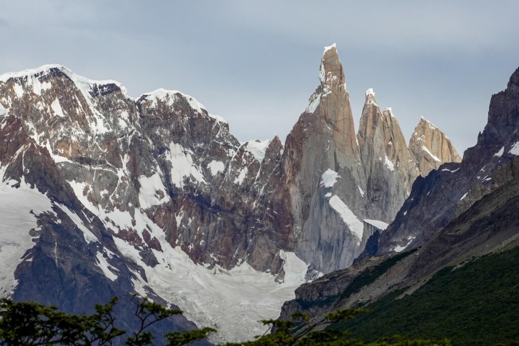
This short hike will take you to a lovely viewpoint of Cerro Torre. This is a great alternative if you either don’t want to, or don’t have the time to, hike all the way to Laguna Torre but wish to enjoy some beautiful views of the mountain.
After an initial steep climb from the trailhead, you’ll be walking through lovely meadows before reaching the first viewpoint: Mirador Cascada Margarita. Here you can see the meandering Fitz Roy River, the impressive Cerro Solo mountain and your first peek of Cerro Torre itself. Even Mount Fitz Roy is visible from this vantage point.
The path then continues to meander up and down. About 2.5 km into the hike, you’ll arrive at the Mirador del Cerro Torre viewpoint. Here you’ll have a clear view of the four jagged peaks ahead: Cerro Torre, Torre Egger, Punta Herron and Cerro Standhardt. At 3,128 m (10,262 ft) tall, Cerro Torre is the highest in this mountain chain. Other notable peaks nearby are Cerro Solo to the west and of course Mount Fitz Roy to the east.
Read Next: A Complete Guide to the Laguna Torre Hike

Moderate Hikes in El Chalten
5. Mirador Fitz Roy
- Distance: 8 km / 5 miles (out-and-back)
- Elevation: 375 m / 1,230 ft
- Trailhead: Sendero Fitz Roy Car Park
Hiking to Mirador Fitz Roy is a great alternative if you’re not planning on attempting the much longer version that takes you all the way to Laguna de los Tres. The trail starts from the northern end of El Chalten, where you follow the path to the right at the first fork towards Mirador Río de las Vueltas. From here, carry on hiking up through the forest and circle around Leon hill. At around the 3 km mark the trail will split again, with the left one heading to Laguna Capri and the right one towards Mirador Fitz Roy.
From the viewpoint, you can enjoy stunning views of Cerro Fitz Roy and its neighbouring peaks. You can either just turn back here, or carry on a little further following the trail towards Laguna de los Tres. At the next fork, we suggest going left towards Laguna Capri. Here, you can stop along the shores of the lake for beautiful views before following the path back to El Chalten. If you do this slight loop, then the total distance of the hike will be around 9.7 km, or 6 miles.
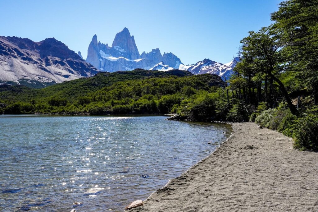
6. Laguna Capri
- Distance: 8.5 km / 5.2 miles (out-and-back)
- Elevation: 400 m / 1,312 ft
- Trailhead: Sendero Fitz Roy Car Park
Laguna Capri is a beautiful spot to enjoy lake views with Mount Fitz Roy in the distance. From the trailhead (which also leads to Mirador Fitz Roy and Laguna de los Tres), you’ll climb steeply before arriving at Mirador Río de las Vueltas. The path will carry on climbing higher through the forest and pass around the side of Leon hill before reaching the turn off for Laguna Capri on the left hand side about 3 kilometers in. You’ll only have a short push left before reaching the shores of the lake, where Cerro Fitz Roy is visible in the distance.
If you wanted to, you could easily spend your day relaxing on the beach here enjoying the views. From here, you can either head back the same way you came, or carry on along the path until you reach the next fork, where you would take the right path that circles back towards El Chalten, stopping at Mirador Fitz Roy along the way for an even better view of the mountain. If you do this slight detour, then the total distance of the hike will be around 9.7 km (6 miles).

7. Laguna Torre
- Distance: 18 km / 11 miles (Out-and-back)
- Elevation: 475 m / 1,558 ft
- Trailhead: Laguna Torre Trailhead at the end of Los Charitos street, or from Sendero Fitz Roy Car Park
Probably the second most popular hike in El Chalten is to Laguna Torre. This moderate but long trek will reward you with views of a beautiful glacial lake with icebergs floating in it, Torre glacier and the iconic four jagged peaks as a backdrop.
The first point of interest along the trail is Mirador Cascada Margarita. It provides you with views of the Fitz Roy River, Cerro Solo mountain, Cerro Torre and its neighbours. Even Mount Fitz Roy will be visible from this viewpoint. Then, about 2.5 km into the hike, you’ll arrive at Mirador del Cerro Torre. The rest of the path will zig-zag along the valley floor, with Cerro Torre visible the entire time in front of you. In a few kilometres you’ll reach the shores of Laguna Torre, where you can see icebergs floating in the glacier lake. If you wish, you can hike further along the rim of the lake to get a closer view of the glacier.
Read Next: A Complete Guide to the Laguna Torre Hike


8. Mirador del Glaciar Piedras Blancas
- Distance: 13.5 km / 8.4 miles (out-and-back)
- Elevation: 380 m / 1,247 ft
- Trailhead: El Pilar trailhead
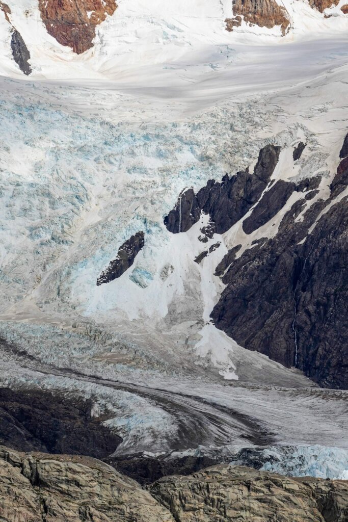
A slightly quieter hike compared to the Laguna de los Tres one, with some incredible views of the Piedras Blancas Glacier. The shorter version of this hike starts from El Pilar, north of El Chalten, which you would ideally need some transport to get to from town. Along the way, you’ll pass through the forest and along the Rio Blanco. The path will then gradually ascend before reaching the Piedras Blancas Glacier viewpoint. From the viewpoint, you can also extend the hike by going all the way to Poincenot Campsite and taking the trail on the right towards the shores of Laguna Piedras Blancas.
If you can’t make it to the El Pilar trailhead, you can also start the hike on foot from the Sendero Fitz Roy Car Park. However, this would make the trail 21.5 km (13 miles) long with 670 m (2,200 ft) of elevation. You can actually see the glacier from a distance from the Laguna de los Tres trail. If you would still like to get a closer look, then instead of doing this as a separate day hike, you can just add the slight de-tour to the glacier viewpoint during your Laguna de los Tres day hike.
Hard / Difficult Hikes in El Chaten
9. Laguna de los Tres
- Distance: 22 km / 13.7 miles (Out-and-back)
- Elevation: 1,054 m / 3,458 ft
- Trailhead: Sendero Fitz Roy Car Park
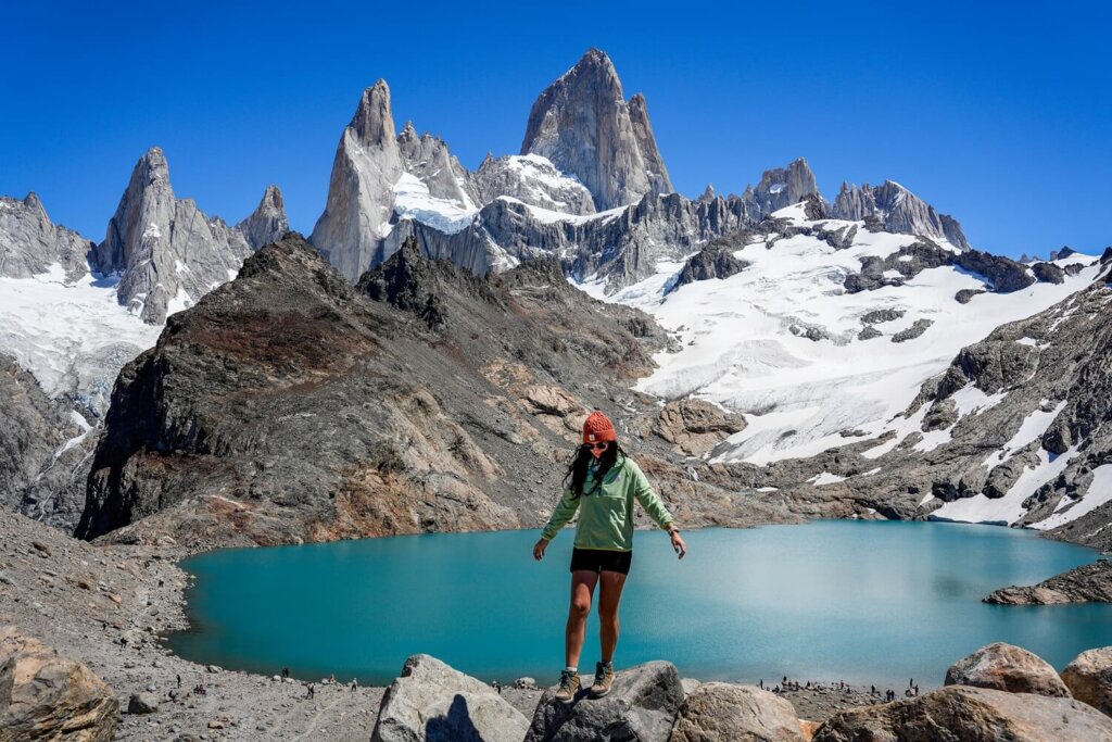
Laguna de los Tres is the most popular hike in El Chalten. The trail takes you from the town to the shores of the turquoise-blue lake at the base of Mount Fitz Roy. It’s a 22 km (13.7 miles) long out-and-back trail, so you’ll need a whole day to complete it.
Along the path, there’ll be many beautiful viewpoints, such as Mirador Rio de las Vueltas shortly after passing the trailhead. Then you’ll also pass Mirador Fitz Roy before heading through the valley with the mountain in front of you the whole time. Eventually you’ll reach Poincenot Campsite where many hikers camp for the night. From here, you’ll have just over 1 km remaining of the trail (one-way) but it’ll be the hardest part of the entire trek, with an elevation gain of 400 m. Once you get through this part, you’ll be treated to some incredible views of Laguna de los Tres and Mount Fitz Roy before returning to El Chalten.
10. Laguna Sucia
- Distance: 22 km / 13.7 miles (out-and-back)
- Elevation: 764 m / 2,507 ft
- Trailhead: Sendero Fitz Roy Car Park
Laguna Sucia is the adjacent one to Laguna de los Tres and you can actually see both lakes if you walk a little higher up the ridge from the Laguna de los Tres viewpoint. (It’s called Mirador a la Laguna Sucia on Google Maps). However, if you also want to head down to its shores, you’ll need to follow the path that goes left at Poincenot Campsite.
If you set off early enough and have the energy, you can visit the shores of Laguna Sucia, Laguna de los Tres and even the shores of Laguna Piedras Blancas or the viewpoint in one day. The extra de-tours will add km’s quickly though, so bear that in mind when planning your route.
11. Loma del Pliegue Tumbado
- Distance: 19 km / 12 miles (out-and-back)
- Elevation: 1,132 m / 3,714 ft
- Trailhead: Los Condores Trailhead
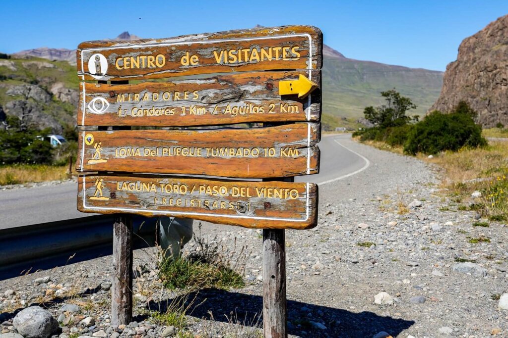
If you’re after a challenging full-day hike that’s less popular, Loma del Pliegue Tumbado will be an excellent choice. You’ll start off at the same place you would for the Los Condores and Las Aguilas viewpoints. However, at the first fork you’ll need to follow the path to the right. The footpath follows the same route as the Huemul Circuit for a while. You’ll be going in and out of the forest and through the flat Pampa de las Carretas. After taking the subsequent right fork, the hike will get pretty steep with a lot of switchbacks.
Unfortunately, even though we spent 5 days in El Chalten, we just didn’t have enough time to fully recover after completing the Laguna de los Tres and Laguna Torre trails to also squeeze this one in. It would’ve been a fantastic trail to do though.
12. Huemul Circuit
- Distance: 65 km / 40 miles (loop)
- Elevation: 3,378 m / 11,085 ft
- Trailhead: Los Condores Trailhead
- Time: 4 Days
For those after a challenging multi-day trek, the Huemul Circuit is the one you should consider. It is not a beginner friendly multi-day trek though, so you should only consider it if you have plenty of long distance, multi-day trekking experience, a great level of fitness, good navigation skills and the right gear. It actually includes a Tyrolean traverse, which is definitely not for the faint hearted.
Your reward will be an incredible adventure through Patagonia that you’ll never forget. This route includes views of the South Patagonian Ice Field, the world’s third-largest ice field (after Antarctica and Greenland). If we ever were to return to El Chalten after gaining more experience, we would definitely try to attempt this trek.
FAQs on Hiking in El Chalten
Below we’ll answer a few questions you may have before hiking in El Chalten. For more detailed information, read our Complete El Chalten Travel Guide.

Final Thoughts on the Best Hikes in El Chalten
Hiking in Patagonia was always a big dream of ours and El Chaten definitely exceeded our expectations. We were also quite lucky with the weather and had some incredibly sunny and clear days with minimal wind. If not for the high cost and some slight time constraints, we could’ve easily spent a few weeks there trying to complete some of the lesser known trails. However, even the popular trails were totally worth it and we can appreciate why they are so popular.
Have you ever done any of these hikes in El Chalten before? If so, let us know what your experience was like? If you found this blog post useful and want to show your support, you can buy us a coffee here.
Now, let your adventure begin,

Remember…It all starts with a Pin…




We were in El Chaltén only a few weeks ago and it was one of my favorite places in Argentina! The Mirador de los Condores hike and of course the one with views on Fitz Roy were my favorite:) This poet brings up great memories!
We also really loved El Chalten. All the hikes were fantastic and just wish we had more time to do a few more trails.
I’m saving this for my next Argentina trip! Didn’t get to visit El Chaltén last time, but would love to visit next time.
I hope you can visit Argentina again and get to hike in El Chalten.