

A Guide to Hiking Laguna Esmeralda in Ushuaia

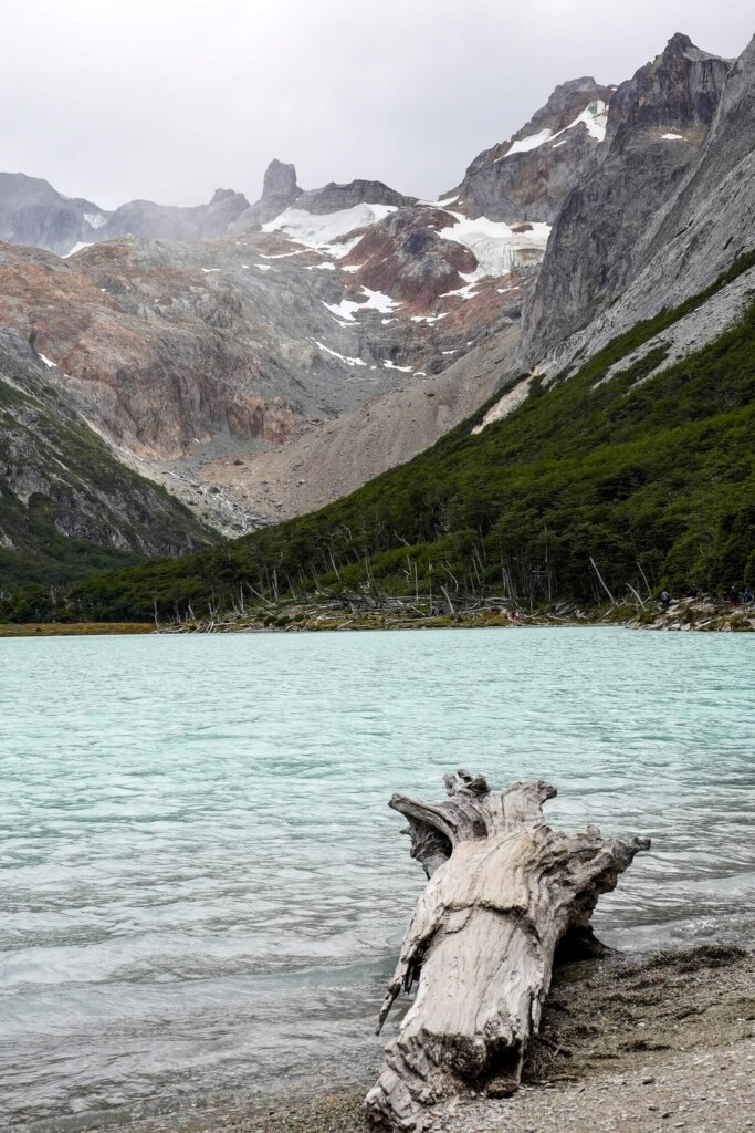
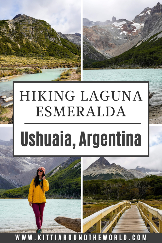
Laguna Esmeralda is one of the most beautiful – and also most popular – hikes around Ushuaia. It’s a fantastic day hike option if you wish to do something active outside of Tierra del Fuego National Park. The trail takes you through the beautiful Tierra del Fuego landscape before reaching the stunning turquoise-green lagoon surrounded by snow-capped peaks and the Ojo del Albino Glacier.
In this guide, we’ve collected everything you should know before attempting the trail, including its length, difficulty and other practical information, such as the best time to hike it, what to wear and what to expect from the trail.
If you’d like to see the hike, make sure to watch our Ushuaia video, which we shared on our YouTube channel Kitti and Jon. For more videos from the country, check out our Argentina playlist.
Disclosure: This post may contain affiliate links, which means we may receive a small commission if you click a link and purchase something. Clicking these links won’t cost you anything, but it will help us to keep this site up and running! Learn more about our affiliate policy.

About Laguna Esmeralda in Ushuaia
Laguna Esmeralda is a beautiful glacier lake about 18km (11 miles) northeast of Ushuaia, just off Ruta 3 in the Tierra del Fuego province.
The lagoon is fed by Glaciar Ojo del Albino and surrounded by some impressive peaks of the Fuegian Andes, such as Cerro Domo Blanco (1,172 m) and Cerro Bonete (1,137 m).
Read Next: Things to do in Ushuaia
Map of Laguna Esmeralda Hiking Trail
Quick Hiking Trail Statistics:
- Trailhead: Small car park at the start of Valle de los Lobos
- Trail Length: 9 km / 5.6 miles (Out-and-back)
- Elevation Gain: 264 m / 866 ft
- Highest Point: Laguna Esmeralda (400 m / 1,312 ft)
- Level of Difficulty: Easy to Moderate (fitness level dependent)
Laguna Esmeralda Hike Statistics
Length of the Laguna Esmeralda Hiking Trail
The Laguna Esmeralda hike starts from this car park just off Ruta Nacional 3. From here, it’s a 9 km (5.6 mile) long out-and-back trail.
It took us about 1.5 hours to reach Laguna Esmeralda from the trailhead. Then we spent about an hour at the glacier lake, enjoying the views and having our packed lunch. The way back was quicker, only taking us an hour to get back to the car.
Depending on your speed, weather conditions and how long you wish to spend at the lake, we suggest allocating around 4 to 5 hours for this hike.


Level of Difficulty of the Laguna Esmeralda Hiking Trail
On AllTrails, this route is marked as moderate, although if you have plenty of hiking experience and a good level of fitness, then you may find this trail more on the easy side.
The total elevation gain along the Laguna Esmeralda trail is about 264 m (866 ft). You’ll gain the majority of this just before you reach the lake.
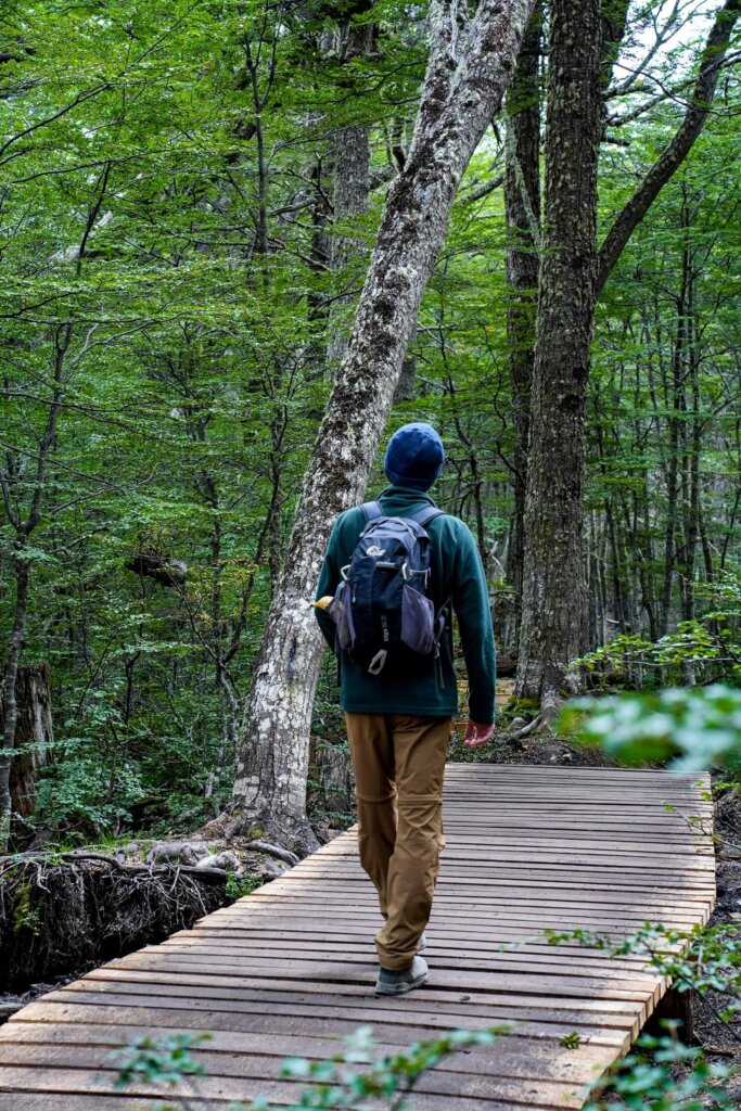
The trail can be muddy and slippery through the forest sections and a bit more rocky towards the end when you follow the river. There’s also a huge boggy area midway through, however there is now a wooden walkway which makes getting through this section much easier.
Another thing to bear in mind is the weather conditions. You’re in Patagonia and within the Andes Mountains, so always be prepared for a quick change in conditions. If it’s a particularly windy day, walking through the lenga forest can be a bit scary, with the trees constantly moving and falling easily. Out in the open section, you won’t be able to escape the elements either. Clouds can also roll in and out, obstructing the views once you reach Laguna Esmeralda.
Laguna Esmeralda Hike: Route Description
Section 1. Lenga Forest
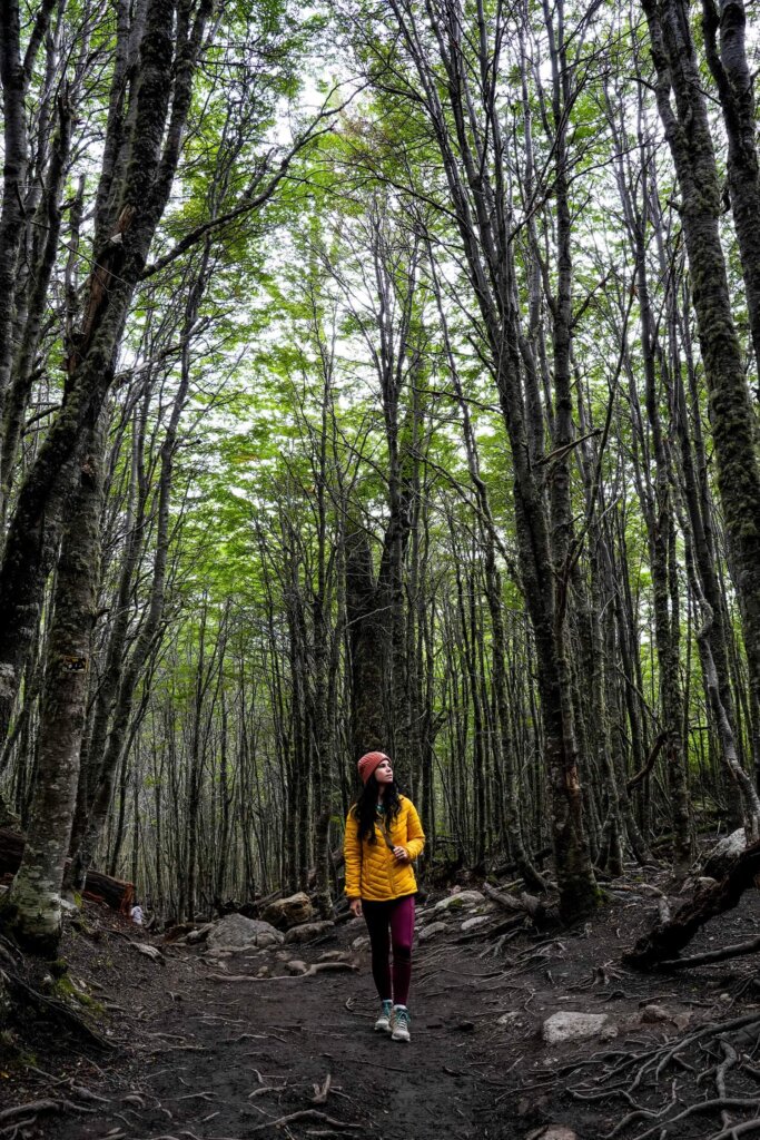
This first section of the trail is about 1 km (0.6 miles) long and will take you through a lenga forest with tall, thin trees. On a particularly windy day, the trees will sway and let out creaking sounds, similar to what you would expect from a horror movie. Do be careful though, as branches can snap quite easily and the least thing you want is a tree falling on you.
Just make sure to follow the blue or yellow/white markers displayed on the trees, as the very first few metres of the trail can be a bit confusing.
The path itself will get slightly wider and it’ll be rocky with tree-roots jutting out. Wearing appropriate footwear is also essential, as the trail can be quite muddy. As we emerged from the lenga forest, we arrived to a small clearing where we saw tree trunks in the lake and some of the mountain peaks in the distance.

Section 2. Peat Bog and Wetlands
This next section will take you through a lovely but very boggy area of the Carbajal-Tierra valley. It is actually one of the largest peatbogs in South America, stretching for about 20 km (12 mi). Luckily, they’ve built a wooden boardwalk across the bog, so you don’t need to navigate through it. This was a relief, as we could enjoy the views of the mountains surrounding us in the valley instead of watching our feet to avoid sinking into the bog. Plus, this also helps to protect the peat moss, which would get destroyed by the number of people walking on it.
Just before entering the forest once again, we got a closer look at the Esmeralda River and a massive beaver dam across it. Unfortunately, beavers are a huge problem in Tierra de Fuego, as they aren’t native to the area. In fact, they were only introduced in 1946 but since they have no natural predators here, their numbers have increased significantly.
Section 3. Native Primary Forest & Peat Bog / River
After passing the river with the massive beaver dam, you’ll enter the native primary forest section of the trail. Here, you’ll gain the majority of the elevation along this hike, so take it easy. The path zig-zags steeply through the forest until it comes out onto another peat bog section.
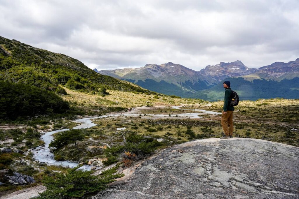
From here, we could see the mountain peaks in front of us as we followed the meandering river, which had the same colour as Esmeralda Lagoon. There was another boardwalk first before we had to follow the rocky path along the river.
Initially, the trail was flat, which was welcome after the steep uphill through the forest. However, we soon had to climb up a smaller hill before reaching Laguna Esmeralda. Don’t forget to turn around when you reach the top, because the views are stunning. From this point, you will pretty much be at Laguna Esmeralda.
Section 5. Laguna Esmeralda
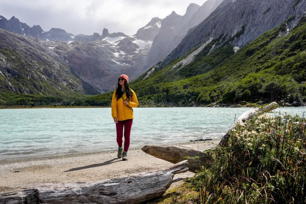
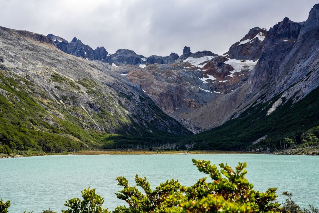
Laguna Esmeralda is such a stunning spot in Tierra del Fuego. The glacier lake gets its beautiful colour from the sediments of the Ojo del Albino Glacier. It’s also surrounded by mountain peaks and the glacier as a backdrop. You can even walk around the entire lagoon if you want to, which is about 1.5 km (1 mile). This will also allow you to get away from the crowds.
It was way cooler and windier at the lake compared to the rest of the hike. We found a more sheltered spot within the trees to have our picnic, but you can also relax on the beach if the weather is nice. We spent almost an hour there watching as the clouds rolled in and out, rapidly changing the visibility. Once you’re ready to leave, just follow the trail the same way you came back to the car park.
Practical Information on the Laguna Esmeralda Trail in Ushuaia
How to Get to the Laguna Esmeralda Trailhead
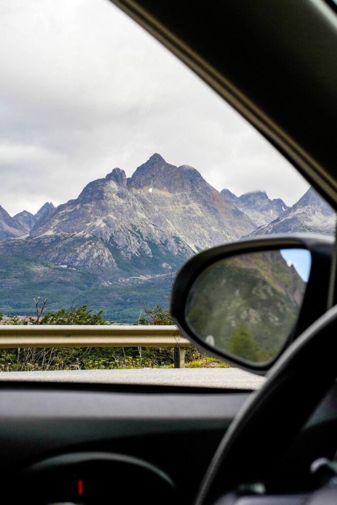
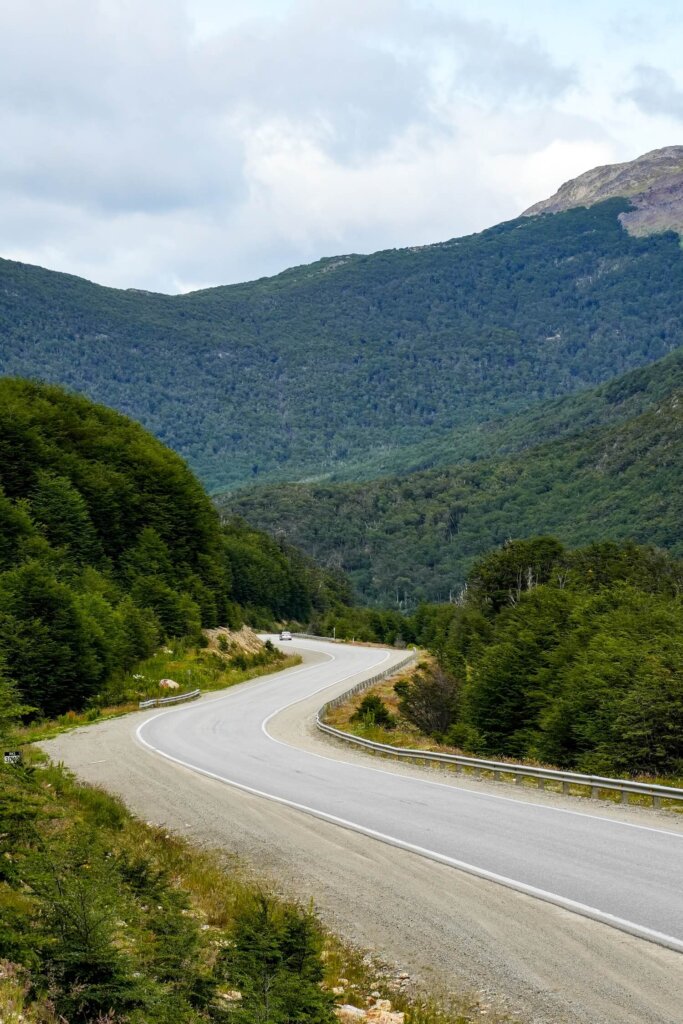
Hire Car. We decided to hire a car for a few days in Ushuaia, which allowed us to drive to the trailhead as early as we wanted to. We also stopped at a few viewpoints along the way and visited Tierra del Fuego National Park the following day. If you also wish to hike Laguna Esmeralda in your own time, we recommend renting a car.
Shuttle Bus. Another option for reaching the trailhead independently is with a shuttle bus. This company offers a round-trip transport service from Ushuaia to the trailhead. At the time of writing, the shuttle departs at 10AM, 11AM and 12PM, and returns at 3PM and 5PM to the city. They also pick you up and drop you off at your accommodation, which is very convenient.
Group Tour. If you’re short on time, or don’t want to do the hike independently, then we suggest booking this organised hiking tour. It includes transfers to and from your hotel and you’ll be accompanied by a guide along the whole trail, as well as be provided with a packed lunch.
If you wish to include a hike up to Ojo del Albino Glacier, we suggest booking this guided hiking tour.
Laguna Esmeralda Day Tours
Should You Hike Laguna Esmeralda Independently or with a Guide?
You can totally hike the Laguna Esmeralda trail on your own. The path is well signposted and easy to follow. There are always people on the trail, so you’ll never feel alone if you need any assistance.
That said, if you’re not a confident hiker, or just want to enjoy the trail with like-minded others, then consider joining a guided group hike. Guides can help you along the way and also point out some interesting flora and fauna. We would also likely go with a guide if we wanted to hike up to Ojo del Albino Glacier, or if we were visiting Ushuaia in the winter season.

Best Time to Hike to Laguna Esmeralda
The best time of the year to hike to Laguna Esmeralda is between November and March. This is late spring, summer and early autumn in Argentina. During this timeframe, you’ll have more chances of dry, clear and warmer days, with plenty of daylight hours. On the other hand, the summer is also the high tourist season in Patagonia, so expect the trail to be more crowded. For this reason, we suggest setting off earlier if you want to do the hike with less people on the trail.
Always check the weather forecast before you set off and be prepared for conditions to change quickly.


What to Wear and Bring with You
Clothing and Footwear. Wear season-appropriate clothing and footwear. When we did this hike at the start of February, it was on a sunny day, although it got much cooler and windier at the lake. Therefore, make sure to wear layers so you can adjust to the conditions. You can wear either shorts or long trousers depending on what you feel more comfortable in. We still suggest taking a fleece and / or a rain jacket. In terms of footwear, try to wear hiking boots or shoes with good grip.
Food and Drinks. Have plenty of drinking water because you’ll be drinking more on the way up. Don’t forget to pack some snacks and a packed lunch to help re-fuel your body. Also make sure to leave no trace and bring all your rubbish back with you!
Additional Items. Make sure to have enough SPF on you as the sun can be pretty strong. Take a hat and sunglasses for extra protection as well. The descent and ascent can be tiring on the knees, so you might want to use hiking poles.

Where to Stay in Ushuaia
Even though Ushuaia is often referred to as “the city at the end of the world”, there are still plenty of accommodation options available. Below are some of our favourites:
- 🛏️Hosteria y Restaurante America ($). This hotel is located a short walk from the centre and offers comfortable rooms and free parking if you have a hire car. Breakfast is also included.
- 🛏️Australis Apartamentos ($). If you’re staying in Ushuaia a bit longer, then this is a great one bedroom apartment with a fully equipped kitchen. It’s also right in the centre of the city, close to all amenities.
- 🛏️Original House Hotel Boutique ($$). This hotel is just outside the centre. It has spacious rooms with sea or mountain views and each room includes a kitchenette and breakfast.
- 🛏️Arakur Ushuaia Resort & Spa ($$$). For the ultimate luxury experience, consider staying at this 5-star hotel located in Cerro Alarken Natural Reserve. Perched high on the hills, you’ll get some incredible views across Ushuaia, the Beagle Channel and surrounding mountains. They have their own restaurant, spa and other facilities. We spent 2 nights here before our expedition cruise to Antarctica and summarised our experience staying at the Arakur in this post.
Final Thoughts on Hiking to Laguna Esmeralda in Ushuaia
Hiking Laguna Esmeralda was a lovely day trip from Ushuaia. Luckily, the trail wasn’t crazy busy when we did the hike, although since it’s a free hike close to Ushuaia it can get pretty crowded. Whilst it got colder at the lake, we still had a fantastic time on the trail, with lovely views along the way.
Have you ever done this hike before? If so, let us know what your experience was like? If you found this blog post useful and want to show your support, you can buy us a coffee here.
Now, let your adventure begin,

Remember…It all starts with a Pin…



The hike looks absolutely amazing! I’d love to try it one day.
Thanks for sharing Kitti. Looks like a doable hike! 👍