Helvellyn via Striding Edge, Lake District – A Complete Guide
In this blog post you’ll find everything you need to know about hiking up Helvellyn via Striding Edge and Swirral Edge in the Lake District National Park.
Hiking Helvellyn via ‘the edges’ is a very iconic and popular hike in the Lakes. Being the third highest point in England, you can bet the landscape will be magnificent and views will get better and better as you climb higher. This particular trail also involves some Grade 1 scrambling which just makes the hike even more fun.
If you’d like to see our Helvellyn via Striding Edge ridge hike then make sure to watch our YouTube video by clicking here.
Disclosure: This post may contain affiliate links, which means we may receive a small commission if you click a link and purchase something. Clicking these links won’t cost you anything, but it will help us to keep this site up and running! Learn more about our affiliate policy.
About the Lake District and Helvellyn
Covering 2,362 sq km, the beautiful Lake District is England’s largest National Park. It was established in 1951 and in 2017 it was designated as a UNESCO World Heritage Site.
Fun facts about the Lake District:
- The Lake District contains all the land in England that is more than 3,000 ft (914m) above sea level.
- At 74m (243 ft) it’s home to Wastwater, England’s deepest natural lake.
- With 16km (10.5 miles) it’s also home to the longest natural lake in England, called Windermere.
- Although the national park is called the Lake District, it only has one official lake (Bassenthwaite Lake). Everything else is called ‘meres’ or ‘waters’.
- With nearly 16 million visitors each year, the Lakes is the most visited National Park in the UK.
After Scafell Pike (978m (3,210 ft)) and Sca Fell ( 964m (3,162 ft)), at 950m (3,114 ft) Helvellyn is the third highest point in England. Since all these peaks are located in the Lake District, it’s also the third highest point in the National Park.
Did you know? – Just to prove how adaptable modern aircraft are and to show that they can land in strange places, in 1926 a small airplane landed on the summit of Helvellyn. There were two initial attempts (15th December and 21st December) before Bert Hinkler made another attempt on 22nd December.
On that day he successfully landed the two-seater biplane. Apparently landing the plane wasn’t an issue. The difficulty was actually the uphill take-off. The plane didn’t have enough airspeed at the start and dived off the edge before it luckily picked up speed again just missing Striding Edge. It then successfully returned to Manchester.
How to Get to Helvellyn
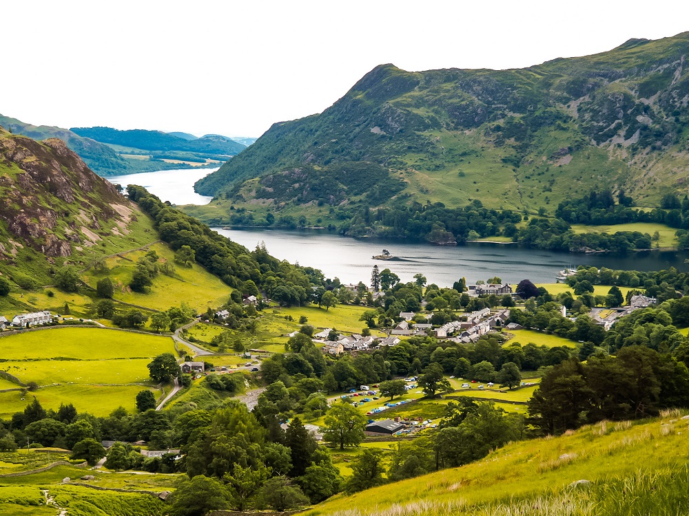
By Car: Helvellyn is located to the southwest of the village of Glenridding. The most convenient place to park is at the car park just off the A592 in the centre of Glenridding adjacent to Ullswater Information Centre. It costs £8 for 9 hours of parking. You have to pay the charges between 9am to 6pm, but we could park there earlier. Whilst it’s a big car park, I suggest you arrive early to secure a spot for the day.
If you don’t have your own car but would like to enjoy the freedom of a private vehicle then you can always hire a car to visit Helvellyn.
By Public Transport: You can also arrive to Glenridding by bus. Buses 208 and 508 provide hourly services to Penrith and two hourly services to Patterdale and Windermere. The bus stop is located along Greenside Road, adjacent to the car park, from where you can start your walk.
If you’re coming from further afield, I recommend getting a train to Windermere, from where you can take Bus 508. Hourly trains run between Windermere and Oxenholme Lake District. From Oxenholme Lake District station it interchanges to other services so you can travel further afield. Make sure to plan your journey with Trainline which also provides information on bus fares.
Practical Information Before Hiking Helvellyn via Striding Edge
Hiking Route Map
Helvellyn via Striding Edge Hike Stats:
- Trail length: 13 km / 8 miles
- Trailhead: Glenridding Car Park (Post code: CA11 0PD)
- Summit of Helvellyn: 950m / 3,114 ft
- Elevation Gain: ~800 m / 2,654 ft
- Level of Difficulty: Moderate to Difficult
Length of the Helvellyn via Striding Edge Hiking Trail
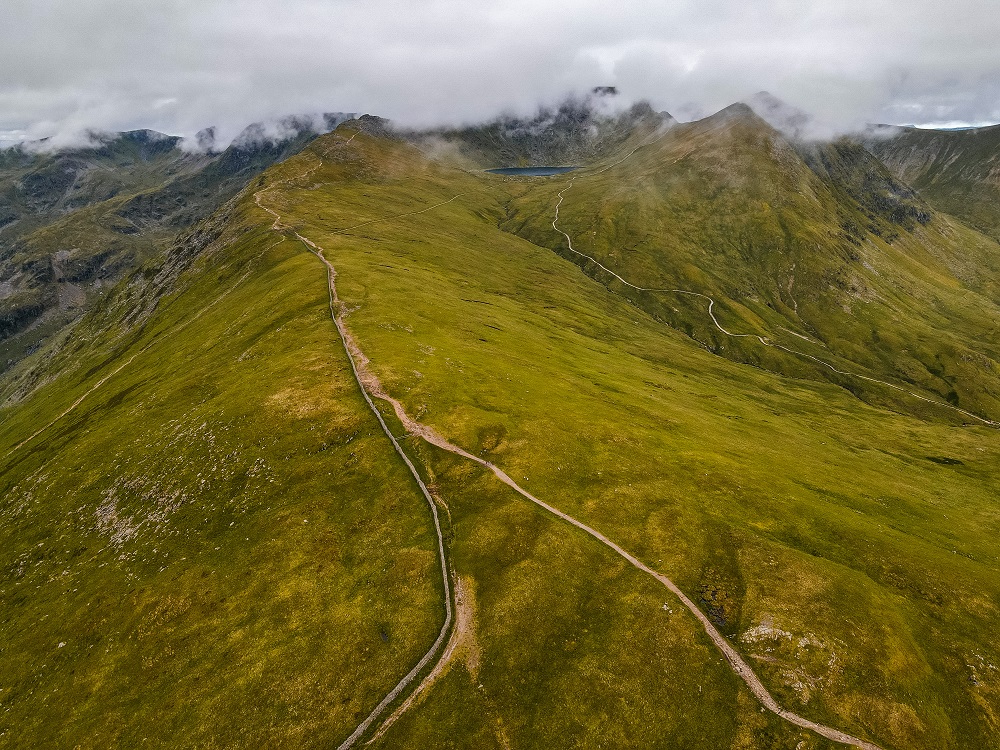
This Helvellyn via Striding Edge and Swirral Edge hiking trail is a 13km (8 miles) long circular route. Depending on your speed, how long it takes to walk along Striding Edge and Swirral Edge, and how long you’re spending on top of Helvellyn, this route could take between 5 to 7 hours to complete. The scenery is stunning, so you’ll inevitably want to stop every 5 minutes to admire it, and also to catch your breath.
For reference, we got to Glenridding around 7:30AM. The first part might take you a bit longer since it’s all uphill. We just tried to enjoy the scenery and stopped regularly. At the end, we completed the walk around 3PM.
I would definitely allow enough time to complete this particular walk and suggest starting earlier rather than later. If you’re buying a parking ticket, I recommend paying for all day parking so you’re not in a rush.
Level of Difficulty of the Helvellyn via Striding Edge Hiking Trail
I would personally rate the Helvellyn via Striding Edge route as moderate to difficult. This, however, really depends on your fitness level, scrambling/hiking experience and even the weather conditions.
I think this ridge hike is great if you have been hiking a lot and are trying to gain more scrambling experience. However, I really don’t recommend attempting Striding Edge without any prior hiking experience.
What is scrambling? – Scrambling is somewhere in between walking and climbing. In the UK, scrambles are graded from 1 to 3. A Grade 1 scramble requires you to use both your hands and feet, but it’s the easiest one you can do. Grade 2 and 3 are closer to proper rock climbing, where you will most likely require the use of a rope. Needless to say that Grade 3 scrambles are the hardest and you need to have proper experience.
The length of the trail might not seem too long, but there are many steep sections straight from the start. Walking along both Striding Edge and Swirral Edge will require you to be alert and focused at all times which can tire you out quicker. Even after completing the ridges you need to watch your steps as you make your way back to the car along the rocky path. For reference, I slipped and fell twice along this straight but rocky route.
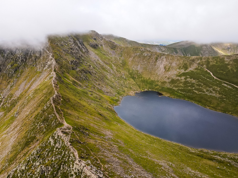
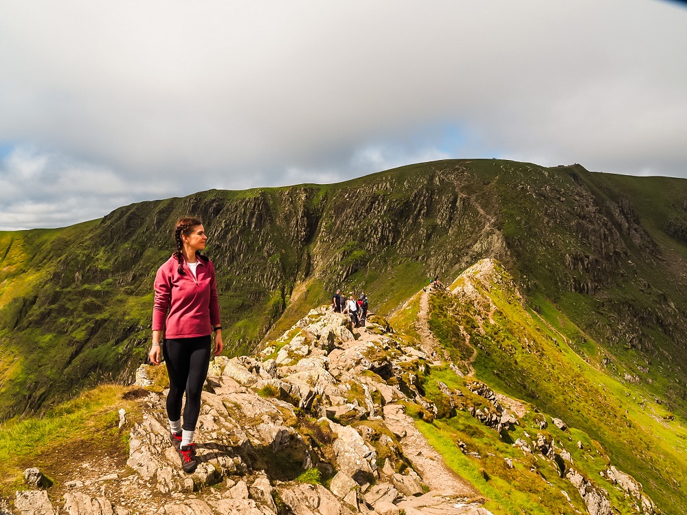
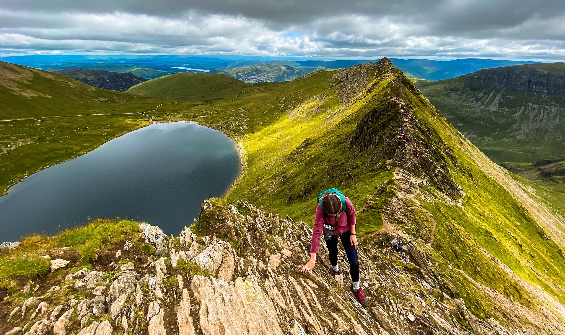
To complete Helvellyn via Striding Edge, you also need to have a head for heights. The ridge is relatively narrow and exposed. Unlike Crib Goch, Striding Edge has a slightly easier path you can switch between just below the ridge.
Top Advice – Whilst you’ll have plenty of chances to pass people along the ridge, I would proceed with extra caution. If, for some reason, you get stuck behind a slower hiker please be patient. Even experienced ones could be paralysed with fear or cragfast. If you happen to be the slow one, then make sure to just take your time. Don’t try to rush it because of others as rushing could lead to an accident. The mountain rescue team receives callouts to Striding Edge often.
Best Time to Climb Helvellyn via Striding Edge
You’ll be hiking in the Lake District which is known to be wet and mild. You’ll find that winters here can feel milder, whilst summers can feel a bit cooler. These type of weather conditions are due to the impact of the sea, especially the Gulf stream.
Whilst we all want to have dry and sunny weather conditions on our hike, let’s face it, the Lakes wouldn’t look so lush and have all the beautiful lakes if it wasn’t for the amount of rainfall. Since the weather conditions can change in the blink of an eye, you’ll probably find yourself getting a bit of everything during your visit.
Although you can probably attempt Helvellyn all year-round, I personally recommend planning your hike between the end of spring and start of autumn. Winter can be super rainy, windy, gloomy and snowy so you don’t want to be hiking along an exposed ridge. Low visibility, rain and wind can make any ridge hike more dangerous. You really only need one wrong step!
I believe Helvellyn via Striding Edge is doable in less ideal weather conditions. Nevertheless, I would aim to hike on a relatively clear day, as missing out on the views would be a shame. My biggest advice is to check the weather forecast even on the morning of your planned hike.
Helvellyn will be busier during weekends, bank holidays and school holidays. Therefore, if you’d like to have a quieter experience try to come on a weekday. We completed the hike on a normal Sunday and it wasn’t packed but wasn’t super quiet either. I also suggest starting your hike early in the morning, especially if you’d like to snag a parking spot.
Facilities Around Helvellyn
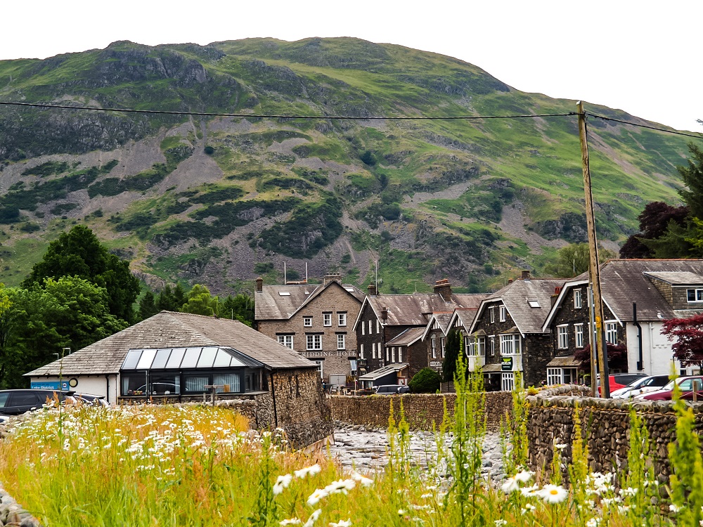
Cafés and Picnic Spots – If you’d like to grab a drink or something to eat after your hike then Glenridding has a good selection of pubs, take-aways and convenience stores. They are only a few minutes walk from the car park. You can also find some picnic tables around Ullswater Information Centre.
However, I highly recommend bringing your own picnic with you. You can find a great spot to eat or have a coffee break anywhere along this walk. The best spots are probably just before you start your Striding Edge ridge section or on top of Helvellyn. You’ll be treated with the most amazing views!
In addition, you can also spend some time relaxing at Red Tarn, especially if you’re in the area for more than a day.
Toilets – There are toilet facilities available next to Ullswater Information Centre. You’ll have to pay 20p to use these facilities. There are no other toilet facilities available along the rest of the trail.
What to Wear and Bring with You?
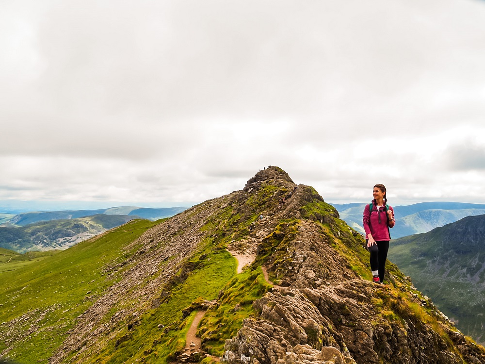
At the time of our visit the weather was a bit cloudy but muggy. Normally the Lake District is rather wet and conditions can change quickly the higher you go. Therefore, I recommend weather appropriate clothing when going on the Helvellyn via Striding Edge ridge hike. You’ll be exposed along the majority of the trail. Therefore, make sure you check the weather forecast before you set off and have a few layers with you. You might feel a bit cooler along the ridge but warmer lower down or whilst your ascending.
Accidents can happen easier if you’re not wearing proper walking/hiking shoes or boots. Therefore, I can’t emphasize enough to wear hiking appropriate footwear when attempting the Striding Edge route. During wetter conditions the rocks can become extremely slippery so you want shoes with good grip. Even the easier paths are pretty rocky so you want shoes with thicker soles.
I also suggest packing your own lunch and snacks and having plenty of water and hot drinks with you depending on the weather. During your ascents you’ll sweat a lot more, so you want to keep hydrated and have enough energy to carry on.
I assume during the summer months many people have a dip in Red Tarn after their hike. So, if you’d like to do the same, then take some swimsuits and towels with you. If it’s a sunny day make sure to have sun-cream on you!
Please Note! – Whatever you bring with you, make sure you either take it home with you or dispose of it responsibly. I suggest bringing a garbage bag with you where you can collect all your waste. (And obviously dispose of it in a bin!) Enjoy your time in nature but Leave No Trace!
Helvellyn via Striding Edge Ridge Hike
You’ll start your hike in Glenridding, then follow the path all the way up to Striding Edge. After completing Striding Edge, you’ll reach Helvellyn. To descend, you’ll scramble down along Swirral Edge. From there, you can walk up to Catstye Cam. Once you’ve descended Catstye Cam you’ll need to follow the relatively flat but rocky path all the way back to Glenridding.
For a more detailed description of the trail, I divided the route into 4 main sections as follows:
1. Glenridding to Striding Edge
From the car park you’ll need to walk out to the A592, cross the bridge across the stream and turn right onto the first road. You want to be on the left hand side of Ulls Water. You’ll pass Glenridding Village Hall on your right. Soon you’ll walk past Gillside Camping and Caravan Park which should be on your left. At the crossroads, take the road on your left. The tarmac will become gravel soon where you should keep to your right. The path will split again, so you should keep to your left, before another split. Here, keep left again.
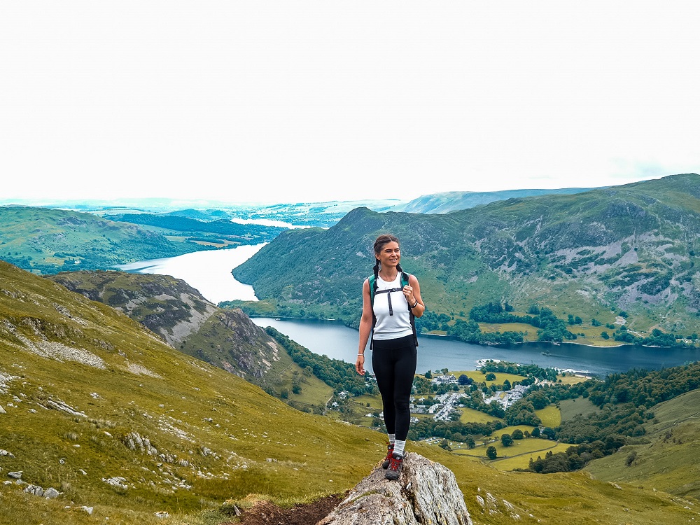
From that point you’ll start your 700m ascent to the hill of Birkhouse Moor. As you climb higher and higher through the open area, make sure to stop regularly and look back. You’ll have a fantastic view of Ullswater and the village of Glenridding behind you. In front of you the iconic view of Striding Edge, Swirral Edge and the Red Tarn should appear slowly.
Soon after passing Birkhouse Moor, you’ll come to some ladders that you have to climb over to get through the stone wall. This section is called ‘Hole-in-the-Wall’ which also marks the start of Striding Edge. Just before you start the ridge walk you can just stop in this area for a quick coffee and snack break. You can enjoy the views of Ullswater in front of you, the valley to your right and Striding Edge, Helvellyn and Swirral Edge behind you and to your left with Red Tarn in the middle.
2. Striding Edge to Helvellyn
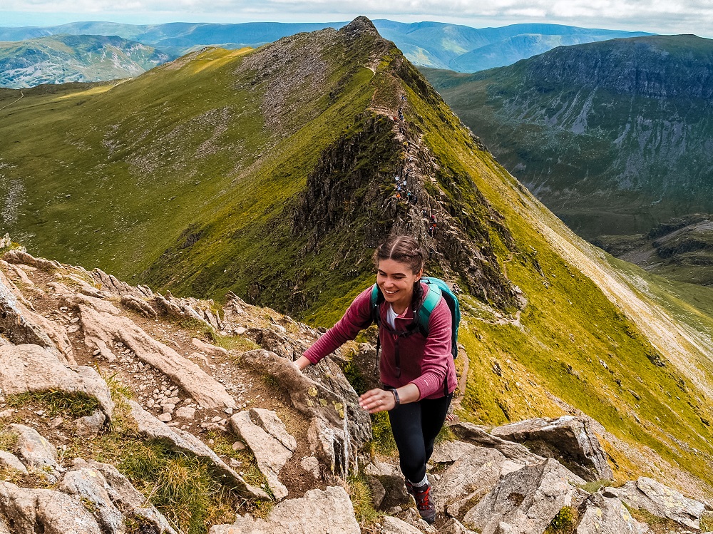
Once you’re ready, you can start climbing Striding Edge to Helvellyn. If you love scrambling then I recommend you going for the crest. Although the views are breathtaking, make sure to pay attention to your steps. Stop for a few seconds if you’d like to enjoy the view.
Top Tip – Always check if the rock is stable before you fully step on it.
If you’re unsure or the weather conditions aren’t great you can take some of the easier paths that skirt around the crest. You can always mix and match depending on how you’re feeling.
Once you’ve done Striding Edge, there will be a big and steep climb to reach Helvellyn.
Top Tip – This is the iconic spot where most people take their photos since it has a stunning view of Striding Edge. Make sure to snap a few of you too.
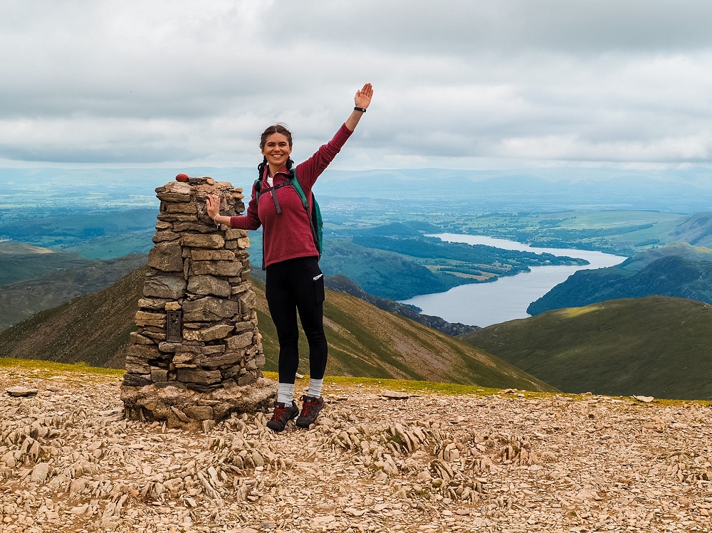
After the steep climb, you’ve reached the summit of Helvellyn. It’s a broad plateau that slopes to the south-west, but drops steeply to the north-east to Red Tarn. The views from here on a clear day are amazing so I suggest spending a little more time on the top. Have your lunch, snack and some coffee up here and have a little wander around. But make sure not to stand too close to the edge especially on a windier day!
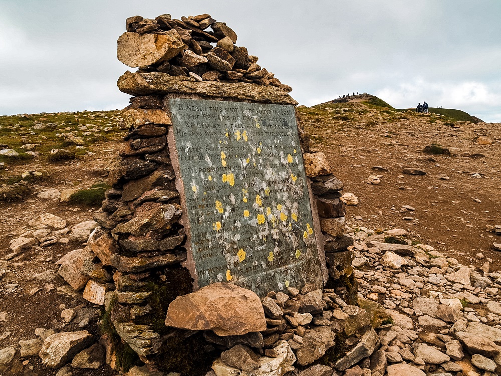
Did you know? – As you reach the top, you’ll pass a memorial, which isn’t the easiest to read. It’s a memorial to Charles Gough who fell from Helvellyn and unfortunately died back in 1805. His dog, Foxie, guarded his owner’s body until his skeleton was found about three months after the accident.
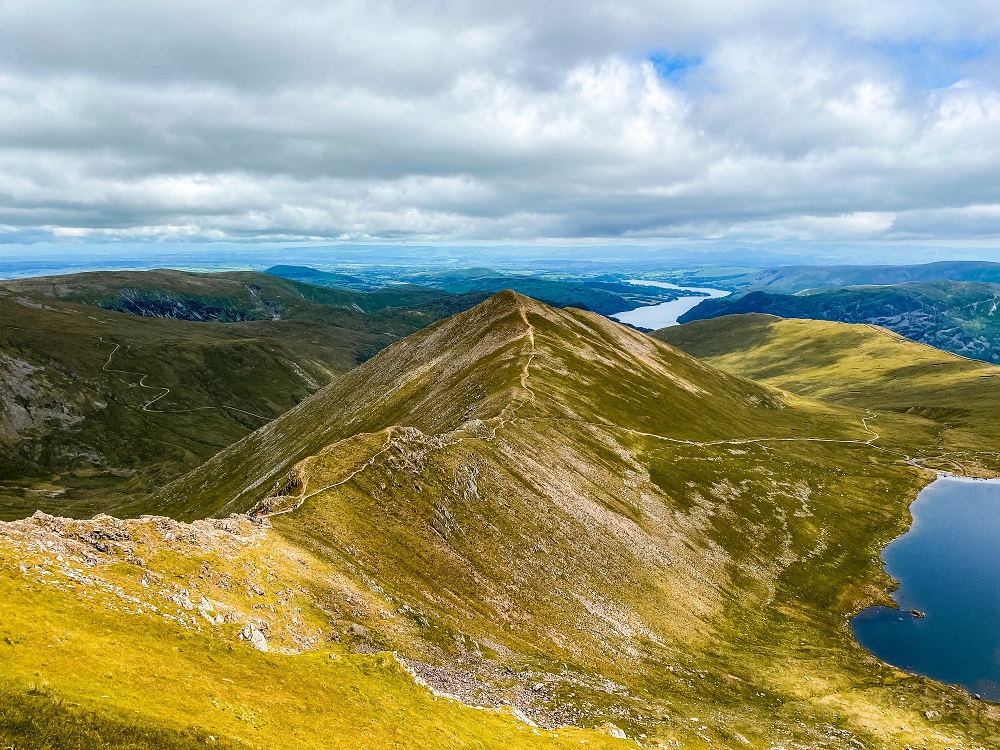
3. Helvellyn to Catstye Cam via Swirral Edge
After enjoying the views from Helvellyn, slowly make your way down via Swirral Edge. Whilst Swirral Edge is much shorter than Striding Edge, I would still treat it with respect. You’ll still need to be cautious and have your full attention on your steps.
After the short descent, you’ll walk along a relatively flat path with Red Tarn on your right. You’ll come to a crossroads where you can decide whether to carry on descending or walk up to the top of Catstye Cam. We had enough energy left so we did the short ascent to the peak that stands 890m above sea level.
You get some great views from the top, so I was happy we did this little detour.
4. Catstye Cam to Glenridding
Descending Catstye Cam might be a bit steep so just watch your steps. Once you’re level with Red Tarn carry on along the rocky path that will lead you back to the car park.
Whilst this path seems like a walk in the park, be cautious. The loose rocks can be very slippery and you can slip easily. For reference I slipped and fell twice along this section.
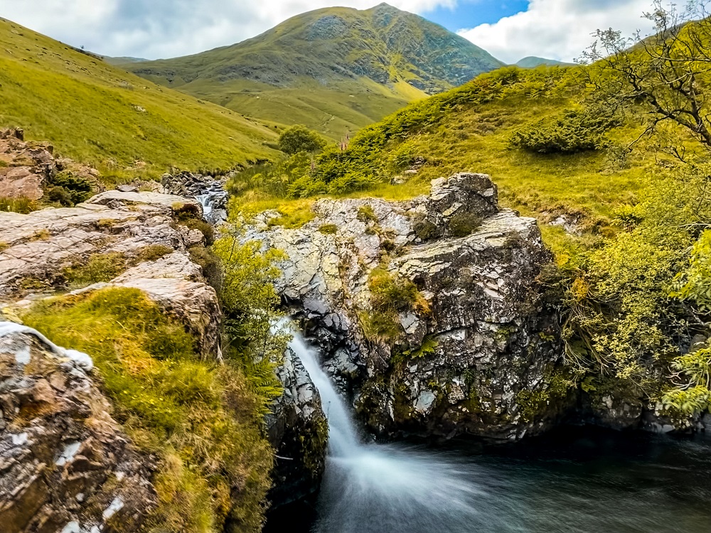
Although this path is a bit monotonous, the scenery around you is beautiful. It will circle around Birkhouse Moor so it’s a relatively long route. However, there are plenty of waterfalls which you can stop at to break up the trail a bit.
After the rocky path, you’ll walk through a section of ferns before you join the path that leads back to the car park. Once you’ve reached your car you have completed the Helvellyn via Striding Edge and Swirral Edge hiking trail.
Additional Ridge Hikes in the UK
If you enjoy ridge hikes and scrambles, I highly recommend checking out the following ridge hike posts:
- Hiking up Tryfan in the Ogwen Valley in North Wales.
- Climbing Snowdon via Crib Goch, Snowdonia, North Wales
- The Ultimate Guide to Hiking the Glyders via Bristly Ridge, Eryri (Snowdonia), Wales
- The Ultimate Guide to Climbing Ben Nevis via Carn Mor Dearg Arête, Scotland
You can also browse for more hiking trails in the UK and around the world in my Hiking Adventures Series.
Final thoughts on the Helvellyn via Striding Edge hike
We thoroughly enjoyed hiking Helvellyn via Striding Edge and Swirral Edge. It’s definitely a great scramble and the views we had were truly amazing. Whilst we personally found the ridge hike fun and not too difficult, I wouldn’t want you to underestimate the mountains.
We were lucky with the weather conditions which obviously made the hike even more enjoyable. However, weather conditions in the Lake District can be unpredictable. Therefore, completing the trail in fog, rain and a strong wind would’ve made the trail less enjoyable and probably more dangerous.
Have you ever hiked up to Helvellyn before? If so, which route did you take and how much of the Lake District did you manage to explore? Let me know in the comments below.
Now, let your adventure begin,

Our Top Travel Resources
Accommodation: For hotels we always use Booking.com and Hostelworld for hostels. We also book longer stays on Airbnb or Vrbo.
Flights: To find the best flight prices we always check Skyscanner, Google Flights or WayAway. Then we also check the airlines’ websites too for comparison.
Car Rentals: We use Discover Cars when we want to rent a car as it compares local, national and international companies.
Activities: If we book organised tours we always check either GetYourGuide or Viator.
Foreign Currency: Whenever we can we prefer to pay in local currency and for that we always use our Wise card. We can easily withdraw money from the ATM or pay by card at most shops and restaurants.
Travel Insurance: We never go anywhere without travel insurance. You never know what will happen on your trip, so good travel insurance like SafetyWing can protect you in case of injury, illness, theft and cancellations.
eSIM and VPN: To get data abroad we use Airalo which is an app that allows you to download a prepaid eSIM to your phone in over 190 countries. Make sure to have a VPN to avoid hackers accessing your personal data when using public WIFI. We use Surfshark which is the only VPN that offers one account on unlimited devices.

What a beautiful hike! This one is definitely out of my reach but I very much enjoyed it vicariously through you. I’ve never heard of scrambles, though that’s probably because we don’t have anything tall enough to scramble in Florida. I wonder if its a thing in the rest of the US or graded here like there.
Thank you Cris I’m glad you enjoyed the post even if you have no previous scrambling experience. I looked it up and you have a similar scrambling grades in the US. Yours is split into 5 if my source is correct and a Grade 3 scramble in the US equals a Garde 1 here in the UK. I hope you can practice some scrambling in the future.
Ah, Helvellyn is up there on my bucket list! But Striding Edge looks so hair-raising! I’m not sure I could manage it! The views look incredible though, what an amazing hike! Thanks for the great guide!
Thank you Hannah, I’m glad you liked it and you would like to climb Helvellyn one day. If you don’t feel like Striding Edge is for you then you can climb it via Thirlmere which is definitely a much quieter path 🙂
I’ve been to the Lake District so many times but had no idea about this hike! We are hoping to head up there in a couple of weeks and couldn’t decide on a hiking trail – I’ll mention this one for sure!
Thank you Krista, I hope you can complete this hiking trail and you’ll have an amazing weather to do it. Let me know how it went!
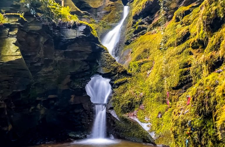
I’ve had the Lake District on my list for quite some time and Im so glad I stumbled upon your write up! I also love the photos you took, especially the picture of the mini-waterfall on your iPhone? The exposure on that photo is fantasitc. Super post.
Thank you Missy I’m glad you liked my post and my photos. iPhones take some pretty good pictures, so I use it very often, especially if I want to take a wide angle photo or have no time to set my camera up 🙂
There seems to be a ton of deep history and interesting geology in this area. I would absolutely love to visit someday!
Thank you so much I’m so happy you found all the history and geology of the place interesting. I hope you can come and visit in the near future.
I have heard of this classic walk/scramble, but have never done it myself. Think it might be something I might try, but only in good and clear conditions. The views are spectacular all the way around! Like the idea of having an alternative route around the trickier bits!
Thank you Karan, I think you would enjoy this trail. I agree I would also time my visit well and pick a nice clear but most importantly dry day. Let me know if you had a chance to complete this hike.
It looks like a beautiful place to hike. Great trail map! A lot of information and good tips and tricks for visitors too.
Thank you Ashley I’m happy to hear that you found my post useful 🙂
What a beautiful hike. Would love to do it, but would need to practice more with hiking and scrambling, since I’m not that fast with scrambling. The views are amazing.
Thank you Cosette, I’m glad to hear that you would like to try this trail. I agree if you’re a bit unsure I would just go out for longer walks to build up your confidence and gain more experience. I hope you can complete this trail soon 🙂
The views are incredible! I definitely need some training before I can make it to the top!
Thank you Denise. Yes this hike definitely requires a bit more experience. Once you built that up I’m sure you’d be able to complete it 🙂
What a detailed guide. I would love to visit The Lake District one day. The views look beautiful.
Thank you Mel, the Lake District is such a beautiful area. You don’t need to go on a ridge hike to enjoy walks and stunning views. You can do many walks around the lakes with breathtaking views. Hope you can visit soon.
Really informative for those unfamiliar with the mountain. Worth noting that in snow and ice (it does happen quite regularly higher up in Winter) the edges are a very different proposition and the scene of many accidents.
Also , spare is thought for others tranquility and leave the drones at home!
Thank you for your comment Andy. I agree, I wouldn’t hike this ridge during the winter without prior experience and proper equipment.