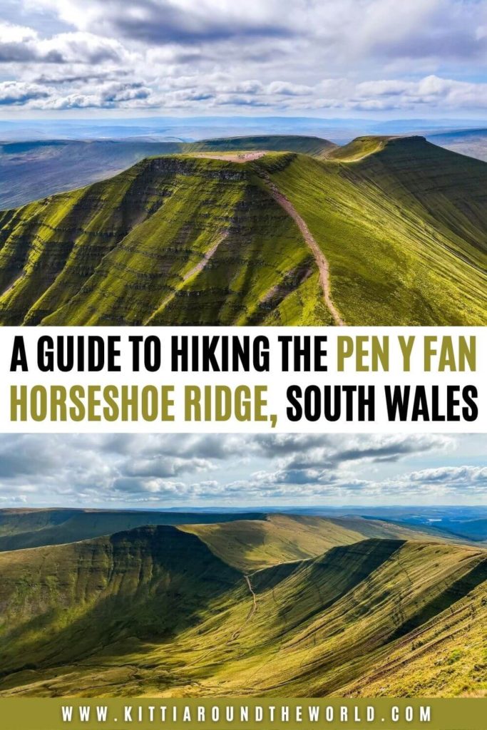
A Guide to Hiking the Pen Y Fan Horseshoe, Bannau Brycheiniog (Brecon Beacons), South Wales
Are you thinking about completing the well-known Pen Y Fan Horseshoe ridge circular hike to reach Pen Y Fan, the highest peak in South Wales? Then you’re in the right place.
Completing the Horseshoe trail has been on our bucket list for a long time. If it’s on yours too then hopefully in this blog post you’ll find everything you need to know about hiking the highest peak in the Bannau Brycheiniog (Brecon Beacons) National Park.
If you’d like to see our Pen Y Fan Horseshoe ridge hike with some amazing drone footage then make sure to watch our YouTube video by clicking here. We completed this hike during our week in Herefordshire. You can also check out our Herefordshire Playlist for more adventures.
Disclosure: This post may contain affiliate links, which means we may receive a small commission if you click a link and purchase something. Clicking these links won’t cost you anything, but it will help us to keep this site up and running! Learn more about our affiliate policy.
Introducing Bannau Brycheiniog (Brecon Beacons) and Pen Y Fan
Bannau Brycheiniog (Brecon Beacons) National Park is one of the three national parks you can find in Wales. It was the last one to be established in 1957 after Eryri (Snowdonia) in 1951 and Pembrokeshire Coast in 1952. It was often referred to as ‘the Brecon Beacons’. Only recently the national park reclaimed its Welsh name: Bannau Brycheiniog, informally ‘the Bannau’. It’s pronounced as ‘Ban-eye Bruck-ein-iog’.
The national park is comprised of the Brecon Beacons mountain range and Fforest Fawr or ‘great forest’ in the centre, the Black Mountain to the west, and the similarly named Black Mountains to the east. I know it can be a little confusing.
Whilst the majority of the national park consists of grassy moorlands, it’s also known for its reservoirs, stunning waterfalls and cool caves. Since 2013 it’s also considered an International Dark Sky Reserve which is an area that restricts artificial light pollution mainly to promote astronomy.
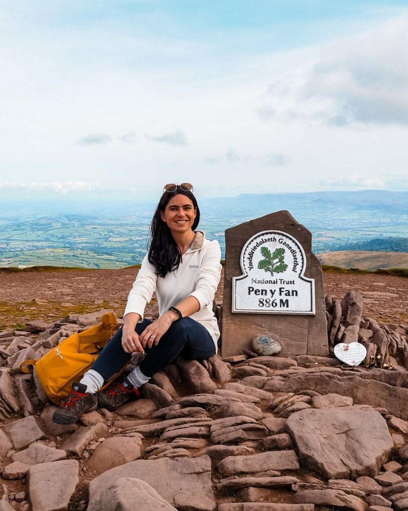
At 886 metres above sea level, Pen Y Fan is the highest peak in South Wales. It’s owned by the National Trust whose aim is to control the erosion that’s caused by the large number of visitors every year. Pen Y Fan is also part of the 159 km long Beacons Way. It’s a long distance route that crosses the national park and passes many iconic landmarks and peaks along the way.
Did you know? – Pen Y Fan’s harsh weather conditions provide an ideal training field for UK Special Forces including SAS and SBS. They actually hold the Fan Dance here which is the fitness and navigation phase of the selection process. Candidates will have to complete a 24 km load bearing march which they have to complete within 4 hours and 10 minutes. Sounds pretty tough!
How to Get to the Trailhead of Pen Y Fan Horseshoe
By Car: The start of the Pen Y Fan horseshoe is to the south of the Lower Neuadd Reservoir (grid ref. SO033180). The most convenient place to park is at Neuadd Car Park (address: Talybont-on-Usk, Merthyr Tydfil CF48 2UT). We parked here for free all day.
In case this car park is full, there are other car parks nearby, which I marked on the map below.
If you don’t have your own car but would like to enjoy the freedom of a private vehicle then you can always hire a car to get to the trailhead.
By Public Transport: Unfortunately there aren’t any public transport options to reach the Pen Y Fan horseshoe trail head. Your only option is to take Bus T4 TrawsCymru and get off at the Storey Arms bus stop. This bus travels to destinations such as Cardiff, Merthyr Tydfil, Brecon and Newton. It’s not super regular and it means that you’ll need to reach Pen Y Fan via ‘The Motorway’. Of course you can still complete the horseshoe but it would add quite a few extra miles onto your route.
If you’re coming from further afield, then plan your journey with Trainline which also provides information on bus fares. In case you travel by train a lot then check if you’re eligible for a railcard to save 1/3 off your journey fare.
Good to Know Before You Go
Disclaimer! – Although this post is all about the Pen Y Fan Horseshoe trail, I decided to quickly run through a few alternative routes you can choose from to reach Pen Y Fan itself.
But before I do that, I’d like to emphasize that we haven’t completed any of these routes. Hence why the below section will only be a quick summary of all the potential routes, their length and elevation. This will hopefully help you decide which route is the best for your level of experience. I dive into the full horseshoe in greater detail after the following section.
Ways to Reach the Top of Pen Y Fan
Depending on your level of experience here are some of the other well-known paths you can choose from:
- Starting from Pont ar Daf car park aka ‘The Motorway’: The quickest and easiest way to reach Pen Y Fan is via the trail starting at the Pont ar Daf car park. It’s a 4 mile trail and only has just under 450m of elevation gain so is very manageable. This path is commonly referred to as The Motorway, and for good reason, as it is by far the most popular route and therefore the busiest. Expect a steady stream of other walkers if you attempt this route!
- Starting from Storey Arms aka ‘The Military Route’: This route is approximately 4.5 miles long with 530m of elevation gain. It starts from Storey Arms Outdoor Centre and you’ll have the chance to climb Corn Du too.
- Starting at Cwm Gwdi car park aka ‘The Quiet Route’: If you want to avoid crowds then consider starting from the Cwm Gwdi car park and following the 7.5 mile ancient track up to Pen y Fan. This route will have around 560m of elevation gain.
There are many trails zig-zagging this area so you can definitely create your own unique way up to Pen Y Fan.
Length of the Pen Y Fan Horseshoe Ridge Hike
The Pen Y Fan Horseshoe ridge hiking trail we completed was approximately 14 km (8.5 miles) long. Depending on your speed, how long it takes you to climb up the peaks and how many breaks you take, this route could take around 6 hours. The scenery is just breathtaking, so inevitably you’ll want to stop often to admire it, and also to catch your breath when you’ve conquered a peak.
For reference, we started our hike between 8 and 8:30AM, got to Pen Y Fan around 11AM and finished the route around 2:30PM. We took our time because the weather conditions were amazing which is very rare in this area. We were also filming and taking a ton of photos that day so we probably completed the trail a bit slower than if you’re constantly walking with minimal breaks.
Top Tip – If you still have some energy to burn, you can also climb up to Fan Y Big. This would add some extra time to your total completion time.
All in all, I would definitely allow enough time to complete this particular walk and suggest starting earlier rather than later.
Level of Difficulty
The level of difficulty for completing the Pen Y Fan Horseshoe ridge walk really depends on a lot of factors. To me personally it was more like easy to moderate especially after completing much more difficult ridge hikes such as Crib Goch and Ben Nevis via CMD ridge. The weather conditions on the day we chose to do the hike were also ideal.
However, I do not want you to underestimate hiking the Horseshoe. The length of the trail might not seem too long, but there are many steep sections straight from the start.
Although I hike a lot, I even struggled to ascend some of the peaks, so make sure to take your time. The weather conditions can also make the route a bit more difficult. Whilst we had a glorious day, the heat definitely slowed us down going uphill. I’m sure climbing in windier or rainy conditions would make your hike more difficult too.
Therefore, I would generally rate the Pen Y Fan Horseshoe ridge hike as moderate to difficult depending on the weather conditions and your level of hiking experience.
Best time to climb Pen Y Fan
The Brecon Beacons are normally cool and cloudy even during the warmer months. During winter the area is wet, windy and cold. Therefore, I recommend completing the Pen Y Fan horseshoe ridge hike during the warmer months like June to August/September.
Having said that, summer months can also be very rainy so you really want to check the forecast. In July 2019, when we completed the Four Waterfall Walk it rained so much that we had to purchase a new phone for my husband as the rain ruined his completely.
Sometimes in Wales spring can be nice too so late April and May might be a good option as well.
Although we were incredibly lucky with the weather in mid September, I believe Pen Y Fan is doable in less ideal weather conditions. However, I wouldn’t attempt completing it in very poor weather conditions with low visibility! I would aim to hike on a relatively clear day, as missing out on the views would be a shame. Plus it’s also safer from a navigational perspective. My biggest advice is to check the weather forecast even on the morning of your planned hike.
Pen Y Fan will be busier during weekends, bank holidays and school holidays. Therefore, if you’d like to have a quieter experience try to come on a weekday. We completed the hike on a normal weekday and we had the majority of the trail to ourselves. Obviously Pen Y Fan itself was a bit busier but nowhere near as busy as, for example, Snowdon was where you had to queue for at least 30 minutes to touch the trig point.
If you can only come during peak times, then I suggest starting your hike earlier in the morning.
Facilities around Pen Y Fan
Pubs, Cafés and Picnic Spots – The closest pubs and cafés are in Brecon. Therefore, I highly recommend bringing your own picnic with you. You can find a great spot to eat or have a coffee break anywhere along this hike. The best spots are probably just before you climb up to Corn Du or Pen Y Fan or atop any of the peaks. You’ll be treated with the most amazing views!
Toilets – The closest public toilets I could find are located at Pont ar Daf Car Park to the south of the Storey Arms. Unfortunately there are no toilet facilities available along this particular route.
What to wear and bring with you?
At the time of our visit the weather was unusually hot. Normally the national park is rather cool, wet and cloudy and the weather conditions can change quickly. Therefore, I recommend weather appropriate clothing when going on the Pen Y Fan Horseshoe ridge hike.
You’ll be exposed along the majority of the trail. Therefore, make sure you check the weather forecast before you set off and have a few layers with you. You’ll feel warm ascending the peaks but it can be windy on the top.
Accidents can happen more easily if you’re not wearing proper walking/hiking shoes or boots. Therefore, I can’t emphasize enough to wear hiking appropriate footwear when attempting this particular route. During wetter conditions the rocks can become slippery and the trail muddy, so you want shoes that are waterproof and have good grip.
Although the trail is easy to follow, make sure to have an offline map or screenshot of your route. Alternatively you can always have the good old paper maps with you.
I also suggest packing your own lunch and snacks and having plenty of water and hot drinks with you depending on the weather. During your ascents you’ll sweat a lot more, so you want to keep hydrated and have enough energy to carry on.
Please Note! – Whatever you bring with you, make sure you either take it home with you or dispose of it responsibly. I suggest bringing a garbage bag with you where you can collect all your waste. Enjoy your time in nature but Leave No Trace!
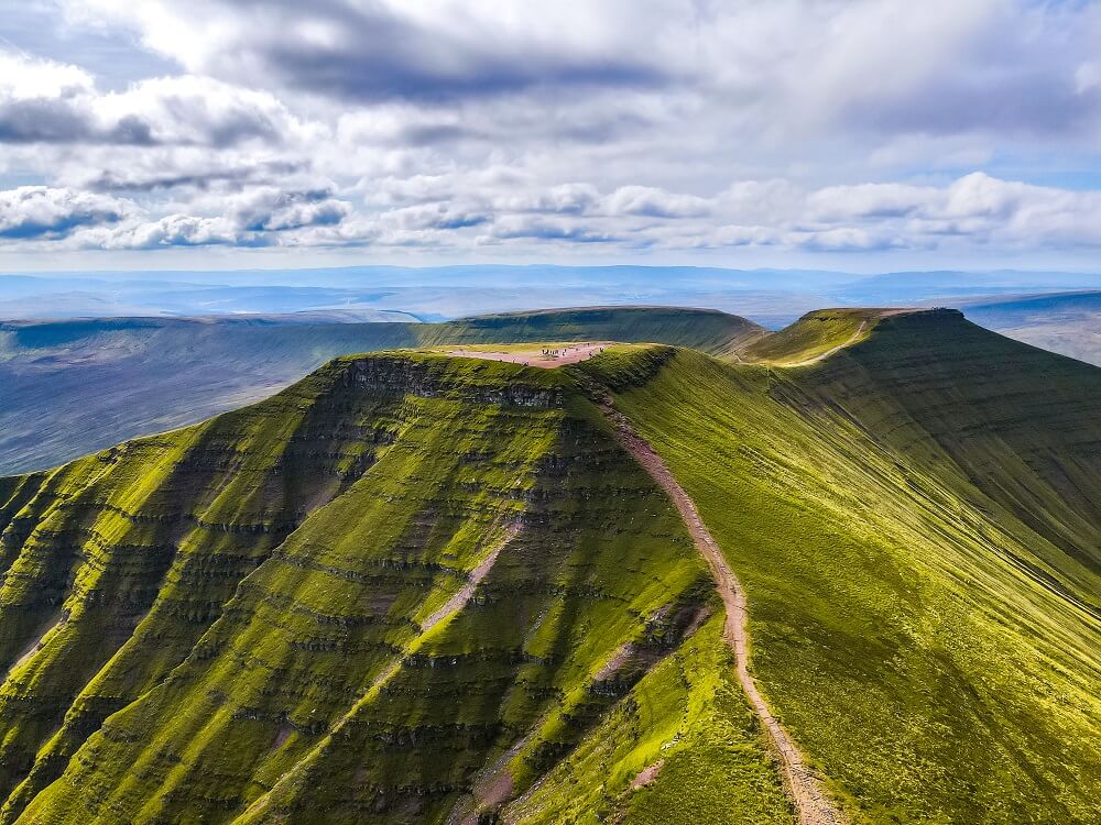
Pen Y Fan Horseshoe Ridge Hiking Trail
You’ll start your hike from Neuadd Car Park from where you’ll follow the trail up to Corn Du. From Corn Du, the trail will lead you to Pen Y Fan. After a descent, you’ll have to ascend another peak called Cribyn. From Cribyn you can either reach another peak called Fan Y Big or just follow the old track road back to Neuadd Car Park.
For a more detailed description of the trail, I divided the route into 4 main sections as follows:
1. Neuadd Car Park to Corn Du
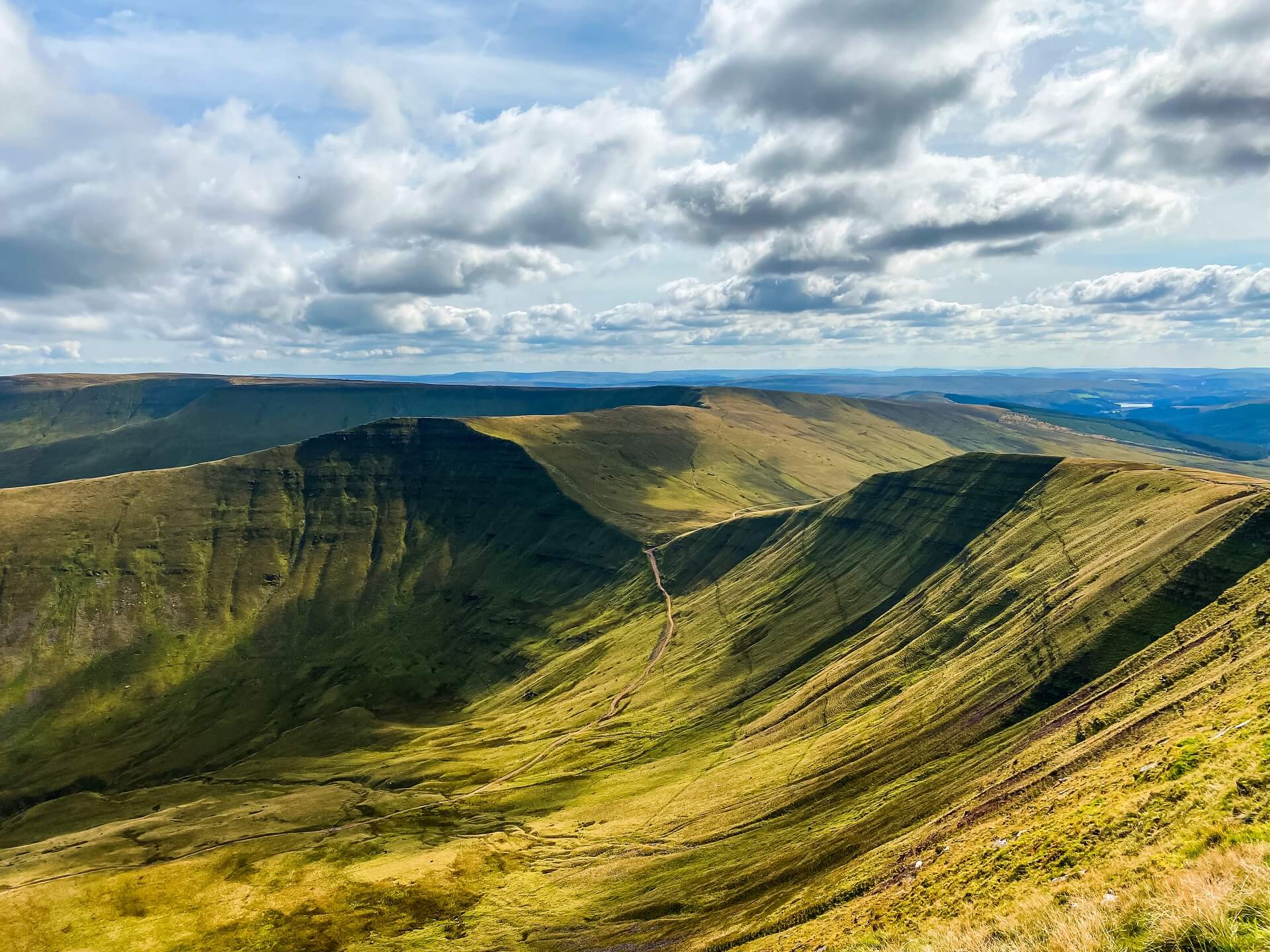
This is probably the longest section of the route but also the easiest (I think). From Neuadd Car Park head to the tarmac road and follow it until you reach the entrance of the now empty Lower Neuadd Reservoir. At the gates, follow the path to your left. You’ll cross a newly built bridge over the river. At this point you’ll have a pretty good view over the route you’ll be taking.
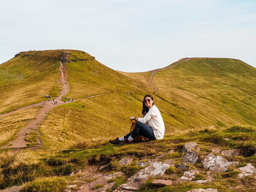
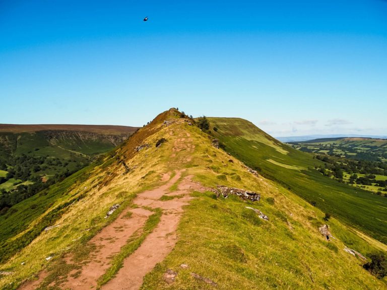
From the bridge the path ascends pretty steeply up onto the Graig Fan Ddu ridge. You should have a forest area on your left and a clear view over the glacier valley on your right. Take your time and turn around often to see your progress and enjoy the views. Once on top of the ridge, head north along the well maintained path all the way to Corn Du. This section is actually pretty relaxing and flat for the most part. However, you’ll be walking close to the edge so be careful if the weather conditions are wet and windy.
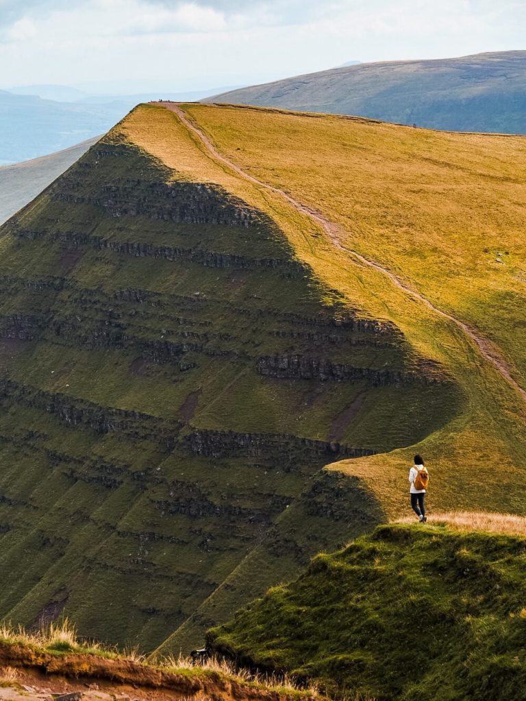
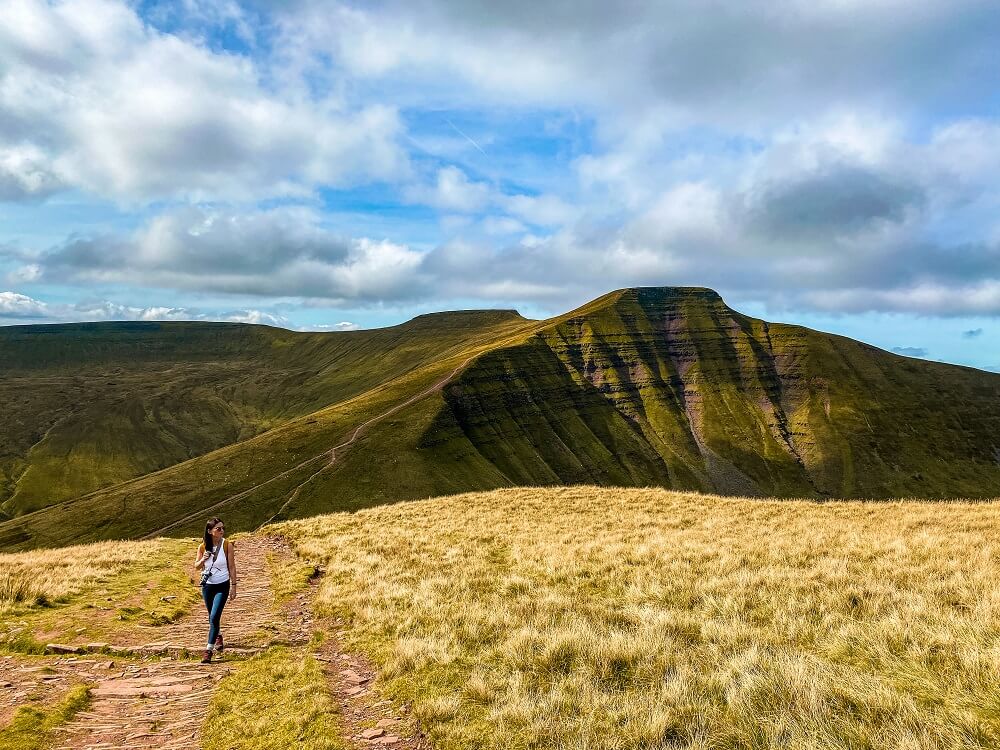
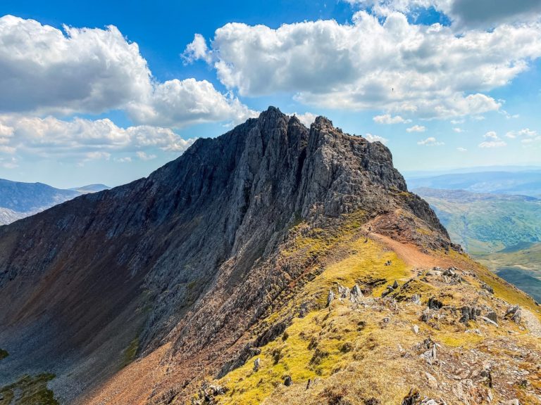
As you head closer and closer you should have a great view of the four peaks: Corn Du, Pen Y Fan, Cribyn and Fan Y Big. You’ll soon reach a crossroads where ‘The Motorway’ path crosses the Horseshoe path heading to Pen Y Fan. At this point take the path on the left and make your way up to Corn Du. At 873m above sea level, Corn Du is the second highest peak in South Wales. The climb up to it will be steep but well worth your efforts.
Once on the top, admire the 360 degree view this peak offers. The summit has a Bronze Age burial cairn. Whilst it’s slightly smaller than Pen Y Fan, from here you can actually see Pen Y Fan itself.
2. Corn Du to Pen Y Fan
Once you’re ready to leave, you’ll have a little descent then and then will ascend again to reach Pen Y Fan.
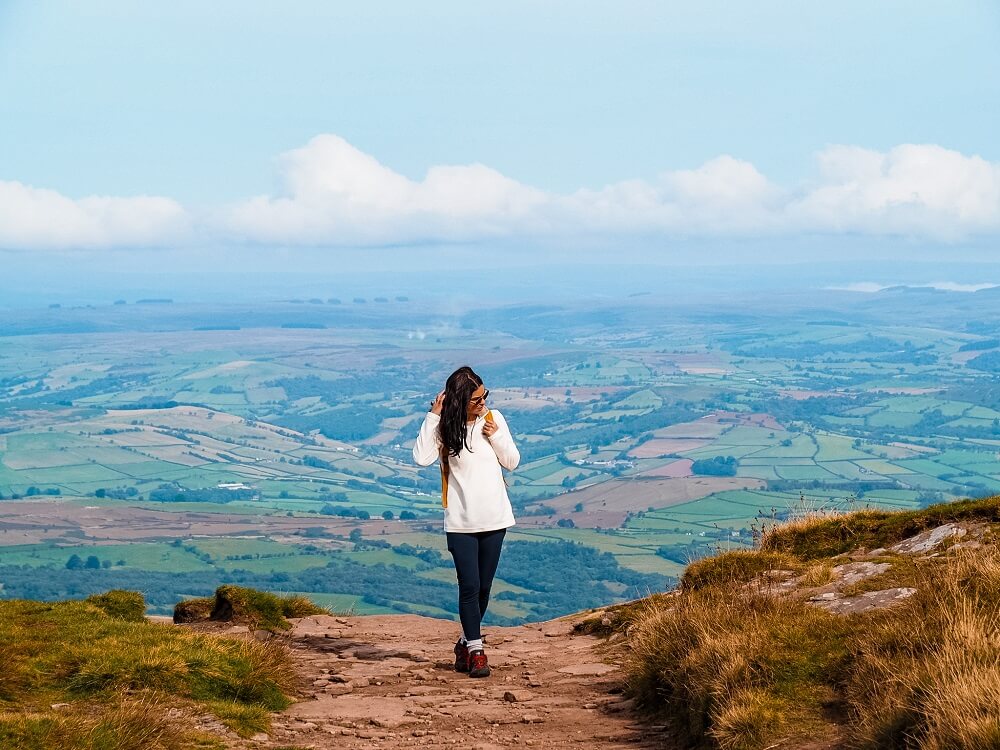
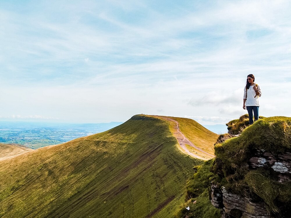
The summit of Pen Y Fan is also marked by a Bronze Age cairn like on top of Corn Du. I highly recommend lingering a bit longer on the top, have your lunch and again admire the stunning 360 degree views. From here you can also see ‘The Quiet Route’ and all other possible routes leading up to the summit.
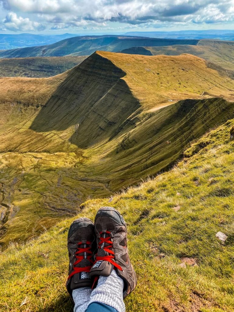
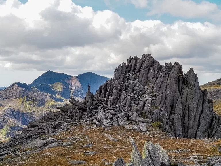
3. Pen Y Fan to Cribyn
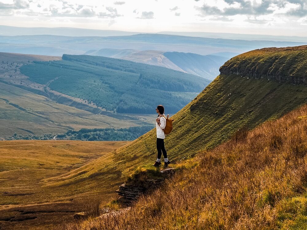
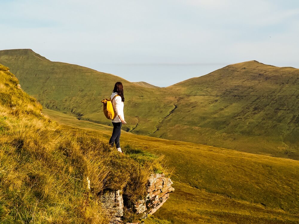
The descent from the summit is pretty steep, so make sure to go slowly. Once you’re down, the path will take you straight back up onto your third peak called Cribyn. I think this was possibly the steepest climb so just take your time. Don’t forget to stop and look back every so often because once again the view of Pen Y Fan will be amazing from this angle too.
On top of Cribyn you’ll find another cairn and you’ll be treated with beautiful views.

4. Cribyn to Neuadd Car Park
Once you’ve descended Cribyn you should reach an old road. Apparently this was the first road that enabled horse-drawn carriages to cross the mountain range. At this point, you can climb up to Fan Y Big if you wish.
If not, you’ll just have to follow this road all the way back to Lower Neuadd Reservoir. This part of the walk is pretty straight forward and might be a bit boring so it will feel like you’re on it forever.
There might be some live stock like cows grazing in this area, and people might pass you on their bikes, so just be aware.
The path will eventually merge with the tarmac road where you turned left in the morning. Follow this road back to Neuadd Car park to complete the Pen Y Fan horseshoe ridge hike.
Additional Hikes in the Brecon Beacons
The Brecon Beacons National Park offers a ton of different adventures for its visitors. Therefore if you enjoy hiking, then make sure to check out these beautiful hiking trails:
- Four Waterfalls Walk – Complete an 8 km long trail and explore four stunning waterfalls in the Waterfall Country of the Bannau Brycheiniog. Click here to read it.
- Henrhyd Falls Point to Point Walk – An easy walk to the tallest waterfall in South Wales. Click here to read it.
Additional Ridge Hikes in the UK
If you enjoy ridge hikes and scrambles, I highly recommend checking out the following ridge hike posts:
- Hiking up Tryfan in the Ogwen Valley in North Wales
- Climbing Snowdon via Crib Goch, Eryri (Snowdonia), North Wales
- Hiking the Glyders via Bristly Ridge, Eryri (Snowdonia), North Wales
- Hiking Helvellyn via Striding Edge and Swirral Edge, Lake District, England
- The Ultimate Guide to Climbing Ben Nevis via Carn Mor Dearg Arête, Scotland
Final Thoughts on the Pen Y Fan Horseshoe Hike
I have been wanting to complete the Pen Y Fan Horseshoe ridge hike for a very long time, and it didn’t disappoint. This hiking trail is absolutely beautiful with 360 degree views pretty much all the way. The stunning weather conditions definitely made the hike easier and more enjoyable. In addition, the fact that we pretty much had the whole trail to ourselves made the experience even better.
Although the hike can be a bit challenging with all the ascents, I think if you’re an experienced hiker you’ll find this route a rather relaxing ridge hike.
Have you ever completed the Pan Y Fan Horseshoe ridge or hiked up to Pen Y Fan before? If so, which route did you take and how much of the Brecon Beacons did you manage to explore? Let me know in the comments below.
Now, let your adventure begin,

Our Top Travel Resources
Accommodation: For hotels we always use Booking.com and Hostelworld for hostels. We also book longer stays on Airbnb or Vrbo.
Flights: To find the best flight prices we always check Skyscanner, Google Flights or WayAway. Then we also check the airlines’ websites too for comparison.
Car Rentals: We use Discover Cars when we want to rent a car as it compares local, national and international companies.
Activities: If we book organised tours we always check either GetYourGuide or Viator.
Foreign Currency: Whenever we can we prefer to pay in local currency and for that we always use our Wise card. We can easily withdraw money from the ATM or pay by card at most shops and restaurants.
Travel Insurance: We never go anywhere without travel insurance. You never know what will happen on your trip, so good travel insurance like SafetyWing can protect you in case of injury, illness, theft and cancellations.
eSIM and VPN: To get data abroad we use Airalo which is an app that allows you to download a prepaid eSIM to your phone in over 190 countries. Make sure to have a VPN to avoid hackers accessing your personal data when using public WIFI. We use Surfshark which is the only VPN that offers one account on unlimited devices.
Remember…It all starts with a Pin…

What an amazing hike! So good to see all the photos in such clear weather. They give a really good impression of the walk and views. Good to see lots of alternatives too, something to suit everyone. Thanks for sharing. :)x
Thank you Karan, we were incredibly lucky with the weather and could enjoy the sunshine and the views from the top. X