

A Guide to Driving Pikes Peak Highway in Colorado

There are so many breathtaking roads to drive along in Colorado that will not only figuratively take your breath away, but might well literally do it too. One of these is the Pikes Peak Highway, the second highest road in the USA, taking you over 14,000 ft above sea level. After driving Trail Ridge Road in RMNP, we knew that we’d also enjoy driving Pikes Peak Highway in Colorado.
In this guide we’ve summarised our experience, which includes practical information and useful tips for an unforgettable and successful road trip. We’ll share details on entry fees and timed entry passes, when the best times to drive the road are, and all the things to see and do along the route.
Disclosure: This post may contain affiliate links, which means we may receive a small commission if you click a link and purchase something. Clicking these links won’t cost you anything, but it will help us to keep this site up and running! Learn more about our affiliate policy.

What is Pikes Peak and Pikes Peak Highway?
Pikes Peak, also known as “America’s Mountain”, is located in Pike National Forest, about 12 miles (19 km) west of Colorado Springs in Colorado. With a height of 14,115 ft (4,302 m) it is one of Colorado’s 54 “fourteeners”. (If you didn’t know, “fourteeners” are mountain peaks that exceed 14,000 ft (4,267 m) of elevation).
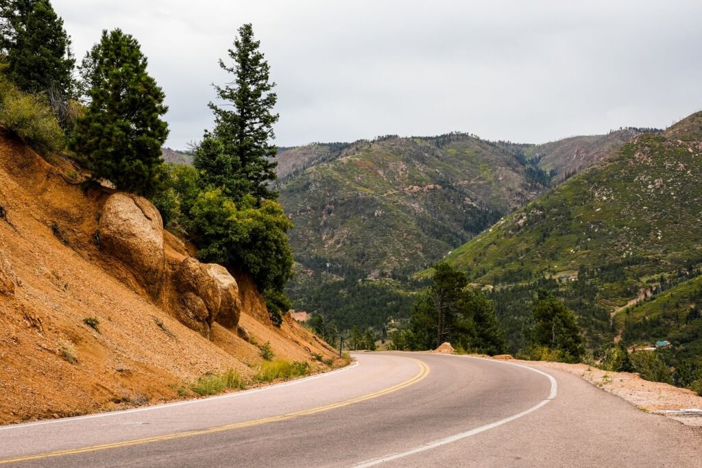
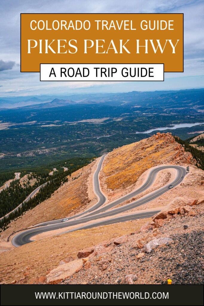
Pikes Peak Highway is a 19-mile (30.5 km) long paved toll road that was built in 1915. Starting from the town of Cascade, this windy mountain road will take you through four different ‘life zones of Colorado’, giving you incredible views of the surrounding area. In fact, the words “America the Beautiful” were inspired by the summit views of Pikes Peak.
This highway is also where the Pikes Peak International Hill Climb takes places every June. Professional drivers drive up this crazy road in less than 10 minutes! In comparison, it takes anywhere between 1 to 3 hours for the average person to wind their way up the 156 turns.
Practical Information Before Driving Pikes Peak Highway
Hire your car to drive Pikes Peak Highway using Discover Cars where you can find the best rates as they compare local, national and international companies.
Pikes Peak Entry Fees and Timed Entry Permits
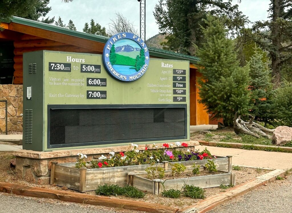
To drive Pikes Peak Highway you’ll need to have a valid entry ticket. Between 1st May and 30th November it’s $18 per person. From 1st December to 30th April it’s only $10 per person. Depending on the season, there are different opening and closing times.
In order to balance the number of cars driving up with the available parking spaces, you’ll need to reserve a timed entry permit between May and the end of September. This is in addition to your entry pass. You can book your timed entry permit on the official website.
Permits are released around the 15th April and they only cost $2 per vehicle. We recommend securing your spot online, even though you can also purchase one at the Pikes Peak Highway Tollgate. Make sure to arrive at the Tollgate within your two-hour window. Since the signal can be spotty, don’t forget to download your reservation prior to arriving. Note that you should not be parking at the summit for more than two hours.
Reserve you entry ticket and permit on the official website.

Best Time to Drive Pikes Peak Highway
Pikes Peak Highway is open all-year-round. The road is only closed in extreme weather conditions. That being said, there are obviously better and worse times of the year to visit.
Generally speaking, if you’re planning on doing other activities in Colorado, such as visiting Rocky Mountain National Park, then it’s probably best to visit between late spring and mid autumn. The temperatures will be much better, although at over 14,000 ft it’ll still be much cooler. We drove Pikes Peak Highway in mid-September, which was a great time to see the fall foliage. However, there were still patches of snow at the summit and it even snowed at one point. Of course, during the summer months it’ll be more crowded and you’ll need to reserve your entry permit in time.
Whilst the road stays open in winter, driving it might be more difficult due to icy conditions. Plus, unless you’re an experienced hiker, many hiking trails in Colorado will be more difficult to navigate. Not to mention that other scenic drives such as Trail Ridge Road and Old Fall River Road will be closed throughout this season.

Is the Pikes Peak Highway Safe to Drive
Driving Pikes Peak Highway is generally safe, but there are a few things you should be aware of to help you prepare for your road trip.
Vehicle Related Safety Tips
Usually, average cars that have a “1” or “L” on the shifter are allowed to drive the road. However, pull-behind trailers or campers are prohibited from using the road. Check out the website for further vehicle restrictions.
Just like before any road trip, we recommend doing some necessary safety checks to make sure that your car is up for the drive. You want to limit your chances of breaking down.
Another important thing to be aware of is there are no gas stations along Pikes Peak Highway or even in Cascade. You are required to have at least half a tank before starting your journey. The staff at the Tollgate will check this and won’t let you procced if it’s lower. We filled up our car before leaving Colorado Springs. In addition, there are no electric vehicle (EV) charging stations along the route either.
It is also recommended to turn off your A/C when ascending to prevent your engine overheating. Even in the summer, it gets cooler the higher you drive, so you’ll be fine with your windows down.
Make sure to use a low gear on the way down. At Glen Cove the staff will check the temperature of your brakes. Ours were slightly high, so they suggested a 20-30 minute break to let them cool down before descending further.
Lastly, always obey the speed limit. Wildlife can be present on the road, so drive carefully.
Health and Weather Related Safety Tips
Driving Pikes Peak Highway is not recommended for infants under 6 months old and anyone with cardiac or respiratory issues.
After Glen Cove you’ll be driving for about 7 miles (11 km) above the tree line until you reach the summit. There are steep drop-offs and hairpin switchbacks. If you have a fear of heights, this section may be scarier for you, especially if you’re also not in control of the vehicle.
Let’s not forget about the high altitude and elevation gain. The road reaches 14,115 ft (4,302 m) above sea level, so you can get altitude sick if you haven’t acclimatised properly. We recommend spending some time at lower altitude to get used to Colorado’s higher elevations. In addition, you’ll be gaining a lot of elevation in a short amount of time. It’s important that you keep hydrated and descend if you develop strong symptoms of altitude sickness, such as dizziness, shortness of breath, heavy breathing, nausea or vomiting.
Another thing you have to factor in is the unpredictable mountain weather. You can literally experience four seasons during your drive, even in the middle of summer. Wind, cold temperatures, rain, snow, sunshine and thunderstorms can all happen in the space of a day. Make sure to come prepared with layered clothing, check the forecast and search their website for potential road closure updates.

Facilities Along Pikes Peak Highway
There are plenty of facilities along Pikes Peak Highway. Food, gift shops and toilet facilities are available at the Crystal Reservoir Visitor Center, Glen Cove Inn and the Pikes Peak Summit Visitor Center. There are also additional toilet facilities at the Pikes Peak Highway Tollgate and the Halfway Picnic Area.
However, we still recommend bringing plenty of water with you to stay hydrated the whole time, as well as enough snacks or a packed lunch which you can eat at one of the picnic areas. Whatever you bring with you, make sure you either take it home with you or dispose of it responsibly. Enjoy your time in nature but Leave No Trace!
Map of the Pikes Peak Highway, CO
Pikes Peak Highway Quick Statistics:
- Start: Town of Cascade (7,381 ft / 2,250 m) / Tollgate (7,800 ft / 2,377 m)
- Total Length: 19 miles / 30.5 km (one-way)
- Highest Point: Pikes Peak (14,115 ft / 4,302 m)
- Elevation Gain: 6,715 ft / 2,047 m
- Opening Times: All-year-round
Things to See Along the Pikes Peak Highway
Since the signal will be spotty, make sure to download offline maps if you want to follow your route and see where the next stop or facility is. We also received a map at the Tollgate which had a list of points of interest on it.
Top Tip. We personally suggest stopping at a few places on the way up, but also leaving a few spots for the way down. This way you won’t gain and lose too much altitude all at once. Plus, it’ll give your car a little break from working very hard in both directions.
Crystal Creek Reservoir
Elevation: 9,160 ft / 2,792 m
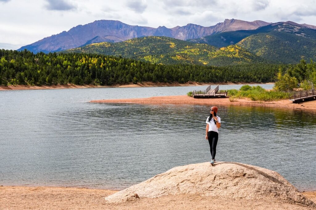
Apart from the Pikes Peak summit itself, Crystal Creek Reservoir was our second favourite stop along the route. This 136-acre reservoir is about 5.5 miles (9 km) from the Tollgate in the North Slope Recreation Area. It was dammed in 1935 to supply water to Colorado Springs and other towns in the vicinity.
The reservoir is located within the Montane Zone (one of the four life zones) where we could still see a variety of wildflowers, shrubs and trees, including Aspen Groves, which are known to paint the forest in yellows and golds during the fall.
We walked down to the shores of the lake, where we could enjoy some stunning vistas of the mountains and colorful trees in the distance. There’s also a visitor centre and other facilities, so it was a great stop to stretch our legs before continuing our drive.
Glen Cove Inn
Elevation: 11,440 ft / 3,487 m
Further up the mountain, the next popular stop is Glen Cove Inn, located around the Mile 13 marker. We definitely noticed a change in scenery once we reached around 10,000 ft (3,048 m) of elevation. As we got close to Glen Cove Inn, the trees started to look different, and we could most definitely feel the altitude. We were now driving through the Sub Alpine Zone.
Unless you need to stretch your legs, use the facilities, or need a minute to get used to the higher elevation, we suggest stopping here on the way back down. It’s where they’ll check your brake temperatures, so even if they’re within acceptable limits, it’s still good to give you and your car a little break here on the way down.
Glen Cove Inn is home to a fun gift shop, and a cafe selling a variety of foods and drinks. We definitely enjoyed browsing the shop here for a bit. The building is roughly the point where the tree line ends, so from outside we could see the mountains towering over us much more clearly.
Devil’s Playground
Elevation: 12,960 ft / 3,950 m
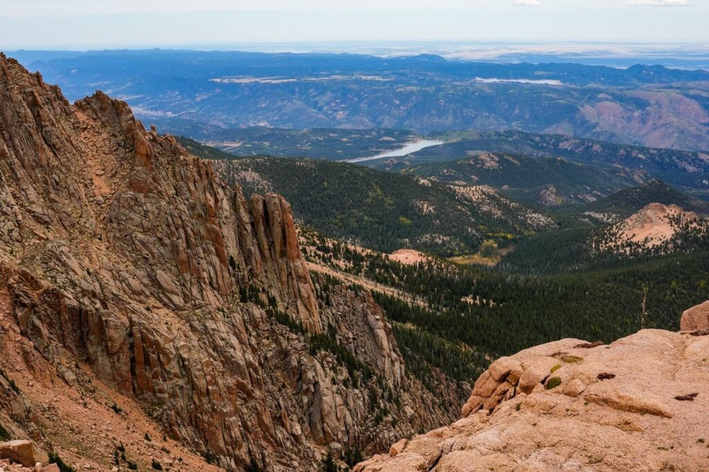
Once you pass Glen Cove Inn, the trees disappear completely around the next bend, marking the area where the Alpine Zone begins. The flora and fauna will be different here, as the environment is much harsher and harder to survive in.
For some incredible views we recommend stopping at the Devil’s Playground. There’s a short hiking trail next to the car park that’s worth getting out of the car for. Here, we were just under 13,000 ft (4,000m). Our breath was taken away not only by the views but by the high altitude and cold temperatures too. We also spotted a Yellow-bellied Marmot chilling at the side of the road here, one of the few mammals that live in this zone.
From here, you can also reach the summit of Pikes Peak. The trail is about 5.3 miles (8.5 km) out-and-back, with over 1,312 ft (400 m) of elevation gain. Whether you’re just stopping here for the short trail or the long one to the summit, please always stay on the marked paths to protect the fragile tundra. The plants can take 75 years to grow just half an inch!
Pikes Peak Summit
Elevation: 14,115 ft / 4,302 m
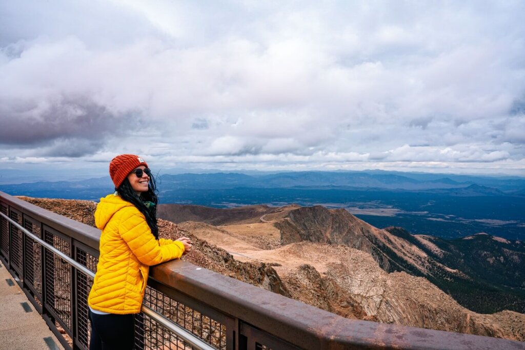
After a few more turns we finally reached Pikes Peak Summit. Even though we did drive our car up the mountain, it was still a bit of a surprise to see just how lively it was at the top. People can drive up, take the shuttle, the Cog Railway, or hike up too. Being one of the most accessible fourteeners, it’ll be busy at the summit whenever you go. It kind of reminded us of Yr Wyddfa (Snowdon) in North Wales on a warm and sunny day.
We enjoyed the outdoor walkways and viewing areas, where we could see for miles. Apparently, on a very clear day, you can see five states! We also saw the “America the Beautiful” Centennial Memorial, which is a huge bronze plaque with the lyrics of the song written on it.

Pikes Peak Visitor Centre & Summit House
Elevation: 14,115 ft / 4,302 m
Don’t skip going inside the Pikes Peak Visitor Centre before you start descending the mountain. Opened in June 2021, it has an exhibit, gift shop, dining area and of course toilet facilities.
Whilst we were up at the top it started snowing, so it was nice to warm up inside. We loved the huge top to bottom glass windows, which allowed us to enjoy the views without getting beaten by the elements.
If you want a unique treat, grab one of the famous Pikes Peak doughnuts from the café. They aren’t just your average doughnuts though because they’re made on-site at over 14,000 ft with special, high-altitude ingredients. Don’t wait to eat it later because the texture will change as you descend to lower altitudes.
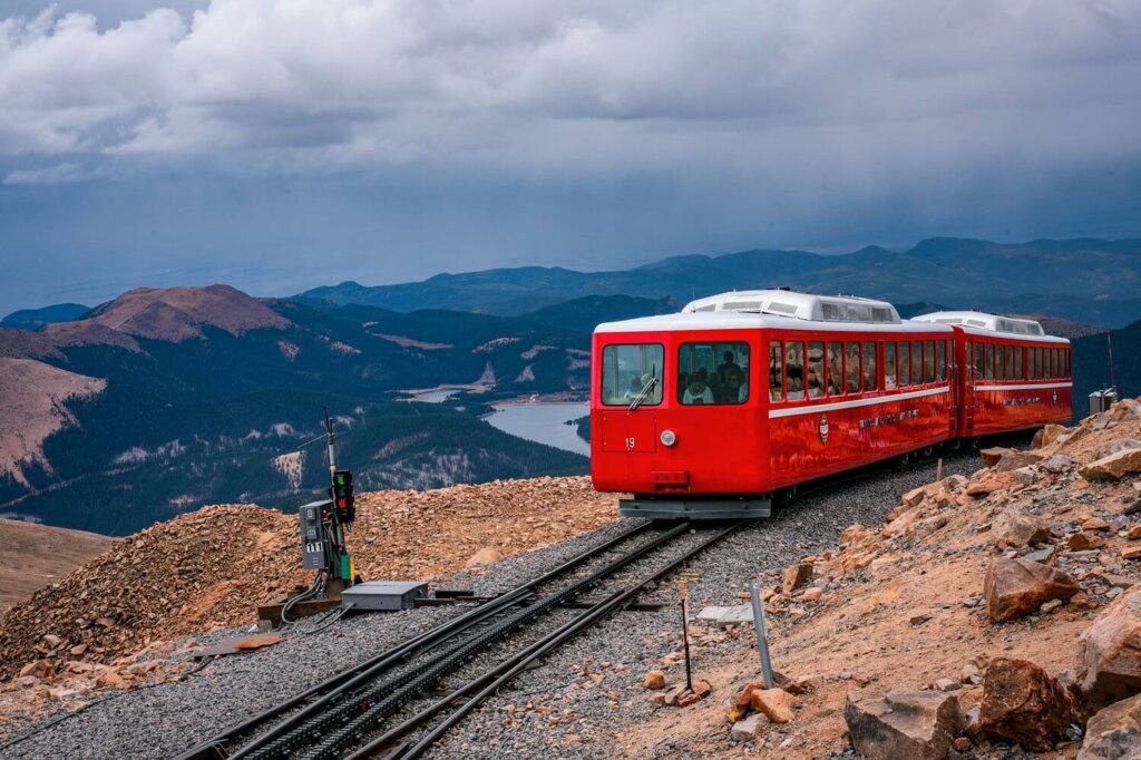
Once we went back outside, we spotted the remains of the original summit house next to the railway line. It was constructed in 1873 using stones from the mountain. Apparently, it was a weather station until it became the Pikes Peak Summit House in 1888.
Other Ways to Reach the Top of Pikes Peak in Colorado
If driving your own vehicle sounds too scary to you, or you’re after a more unique way to reach the summit, then you can consider the following alternatives to getting over 14,000 ft.
Pikes Peak Shuttle
If you want to experience the road, we suggest booking a ride with the Pikes Peak Shuttle. It operates regular services from Memorial Day weekend until mid-August.
The first one departs from the Mile 7 car park at 9 AM and runs every 30 minutes. The last one leaves the summit at 6:15 PM. It’s like a hop-on hop-off bus stopping at Crystal Reservoir, the Shuttle Parking Lot, Glen Cove Inn, the Devils Playground and the summit.
It costs $35 per adult, which also includes your entry fee. Book your shuttle online via the website.
Pikes Peak Cog Railway
A unique way to get to Pikes Peak summit is with the Cog Railway. Unlike the shuttle, the train operates all-year-round. It’s important to note that the train departs from Manitou Springs.
The 9-mile climb lasts about an hour, then you have a good 40 minutes at the summit before having to take the train back down. You can book your ticket on Cog Railway’s website.
Hiking
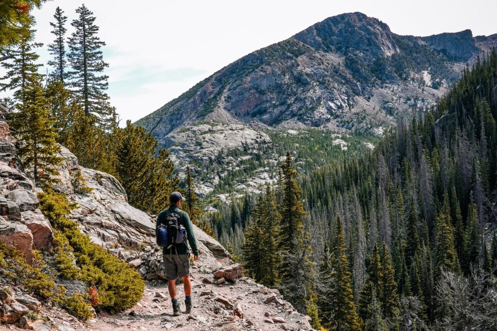
A more physically challenging way to get to the top of Pikes Peak is to hike. You can go via the Barr Trail or the Crags Trail. The Barr Trail starts from Manitou Springs and is a 13-mile (21 km) long trail one way. You’ll gain a crazy 7500ft (2,286 m) of elevation, so it’s not for novice hikers.
There’s also the slightly shorter Crags Trail, which is a 13.6 mile (22 km) out-and-back path, as opposed to just one way. The elevation gain is only about 4,400 ft (1,340 m), so it’s shorter and easier. This trail will join up with the one at the Devil’s Playground.
Make sure to always stay on the dedicated footpaths, especially once you reach the tundra.
Cycling
Lastly, cycling is another challenging but rewarding way to get up Pikes Peak. You’ll be riding along the highway, so you have to be careful of passing vehicles. Unlike with cars, you won’t need a timed entry permit to cycle the road.

Best Places to Stay Near Pikes Peak in Colorado
Depending on how long you’re in the area for, you can book your stay in the towns of Cascade, Manitou Springs or Colorado Springs.
Budget Friendly:
Mid-Range:
Luxury Stays:
Additional Things to Do Near Pikes Peak in Colorado
Garden of the Gods in Colorado Springs. Before or after your drive up Pikes Peak Highway, you can either drive through or take a stroll around the crazy red sandstone formations here.
Rocky Mountain National Park. If you’re in Colorado for a few more days, you cannot leave without visiting this stunning national park. There are many hiking trails, scenic alpine lakes and crazy roads to drive on. See all of our dedicated RMNP guides for more inspiration.
Boulder. Another beautiful city surrounded by plenty of hiking opportunities. We completed the 1st / 2nd Flatirons hiking trail, which is a moderate hike with great views across the city and surrounding area.

Final Thoughts on Driving Pikes Peak Highway in Colorado
Whilst we would’ve loved to summit Pikes Peak on foot, being a bit short on time meant that it was best for us to drive to the top. After our scenic drives on Trail Ridge Road and Old Fall River Road, we knew that Pikes Peak Highway would also be a fun road trip. Seeing the quick changes in our surroundings as we climbed through four different life zones was incredible. We also had pretty great weather conditions and visibility, whilst still being able to enjoy a brief snowstorm at the top as a reminder that we were in fact on the summit of a very tall mountain.
Have you ever driven Pikes Peak Highway in Colorado? If so, how was your experience? Also, let us know if you reached the summit by an alternative method, because we’d love to hear your thoughts on it. Would you dare drive up this incredibly windy road for the panoramic views?
Now, let your adventure begin,

Remember…It all starts with a Pin…




I am obsessed with all the incredible road trips you can take in the USA! Driving Pikes Peak highway in Colorado is now definitely on my bucket list a this blog post has helped so much! So thank you!
We love a good road trip too, and Pikes Peak is a fantastic one in Colorado.
My husband thinks it would be an absolute blast to be able to try the Pikes Peak International Hill Climb!
Wow, not sure if I would be brave enough to drive this road on a much higher speed, but it would definitely be an adrenaline filled experience!
What a great road trip! This looks beautiful.
Thank you!
Pikes Peak sounds like a drive that is an adventure! It looks challenging and beautiful. I would love to experience it even just to see how the donut changes based on altitude.
Pikes Peak is such a unique road to drive on! And yes, it’s crazy how cooking and baking at high altitude is so different!
I absolutely love this scenic drive — it’s one of the most breathtaking routes in Colorado! The views from Pikes Peak Highway are simply unforgettable, especially as you climb higher and the landscapes open up before you. I remember stopping at Crystal Creek Reservoir and Devil’s Playground — both incredible photo spots. The summit views and the feeling of being above 14,000 feet are truly something special!
We felt the same driving up to Pikes Peak. It was crazy to see the scenery changing so quickly. It’s an unforgettable road trip for sure.
This trip looks amazing! From your photos it looks like the views are spectacular. I may have to do some smaller summits before I attempt this one, as I live at sea level. It definitely looks extraordinary. Thanks for all of your helpful insight as to what to do on the way up/way down, etc..
Yes, I definitely recommend acclimatising before driving up to Pikes Peak as the least thing you want is to get altitude sickness!
This is such a well-written and practical guide, especially for something like Pikes Peak which can feel a bit intimidating at first.
I like how it balances the beauty of the drive with useful tips, because it really is a unique experience with steep climbs, sharp turns, and high altitude.
Thank you so much for the lovely feedback!
Very comprehensive tips!
Thank you!