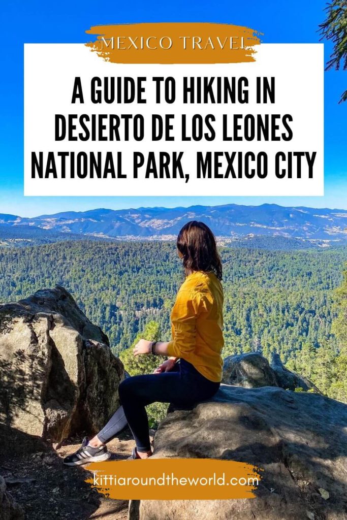
A Detailed Guide to Hiking in Desierto de los Leones National Park, Mexico City
Are you craving a little more raw and off-the-beaten path adventure in Mexico City? If so, then this is going to be your step by step guide to hiking in Desierto de los Leones National Park during your Mexico City visit. This blog post includes a detailed guide on how to get to the national park by different modes of transportation, answers to common questions about the trail and also has a trail description with a map that you can try to refer to during your hike, although still be prepared to get lost a few times!
For reference, we spent 2 weeks in Mexico City and during this time we took many incredible day trips like this one, tried a ton of Mexican food and really fell in love with the city.
If you’d like to see our Mexico City adventures then make sure to watch our YouTube video by clicking here. You can also check out our Mexico Playlist for more adventures.
Disclosure: This post may contain affiliate links, which means we may receive a small commission if you click a link and purchase something. Clicking these links won’t cost you anything, but it will help us to keep this site up and running! Learn more about our affiliate policy.
Introducing Desierto de los Leones National Park, Mexico
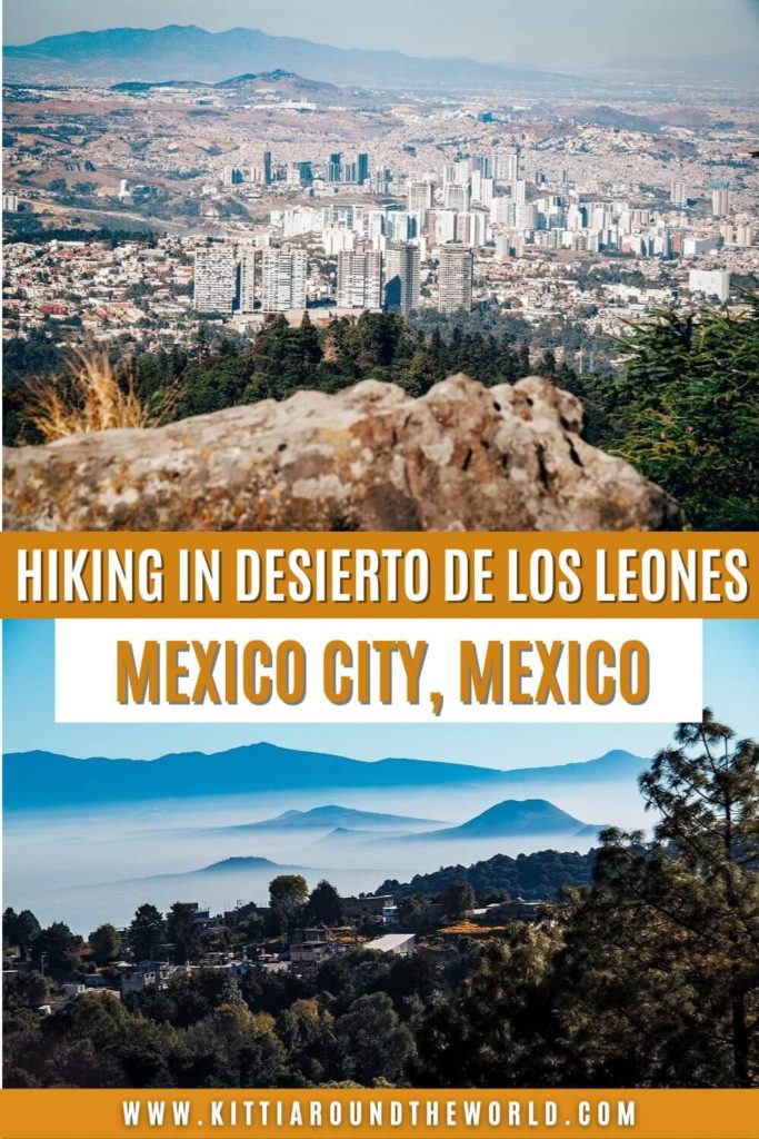
Desierto de los Leones or Desert of the Lions is located in the Federal District of Mexico City to the southwest of the city centre. It covers about 4,600 acres and its altitude varies between 2,600 to 3,700 meters above sea level. Its highest peak is called Cerro San Miguel which has a height of 3,770m.
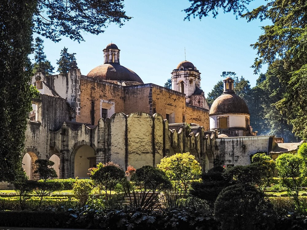
The highlight or main attraction of the park is without doubt the Ex Convento Desierto de los Leones. It was built back in the 17th century by monks seeking a quiet and peaceful place away from the city noise.
Although the national park’s name means ‘Desert of the Lions’, you won’t find a desert or lions here. ‘Desierto’ in this context means ‘big and wild area’ and the ‘Leones’ part refers to the Leon family that helped the monks build the Formal Convent. However, some other stories behind the ‘Leones’ part refer to the pumas that were spotted in the area.
The national park was first declared a forest reserve area in 1876 and then became a national park in 1917.
Today, it’s a popular place for dog walking, mountain biking, camping, hiking and for visiting the monastery, but definitely not super touristy.
Read Next: 5 Great Day Trips from Mexico City
How to Get to Desierto de los Leones National Park from Mexico City
By Private Vehicle
Obviously the most convenient way to get to the national park is by private transport. You can rent a car for a day or for the duration of your stay in Mexico City. Discover Cars is a great one to check out and it has been recommended on multiple comparison websites as it compares local, national and international companies.
If you’re arriving by car then you can just park at the national park’s car park (Estacionamiento Público Parque Nacional Desierto de los Leones). You can also drive to Santa Rosa Xochiac if you’d like to follow the exact hiking route we completed. You should reach either of these destinations in 30 minutes to an hour, depending on traffic and where you are staying in Mexico City.
Alternatively you can also book an Uber or taxi and ride all the way to the park. It’ll cost you at least 200MXN, depending on where you’re staying. However, be prepared to be waiting for a driver who is willing to take you that far. We noticed during our stay in both Guadalajara and Mexico City that Uber drivers like to cancel long trips that require them to drive across the entire city.
By Public Transport
Step 1: Getting to Barranca del Muerto Metro Station
Your first step to get to Desierto de los Leones by public transport is to get to Barranca del Muerto metro station.
For that you’ll need to take Line 7 and travel all the way to the last metro stop. Depending on where you’re staying you might need to change lines once or twice. Click here to view the metro line map.
One way will cost you 5MXN (yes, Mexico City has one of the cheapest public transportation systems in the world). Click here to read more about how to travel around Mexico City by metro.
Did you know? – If you know a bit of Spanish then the station’s name – which in English means ‘Canyon of the Dead’ – might make you curious about why anybody would give such a name to a metro station. So, after a bit of reading, it turns out that the name of the station comes from a ravine that used to run in the area and apparently during the Mexican Revolution many corpses were thrown into this depression. You’ll also notice that the station’s symbol is two eagles which represents the eagles that were attracted by the decomposing bodies.
Step 2A: Getting to Santa Rosa Xochiac by Bus
Okay, now that you have arrived to Barranca del Muerto station with some more knowledge about the origin of the name, let’s get to step two of reaching Desierto de los Leones by bus. Once you’re out of the metro station, cross Avenue Revolucion and head to the bus stop that’s located at the junction of Avenue Revolucion and Barranca del Muerto.
There will be many buses coming so you’ll need to hop onto the one that has Santa Rosa Xochiac written on it. You can take line RTP 116 but you can also check moovitapp.com for other ways to get to Santa Rosa Xochiac.
Step 2B: Getting to Santa Rosa Xochiac by Taxi or Uber
If you miss the bus or the bus doesn’t show after waiting a long time like in our case, then I recommend either getting a taxi or an Uber. Uber will be cheaper, but you might have to wait a bit longer because drivers might cancel your trip a few times.
We noticed that drivers don’t always like to drive so far out of the city. For reference, we paid around 230MXN for our ride, because our driver thought that we wanted to go to Chapultepec Park since Desierto de los Leones isn’t that visited by tourists. For this reason our ride was more expensive (nearly double), but at least it’ll give you a good idea on approximately how much you should pay for a ride if you’re coming from the La Condesa area of Mexico City.
Step 3: Getting Back to Mexico City
Since getting a taxi or an Uber ride back to the city might be a bit more challenging, I recommend getting the bus on your way back. The location of the bus stop is pretty obvious because there are many buses parked at the bay. It’ll also cost you much less than a taxi ride. We only paid 7MXN for an hour ride back to the city which is considerably less than the 230MXN we paid to get there in the morning. Get the bus that has Mixcoac written on it, which is a metro station along Lines 7 and 12. From there it’s easy to get back to your accommodation. Getting a bus back felt way easier than getting the bus to Santa Rosa Xochiac in the morning.
Good to Know Before You Go
Cost of Hiking in Desierto de los Leones National Park
Here’s a quick cost breakdown including bus tickets, taxi fares and entry fees:
- 5MXN for one metro ride in Mexico City
- 7MXN for one-way bus ticket to Santa Rosa Xochiac
- ~200MXN for one-way taxi / Uber ride to Santa Rosa Xochiac
- 19MXN for Monastery entry fee
- Cost of your food, drink and snacks for the day
You’ll have to double up everything to calculate in your return journey.
Length of the Desierto de los Leones National Park hiking trail
Our hiking route around Desierto de los Leones National Park was approximately 16 km (10 miles) long. Depending on your speed, how long it takes you to walk around the Monastery, how many times you get lost and how many breaks you take, this route could take around 6 or 7 hours. You’ll also be hiking in altitude, so you might walk a bit slower on the uphill sections.
For reference, we started our hike around 9:30AM, and finished the route around 4PM. We took our time walking around the Monastery because it was just so beautiful and peaceful there. In addition, we also got disoriented quite a few times and stopped at each viewpoint for at least 10 minutes. As always we were also filming and taking a lot of photos. So, we probably completed the trail a bit slower than if you were constantly walking with minimal breaks and didn’t get lost.
Level of Difficulty
Elevation and Altitude:
This hike can be a little bit of a struggle, especially if you’re not used to hiking at altitude. Desierto de los Leones is located over 3,000m above sea level which is nearly 1,000m more than Mexico City itself. You’ll have some steep sections along this trail where you can easily feel like you’re out of breath. For this reason, I recommend getting used to the altitude in Mexico City first before you attempt hiking in Desierto de los Leones National Park.
Top Tip – I think this hiking trail is actually a great way to get used to hiking in altitude, especially if you’re planning on completing other hikes around Mexico City and South America like we did.
Click here to read about how to avoid altitude sickness when travelling to Mexico City.
Length of the Trail:
Our original trail was about 16km long, which is quite a long trail in general. Getting lost a few times definitely added some extra km to our final length. The mixture of a long and somewhat confusing hiking trail combined with hiking in altitude could be a struggle especially if you’re not acclimatised properly.
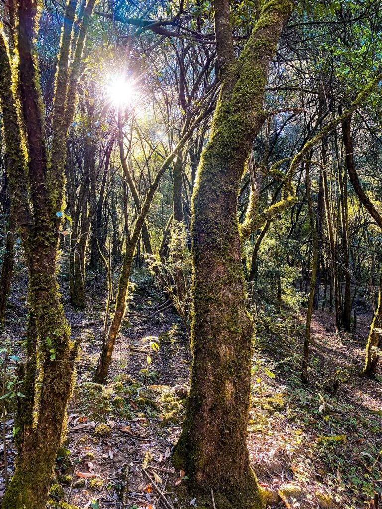
Unmarked Trail:
One of the biggest challenges for us was the unmarked and confusing trails. Whilst the national park is beautiful and at the end we managed to complete the trail and enjoyed some insane views of both the park and Mexico City, getting lost and being unsure about whether we’re heading in the right direction or not definitely made the trail more difficult for us…but that was also part of the fun!
Facilities Around Desierto de los Leones National Park
Places to eat – There are quite a few eating places and vendors to buy lunch, snacks and drinks from around the Monastery. However, I also recommend bringing some snacks and plenty of water with you for your hike.
Toilet facilities – There are toilet facilities available around the Monastery.
What to Wear and Bring with You?
We completed our hike at the end of December, and it was a little chilly in the early morning. However, the temperature warmed up by lunchtime. Therefore, I recommend wearing different layers which you can adjust according to the temperature.
Although the majority of the trail is shaded by trees, make sure to wear sun-cream to protect your skin. You should also consider wearing a cap and bringing some sunglasses.
I recommend wearing comfortable and supportive shoes. I wore a simple pair of trainers and they were fairly sufficient. You can also wear hiking shoes or boots.
In addition, I suggest bringing some snacks and having plenty of water because you want to stay hydrated, especially in such high altitude. I recommend having a reusable water bottle with you.
Please Note! – Whatever you bring with you, make sure you either take it home with you or dispose of it responsibly. I suggest bringing a garbage bag with you where you can collect all your waste. Enjoy your time in nature but Leave No Trace!
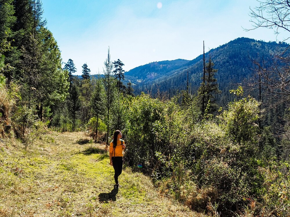
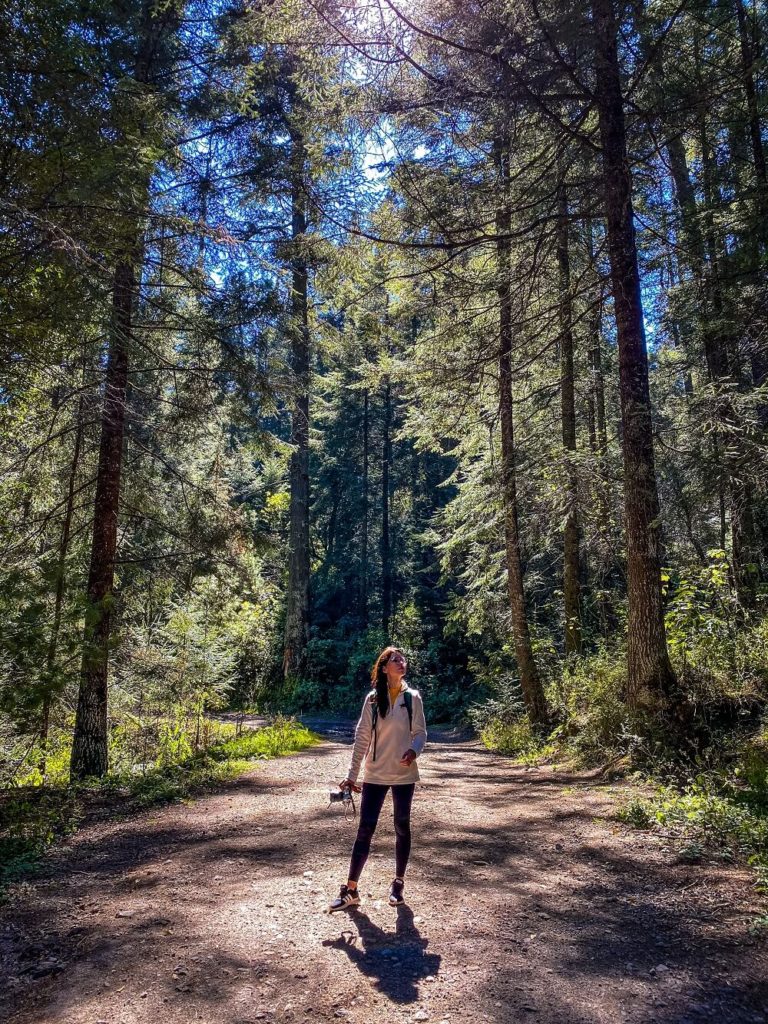
Desierto de los Leones Hiking Trail
Please Note. Before you attempt this hike, I’d like to warn you that there are no maps, the trails are unmarked and overgrown in some places and definitely not well-visited. Although creating a trail in Alltrails might seem easy, in reality, this is the first time I’m not even 100% sure that this is the exact route we took. Whilst it wasn’t impossible to find the trail, I would definitely count on getting confused a few times.
Therefore, it is your responsibility to decide if this particular hiking trail is for you or not. My main advice is not to go on your own, rather find a hiking friend or more people.
If you’d still like a less touristy experience in Mexico City, then you can always just visit the Monastery itself. This section of the park is actually well visited by locals and maybe a handful of tourists, so you’ll be absolutely safe.
1. Santa Rosa Xochiac to Ex Convento Desierto de Los Leones
Unless you arrived to the car park inside Desierto de los Leones, from Santa Rosa Xochiac you’ll first have to reach the monastery. From the bus stop you’ll have to turn onto the Camino Panorámico road and follow it until it literally ends.
Viewpoint tip – At the end of the road, to your right, you’ll see a private road leading to some residential homes. If you walk up a bit, you can have some beautiful views over Mexico City and the volcanos.
The start of the trailhead will look like there’s nothing there, but trust me, to your left you should end up on a small path. Follow this trail until you reach the river. Once you’ve jumped over some rocks to get to the other side, try to stay on the path ahead of you. We turned left here, but soon realised that the path led to nowhere, so we had to scramble up the slippery slope to join the main path again.
The path ahead of you should eventually lead you to the Ex Convento Desierto de los Leones. You might not end up following the exact path because there are a ton of paths criss-crossing each other through the national park.
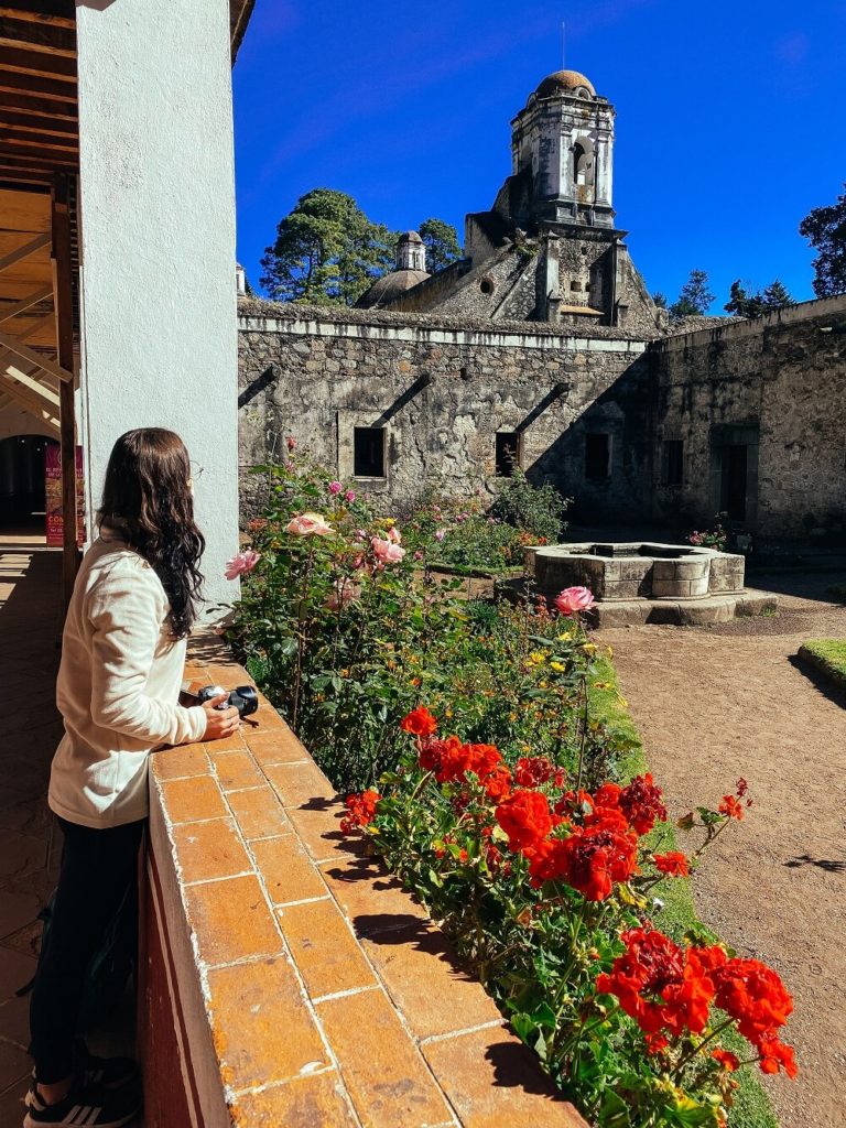
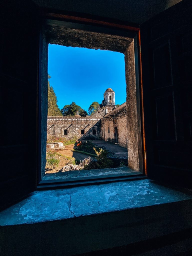
2. Visiting Ex Convento Desierto de los Leones
One of the main reasons for a trip to Desierto de los Leones is the Ex Convento Desierto de los Leones. The Former Convent of the Desert of the Lions was built by the order of the Discalced Carmelites in the 17th century.
At the time, the Barefoot Carmelite order was looking for a place far away from the noise of Mexico City. I think they definitely found the perfect spot here. During the time of independence the monks had to give the convent to the government which was then used as a military base. In 1937, it was declared as a national monument. Many areas of the complex have been restored, preserved and opened to the public.
As you walk around the former convent and its gardens, you can really feel just how peaceful this place was and why it was chosen by the monks.
Opening times: Tuesday to Sunday between 10AM and 5PM. Please note that the convent will be closed on Mondays, just like many museums and attractions across Mexico City.
Entry fee: 19MXN per person.
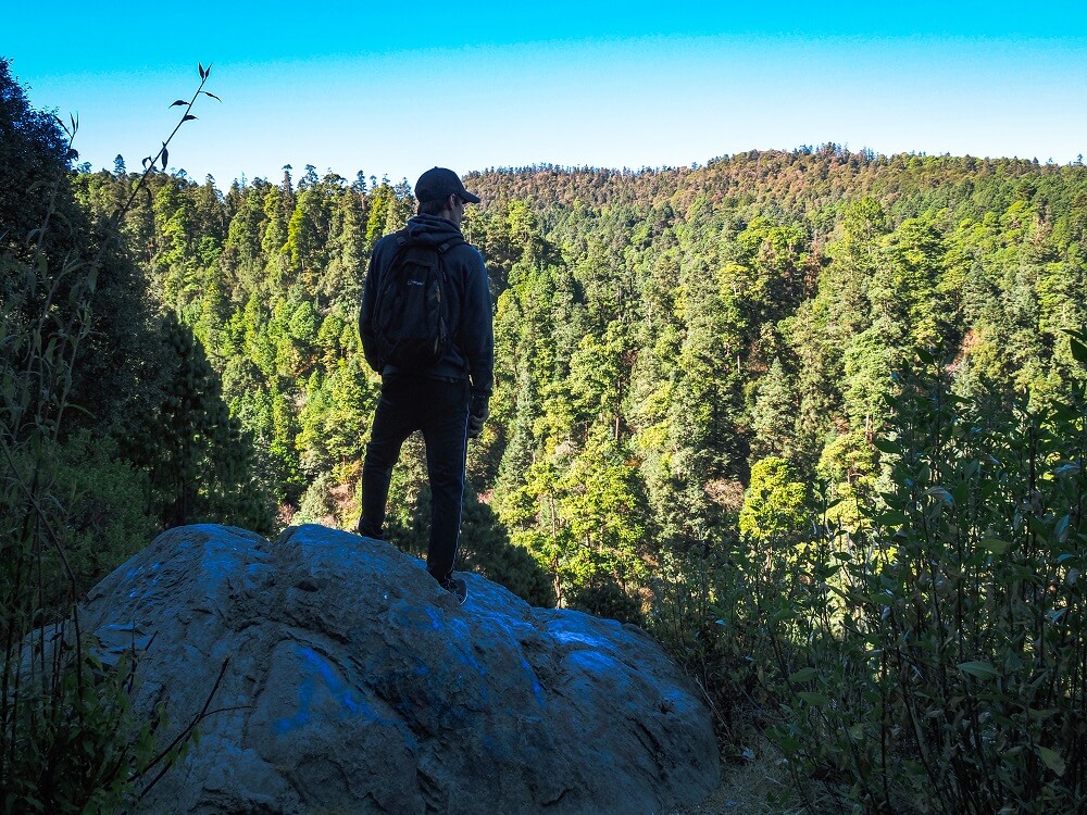
3. Ex Convento Desierto de Los Leones to the Viewpoints
Once you’ve explored the Former Convent, it’s time for the biggest part of your hike. You should head in front of the monastery where the food stalls and car parks are located. The trails around this area of the park are wide and well maintained. However, they’re still confusing. As a general rule of thumb, just head straight and up. As long as you’re walking uphill you’ll be fine.
You might see some walkers or mountain bikers pass you. You’ll eventually arrive at a dirt road/track where you should turn left. Follow this track until you pass a camp ground on your left and then take the next left hand fork leading down the slope afterwards.
This path should bend around, turn into an old grassy track, and soon you should be heading back in the direction of Santa Rosa Xochiac. Continue following this trail until you come to a T-junction with another old road. Here you can go left if you want to get back to the main road and follow it down or you can go right to stay on the old track where you’ll soon get the amazing views.
4. Viewpoints to Santa Rosa Xochiac
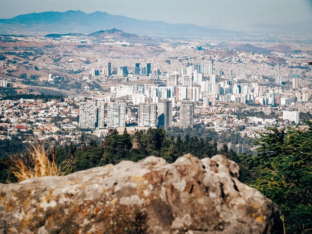
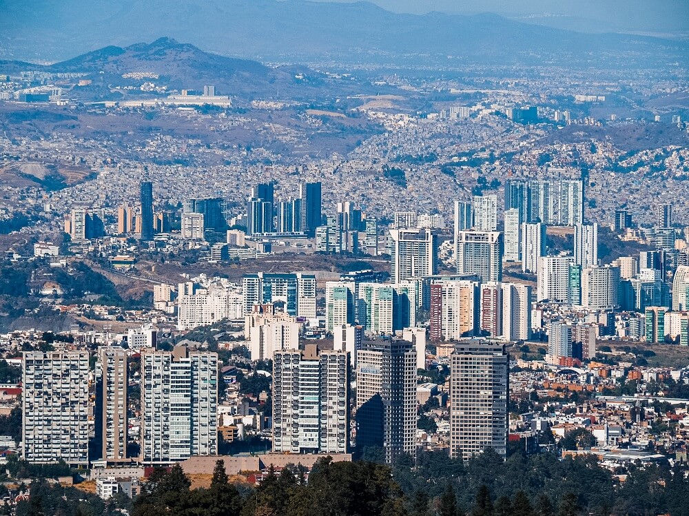
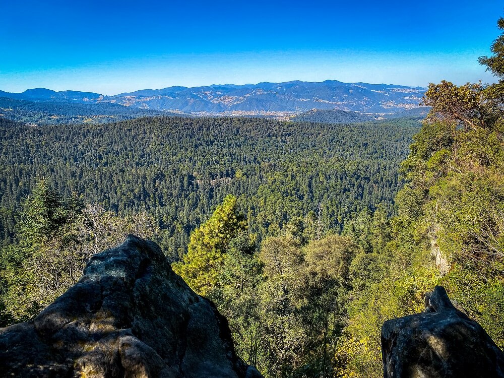
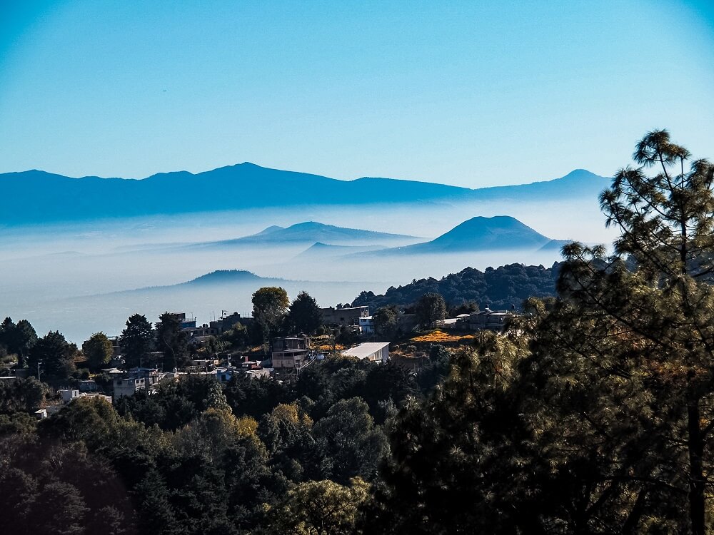
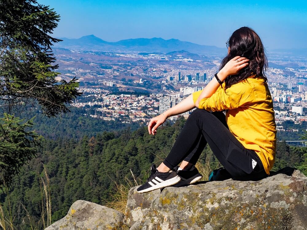
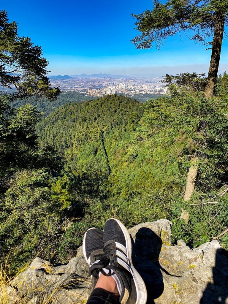
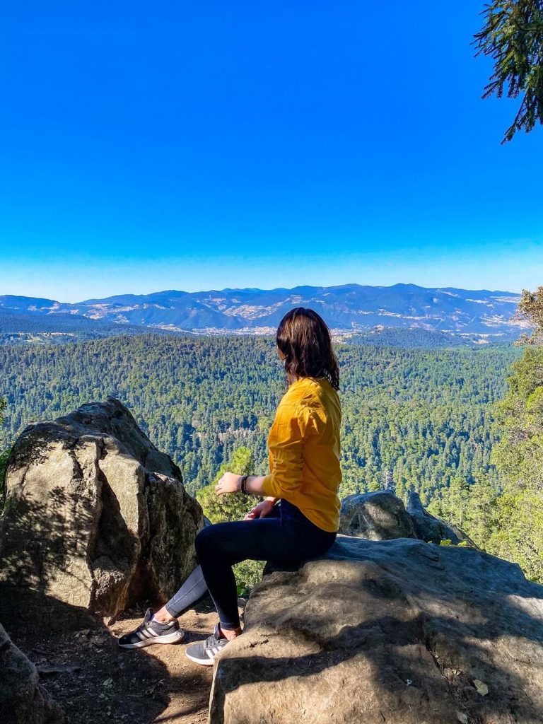
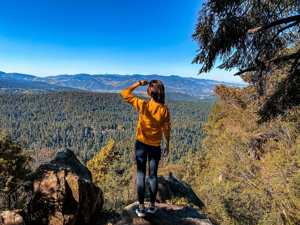
As you walk along this section of the hiking trail, you’ll ascend up to a small ridge and should notice a small path forking to the left. If you follow this one, you should come out at a stunning viewpoint across the park. From this point you should also be able to see the Ex Convent deep in the valley.
Soon after that along the main trail you should see another small fork on the left, from where you can enjoy magnificent views of Mexico City. If you’d like to see a visual reference of these viewpoints then make sure to watch our YouTube video. After these viewpoints the path will head straight downhill almost all the way back to Santa Rosa. You should still have a few sneak peeks of Mexico City on your left. At the bottom you should reach a dirt track which should lead you all the way back to Santa Rosa Xochiac.
Don’t make our mistake of turning off the main track, thinking it’ll be a shortcut back to town. It really wasn’t and we ended up pretty lost trying to find our way back to that main path. At the end the dirt road turned into asphalt and led us back to the bus stop in town.
Final Thoughts on Hiking in Desierto de los Leones National Park
Visiting and hiking around Desierto de los Leones was definitely an adventure we’ll never forget. Whilst we questioned a few times whether our decision to hike here was the right one, at the end we were so glad that we stuck with it. We had the most amazing and peaceful time wondering around the Ex Convent that we even forgot just how close we were to a city with a population of 20 million. In addition, we could also enjoy a hiking trail that’s definitely not visited by many tourists (if any!) and could also have incredible views of Mexico City itself.
Have you ever been to Desierto de los Leones National Park before? If so, how much of the area did you manage to explore? If not, would you want to hike around the national park? Let me know in the comments below.
Now, let your adventure begin,

Our Top Travel Resources
Accommodation: For hotels we always use Booking.com and Hostelworld for hostels. We also book longer stays on Airbnb or Vrbo.
Flights: To find the best flight prices we always check Skyscanner, Google Flights or WayAway. Then we also check the airlines’ websites too for comparison.
Car Rentals: We use Discover Cars when we want to rent a car as it compares local, national and international companies.
Activities: If we book organised tours we always check either GetYourGuide or Viator.
Foreign Currency: Whenever we can we prefer to pay in local currency and for that we always use our Wise card. We can easily withdraw money from the ATM or pay by card at most shops and restaurants.
Travel Insurance: We never go anywhere without travel insurance. You never know what will happen on your trip, so good travel insurance like SafetyWing can protect you in case of injury, illness, theft and cancellations.
eSIM and VPN: To get data abroad we use Airalo which is an app that allows you to download a prepaid eSIM to your phone in over 190 countries. Make sure to have a VPN to avoid hackers accessing your personal data when using public WIFI. We use Surfshark which is the only VPN that offers one account on unlimited devices.
Remember…It all starts with a Pin…


Hello,
Thanks for this usefull post !
We did it in august 2022. Nice walk in the forest and good break out of th city. I would say intermediate difficulty with alitude, but the paths are goods.
We took the bus 117 from Barranca de los muertos. We started the hike from the bus terminus at 9.10 and finish at 13.50. Without the quick visit of the covento and the lunch, we walked a little less than 5 hours (we are quite good walkers).
With mapsme app (and the mexico map download offline), a good GPS on your phone and a little bit of preparation, it is not difficult to follow the track presented on the map at the beginning of this post. You need go be attentive to not take the wrong path, but we didn’t get lost as we had good GPS signal. As said in the post there is any marks on the trail.
However we find only one view, the one where you see the forest and te covento (just befor point 7 on te map, point : 19.306535, -99.303365).
To went back to the city we took the bus no 107 to viveros metro station.
I hope this will help others hikers 🙂
Thank you so much for your feedback Aurelia. I’m glad that my blog post was helpful. It’s great to hear that you managed to catch the local bus both ways and couldn’t get lost at all.