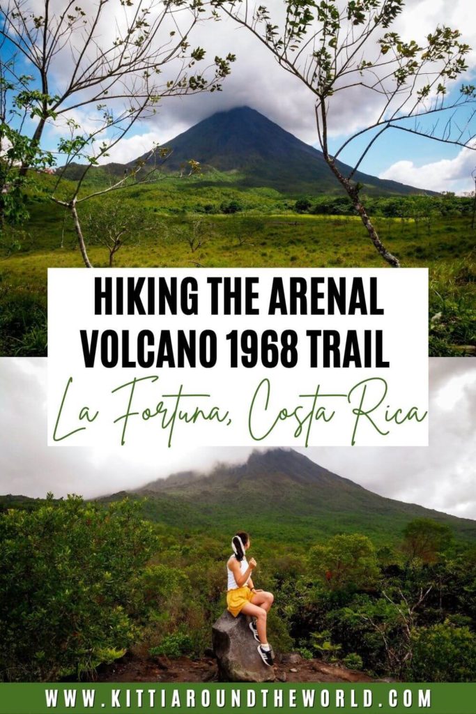
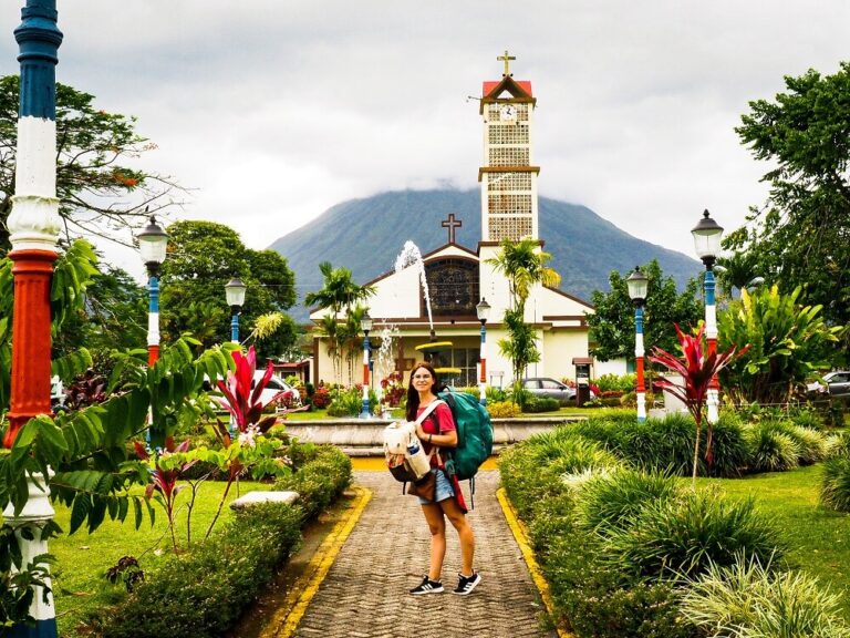
Hiking the Arenal Volcano 1968 Trail in La Fortuna, Costa Rica
Are you planning on hiking the Arenal Volcano 1968 trail during your visit to La Fortuna? Then you’re in the right place. In this blog post, you can read about all the useful information that you should know prior to your visit. This includes details on how to get to Arenal 1968 Park, entry fees, best times to visit as well as helping you decide which trail is more suitable for you to complete.
For reference, we spent an entire week in La Fortuna, and hiking in Arenal 1968 Park was definitely our biggest highlight. (Apart from seeing baby sloths at the Bogarin Trail which you can read about in our best things to do in La Fortuna guide).
If you’d like to see our Arenal Volcano adventures, then make sure to check out our Costa Rica Playlist on our YouTube channel.
Disclosure: This post may contain affiliate links, which means we may receive a small commission if you click a link and purchase something. Clicking these links won’t cost you anything, but it will help us to keep this site up and running! Learn more about our affiliate policy.
About Arenal Volcano 1968 Park
As you’ve probably guessed, the park got its name after the devastating eruption that happened in 1968.
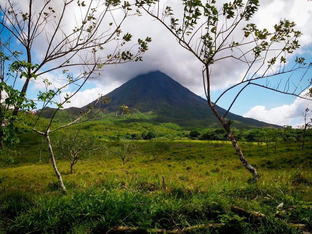
The relatively young (about 4,000 years old) Arenal Volcano was a cone-shaped volcanic mountain with its last major eruption being around 1500 A.D. Since it had been dormant for so many years, many even considered it to be extinct. Apparently, farmers in the area used to refer to the volcano as a mountain: Cerro Arenal.
However, on the 29th of July, around 7:30 in the morning, Arenal Volcano erupted. The eruption effected a large area, destroyed 3 towns, killed many people and damaged crops, livestock and forests. It also changed the landscape forever. Up until 2010, Arenal Volcano remained very active. Although none of the activity has been as serious as the initial eruption.
After the eruption, Arenal Volcano became one of Costa Rica’s most visited natural attractions. Therefore, the eruption didn’t just change the topography of the area, it also resulted in a huge change to the area’s main source of income, which became tourism.
The park now offers its visitors a chance to hike through the lava fields and to get a 360-degree view of both Arenal Volcano and Lake Arenal.
Did you know? In 2007, Arenal Volcano was voted as one of Costa Rica’s Seven Natural Wonders by Costa Ricans. The other wonders are Monteverde, Poas Volcano, Rio Celeste, Isla del Coco, Tortuguero and Cerro Chirripo.
How to get to Arenal 1968 Park Trailhead from La Fortuna
By Private Car: You can hire a car for the duration of your stay in La Fortuna. You do not need to rent a 4×4 whilst in the area, unless you’re planning on visiting some more remote places too. The park should be only about 15 minutes’ drive from La Fortuna and it has a big car park.
By Taxi: You can always take a taxi to the visitor centre. The taxi should cost you between 15-20 USD one way. There are normally many taxis waiting around La Fortuna Park in the centre of town. Make sure to take an official taxicab which should be red with a yellow triangle. Make sure to either agree on a pickup time or ask the driver’s phone number and message him when you’re ready to be picked up on the way back.
Alternatively, there are a few Uber drivers operating in La Fortuna, so you can check the app too. Please note that Uber is technically not 100% legal in Costa Rica. However, based on our research both locals and tourists use the service regularly.
By Tour: There are plenty of organised day trips to Arenal 1968 from La Fortuna that you can choose from if you want to skip all the planning or you’re short on time. So, make sure to shop around and find the best company based on your budget and interests.
Note. Unfortunately, there’s no public bus to the park. During our research on how to get to the trailhead, there was mention of a local bus that runs between La Fortuna and Tilaran. You would need to ask the driver to drop you off at the turn off to the park and would need to walk about 2km to get to the visitor centre.
Useful Information about the Arenal Volcano 1968 Trail
Arenal 1968 Entrance Fee and Opening Hours
The entry fee to the park is 15 USD per person.
The park is open every day from 8AM until 5PM. Note that the last entrance is at 4PM.
For more information, you can always check out the park’s website.
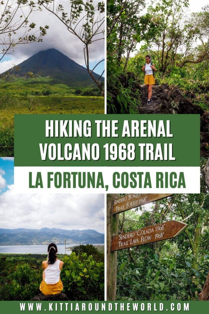
‘Lava Flow 1968’ Trail or ‘Forest 1968’ Trail – Which One to Complete?
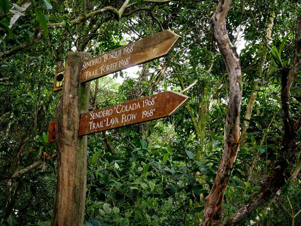
There are actually two trails you can choose from: ‘Forest 1968’ Trail (Sendero ‘Bosque 1968’) or ‘Lava Flow 1968’ Trail (Sendero ‘Colada 1968’).
Which trail is best for you will depend on a few factors. Luckily, since neither of the trails are too long, you can easily complete both in one day.
I recommend only completing the ‘Lava Flow 1968’ trail, if:
- You’re not really into hiking and just want to enjoy some views,
- You’re short on time and planning on visiting other places on the same day.
I recommend combining the ‘Forest 1968’ trail and the ‘Lava Flow 1968’ trail, if:
- You love hiking and want to enjoy a longer hike,
- You want to avoid crowds and enjoy some lesser visited areas,
- You wish to increase your chances of spotting some wildlife.
If you’re coming with an organised tour, you’ll most likely only be completing the Lava Flow 1968 Trail.
Length of the Arenal Volcano 1968 Trails
- Length of the ‘Lava Flow 1968’ Trail: 3 km / 1.8 miles
- Length of the ‘Forest 1968’ Trail: 4.7 km / 3 miles
The combined hiking route was about 7 km (4.5 miles) long. Depending on your speed and how long you are spending taking photos or stopping for breaks, this route could take around 3.5 hours.
For reference, we started the trail around 8:30 AM and got to the café just after 12:00PM. We spent a little time around the café enjoying the views whilst we were waiting for our taxi to arrive.
Top Tip. Make sure you start your walk as early as possible if you’d like to combine both trails.
Level of Difficulty
- ‘Lava Flow 1968’ Trail: Easy.
- ‘Forest 1968’ Trail: Easy to Moderate.
I personally believe that you don’t need to be an experienced hiker to complete either of these trails. You can easily complete them with a basic level of fitness. However, please note that the terrain will have some steep sections (especially the forest trail) and both trails will have a lot of rocks and roots. Therefore, it’s important to wear supportive shoes when hiking the Arenal Volcano 1968 trail. In addition, the only other thing that could make this trail slightly more difficult is the heat and humidity.
All in all, if you have previous hiking experience then even the combined trail will be relatively easy for you.
Best Time to Hike the Arenal Volcano 1968 Trail
Costa Rica has two main seasons: dry season (or peak season) and wet season (green season). However, bear in mind that these seasons vary by region and area.
The best time to hike the Arenal Volcano 1968 trail is during the drier months between January and April. This doesn’t mean that it won’t rain at all during your stay. However, the trails will be generally dry and accessible. For reference, we completed the hike in February and had a great morning. However, during our stay we definitely got caught in some heavy downpours.
Even if you can only come during the rainy season, you can still have a dry morning. Just be prepared for some heavy downpours in the afternoon. For this reason, I highly suggest setting off for the hike in the morning.
Facilities Around Arenal Volcano 1968 Trail
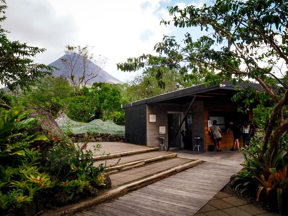
Cafes and restaurants: The park has one of the nicest and best located cafés with a stunning view of Arenal Volcano. As you’d expect, the café is expensive, but it’s definitely worth hanging around and enjoying the view of the volcano as long as you’d like to.
Toilets: There are toilet facilities available at the visitor centre.
What to Wear and Bring with You?
For hiking the Arenal Volcano 1968 trail, I highly recommend wearing closed toed shoes. The trail can be slippery and filled with roots and rocks, so you ideally want shoes with good grip. I wore a simple pair of trainers, and they were pretty sufficient.
I would also pack a light rain jacket, especially if you’re visiting in the rainy season. If you’re carrying some camera gear, then make sure to have a waterproof cover for your backpack too.
If you’re wearing shorts and a t-shirt, then make sure to wear sun-cream to protect your skin. Whilst there are many sections of the trail that are shaded by the trees, I suggest wearing a cap and bringing some sunglasses.
I suggest packing some snacks or a packed lunch. Bringing plenty of water is also important because you want to stay hydrated. I recommend having a reusable water bottle with you.
Please Note! Whatever you bring with you, make sure you either take it home with you or dispose of it responsibly. I suggest bringing a garbage bag with you where you can collect all your waste. Enjoy your time in nature but Leave No Trace!
The Arenal Volcano 1968 Trail
The Arenal Volcano 1968 trail is very easy to follow. As mentioned above, we combined the Lava and Forest trails for a longer hiking experience. For reference, we completed the trail in an anti-clockwise direction.
I divided the route into 3 main sections for a more detailed description of the trail:
1. Trailhead to Arenal Volcano and Lake Viewpoint
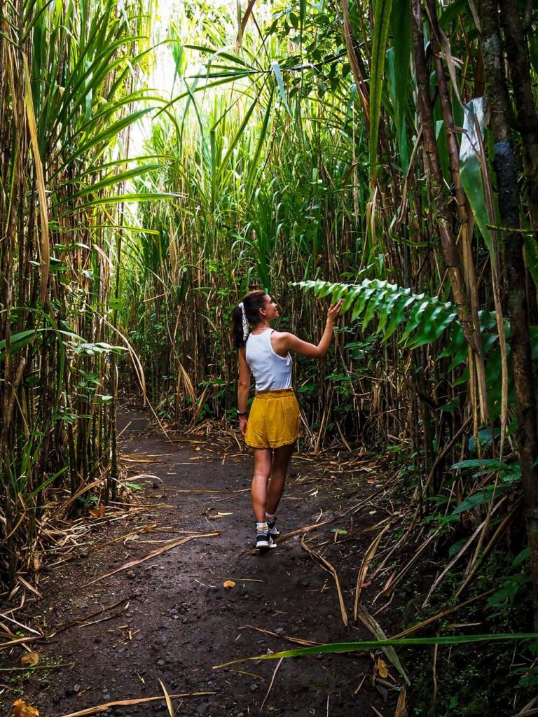
You’ll start hiking the Arenal Volcano 1968 trail through the rainforest and some very tall grass.
Yes, when I say very tall grass, I mean at least 3m tall grass. It’s a great and fun start to the trail and did make us feel like we were in Alice in Wonderland.
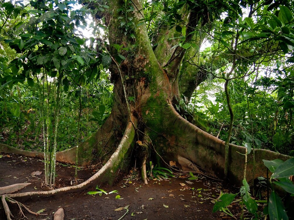
Soon the trail will turn into rocky lava fields, and you’ll be walking through some pretty huge boulders. Can you believe that these rocks were shot into the air during eruptions at a crazy speed? Walking past these boulders you’ll definitely witness just how powerful nature can be.
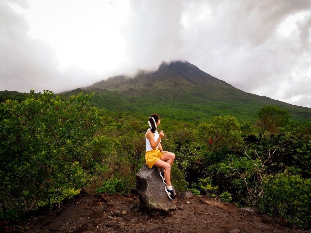
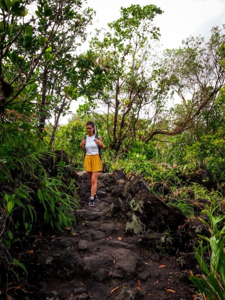
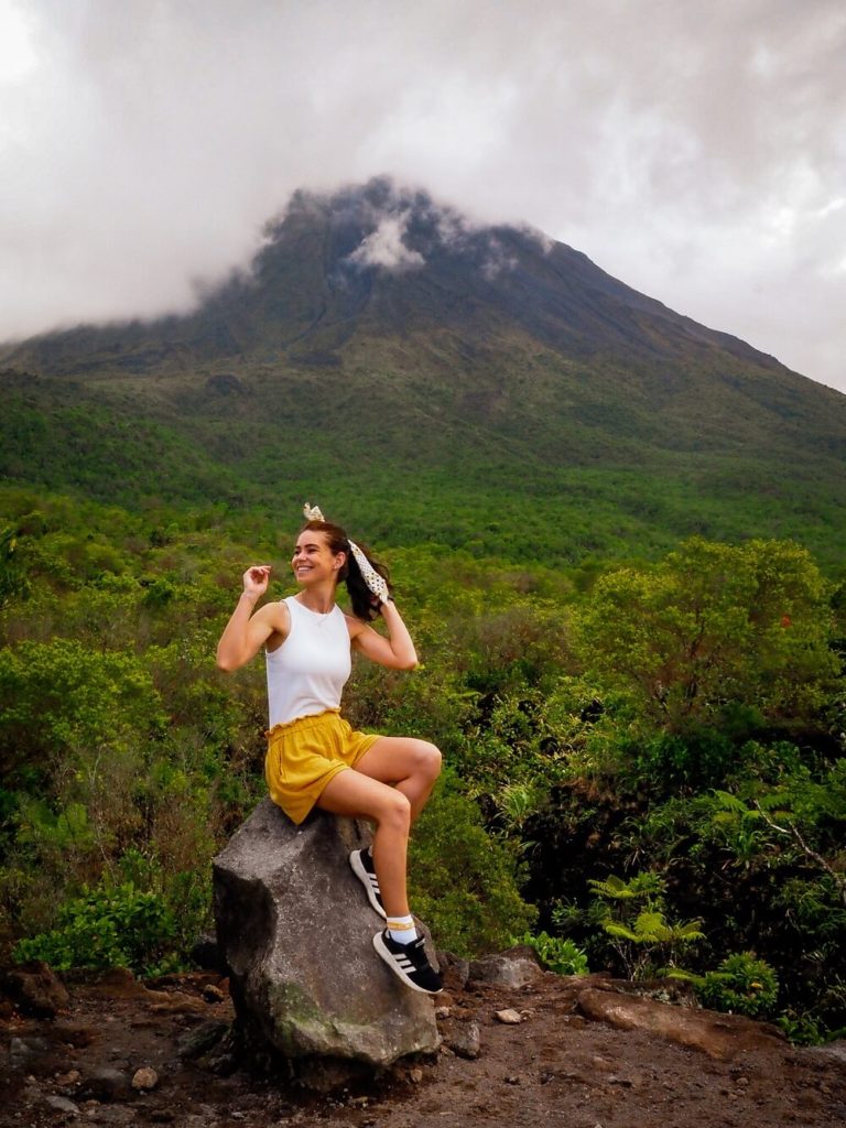
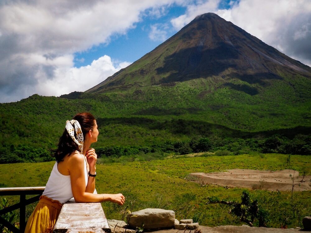
This section of the trail will get steeper, and you’ll have a few sneak-peaks of the volcano. After your ascent, you’ll reach the iconic volcano viewpoint. This is an ideal place to have some well-deserved rest and enjoy the undisturbed 360-degree views of the area.
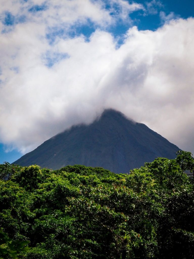
Note – The top of Arenal Volcano is frequently covered in clouds. When we got to the viewpoint the top part was still covered. However, by the time we got to the café, the top had cleared and for that we were incredibly grateful.
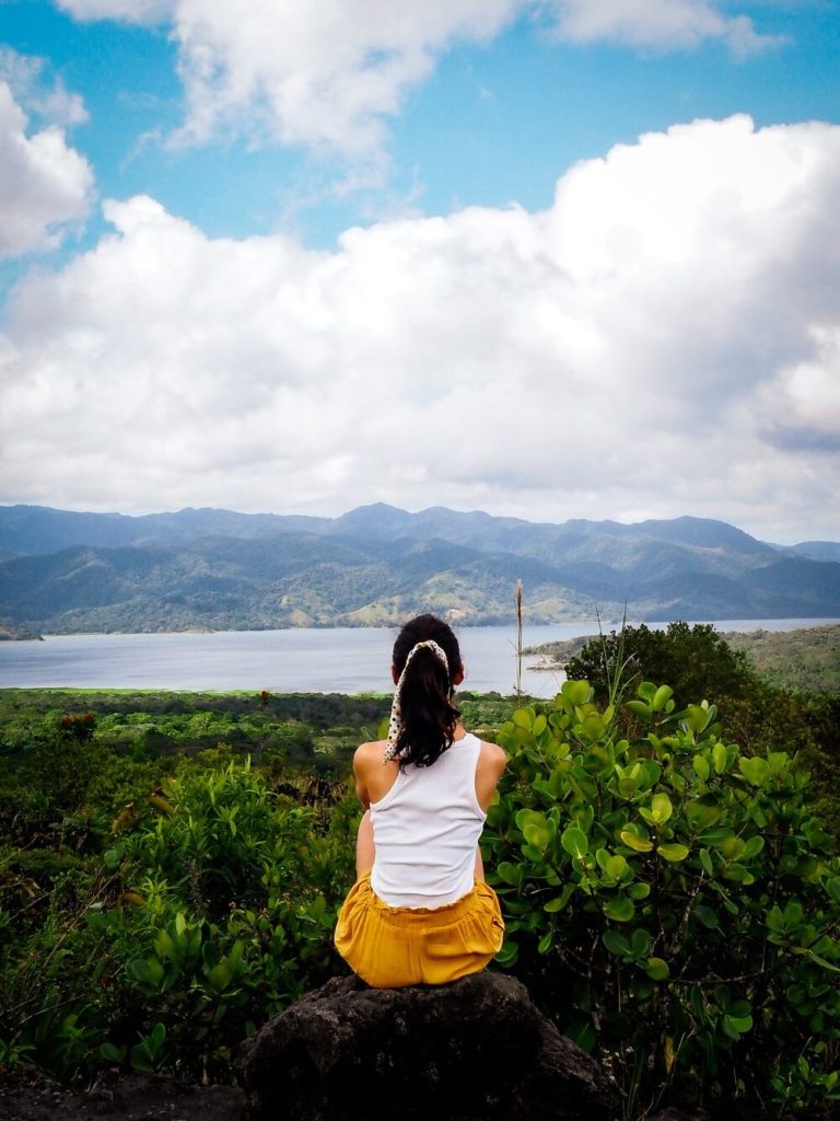
From this viewpoint, you can also enjoy the views of Lake Arenal. It is now Costa Rica’s largest lake. In 1979 a hydroelectric dam was built which tripled the size of the lake. Two towns (Arenal and Tronadora) had to be relocated to higher ground, however the remains of the two old towns are still at the bottom of the lake. This definitely reminded us of those towns that suffered the same fate in the Peak District National Park in the UK.
2. Arenal Volcano and Lake Viewpoint to Lago Los Patos
At the Arenal Volcano and lake viewpoint the trail will diverge. Follow the sign to the ‘Forest 1968’ trail for a longer hike. If you feel like you’re ready to return, then just follow the ‘Lava Flow 1968’ trail that will eventually lead you back to the scenic café.
Following the Forest trail, the lava path will turn into more of a dirt path. It’ll get a bit narrower and will lead you back into the dense rainforest. This path will be much quieter as only a handful of visitors actually combine the two trails.
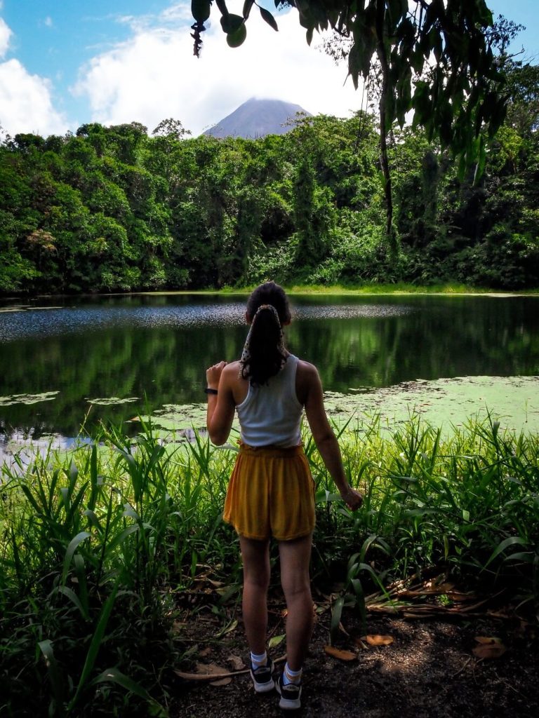
You’ll just have to follow this path until you get a glimpse of a small lake called Lago los Patos or Duck Lake. It’s a 22 m deep lake that was formed by the eruption.
3. Lago los Patos to Café
As you make your way around this small lake, the trail will start to get a bit steeper again. There will be a few clearings in the forest where you can enjoy some views of Arenal Volcano. This was the point where we noticed that the clouds from the top were getting thinner and pretty much revealing the peak.
The forest trail will eventually merge again with the Lava Flow trail, and you’ll have to walk through an open grassy meadow. This will eventually lead you to the scenic café.
The views from the café were a true surprise. Whilst the café itself will be more expensive than in La Fortuna, I think it’s definitely worth sticking around for a while. We were incredibly lucky as the clouds completely cleared around the volcano, so we could enjoy Arenal in its full glory.
Once you’re ready to leave, just head down from the cafe to the visitor centre where you can either get picked up or hop into your rental car.
Want to hike more in Costa Rica? Then check out some of my other Costa Rica hiking guides.
Final Thoughts on Hiking the Arenal Volcano 1968 Trail
Hiking the Arenal Volcano 1968 trail was definitely the highlight of our stay in La Fortuna. I personally think that if you enjoy hiking then combining the Lava Flow and the Forest trail will give you the best experience. By spending longer in the area, you’ll have a higher chance to see the volcano’s top clear. We definitely got lucky with the weather and seeing the entire volcano without clouds was just an amazing bonus.
Whilst I appreciate why many only want to hike the shorter trail, for us, hiking both was a great balance of being on both crowded and quieter paths.
Have you ever hiked the Arenal Volcano 1968 Trail or been to La Fortuna before? If so, how much of the area did you manage to explore? Let me know in the comments below.
Now, let your adventure begin,

Remember…It all starts with a Pin…
Another great blog! I so glad the clouds parted for you!😊x
Thank you Karan, we were incredibly grateful to see the tip of the volcano. Many people unfortunately don’t get the chance during their entire stay!
beautiful photos! You make the hike seem less scary than it sounds… thank you for the inspiration.
Thank you Jenn. I think the hike is totally doable and worth the effort for the views.
Your photos are STUNNING! Definitely adding this to my hiking bucket list, what an amazing landscape!
Thank you so much! I’m so happy that Arenal Volcano is now on your bucket list.
This is so so cool! Your pictures have me wanting to book my ticket right now! Thank you for comparing the two trails as well, it sounds like the forest trail is the one for me! Thanks for sharing!
Thanks Olivia, I’m glad to hear that you found the comparison useful. I think you’d enjoy the forest trail a lot!
Thank you for very useful information!
Thank you for the positive feedback!